Hey there! It is nice that you’ve joined me for today. Come along for the ride!
Things have not changed yet. Yet is the key word here. We are just about 1 week away from there being a pattern change. Normally we don’t go crazy on this stuff. But all my fellow Meteorologists have placed their chips on the table already. Since today is my day, time to lay mine up to the table.
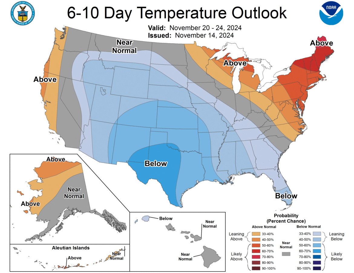
NOTHING BEFORE 11/21/24
If you are expecting ANYTHING before 11/21/24, you have nothing coming. Literally. Temperatures will be in the 40s and 50s during the afternoons with near to below freezing temperatures at night. That is not the best weather in order to get snow cover going. And yes, now that we have hit November 15th, and given how snow cover has gone in some years across the Adirondacks, North Country and Tug Hill, I can speak with authority on when it could hit. But after 11/21/24, a pattern change begins!

BETWEEN 11/22/24 and 11/30/24
This is when, truly, our winter begins! Tons of snow? Unless you are directly downwind of Lake Ontario or Lake Erie, probably not. However, it will be cold enough and there will be enough disturbances, to cause the first snows of the season across MOST of Upstate NY. I would say, with a growing level of confidence per day, that the first 1″ of snow shall fall across all of Upstate NY by November 30th. Even in the harder to get to areas like the Hudson Valley and the Capital Region.
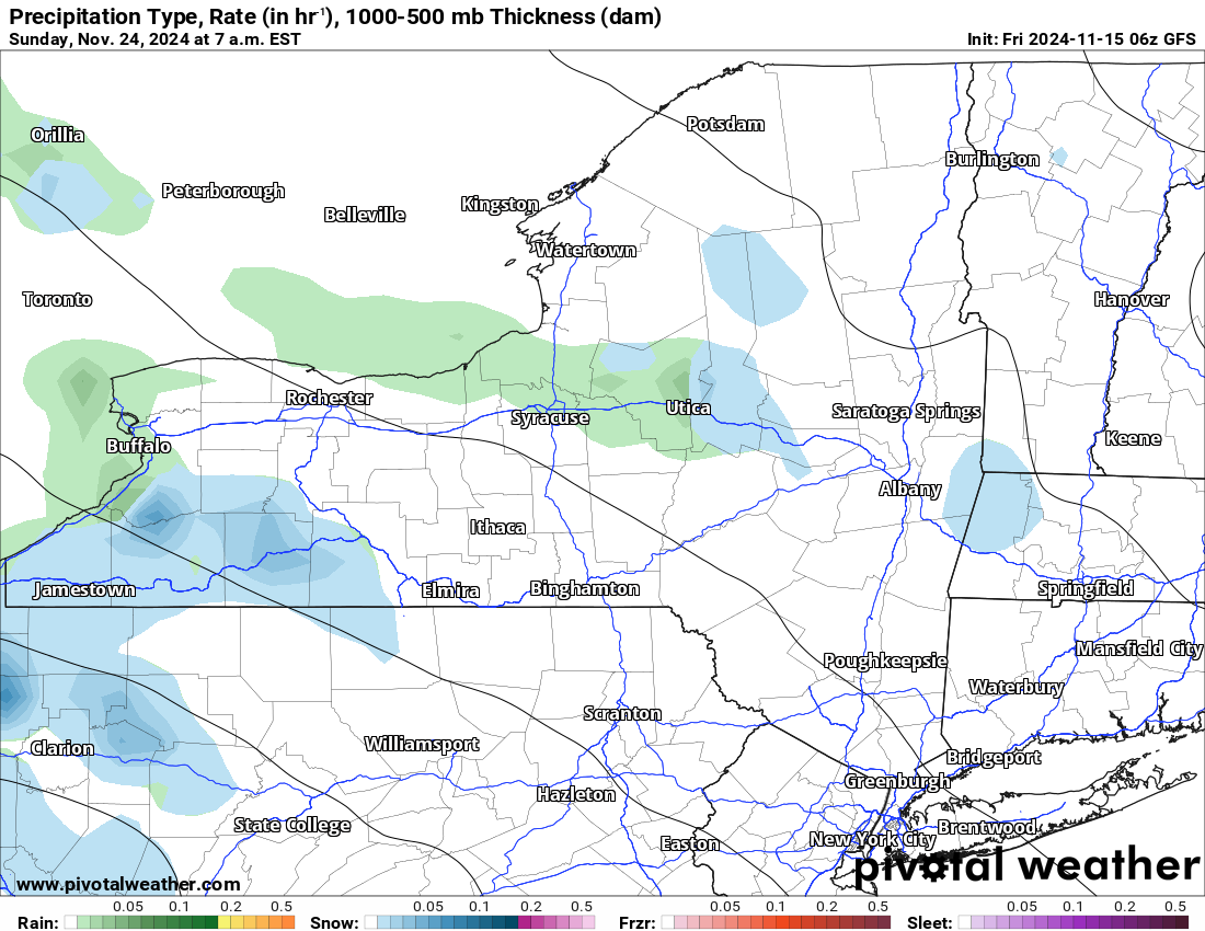
SO WHAT HAPPENED TO THE MACHO STORM I PUT UP YESTERDAY?
Yesterday the models showed a major lake effect storm on Sunday 11/24 in Buffalo. Like feet of snow. It was a Day 10 miracle storm which now on Day 9 has gone POOF! Where and when it will come back, if it will come back to, remains to be seen. Just know that in this range of time from Friday 11/22 to Sunday 11/24, there is a growing chance that SOMETHING lake effect will take shape and form. Whether it is an inches thing or a feet thing, we still have PLENTY of time to figure out. Literally, almost another week to figure out.
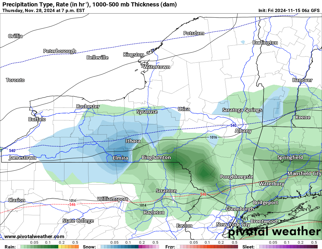
THANKSGIVING WEEK FORECAST
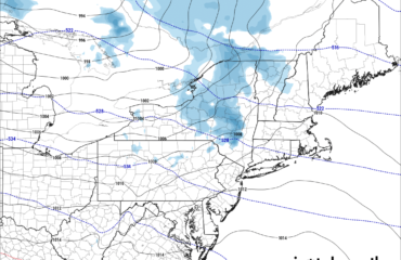
It is not looking as good as recent years. Last year we had some issues but by December the “BLOWTORCH” was on the way and whatever snow we got then was GONE. It looks similar this year, at least at the moment. Storm #1 comes in Thursday 11/21, then colder with lake effect snow Friday 11/22 through Sunday 11/24. Tuesday 11/26 or early Wednesday 11/27 marks our next storm, followed by yet another one developing on Thanksgiving Day 11/28 into Black Friday on 11/29 (pictured above). Each storm is different. Each storm has different intensities, lake effect flows in back of it, and cooler air behind each storm. We are, especially around Thanksgiving, into the 30s during the day, with teens to 20s at night. This is a little below normal, not WAY below normal. We shall see how this forecast pans out.
EARLY LOOK AT DECEMBER
This month has certainly become our biggest trouble month over the last 20 years. The last 10 years, with the exception of 2017-18, which we found ourselves in the midst of near record cold after Christmas 2017 and going into January 2018, December has been a BLOWTORCH month. Period. End of story. Even in 2020 after an all time record snowstorm in Binghamton and the Southern Tier of NY on December 15, less than 10 days later, THE CHRISTMAS MASSACRE OF 2020 with 2-4 inches of rain and temperatures in the 50s wiped out all the feet of snow there was on the ground. For the last 7 years, we have not been able to buy snow! We have not had a White Christmas in years across Upstate NY! It has been so long I have to remember when, but I know we have not had one in the 2020’s yet.
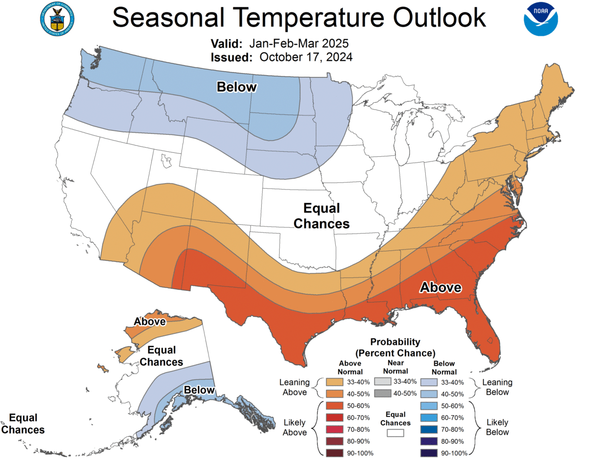
JANUARY AND BEYOND
We are still showing ABOVE NORMAL on this part of the forecast. That is not good. However, January and February are cold enough months to where if the averages are above normal, we could still be riding. So long as it is not WAY above normal. We don’t expect it to be. If anything, we are expecting in the coming days for the next outlook for changes to take place. This part of the winter forecast with near neutral conditions (no El Nino or La Nina), is showing that good snows and decent cold will move on into Upstate NY and be around for parts of January, February, and March. If this indeed happens, it could end up turning out better than the 2020-21 season or the 2021-22 season which lasted about 5-6 weeks. Or the last two seasons which lasted less than that. Or 2019-20 which lasted 6-7 weeks. We have not had at least an 8 week winter since 2018-19. That was the last double digit winter that we had (10 weeks or more of riding). Please PLEASE pray that we we can ride A LOT MORE this year. We have a lot of lost time to make up!
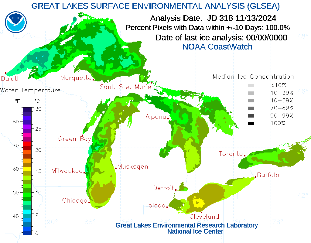
THE BIG X-FACTOR – THE LAKE EFFECT SNOW
This has always been the biggest X-factor of all. Given how warm and dry our fall has been, and given just how warm our lakes our right now, especially when you figure at or below normal temperatures coming overhead anytime from now, afterwards, that is a major heads up play. Seriously. If we get just a few big lake effect events, at anytime during the season, especially early, that can completely gum up the works in terms of seasonal snowfalls and temperatures. Particularly with the snowfalls. Pray on this!
REVISED 2024-25 WINTER WEATHER OUTLOOK
30% Above Normal (Over 117.5″)
50% Near Normal (70″ to 117.5″)
20% Below Normal (Less than 70″)
These forecasts are specifically for Griffiss Airfield in Rome, NY. Where you get in your town in Upstate NY will vary, and perhaps extremely. Just know that “normal” is within 20% of NORMAL. Less is below normal. More is above normal. That is the way we do it.
Join me Sunday December 1st for the final winter weather outlook! That is when we place our final numbers on the winter. We shall see if the next 15 days make for any changes to our forecast.
Zack and Rich Lupia
Upstate Snow
November 15, 2024


