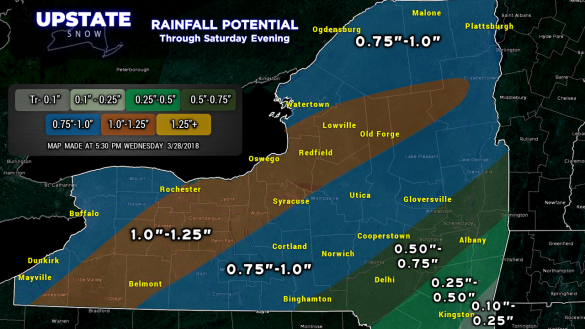
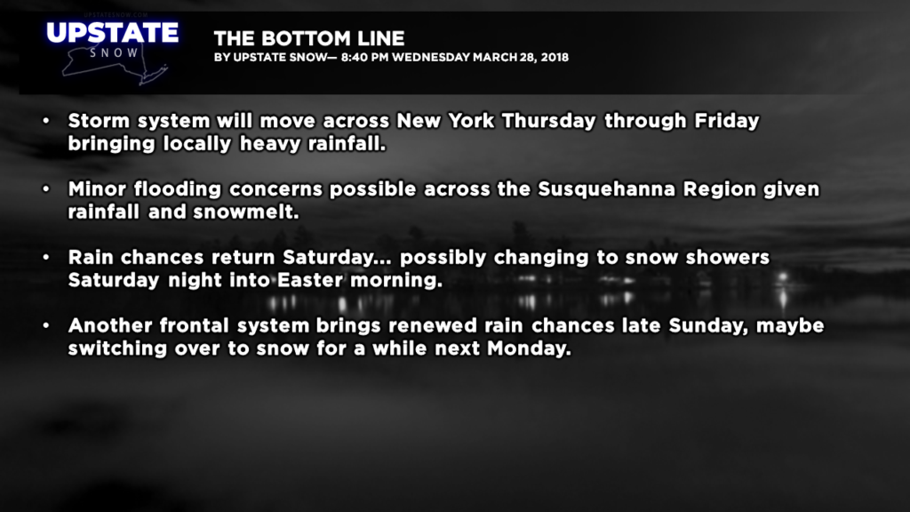
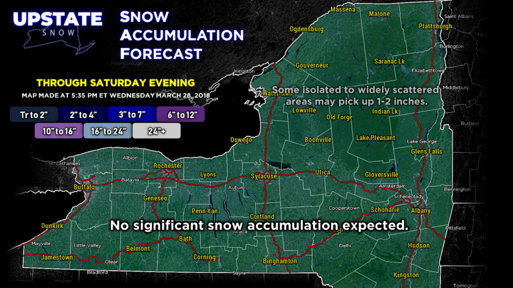
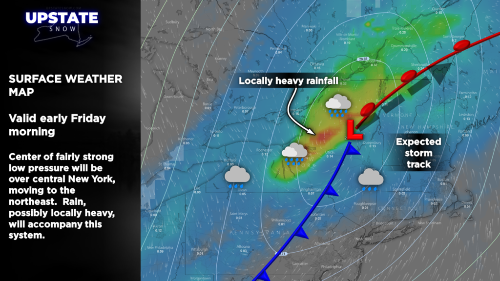
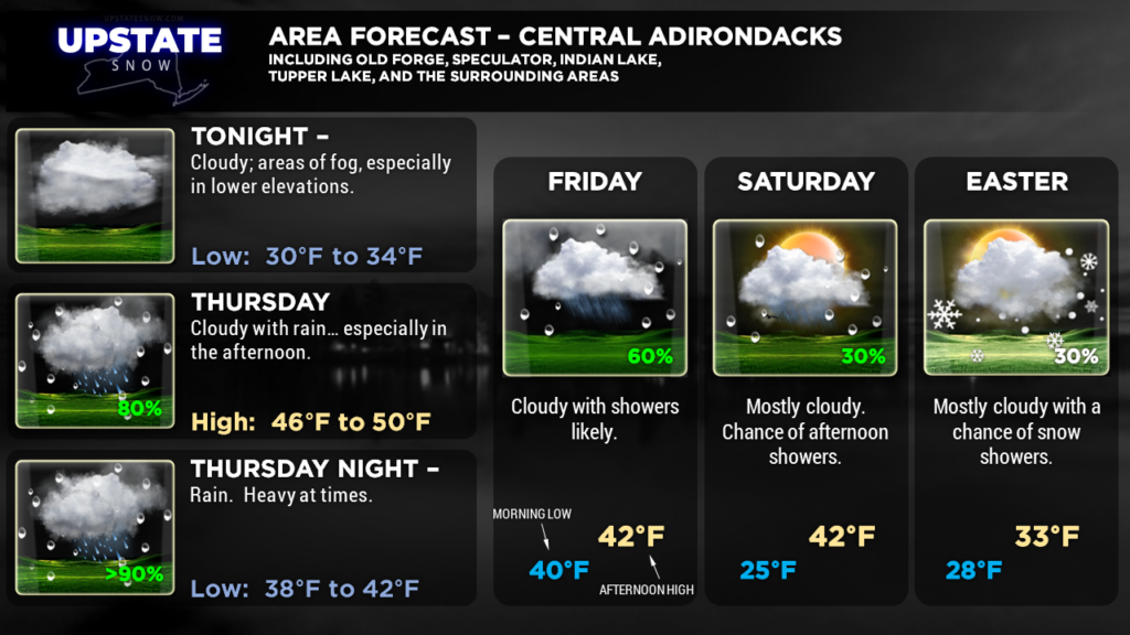
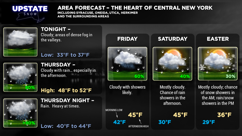
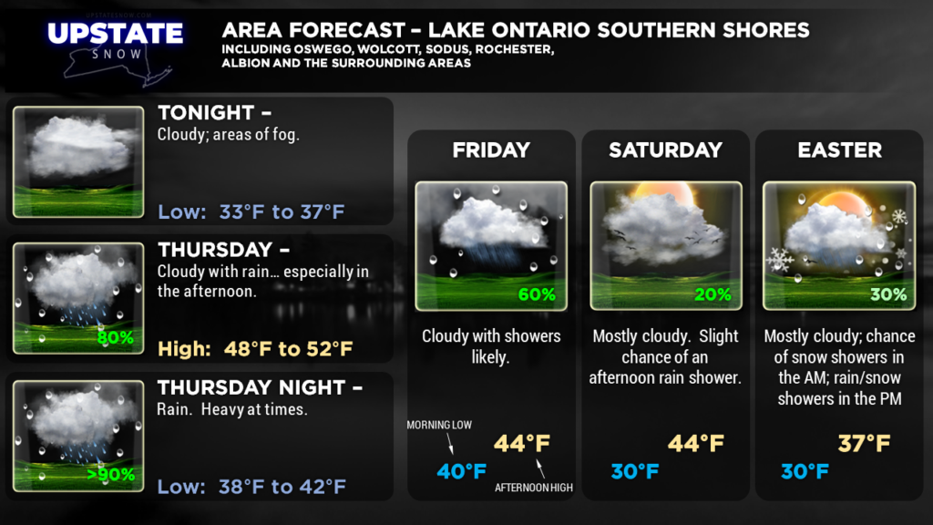
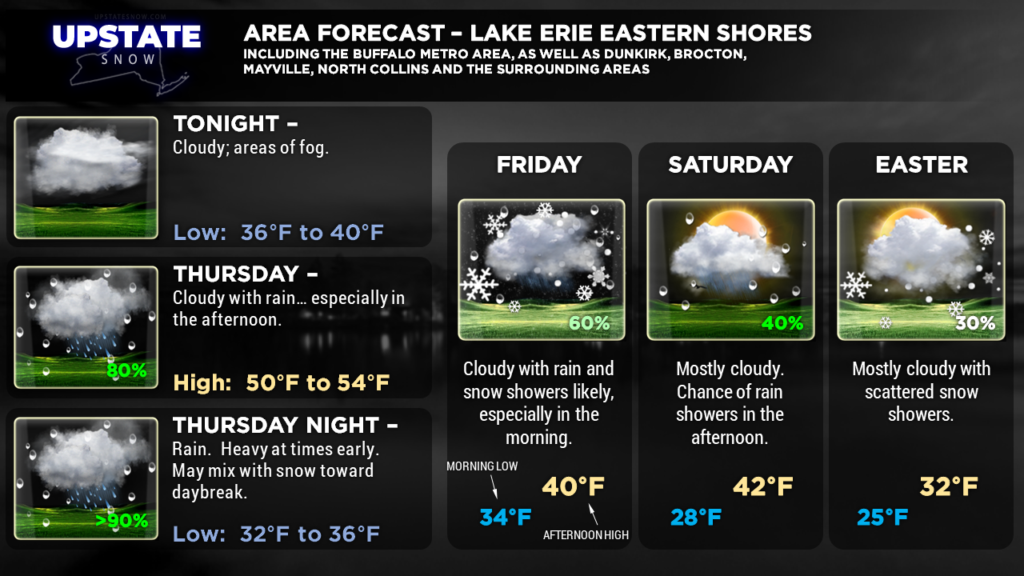
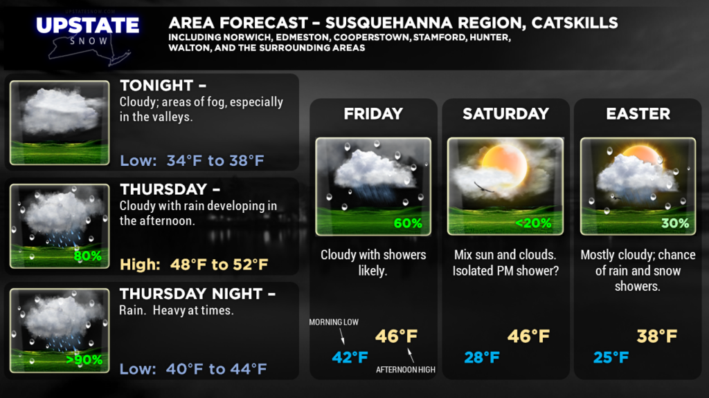
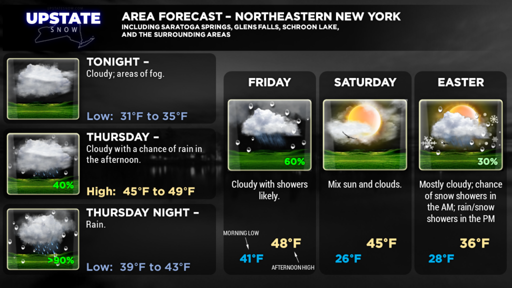
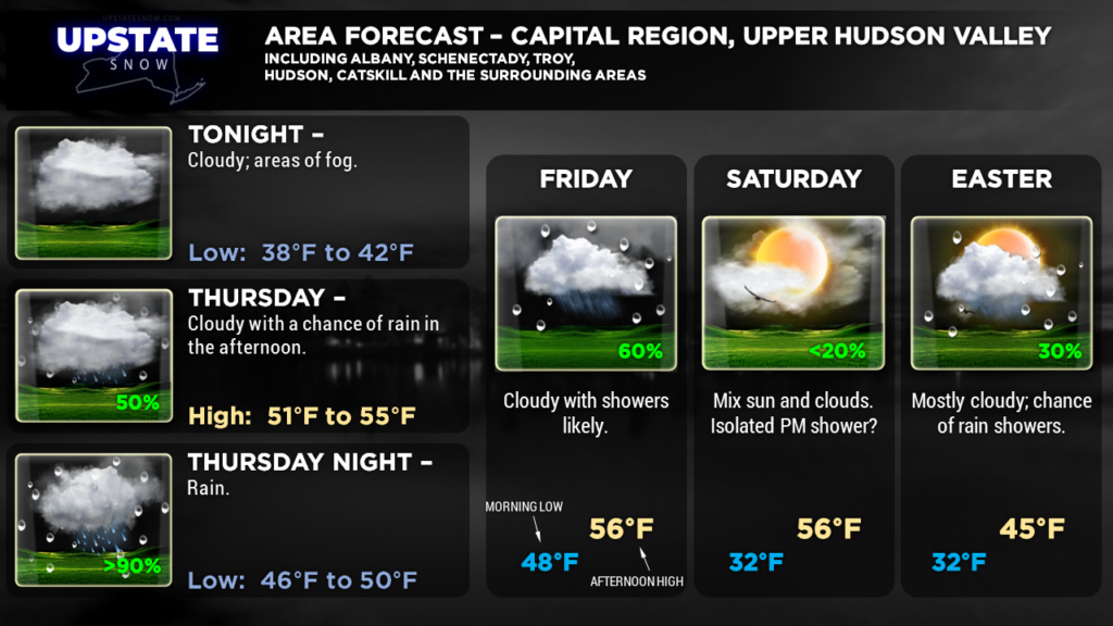
Good evening! Cloudy, damp conditions will persist Thursday and Good Friday. A wave of low pressure will move northeast across the state and into New England late Thursday night through Friday. This will bring abundant moisture and a pretty decent little rainfall… rainfall amounts up to or slightly over one inch can be expected for a good portion of CNY late Thursday through Friday. This might create some flooding concerns over areas where we still have some snow cover. Really it’s this system that will bring the curtains down on the snowmobiling season 2017-2018.
Rain chances return late Saturday… and as some colder air pushes in behind a second front, this may switch over to snow showers Saturday night into Easter Sunday, especially over the northern half of the state.
We’re in a pattern where there will be quick-moving weather systems hitting every 24-36 hours… and that will continue into early next week as models show the next frontal boundary moving through by Monday. This will bring the redevelopment of rain late Sunday night, with possibly enough cold air behind it to bring snow to the Upstate… maybe even some minor snow accumulations.
UNRELATED TO SNOW / SNOWMOBILING — Interested in being a storm spotter this season? The National Weather Service offices in Buffalo and Binghamton have many SKYWARN training opportunities. Click on the links here for a list of the training dates and locations. You can also do the training online.
Here are the zone graphics. Thanks for viewing!

