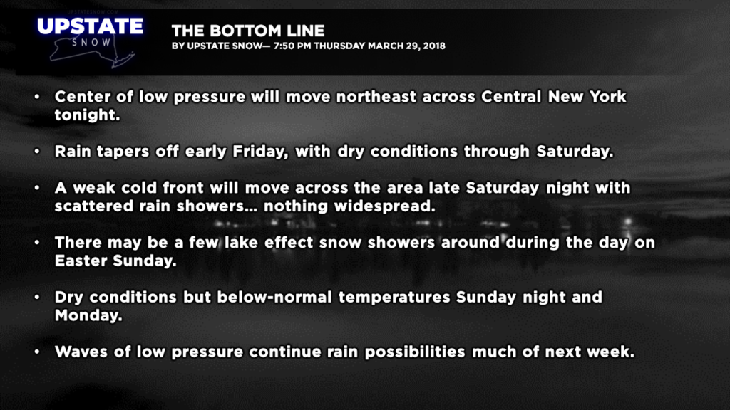
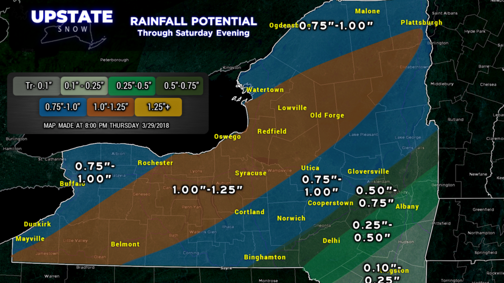
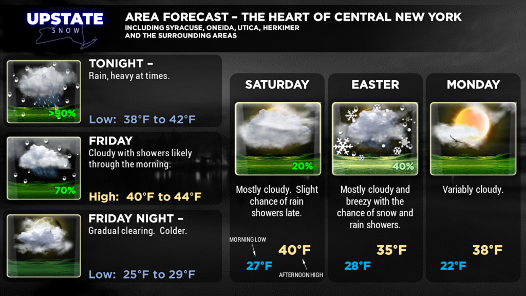
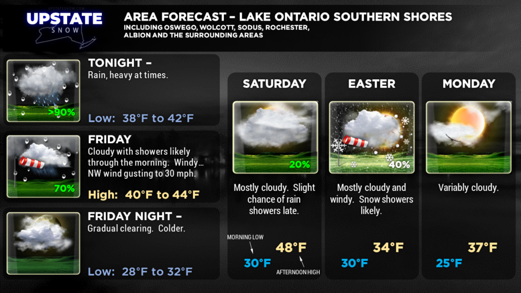
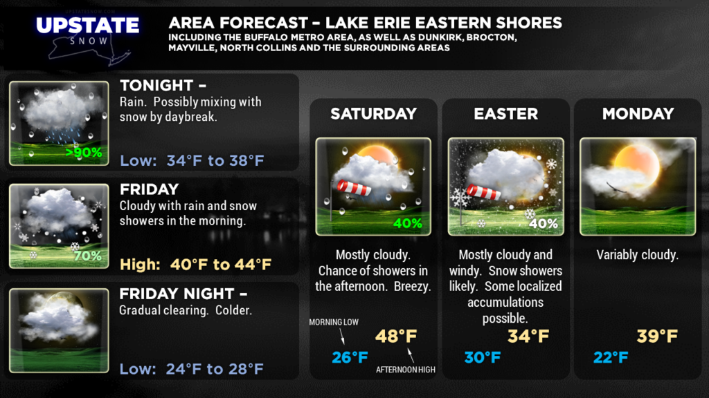
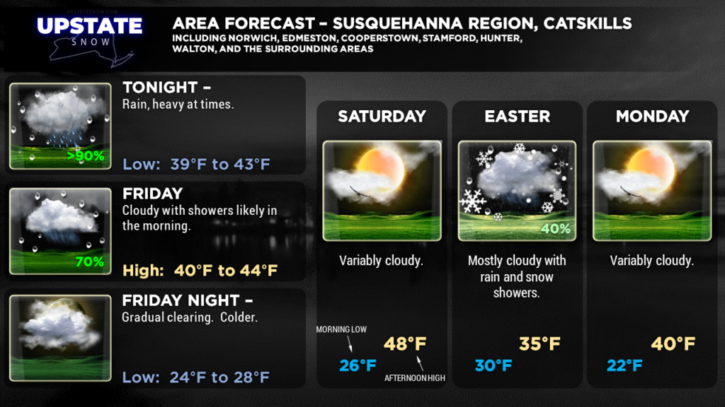
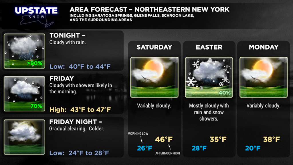
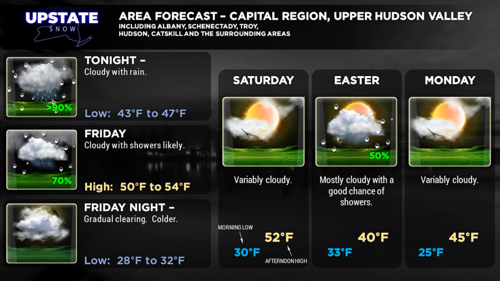
Good evening folks. Not much change in the proceedings from last night’s update. A wave of low pressure will move northeast across CNY overnight tonight, bringing copious rainfall, especially to west/central New York. This will push eastward later Friday, and we should see dry conditions through most of Saturday. The next system, a dying cold front, will move across the area during the overnight Saturday night / Sunday morning as the Easter Bunny makes his rounds. This will bring a renewed chance of mainly light rain showers. .. changing to snow showers Sunday morning on blustery northwest winds. Some accumulation is possible Easter Sunday just east/southeast of the lakes… yes… lake effect snow on Easter.
Dry conditions move in Sunday evening and last through Monday before the next rain system moves in Monday night. A very progressive pattern will stay over the area through most of next week with on-and-off rain threats… or rain/snow threats… and temperatures generally below seasonal norms.
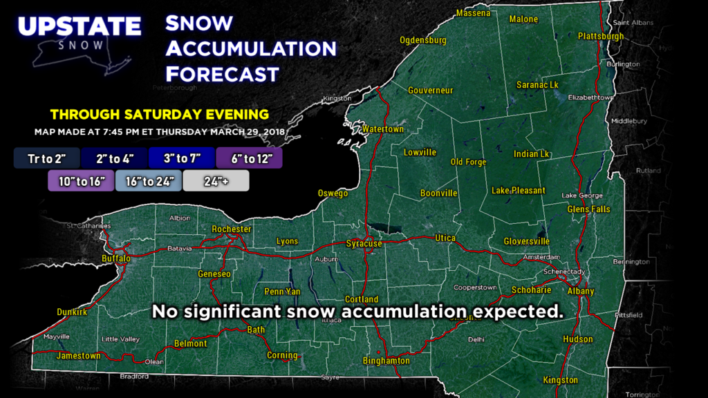
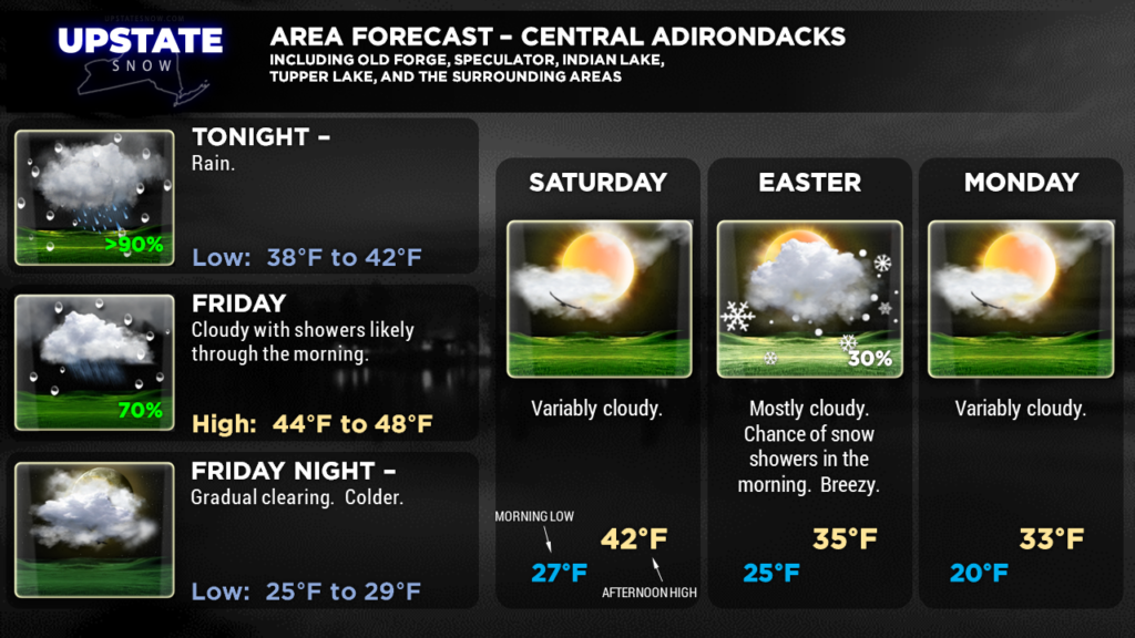
Summary — Widespread rain tonight, heavy at times, tapers off during the day Friday. May mix with or change to snow before ending over far western NY. Dry conditions prevail Friday PM through much of Saturday. Rain showers late Saturday through Saturday night, changing to snow showers for Sunday… with windy conditions near the lakes Saturday night and Sunday. Some snow accumulation is possible Easter Sunday just east/southeast of the lakes as well. Dry conditions Sunday afternoon through Monday, followed by the next chance of rain on Tuesday.
Here are tonight’s zone graphics. Thanks for viewing!


