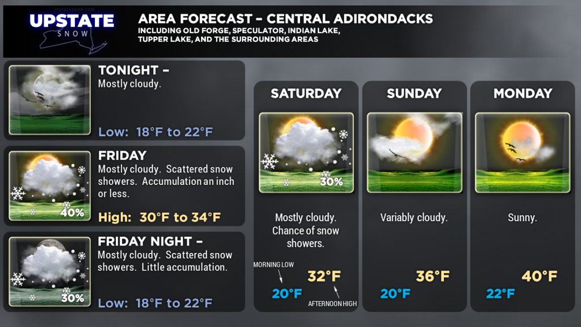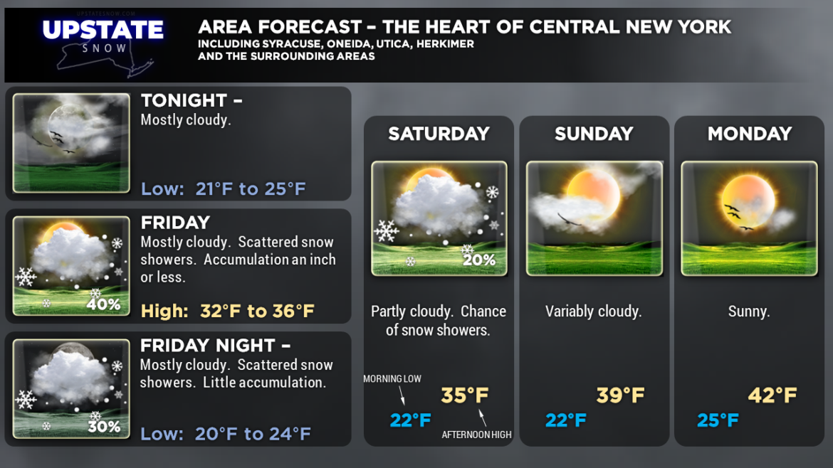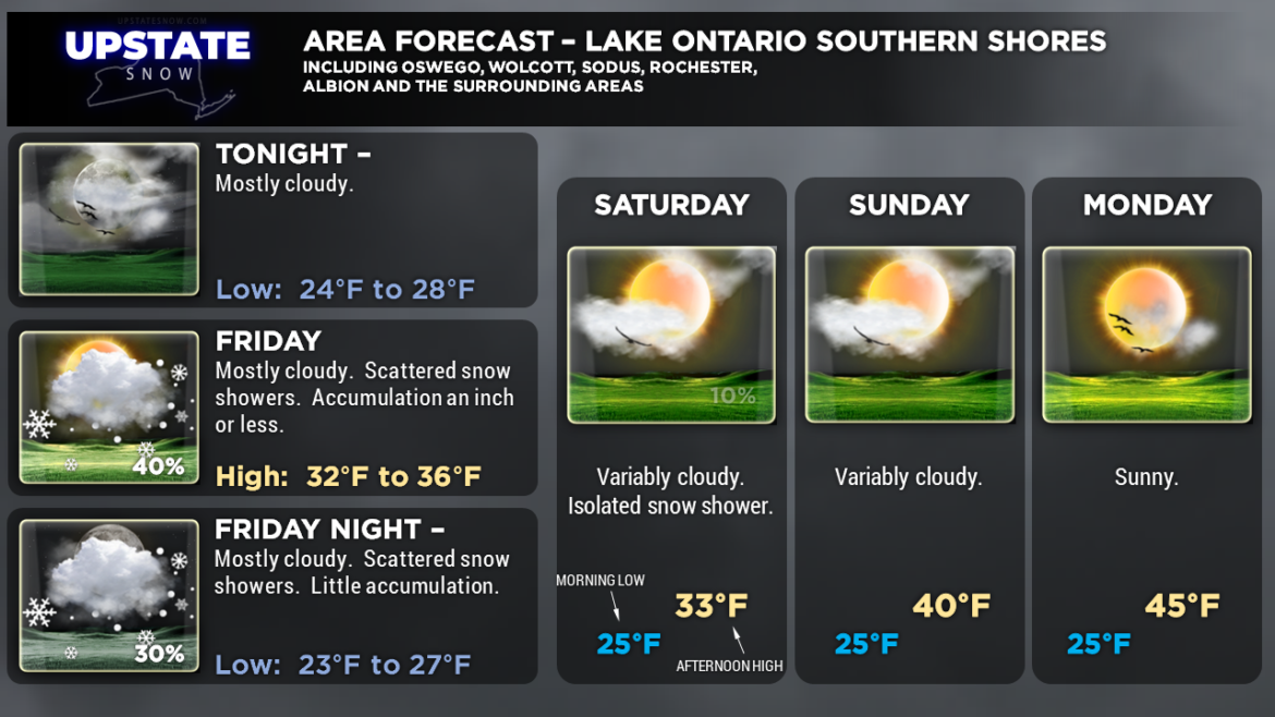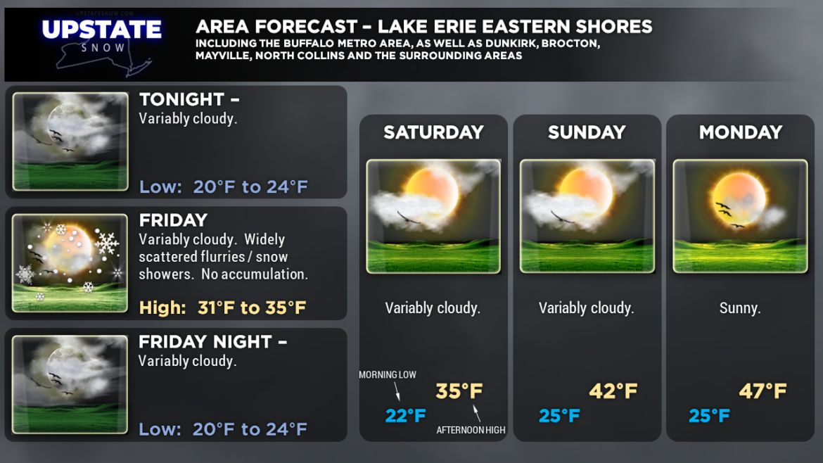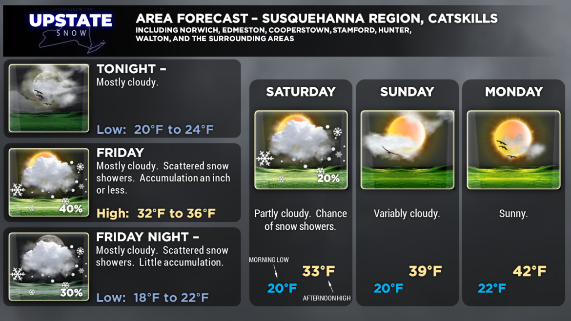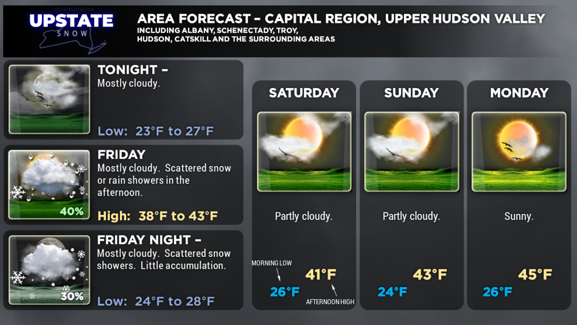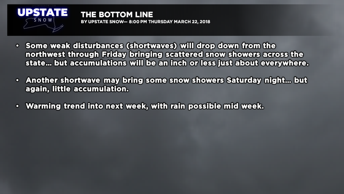
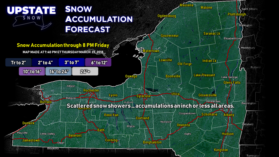
Good evening…. there really is not an awful lot to talk about. The next 5 days look relatively quiet across the Upstate. We’ll have a few shortwaves zipping down from the north/northwest over the next 24 to 36 hours which will bring intermittent light snow showers just about everywhere, with accumulations an inch or less. Instead of trying to get fancy with the snow map, more or less the entire Upstate will be affected by these snow showers.
Another shortwave will drop down and bring some more snow showers in here Saturday night, but again, not much of any accumulation.

For next week we’ll see high pressure building into the region from the north… this high will shift off to our northeast. As this occurs, a southerly flow of warmer air will develop. We’ll start to notice this on Monday, but by Tuesday we could be looking at highs in the 50s across western NY and the Fingerlakes. The models show that our next system will approach by mid-week… there’s some disagreement in the modeling as far as timing, but the end result is more-or-less the same: Increasing clouds with the threat of rain Wednesday… maybe some freezing rain in some areas Wednesday morning.
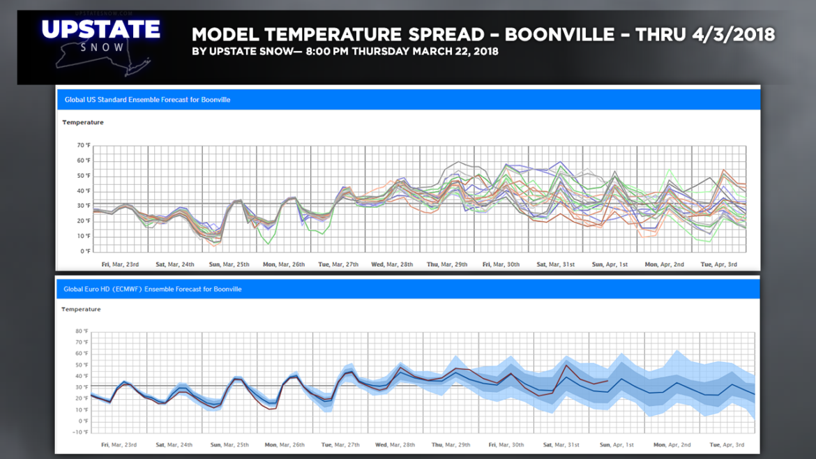
Here is some longer-term information — model ensembles temperatures for Boonville, NY, through April 3rd. The trend is above-freezing beginning the middle of next week but the tighter members keep temperatures averaging a little above freezing each day and a little below freezing each night. Take this with a huge grain of salt — since there’s a wide variance in the ensembles, there’s a wide range of solutions. But it gives a general indication of where we’re headed into the first of April.
The long-range outlook issued by the Climate Prediction Center back on March 16 shows a potential for below-normal temperatures between March 31 and April 13 across the northeast. This doesn’t say how MUCH below normal, just “below normal.” For reference, for Boonville (picked because of it’s CNY location) the normal high for April 1 is 43 with a normal low of 25.
Here are your graphics — thanks for viewing!