Good evening…
First up, we have some warnings and advisories this evening —
FLOOD WARNING —
Tioughnioga River at Cortland, affecting Cortland County, through Saturday afternoon. At 4 PM Friday the stage was 7.8 feet. Flood stage is 8 feet. Minor flooding is forecast. The river is expected to rise above flood stage by 7 PM Friday and crest near 8.2 feet around 2 AM Saturday. The river will fall below flood stage after 12 PM Saturday.
LAKESHORE FLOOD WARNING —
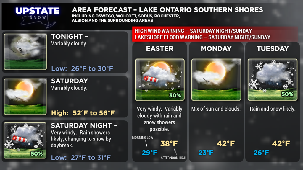
Lake Ontario shoreline – Wayne, northern Cayuga, Oswego, and Jefferson counties. Strong westerly winds will bring significant wave action and the potential for lakeshore flooding and erosion to the eastern and southeastern shoreline of Lake Ontario. This will be from late Saturday night through early Sunday morning.
HIGH WIND WARNING —
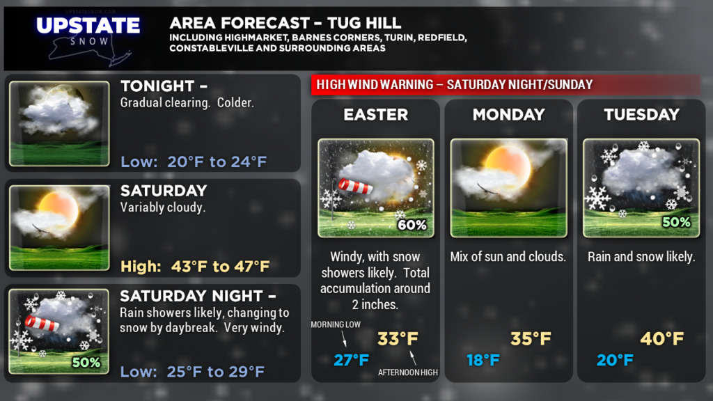
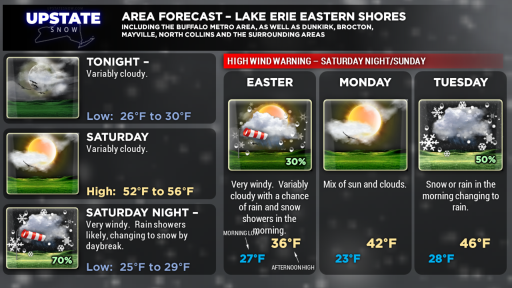
Niagara, Orleans, Monroe, Wayne, Erie, Genesee, Wyoming, and Chautauqua counties, mainly along the lakeshore along Lake Erie and South of Lake Ontario to about the Thruway. Northern Cayuga, Oswego and Jefferson counties. The warning is in effect from late Saturday afternoon through early Sunday morning. Winds will be strongest overnight. Winds will be from the southwest 20-30 mph gusting to 60 mph. This could bring down trees and power lines, resulting in scattered power outages. Travel may also become hazardous for high-profile vehicles.
WIND ADVISORY —
Lewis, Livingston, Ontario, Cattaraugus, Allegany counties. The advisory is in effect from late Saturday afternoon through Sunday morning. Winds will be from the southwest 20-30 mph with gusts to 50 mph. These winds could bring down tree branches and power lines, resulting in scattered power outages.
—–
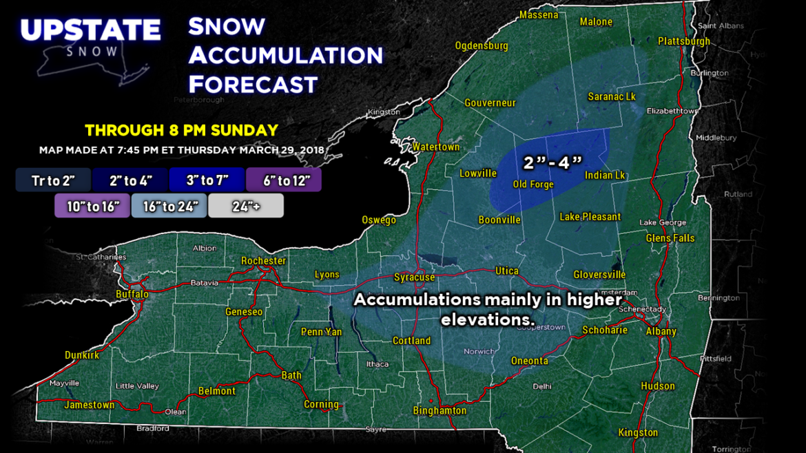
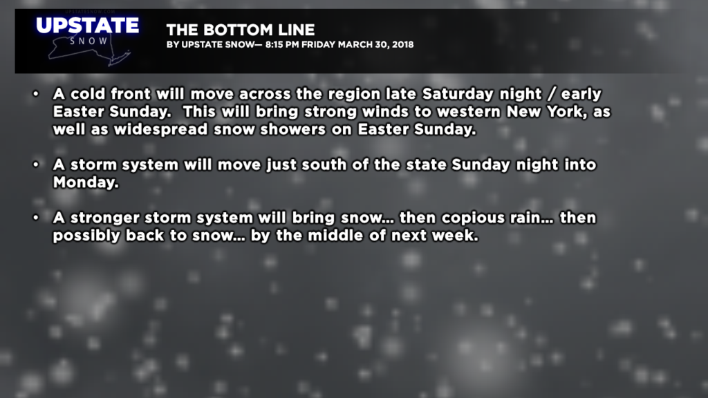
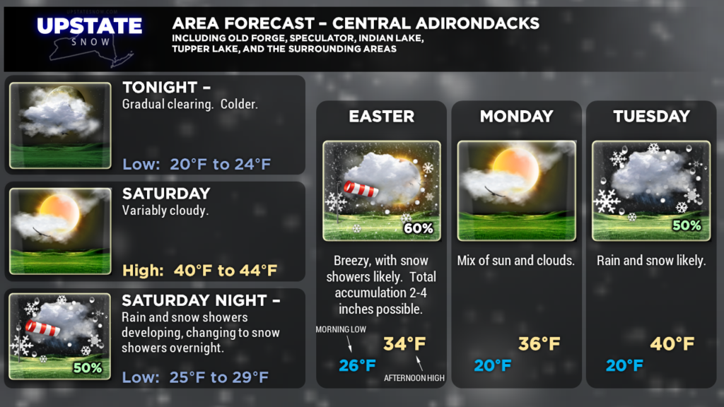
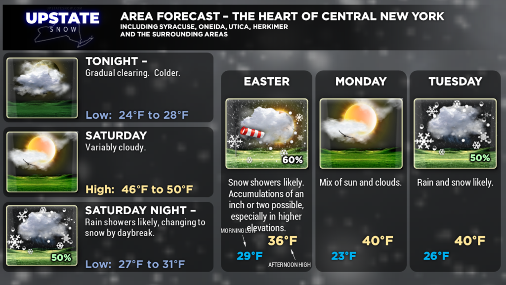
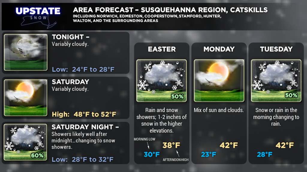
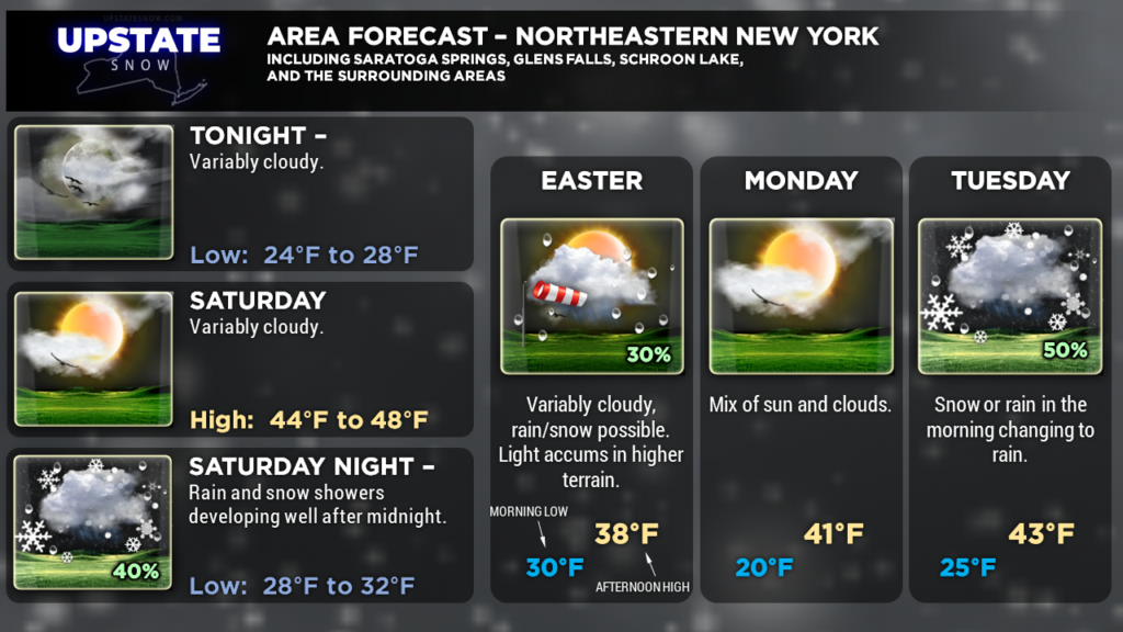
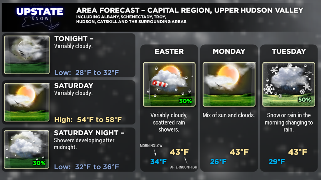
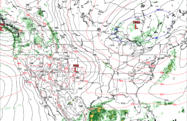
We will see high pressure building in over the region, and this will bring a mostly sunny day for Saturday. An area of low pressure will move north into Canada and drag yet another cold front across the area overnight Saturday night into Sunday… this will be responsible for the strong winds… as well as a rather dramatic return of cold air and snow showers for Easter Sunday. Models are suggesting that a light snow accumulation will occur over a good portion of the state — generally 2 inches or less — but 2-4 inches may fall over portions of the Adirondacks thanks to a little bit of lake enhancement and upsloping flow. Highest accumulations would be over Lewis, northern Herkimer, and northern Hamilton counties through 8 PM Sunday.
The next weather system will scoot just to our south Monday. There’s the chance that some snow moves northward into south-central New York late Sunday night and early Monday. Yet another storm system heads by Tuesday…. bringing a warm front through the area Tuesday followed by a cold front Wednesday. As of right now the pattern looks like we’ll start out with a period of snow Monday night, transitioning to rain Tuesday, continuing through Tuesday night, before transitioning back to snow for Wednesday. There’s considerable model disagreement on this… but heavy rain is a potential for Tuesday.
Our final weather post is scheduled for tomorrow evening. We’ll watch this system for next week and provide updates if the potential for accumulating snowfall becomes more certain. For what it’s worth, dragging the European snowfall model out through April 9 shows double-digit snow accumulations north of a line from Alexandria Bay to roughly Elizabethtown. The GFS, out through 8 AM April 9, shows widespread 2- to 6-inch snows across the state, with double-digits over the far north. So we’ll see.

