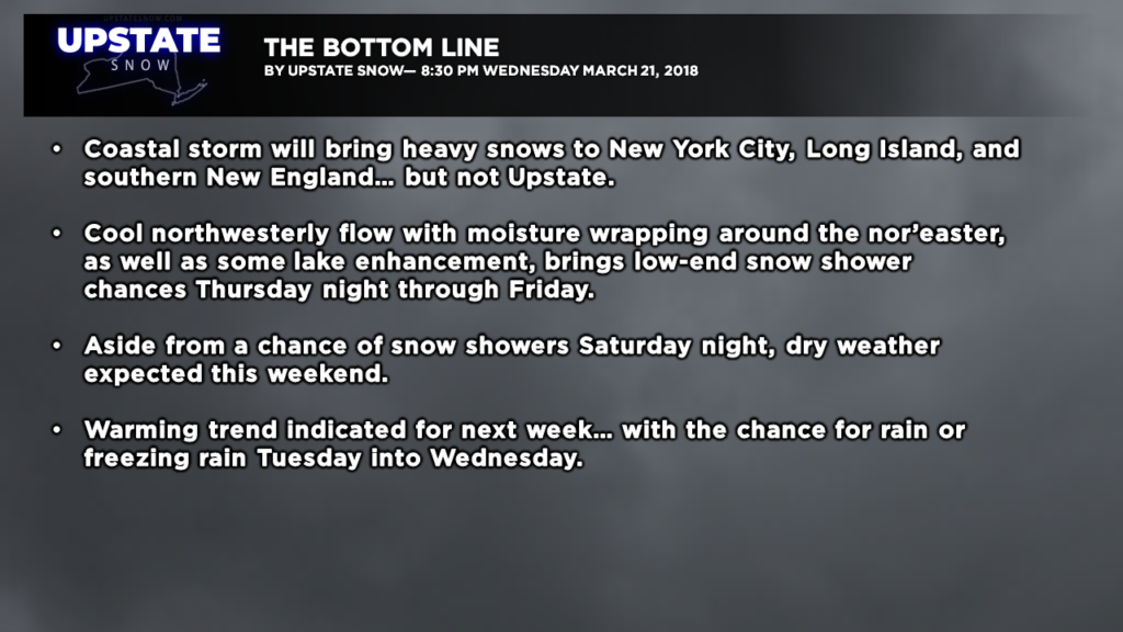
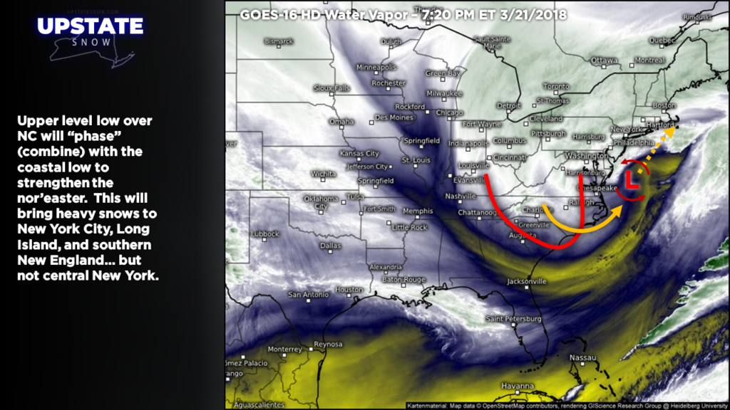
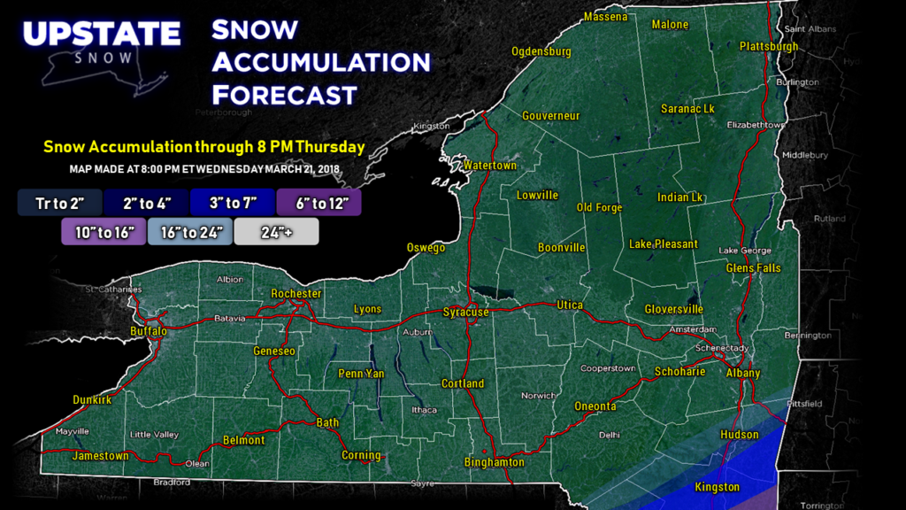
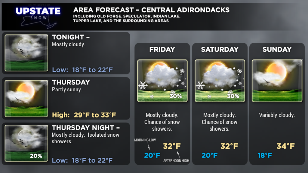
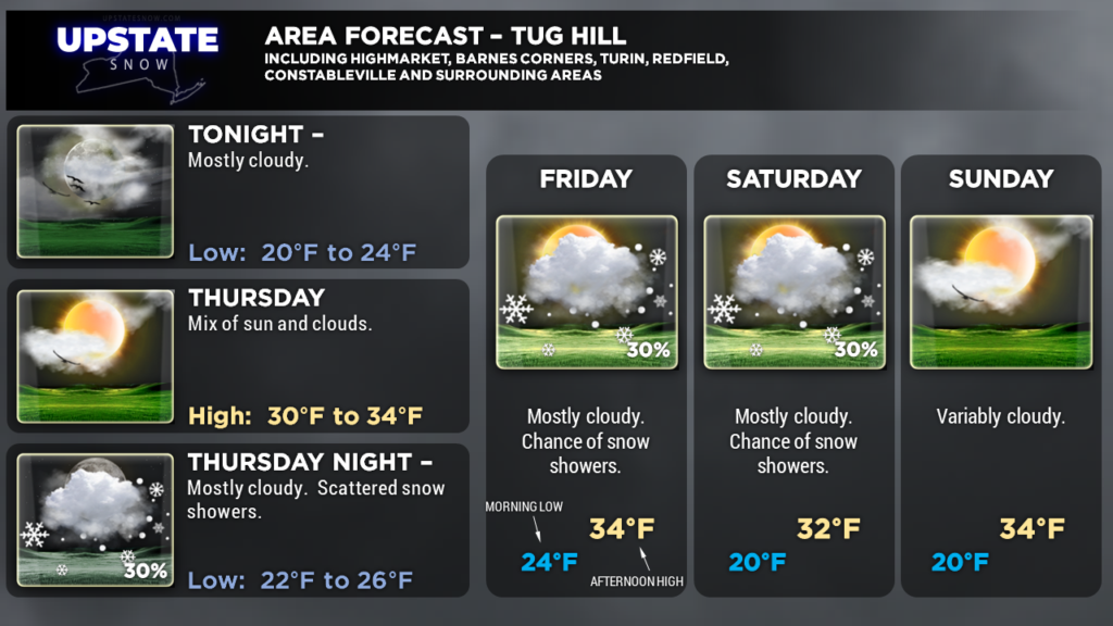
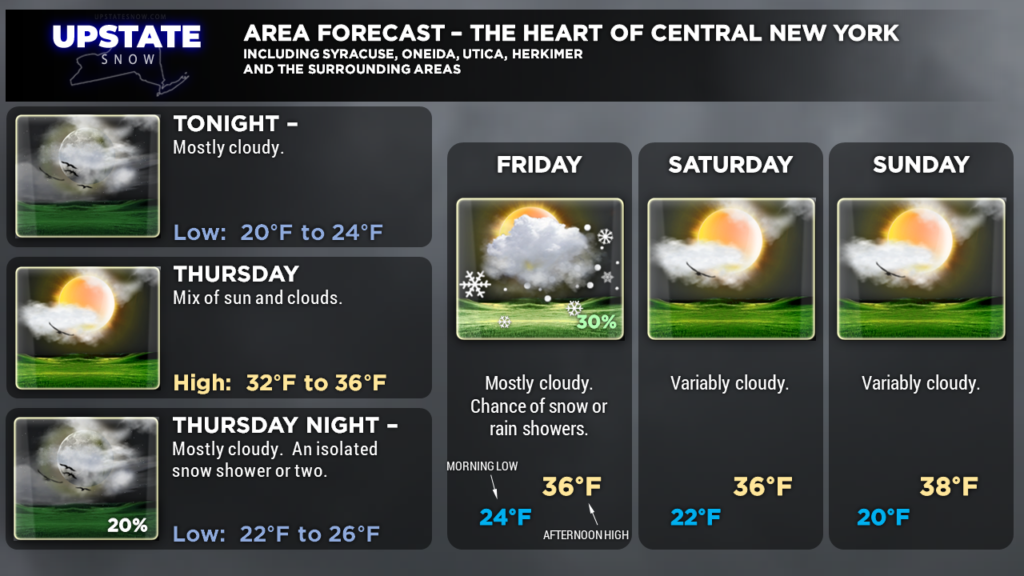
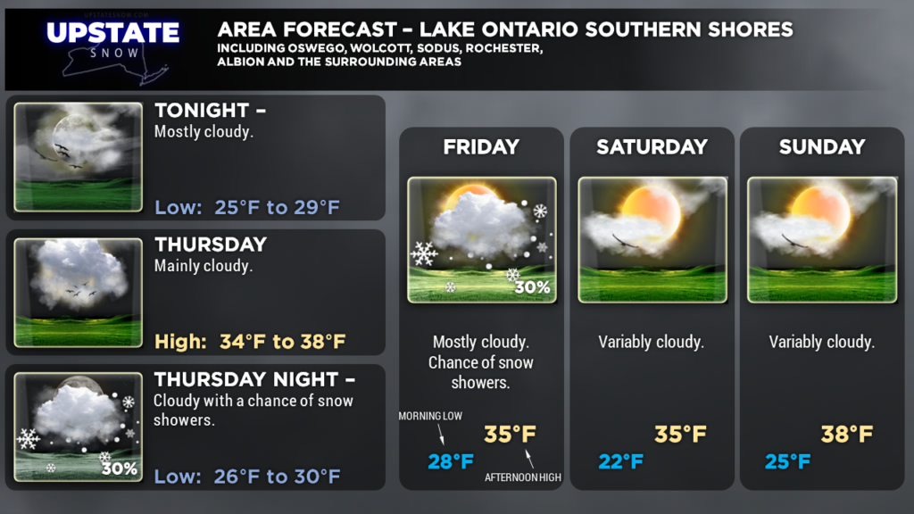
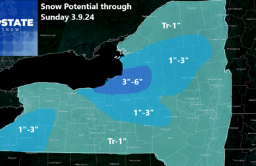
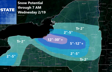
Good evening! The fourth Nor’Easter of the month is taking its sweet time getting its act together this afternoon. Some in the lower Hudson Valley are wondering, “where’s the snow?” but it’s coming. Upper level energy over North Carolina will rotate northeastward and “phase” (combine) with the surface low… which will strengthen the low but finally give it a kick in the pants to move it to the northeast. This will bring heavy snows to NYC, Long Island, and southern New England… but not the Upstate.
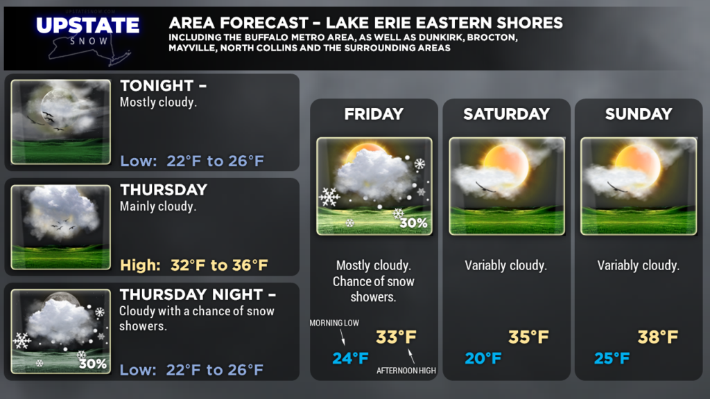
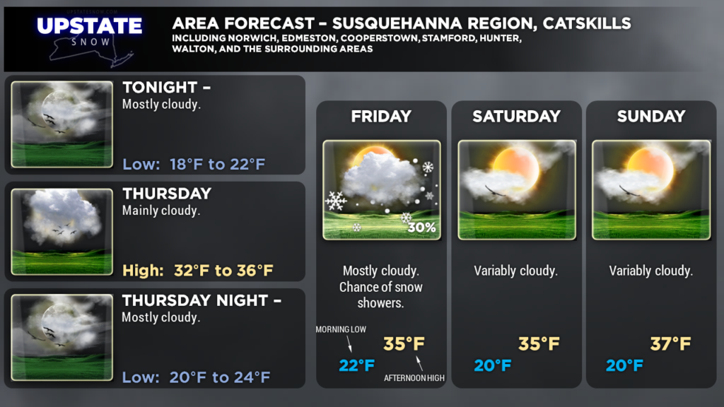
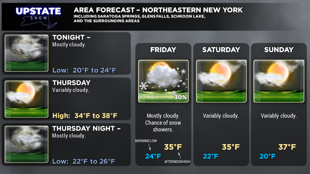
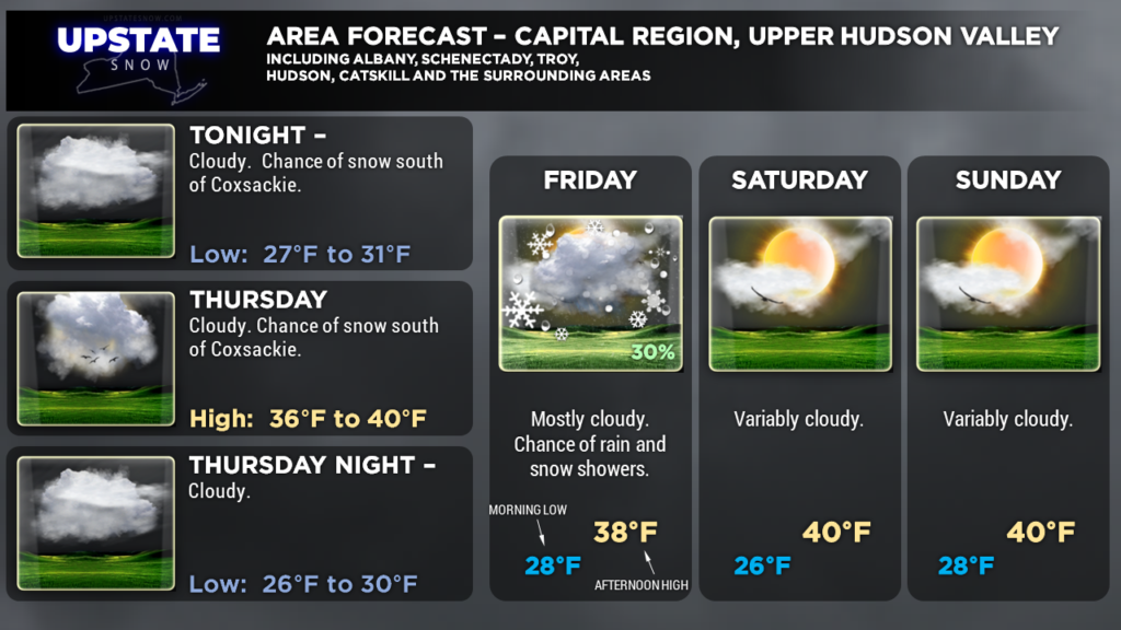
Meanwhile we’ll continue with a cool northwest flow for the next few days. Some moisture wrapping in from the nor’easter may combine with moisture coming over Lake Ontario to provide a bit of lake effect snow shower activity Thursday night into Friday, but on the whole the snows will be light, scattered, and will provide very little accumulation. Afternoon highs will be above freezing just about everywhere save the far north as we get into the weekend.
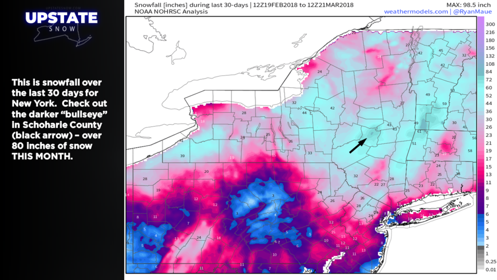
A side note, check out this map… this is how much snow has fallen over the past 30 days (really since the beginning of March). There’s a bullseye in Schoharie County where over 80 inches of snow has fallen… THIS MONTH. Another bullseye just over the border into the southern Berkshires where 80-90 inches of snow has fallen… THIS MONTH.
WEEKEND —
Another area of low pressure will work its way into the southern Ohio Valley, while high pressure continues to flex its muscle off to the north. Good ol’ CNY will be in between these two for the weekend…. but we will serve as a pathway for yet ANOTHER upper-level low to pinwheel down across the state Saturday night. At worst this will bring some clouds and the chance of snow showers Saturday night… with skies becoming sunny on Sunday.
NEXT WEEK —
A warming trend is in the cards for next week. Our winds will turn southerly Monday… especially Tuesday next week with temperatures warming into the lower 50s in some areas. Our next frontal system will approach in the Tuesday-night/Wednesday timeframe… and at this time the models are indicating it will be warm enough that precipitation falls in the form of rain… with freezing rain possible as well… we’ll have to wait and see. Either way, right now it isn’t looking optimistic for snow.
Tick-tock…tick-tock….
Here are your zones for tonight, thanks for viewing!


