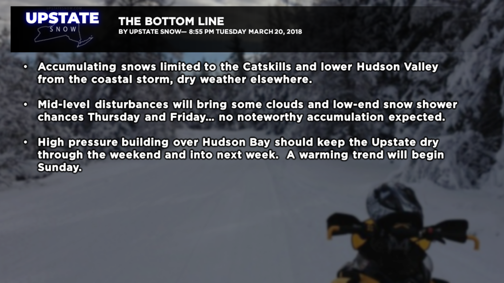
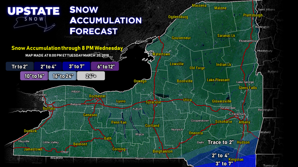
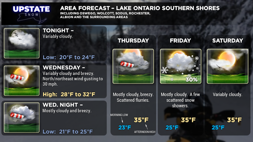
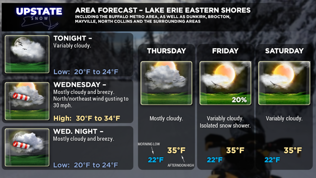
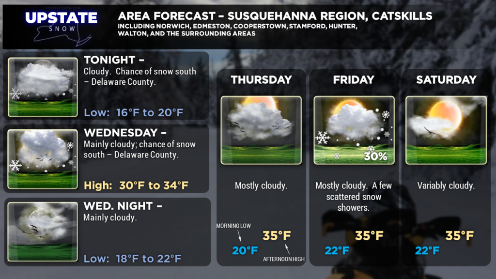
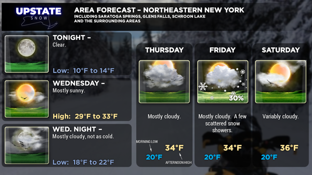
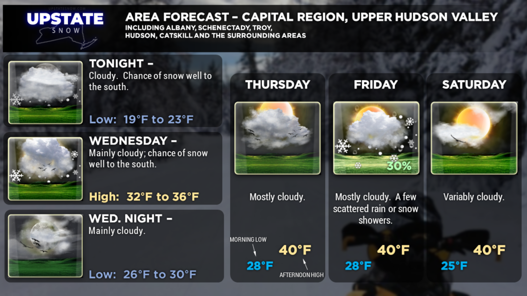
Good evening! Complex, deep low pressure will move along the Virginia coast while middle- and upper-level energy rotate along the NC/VA border “catching up” to the surface low. These will combine to form a powerful, but compact storm off the coast for Wednesday. Strong high pressure over the northern Great Lakes will help suppress the precip from this storm to our south… accumulating snows will be pinned to the Catskills and lower Hudson Valley, and into southern New England, while a mix of clouds and sunshine dominate elsewhere.
A couple of disturbances in the middle levels of the atmosphere will zip down from Canada on the back side of the coastal storm… these will bring additional cloudiness and the chance for some snow showers particularly Thursday night into Friday. Unfortunately these will be “nuisance” snow showers, and no real accumulation can be expected out of these.
A sprawling area of high pressure will continue to build over Canada, while models show another storm system moving off to our south over the weekend. There’s some uncertainty with the models though, so we’ll watch this… if it tracks a little farther northward, we could see some snows across the southern tier.
As we go into next week, the final week in March, high pressure will continue to strengthen (European model says 1043 mb) over southern Quebec and Newfoundland, as a strange area of low pressure wanders aimlessly about 500 miles off the east coast. Warmer temperatures will start building north and east on southerly winds on Sunday, but particularly Monday into Tuesday next week… we could be looking at highs approaching 50 in some areas next week. Longer-term ensembles show temperatures in the 40s and 50s extending into the first few days of April….
Tick-tock-tick-tock…….
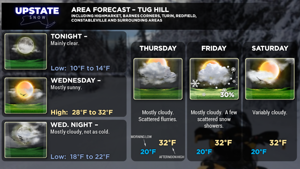
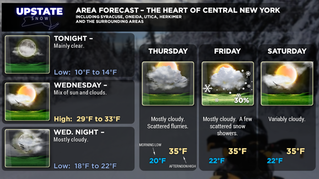
Here are your zones, take care!


