Good evening! I hope everyone’s had a great weekend riding or otherwise enjoying the snow.
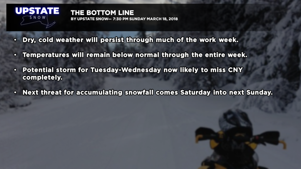
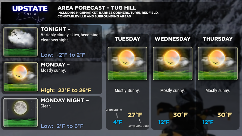
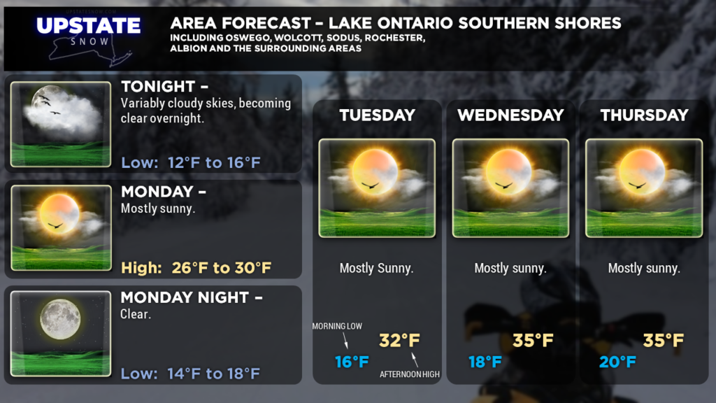
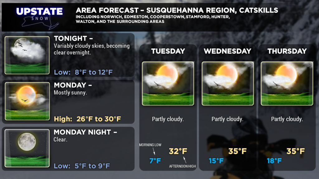
We had a little bit more cloudiness than originally expected over portions of CNY today, but other than that everything is going as planned. Some cloudiness will continue into tonight, particularly from the Tug Hill southward into the Susquehanna Region, but skies should become clear overnight allowing temps to drop.
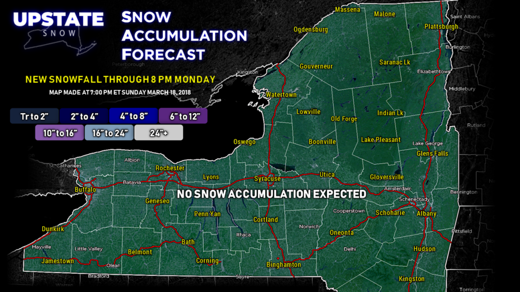
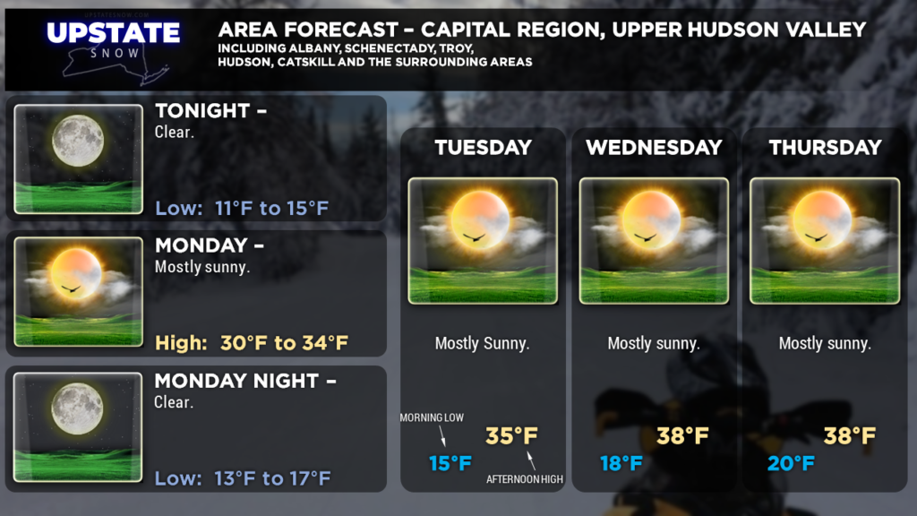
No snow accumulation is expected over the next 24 hours.
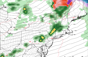
We’re expecting dry high pressure from Canada to dominate the weather throughout the work week. Yes, there’s still that storm potential for Tuesday night into Wednesday, and of course the models can’t seem to get on the same page either. The GFS and NAM keep the system off to our south, with absolutely no impact other than some cloudiness for the southern tier. The European and Canadian want to brush the very southern Catskills with a little bit of snow, as they nudge the center of low pressure back to the north/west. Ensembles are also split in their interpretation of this.
As of right now though, even the models showing the farthest north/west placement, snowfall would only reach as far north as maybe Sullivan County and the southern Hudson Valley, with just some cloudiness moving over south-central New York.
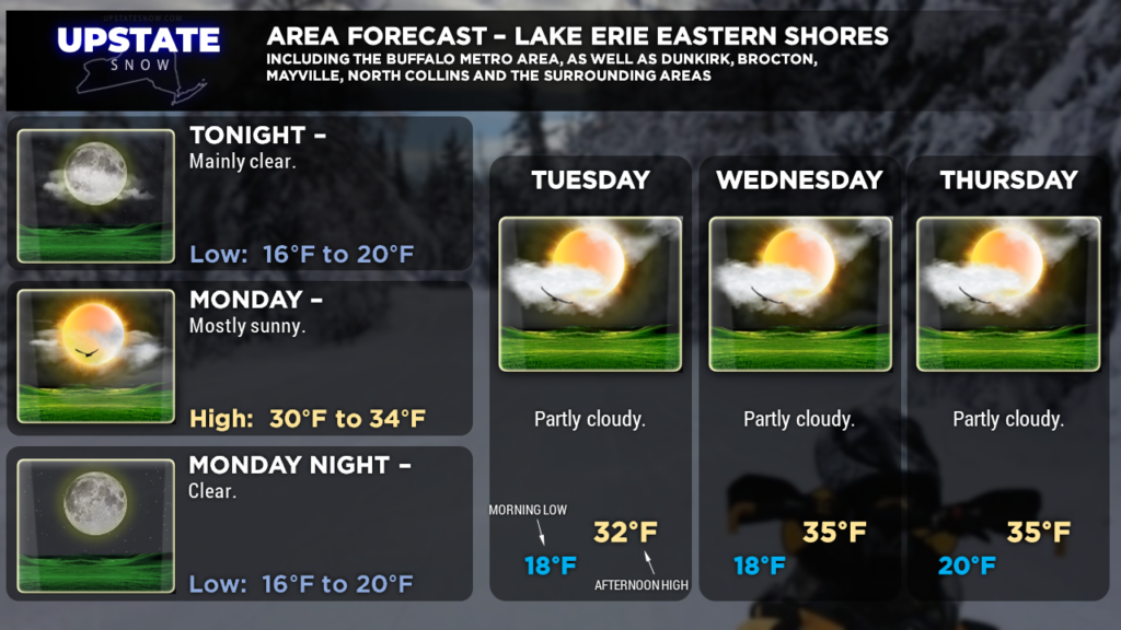
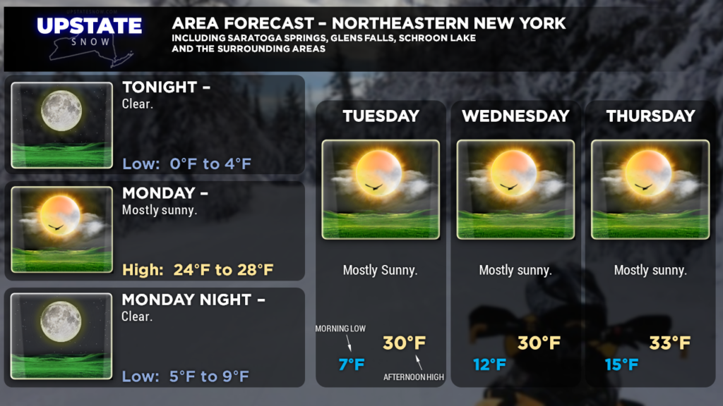
We’re very confident that this storm is a miss, and there’s no mention of precipitation in any of our “zone” forecasts through Thursday.
The next chance for accumulating snows comes this weekend. Models show low pressure moving into the Ohio Valley, with an energy transfer both in the upper levels AND at the surface to a developing area of low pressure off the Delmarva coast Saturday night. We’ll be watching this… because if the long(er)-term models have any validity, this might be the final one for the season.
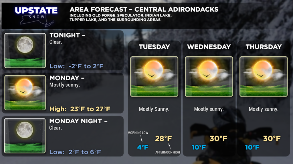
Here are your zones for tonight. Thanks for viewing and supporting the site!


