Good evening! Of COURSE there was a northerly/westerly shift in the modeling for our coastal storm. They say that the sport of baseball will humble you… well… meteorology will do that as well. We were as certain as we could be that there would be no impacts at all anywhere in the state from this storm yesterday… and now we have winter storm watches for NYC and vicinity, and accumulating snows probably into the southern Catskills. Still a “miss” for the rest of upstate New York though.
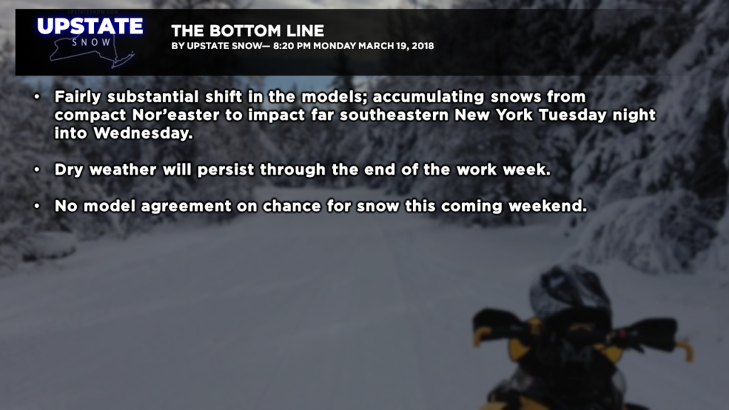
The models today really did shuffle the deck on us. The latest runs of the entire suite of models that we use are all coming into agreement on a complex weather scenario that will bring a deep nor’easter off the New Jersey / Long Island coast, but only brush the farthest southeastern part of the region with snow.
Trying to spell it all out in plain English, there are a couple of factors at play here. First, remember a week or so ago when we talked about a “closed low” that was wandering around northern NY? This is happening again, but this time it will be over eastern Kentucky / West Virginia, southwestern Virginia. This is a “stacked” low as well, meaning we have low pressure running from 5k feet, through 10k feet, up to 18k feet… it’s stacked, like a stack of pancakes. That “closed low” will provide the atmospheric energy and support we need to ………
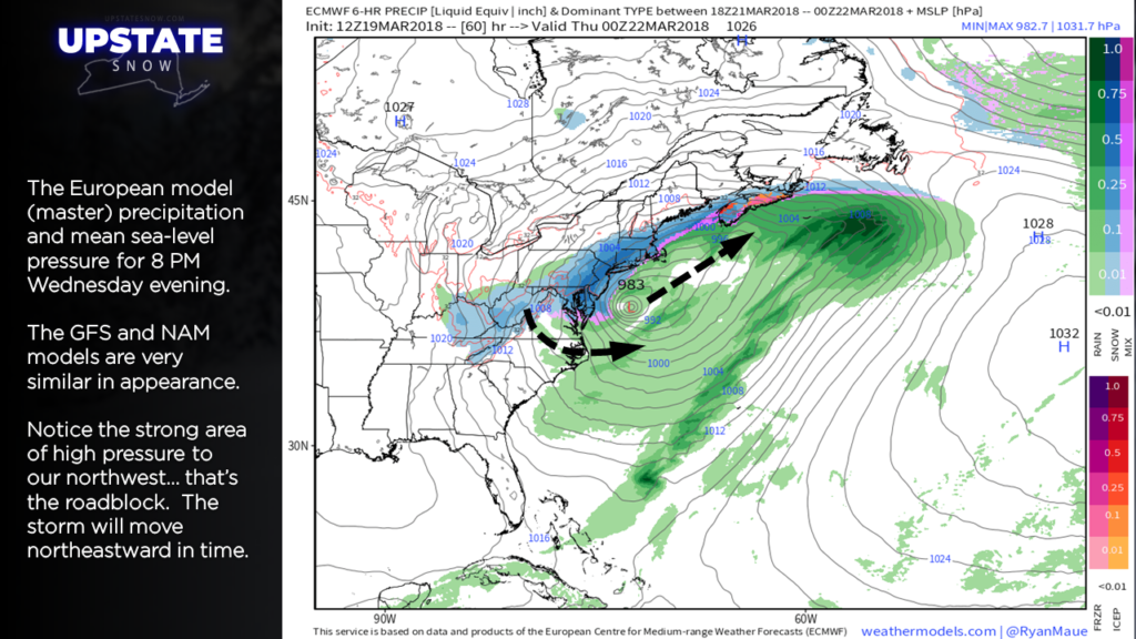
….. have a surface low pressure center develop just off the South Carolina / North Carolina coast, and move northward to the waters off the Virginia coast early Wednesday morning. By Wednesday evening, a strong (983 mb) but compact nor’easter will be off the New Jersey coast, and the European model brings snow as far north as the I-88 corridor.
The GFS and NAM models are in almost perfect agreement with this solution as well. The surface low will tend to drift eastward Wednesday, as the middle- and upper-level low says, “dude, wait for me!” Eventually the upper-level support aligns over the surface low and the storm will reach peak intensity. There may be a several-hour period Wednesday afternoon where heavy snow falls over Sullivan, Ulster, Dutchess Counties and points southward, but accumulating snows as far north as I-88 to about Cobleskill, with the line turning southward from there.
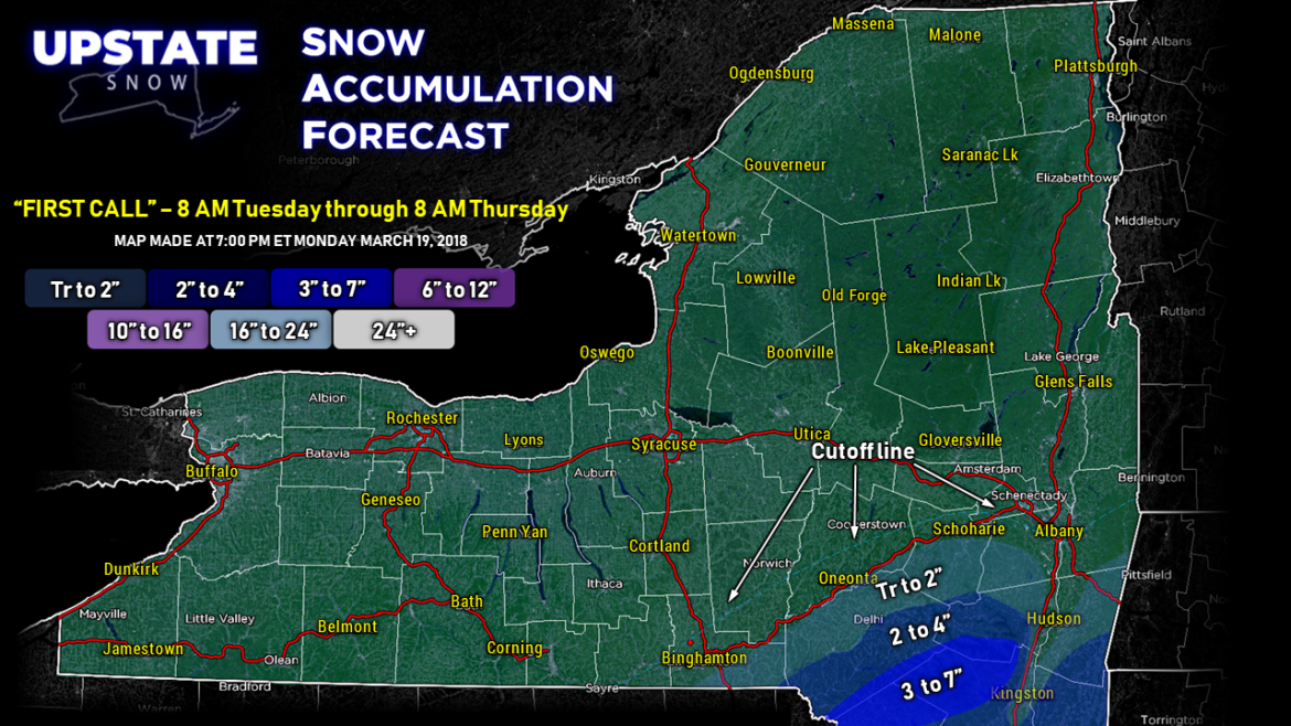
Here’s a “first call” / “rough sketch” map of our current thinking on this….
As of right now, and mercy is this subject to change, we’re painting 3″ to 7″ for most of Sullivan and Ulster Counties (elevation-dependent), basically the southern edge of our map, with 2″ to 4″ for the southern half of Delaware County and Greene Counties. Much less (if any) in the immediate Hudson Valley). We used I-88 as the cutoff for any snow accumulation, and snow itself cuts off completely a little bit north of that.
“But wait… if the storm is so strong, why is it only hitting THAT area?”
The answer is three words: Cold high pressure.
“Wait… what?”
Yes. Cold high pressure, strong high pressure, is DENSE high pressure. That dense, cold sinking air acts as a drying mechanism, and that will prevent precipitation from reaching any farther north than where we’ve illustrated. Strong high pressure will be centered just north of the Great Lakes, and it’s influence will be felt from Newfoundland all the way into the upper midwest of the United States. That also provides a very firm road block as to just how far north the precip can go.
The biggest “bust potential” on this is how far north the snow line will progress. There are a few indications that snow could make it as far north and west as perhaps Corning to Cortland, to Gloversville to Bennington Vermont. That’s not very likely though; where we drew the dotted “cutoff line” on the snow map is the most likely scenario. There’s also the possibility that there’s a short distance between no snow at all and what would be winter-storm-warning criteria snow… i.e., I-88 corridor with nothing, but drop south/east about 10-20 miles and looking at 7 inches or more. Those are example of some of the variables in play, and we’re just putting that out there “just in case.”
No matter how you slice and dice it, though, the vast majority of central, western, and northern New York won’t get in on this event.
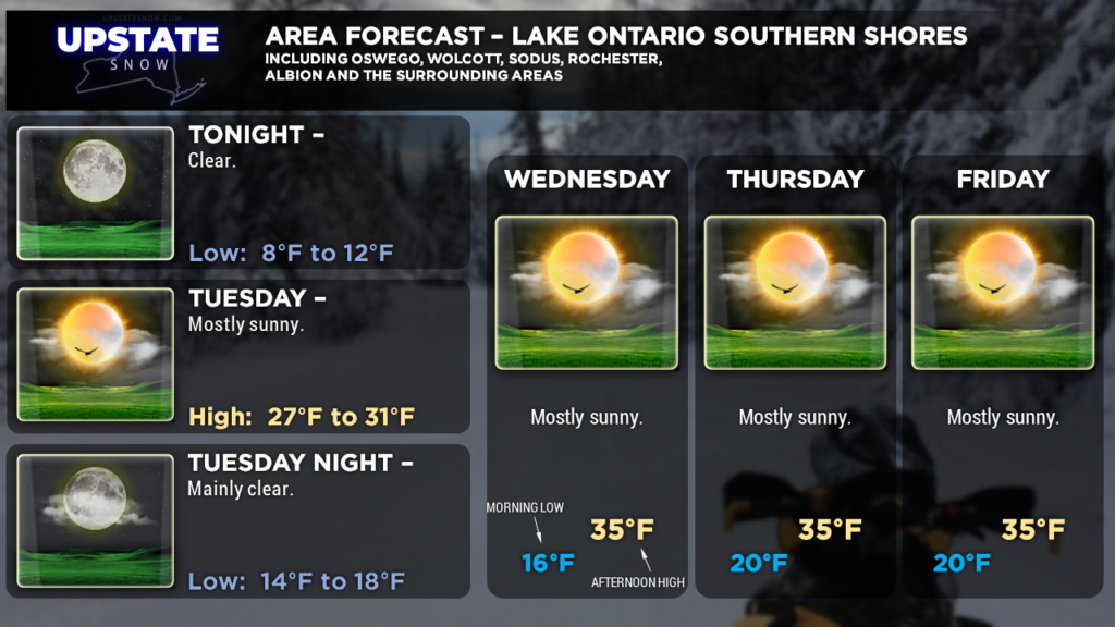
After that all moves away, things look to remain quiet through the end of the work-week. Watching the potential for another storm system for this coming weekend, but the models have once again decided that consistency is overrated. No confidence on any forecast beyond Friday — just the “chance” that we could see more accumulating snows. Temperatures, on the whole, look to run below where they should be this time of year, so keep on riding while we have it. With the high sun angle, and Wednesday being the first full day of spring, even with temperatures in the 30s, we’re going to see some melting more and more each day… that clock is definitely ticking…
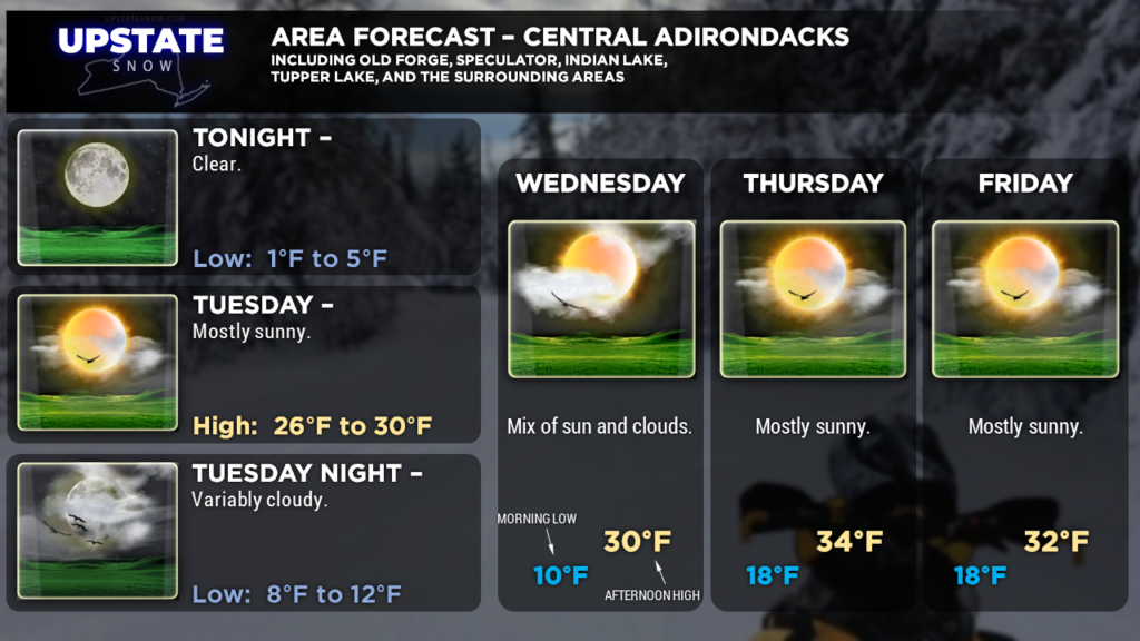
Here are your zones … thanks for viewing!

