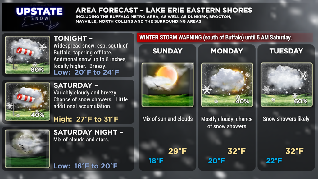
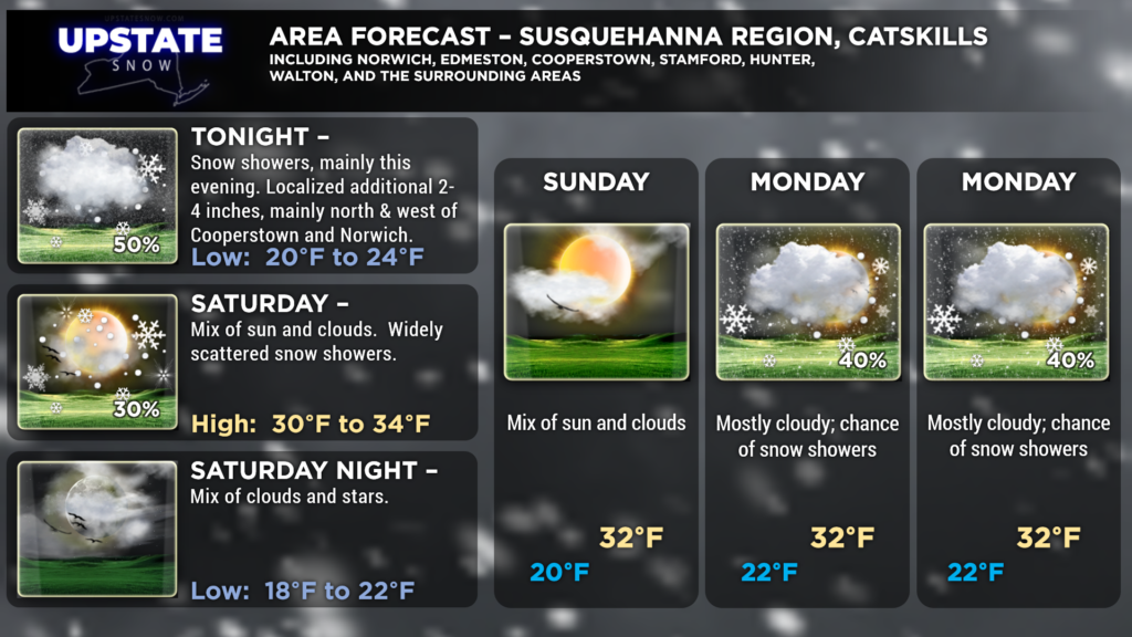
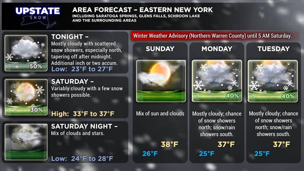
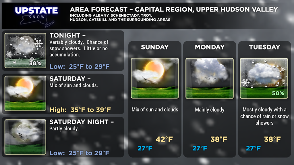
Good evening snow lovers!
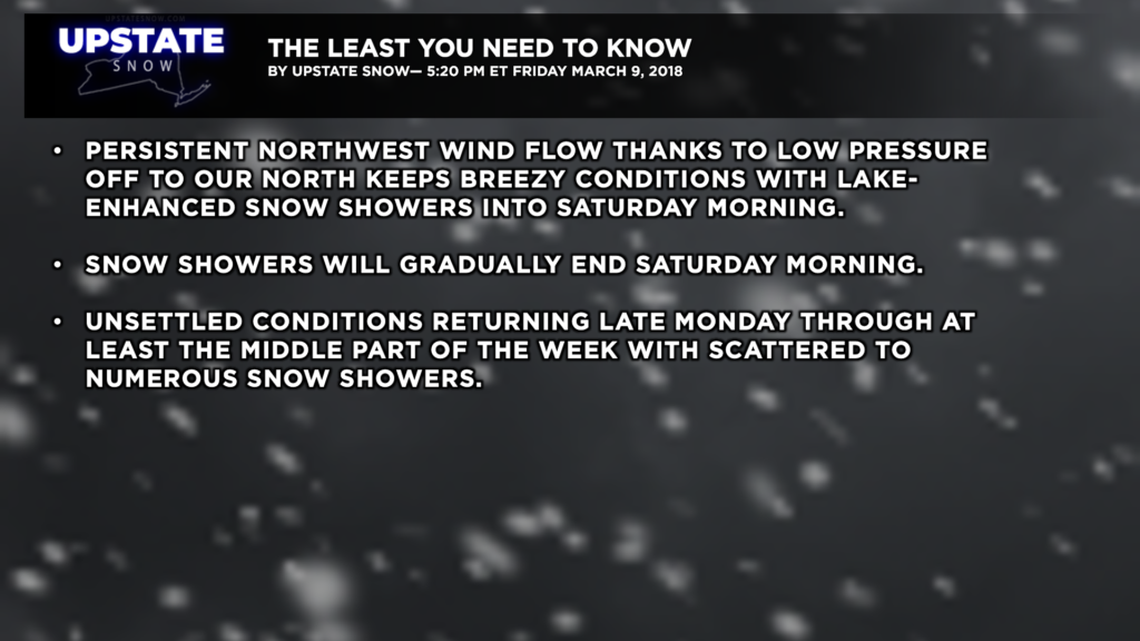
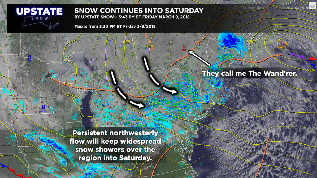
Areas of low pressure doing a little dance off to our north and northeast will keep a persistent cold northwesterly flow going for at least the next 8-12 hours. This will keep widespread snow showers going over much of the state through the night, but we will see a gradual decrease in coverage and intensity overnight, and most of the snow showers SHOULD come to an end during the day Saturday. We’ll see breezy conditions — northwest winds of 15-25 mph with occasional gusts to 30-35 mph will create some reduced visibility in blowing and drifting snow, so keep that in mind for your riding this weekend.
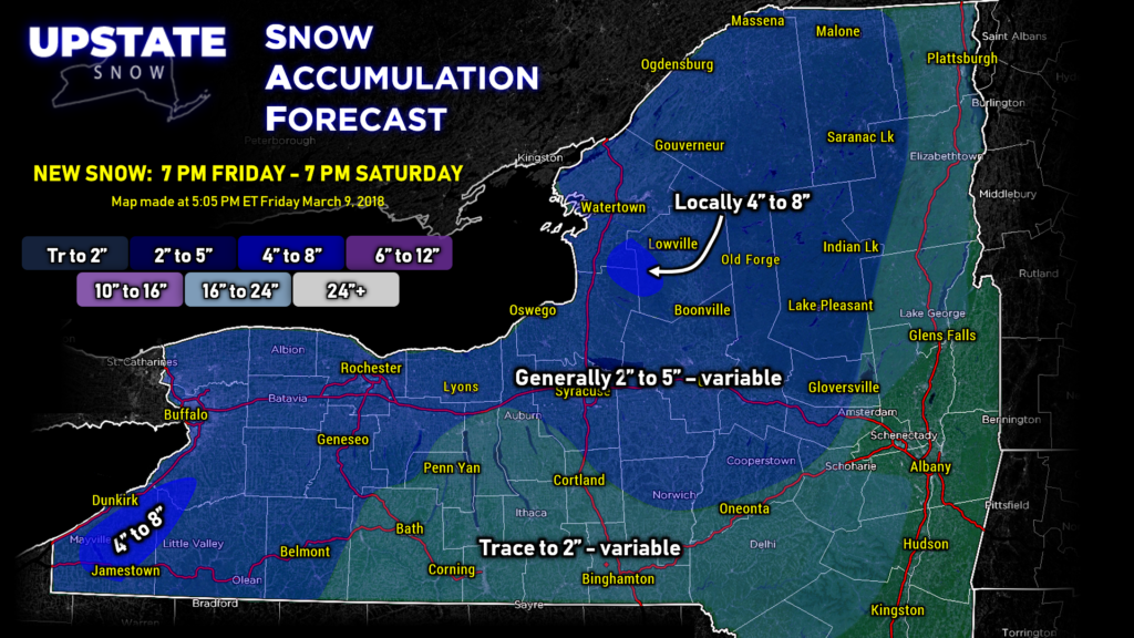
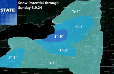
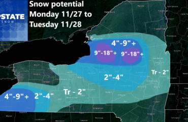
As with last night, tonight’s snow map — we’re not going to try to get too cute with this. The usual suspects to get higher accumulations will win, but we’ve painted a very general 2″-5″ for the vast majority of central and northern NY through 7 PM Saturday, but most of this is going to fall mainly before mid-morning Saturday. Trying to pinpoint just who gets what in terms of accumulation is a task that can only result in frustration, indigestion, and a need for a bottle of the Pepto. No… not everyone is going to get 2″-5″ tonight… but hey, some of us might even get a bit more.
Dry conditions should prevail late Saturday into Monday. We’ll see cold nighttime temperatures in the upper teens to mid 20s so the snow quality should stay quite nice.
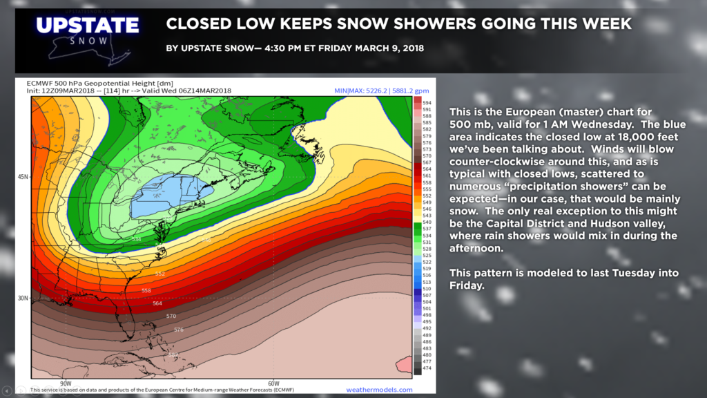
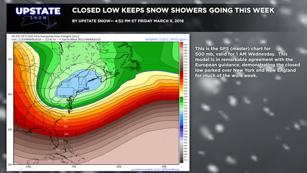
Our weather next week will be dominated by events taking place at about 18,000 feet off the deck. Remember that “closed low” we talked about last evening? The models continue to hammer this home. The European keeps the closed low firmly over central New York in the Tuesday PM through Friday AM period before finally pushing eastward. The GFS model is in remarkable agreement with the European in the placement of this closed low.
This points to unsettled weather pretty much from Tuesday through Friday, but there won’t be much “organization” to anything. Just widespread to numerous snow showers, and accumulations will be wherever those snow showers happen to persist the longest.
As we get toward the end of the week and into NEXT weekend, a brief bit of ridging appears to set up in the upper levels and at the surface ahead of the next significant weather system which could bring mild air with rain, switching to snow behind a front, for next weekend…. but that’s really so far out right now we’re not going to worry much about it.
We must make mention of what is a baby elephant in the room though. For about a week now, models had been hinting at a potential THIRD nor’easter. It’s looking less and less likely that will be an issue here. The GFS and Euro models show a pretty energetic low coming together and moving over southeast Georgia and the Carolinas, and then harmlessly out to sea. So nothing there.
RIDING CONDITIONS
Our folks told us today that Tug Hill seasonal roads, Old Forge, Deerfield, Penn Mountain, Ohio, and Trackside are all ranged from fair to excellent riding today. Need more snow in the lower elevations. Watch out for mud holes. ALWAYS… check with the club before you ride an area. Check our new “club news” tab for the latest grooming and trail conditions directly from the clubs.
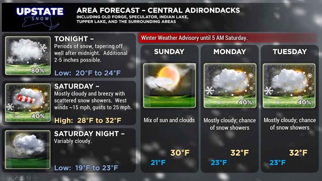
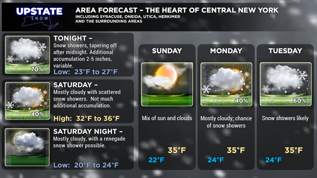
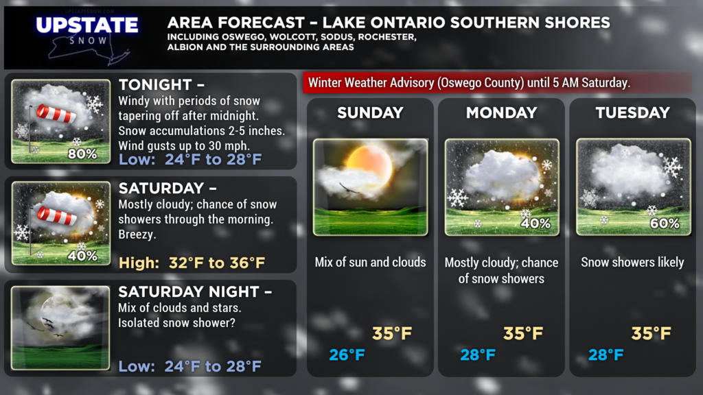
Here are your zone forecasts for tonight… take care!


