Good evening!
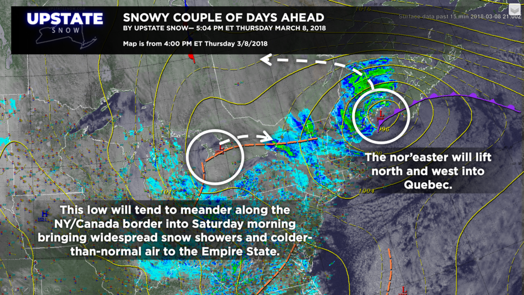
Our nor’easter will move north over Maine and then westward over Quebec, while another area of disorganized low pressure will meander along the New York / Canada border over the next 24 hours. Higher up, a deep trough continues in place over the northeast, while a “closed low” at about 18,000 feet will become established north Lake Ontario into next week. All of this will combine to pump in a moist northwesterly flow with widespread snow showers… and even some lake enhancement… into the weekend.
Advisories are posted for the Adirondacks and for the Chautauqua Ridge thanks to the lake enhancement. The models also show that a very well-organized band of lake effect … with a connection to Georgia Bay … on Friday afternoon, continuing into late Friday night. This will produce even more accumulating snows across portions of the upper Susquehanna region, central New York, the Tug Hill, and the southern Adirondacks.
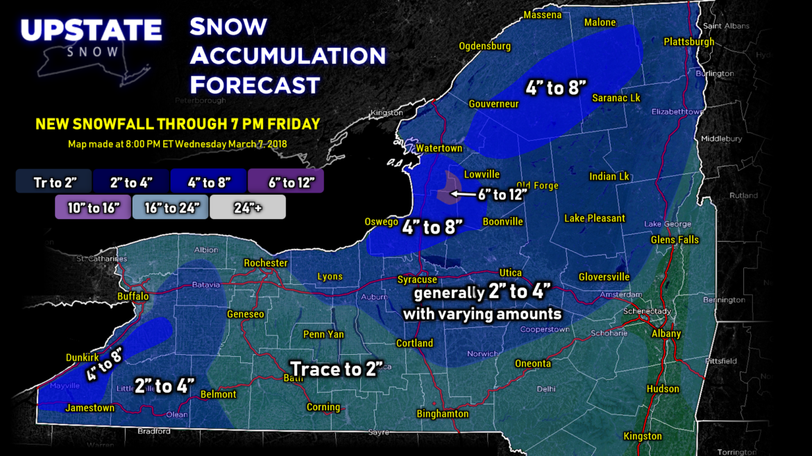
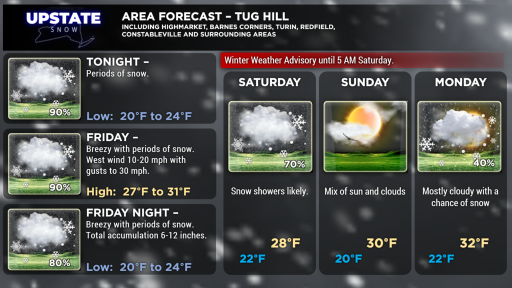
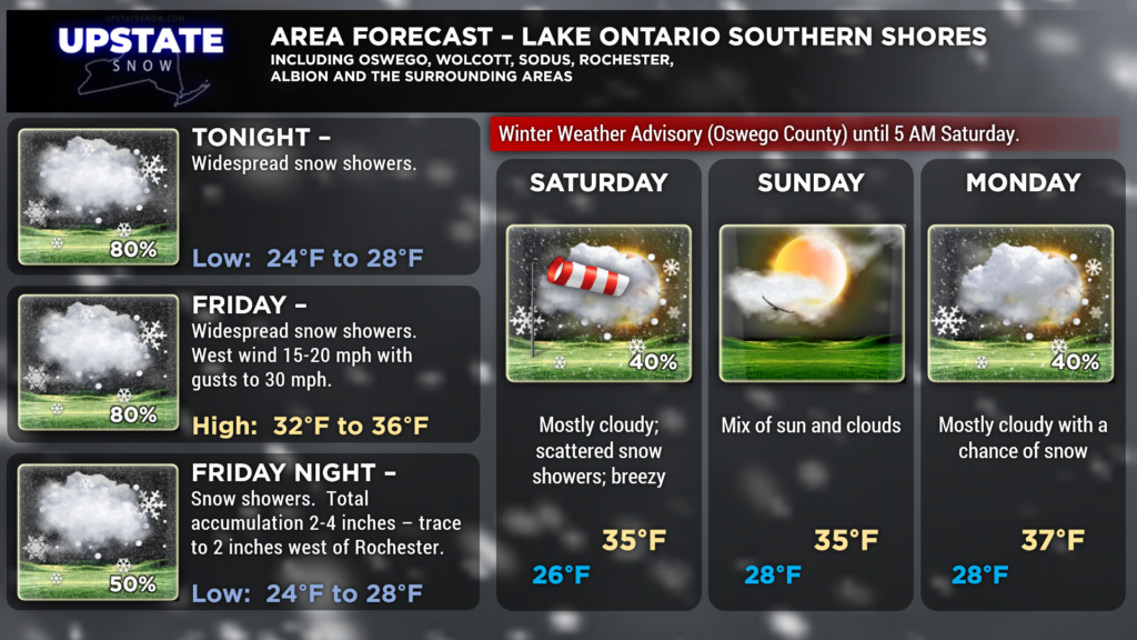
Our snow map goes through 7 PM Friday. We decided not to try to get too “cute” with pinpointing exact areas, and instead with a broad-brushing 2″-4″ inches across most of central and northern NY. This fairly closely resembles the high-res models. We went with 4″-8″ for much of Oswego County, as well as portions of Lewis and Jefferson, and another swath of 4″-8″ farther north as this will be closer to the surface low wandering aimlessly up the St. Lawrence valley. You may also notice that we colored in a 6″-12″ bullseye on the Tug, further enhancing the second riding season that we’ve been blessed with. Additional accumulations will take place after this 7 pm cutoff, especially into Saturday morning — wouldn’t be surprising to see another 2″-5″ or 4″-8″ on top of that.
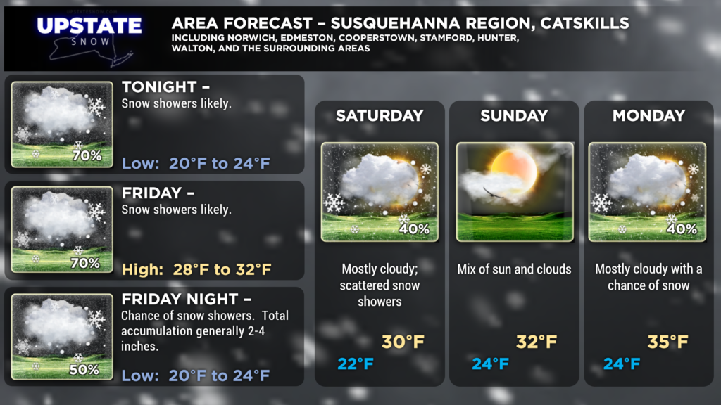
It wouldn’t be surprising to see some 3″ or 4″ amounts extending southward to include Oneonta and Delhi if that lake effect does indeed connect all the way from the Bay.
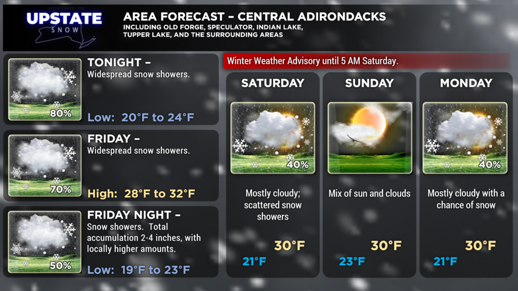
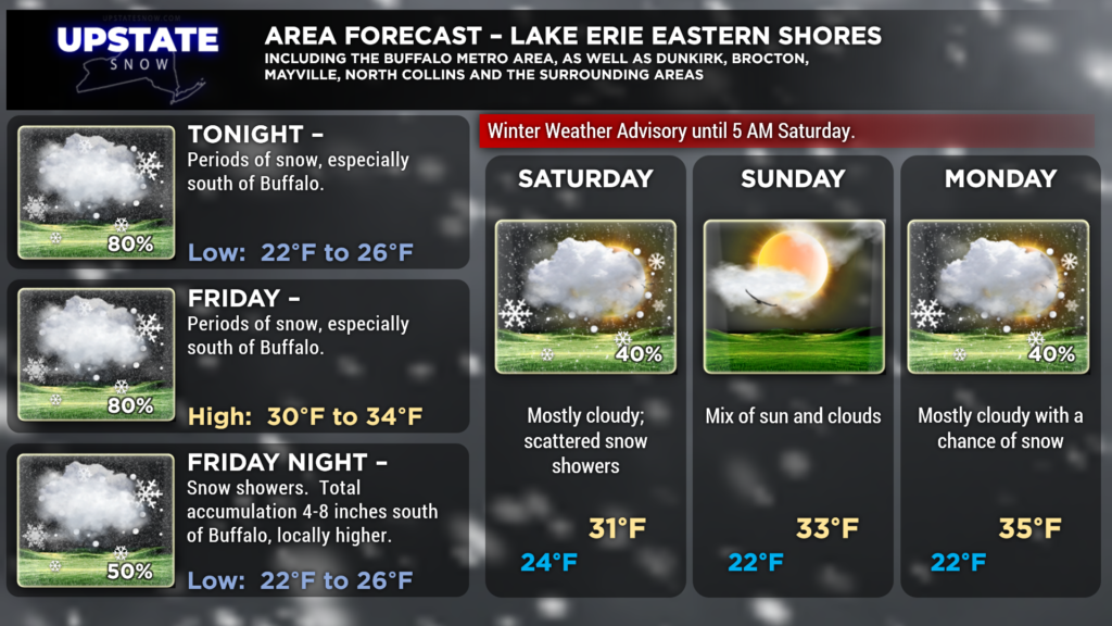
We also decided not to try to get too cute with our zone forecasts and again went broad-brush with widespread snow showers (or “periods of snow” for the Tug).
Snowfall amounts of 2″-4″ also can be expected for western New York from Batavia southward to the PA line, with a ribbon of 4″-8″ over the ridge. Again, wouldn’t be surprised to see some higher amounts as we extend into early Saturday, and Winter Weather Advisories are up for that area as well.
Elsewhere, scattered to numerous mainly light snow showers can be expected with a trace to 2 inches of snow here and there. Not everyone will see snow accumulations, but again, we weren’t going to try to get too cute with the graphics tonight. On the whole, we don’t expect any accumulation for the Albany/Schenectady/Troy areas and the Hudson Valley… but again… an isolated 1″ or 2″ is possible.
NEXT WEEK—
Generally unsettled weather will continue into next week as “closed low” at 18,000 feet (500 mb) becomes established just north of Lake Ontario. The European model shows this wobbling over New York through Thursday, while the GFS shows the influence from central NY all the way into Newfoundland.
What is a closed low? It is typically an area of low pressure that is partially or completely detached from the main atmospheric currents, causing it to sort of meander in place. In general, the weather associated with closed lows tends to be cloudy with precipitation near the center of the low.
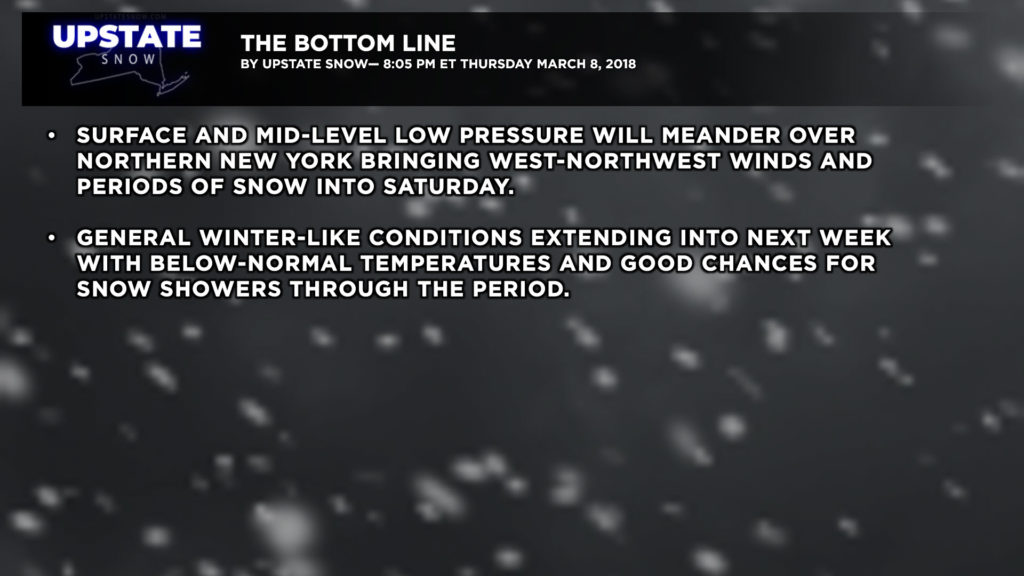
That will be the case as we go into … probably the middle of next week. A stronger surface low will organize over the Tennessee Valley and move across the Carolinas. A few days ago models had this turning northward and becoming yet another nor’easter, but as of this writing, it appears that the surface low will move more east-than-north and not have much impact here, other than enhancing the winter-like northwest flow and occasional snow showers. In short– expect colder-than-normal temperatures with periods of snow showers for the better part of next week as our second-chance winter continues.
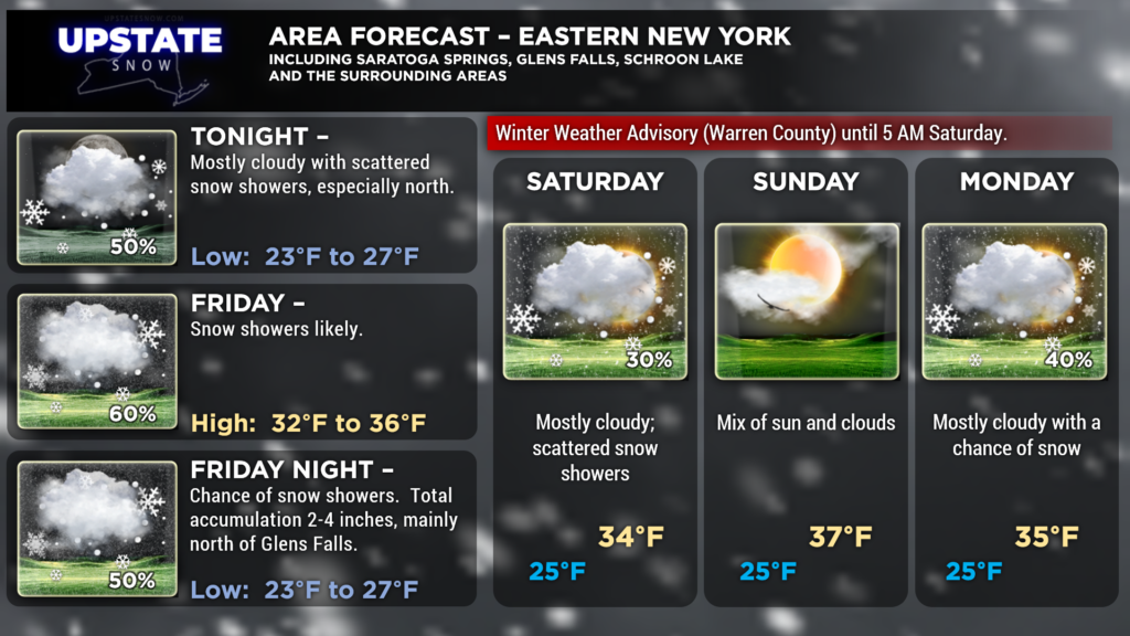
Here are your zone forecasts. As always, thank you for your support!

