Chances of riding through 12.18 – Some minor riding but nothing long lasting
Chances of riding 12.19 through CHRISTMAS DAY – *BUZZER* Sorry! You’re wrong! Thanks for playing our game!
Good morning. First of all, I am SORRY for what was probably my biggest miss of the year forecast wise. The storm ended up being too warm and too far to the east so the big amounts I had in many places… didn’t work out. Not all places ended up like this. There was heavy wet snow that was heavier that even we expected, and some places actually made my range. But to those especially on the Tug Hill and in the western reaches of my range: I was way off. 7-14 only became about 1-2. That’s bad. Way way better to go 1-2 and have 7-14 than the other way around. I’ve known this and have tried this for years. When you get borderline situations like this, sometimes you get this. Again, I’m sorry.
Now on to the next storm, because this one is coming up fast…
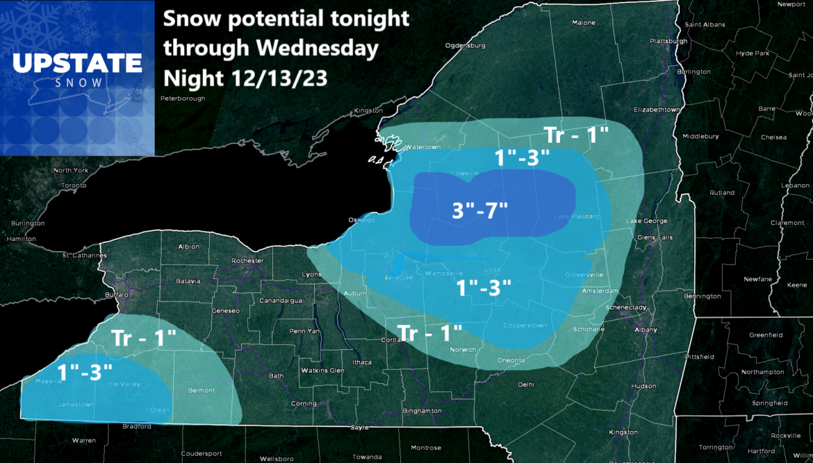
We have a reinforcing shot of cold air, actually about normally cold air for mid-December, coming on through tonight through the day on Wednesday. This will bring some snow showers, with some lake effect off of Lake Erie and Lake Ontario. This lake effect shall be a light event with temperatures borderline. But there will be some. Tonight through tomorrow evening we have about 1-3 for the Southern Tier well south of Buffalo, and to the east of Lake Ontario, about 3-7 for the higher elevations of the Tug Hill and Adirondacks above 1000′. Below 1000′ we are looking at a 1″-3″ for the Syracuse, Utica/Rome areas, the Mohawk Valley, and some areas south of the Thruway between Syracuse and Amsterdam. This would be considered to be a light snowfall event.
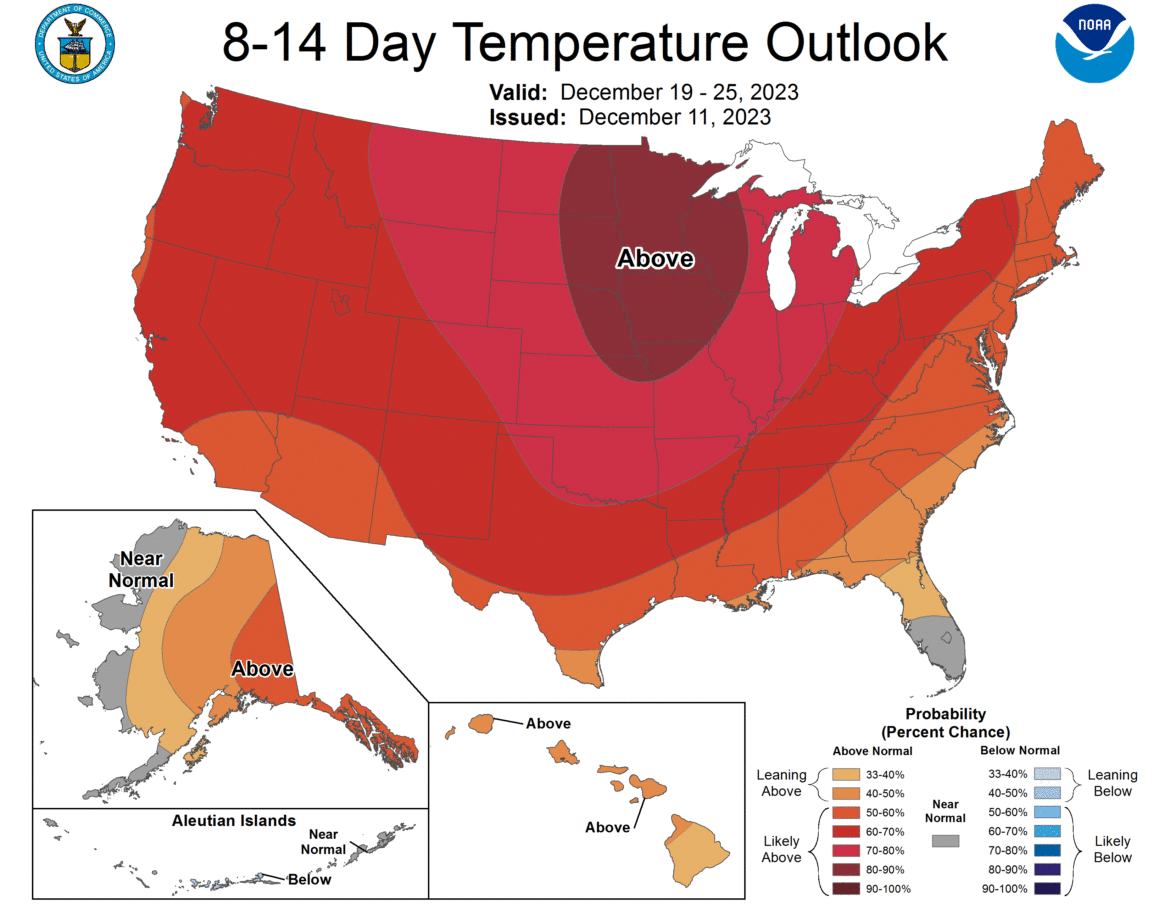
From Thursday, onward, we are screwed. I’m just going to say it. We are screwed. Everything, especially on the temperatures, looks absolutely blasting. Instead of 30s, more like 40s. Even 50s at times. This is not the Holiday Season weather we expect and looking ahead towards Christmas, nope! When will this weather break? It will at some point but before the end of 2023 is looking less and less likely by the day.
So say hello and bye bye to my snowfall maps for now. This could be my last one before Christmas. And to write it, with confidence on 12/12 is a shame. It’s just another very warm December. Another in a string of very warm Decembers. Not since 2017 have we had a really cold one. Not since 2018 have we had a White Christmas. 5 years and counting now 🙁
At least that’s how I am seeing it right now.
Rich


