Chance of snow through 12-6-23 : 33 percent
Chance of snow 12-7 through 12-13: 90 percent
Well have you had a blast the last 4 days? Have you enjoyed this unusually heavy lake effect dumping for November? Are you still having some snow to dig out and clear out today? Well take advantage of today because you’ll actually see sunshine! It will get well above freezing into the high 30s to near 40 in the Adirondacks and Tug Hill and well into the 40s in the lower elevations and especially south of the Thruway. This means if you are in an area that just got snow covered (dusting – 2″), it means your snow will probably be gone by tonight. In areas with much deeper snow you will still lose snow between melting and compacting. You’ll still have some leftover especially if you were in the area that had 6″ or more from the last 3-4 days of snow.
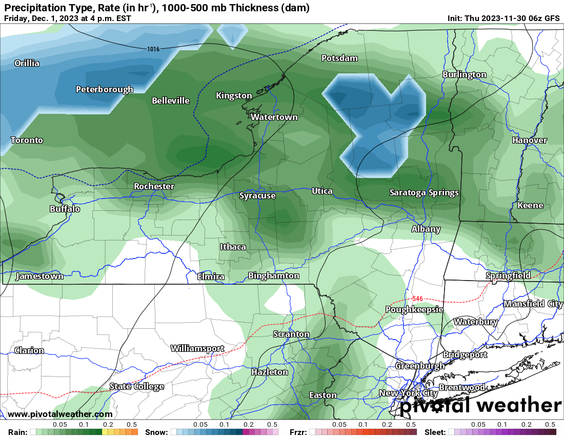
During the day on Friday, rain showers move on in across Upstate NY. In the afternoon rain is across the entire state. The only place in the state having the chance of snow would be inside the Adirondack Park. Even Tug Hill is out of this with rain expected along with warm enough temperatures from the high 30s to low 40s with a southerly flow. Scattered showers will continue through the weekend with temperatures mainly at if not above 40 all weekend long. This will continue the snowpack melting down to just the areas that got over a foot by Monday, having any snow left.
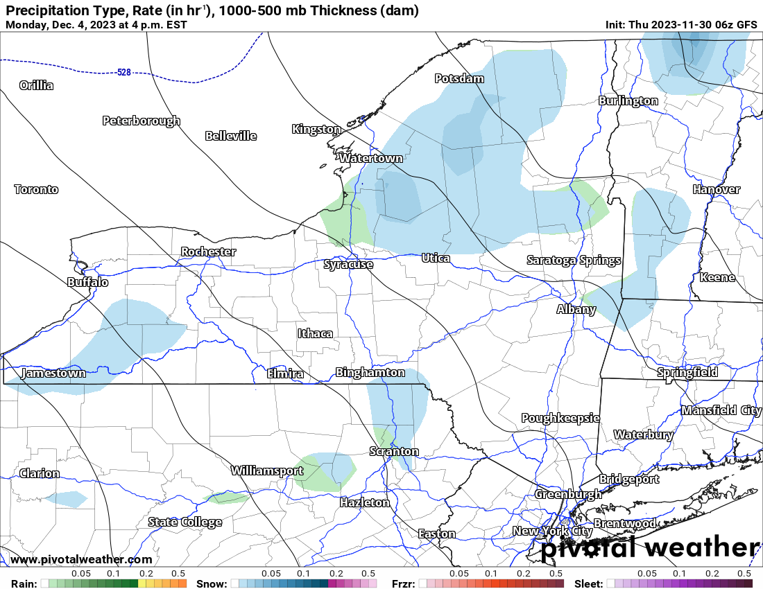
By later on Monday, the pattern begins to flip as lower heights come in, temperatures back off from the 40s into the 30s, and snow showers return to Upstate NY. This is a look at the late afternoon map on Monday which shows the first lake effect since Wednesday redeveloping across Upstate NY. It’s not a big event by any means, but it’s a start.
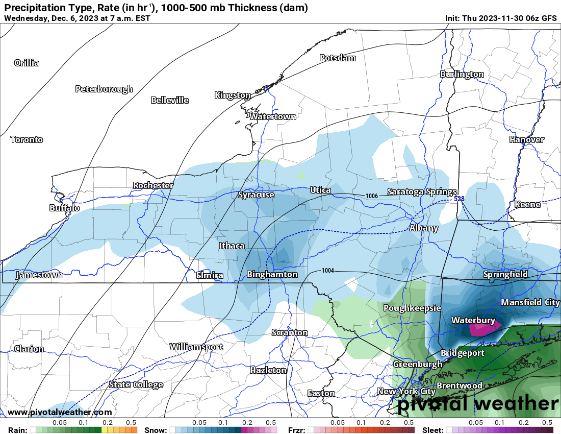
By Wednesday, colder temperatures and more snow showers with steadier snows tend to arrive, especially at the higher elevations. Since Wednesday is Day 7, I am not going gangbusters on this yet, but just know, my eyes are on the middle of next week for a light lake effect event, one that has the potential to produce at least a few inches in spots. Not feet, but not nothing either.
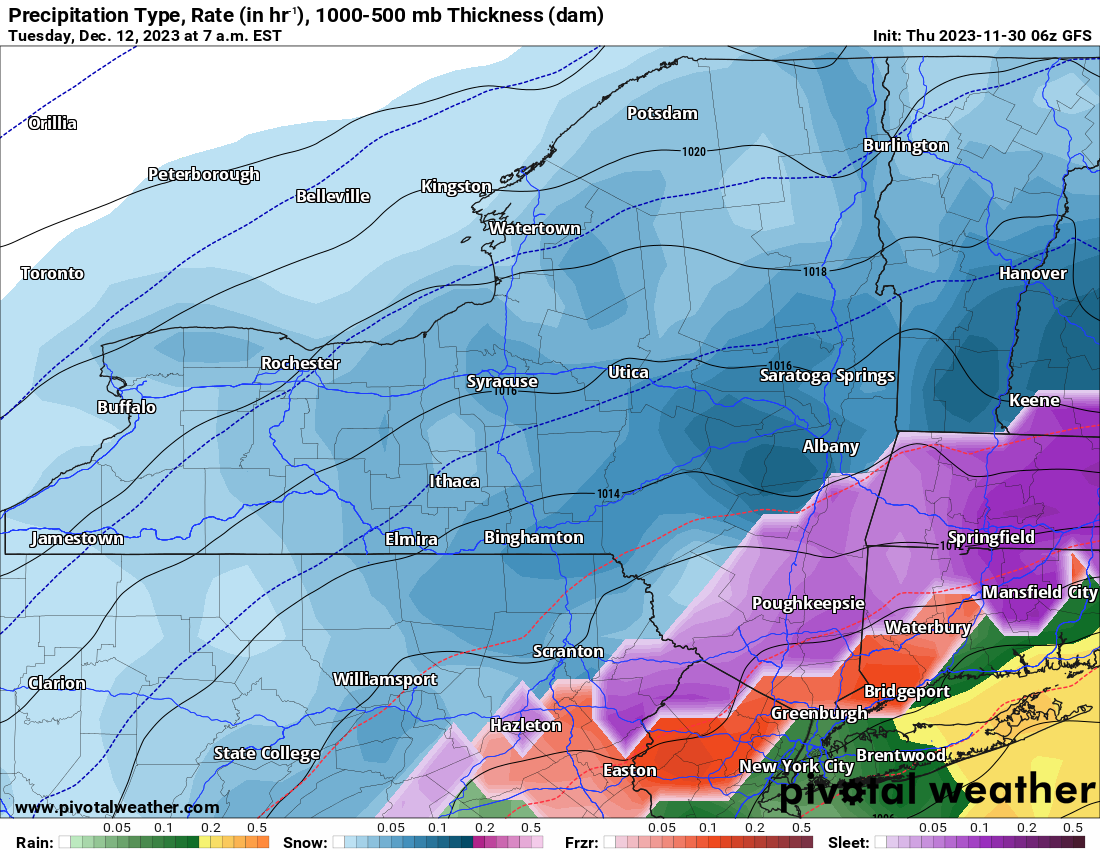
The next time period to keep an eye on, and a particularly close eye on, is the December 11-13 time window. Even though we are way out at the very edges of our ranges here, a significant snow storm or Nor’easter has been shown for the past several model runs. Once does not get my attention, especially beyond day 7. Several runs in a row get my attention and this has. Watch December 11-13th carefully folks.
That’s it for November! It turned out to be a lot colder and especially a lot snowier than the last several years, even though relative to averages, it still wasn’t all that far from normal. After the significant lake effect event after Thanksgiving, and the feet of snow it piled up in parts of Upstate NY, that has definitely reformulated some ideas in my head. The final winter weather forecast for the 2023-24 season comes out tomorrow on December 1. I will have all of the incredible stats for Upstate Snow in the morning tomorrow, then have the final winter forecast probably on Friday Night. Thank you once again for making Upstate Snow one of the best places out there!
Rich


