Every time we get within 72 hours of an event… changes. And not usually for the good. In this case, it’s the same.
Our cold front is working through the area this morning, putting an end to the recent warmup. Rain and thunderstorms will taper off, and temperatures will be falling during the day. By Saturday morning most of Upstate is in the high 30s to 40s… and not going much of anywhere from there under mostly cloudy skies during the day Saturday.

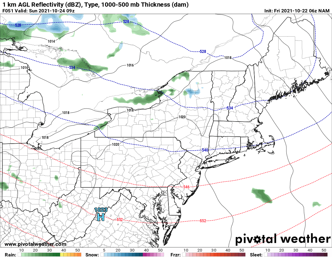
A reinforcing shot of cold air comes in Saturday night into Sunday morning. This should be enough to drive some lake effect rain and potentially snow. The best chances for snow, again, north of the Thruway, Tug Hill and Adirondacks. We just can’t get it areawide or into the lower elevations yet. And it looks like November before we can do that.
It did look like the heart of the cold air, coldest of the season would have come through on Sunday. This would have really gotten the lakes going and made ice and snow fall on a lot more places across Upstate NY, even in the lower elevations. But notice above the coldest air is not a target but getting “spread out”. This is what’s happening because of what’s coming Sunday Night and into Monday. Rain. And a lot of it. And a very unsettled week ahead next week, much cooler, but not cold enough for snow.
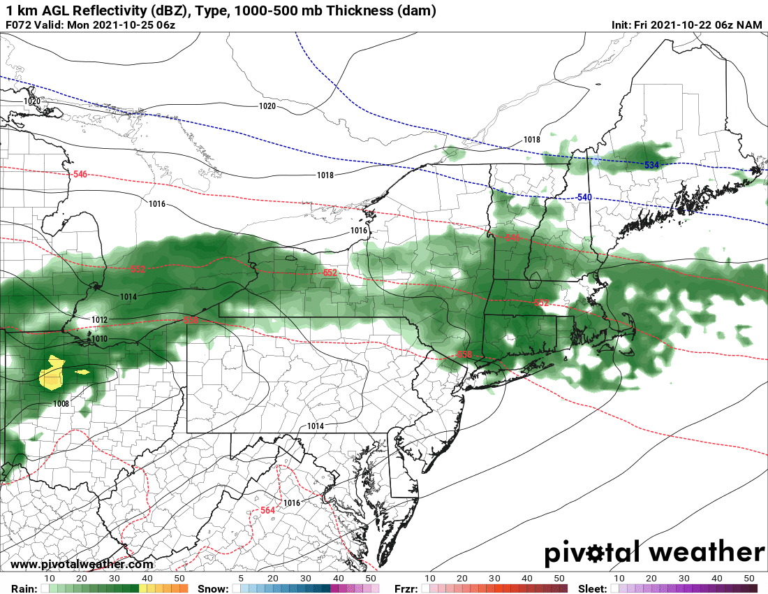
Round 1 moves in Sunday night into Monday morning. We will continue to watch the front edge of this which may start off as snow in the Tug Hill and Adirondacks before going to all rain. Just a quick hit if it does happen, but in this scenario, the warm air WINS. Expect a wet and unsettled day Monday. This storm system will stall and set up off the coast later in the week, but there is not enough cold air in back of this to turn this into anything major to talk about.
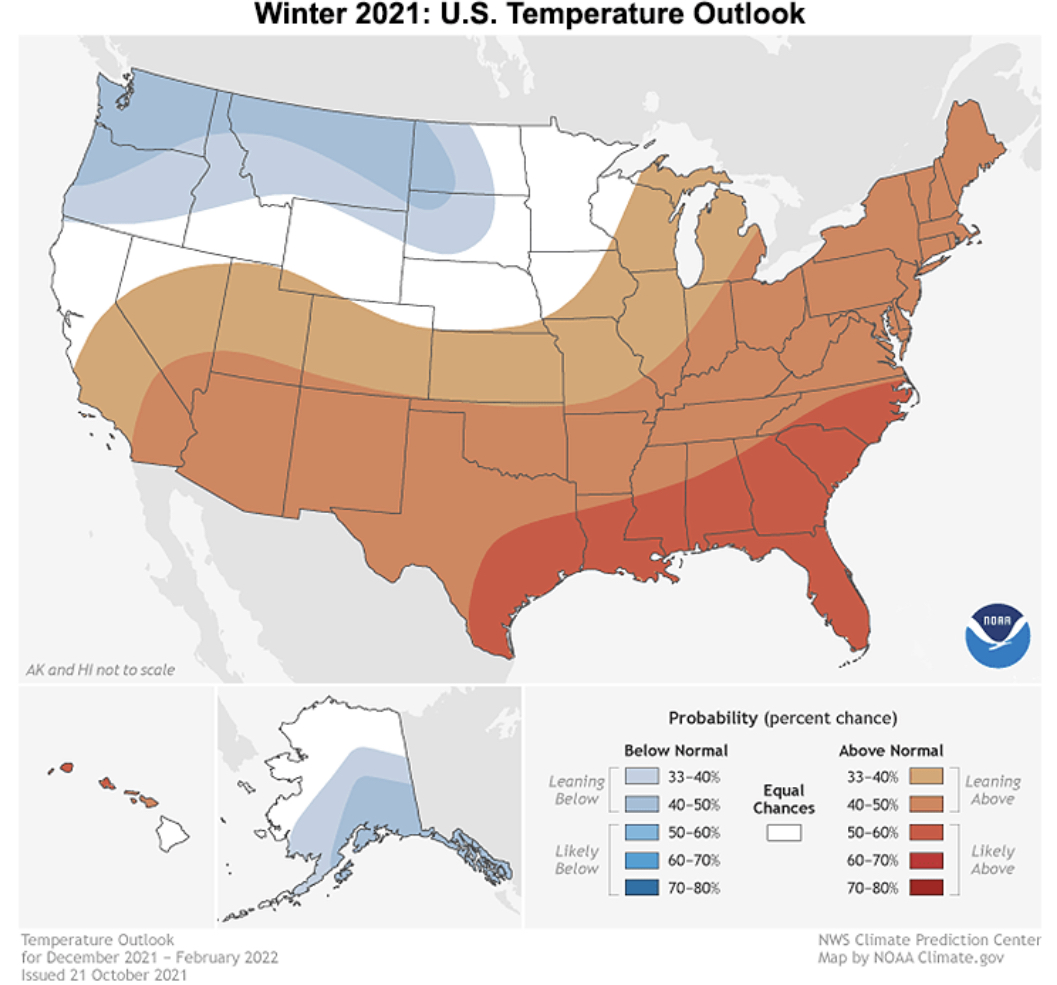
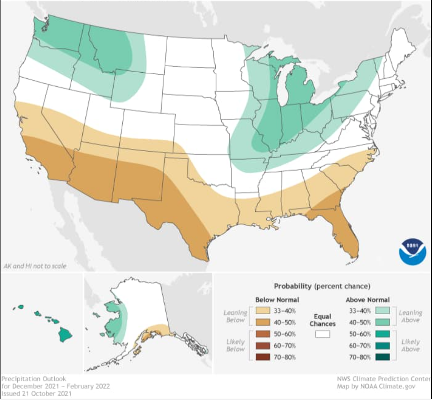
Speaking of warm air WINS… this is the scenario the NWS has officially but out in their formal winter weather outlook. Take a look at temperature and precip. Northwest and northern Rockies and northern Great Plains get HAMMERED. The storm track is up into the Ohio Valley and Great Lakes… western runners for us. Based on early indications and how the forecasts are going so far, I’m starting to lean in this direction.
Remember, my first look is November 1, first call November 15, Final call December 1. Stay tuned. Even though this could make it the third “light winter” in a row… there is always HOPE. And that is why WE ARE HERE!
Do you like our weather reports, podcasts, videos, and features? Say thank you by becoming a SPONSOR or MEMBER of Upstate Snow! For just $60, sponsors receive a hyperlink to your business or social media page on every morning blog and podcast post on upstatesnow.com for the season (until 8/31/22). For just $10, members get name recognition, or if you wish not to use your name, recognition to your favorite snowmobile club or where you live.
Click below to get started
paypal.me/lupiallc
www.venmo.com/u/Richard-Lupia
THANK YOU to our faithful sponsors and members!
SPONSORS
Southern Tug Hill SnoRiders
Saratoga Snowmobile Association
Ohio Ridge Riders
ILSNOW.com
Enjem’s Flooring America
Water’s Edge Inn – Old Forge
MEMBERS
Chris Rinck
Charles Kleese
Chaz Albertson
Dave Gleasman
John Bates
Darrin Harr
Mark Enjem
Matthew Pistner
Eric Vilovchik
Brian & Paula Bedell

