It couldn’t last forever. The warmth that is!
After a near record warm start to the first two weeks of October, the wheels are about to fall off the wagon. At least, mostly. Today is likely to be the warmest day until at least March or April of 2022 so if you like the warmth, GET OUT AND ENJOY IT! The timing of this is moving up as well. Every model run cuts another few hours off of this. Instead of Saturday evening/night for the cold frontal passage, it now looks like during the daytime on Saturday.
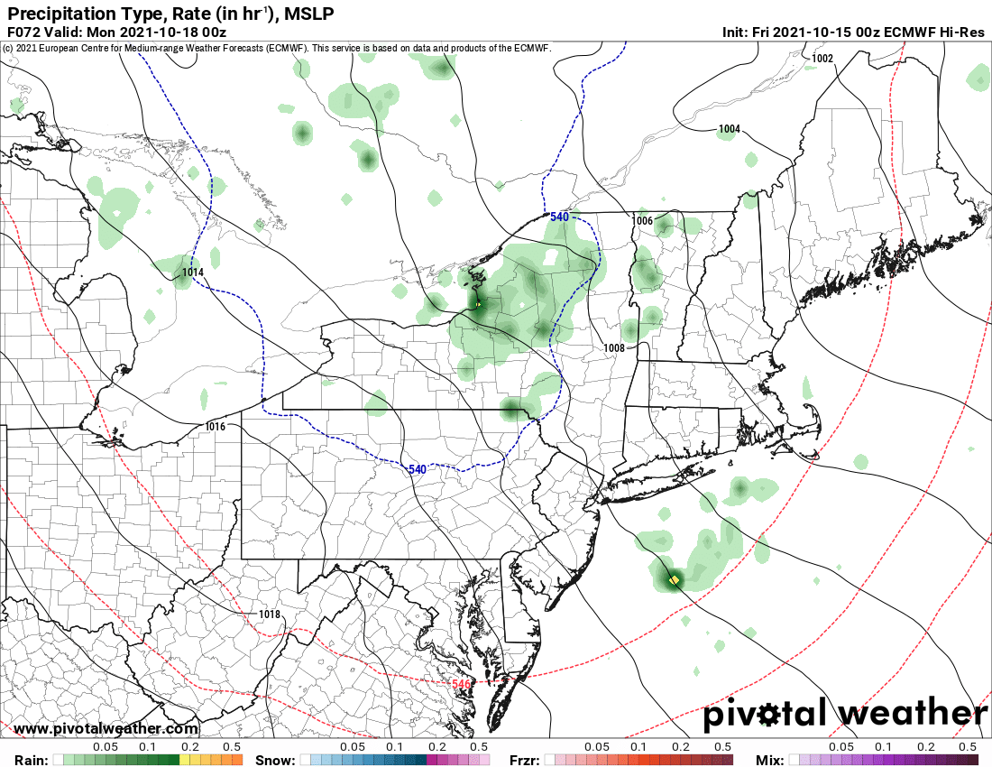
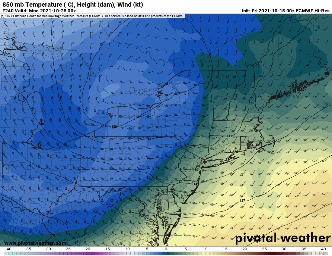
The Setup this Sunday and Monday
WNW to NW flow wrapping around the storm. The VERY WARM Great Lakes in play. With lake temps still anywhere from the low to mid 60s off Lake Ontario and STILL OVER 70F off Lake Erie… with air at 850 pushing near ZERO degrees C, we will have major lake differentials anywhere from +16 to +22 (remember we only need +13 to get the lakes going). This means any chances to see the sun either Sunday or Monday are pretty much GONE, especially across most of Upstate NY. With that much cooler and unstable air coming overhead, it means there will be lots of LAKE EFFECT RAIN going on. Because the air column is too warm and the air at 850 mb is at or just below zero degrees C later Sunday into Monday, I don’t think this is going to be a widespread first snow event for Upstate NY. Close, but it’s just too warm.
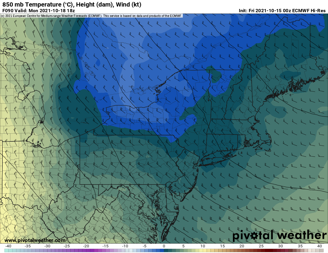
Where will any snows be this Sunday or Monday?
Snow above 1000 feet? Maybe a few flakes but probably not enough to stick to the ground. If that. Above 2000 feet? A better chance but still probably too warm. I think your best chance of seeing snowflakes from Sunday PM through Monday PM across Upstate NY will be in any of these places: Top of the Tug Hill, tops of the hills south of the Thruway and (maybe) the mountains of the Adirondacks. Any dusting or light accumulations will be confined to the elevations at or above 2000 feet. Best timing: Sunday PM through Monday PM. Then we recover in temps Tuesday through next Friday 10/22.
Looking ahead
The storm NEXT WEEKEND… a little stronger… a little colder… and remember the lakes are not just warm, they are near all time record warm. This means between now and Christmas, any surges of cold air that come across the lakes could mean not just good snows… but EPIC SNOWS. Not saying it will happen next weekend into the week before Halloween, but, we are getting into that time of year where snow is not a nuisance but EXPECTED.
It’s coming folks. We’ve just started today, October 15, 2021. We’ll build a little more each day until 45-60 days from now we are “into the thick of it”… sorry for the Backyardagains joke… Enjoy the weekend!
Do you like our weather reports, podcasts, videos, and features? Say thank you by becoming a SPONSOR or MEMBER of Upstate Snow! For just $60, sponsors receive a hyperlink to your business or social media page on every morning blog and podcast post on upstatesnow.com for the season (until 8/31/22). For just $10, members get name recognition, or if you wish not to use your name, recognition to your favorite snowmobile club or where you live.
Click below to get started
paypal.me/lupiallc
www.venmo.com/u/Richard-Lupia
THANK YOU to our faithful sponsors and members!
SPONSORS
Southern Tug Hill SnoRiders
Saratoga Snowmobile Association
Ohio Ridge Riders
ILSNOW.com
Enjem’s Flooring America
Water’s Edge Inn – Old Forge
MEMBERS
Chris Rinck
Charles Kleese
Chaz Albertson
Dave Gleasman
John Bates
Darrin Harr
Mark Enjem
Matthew Pistner
Eric Vilovchik
Brian & Paula Bedell


