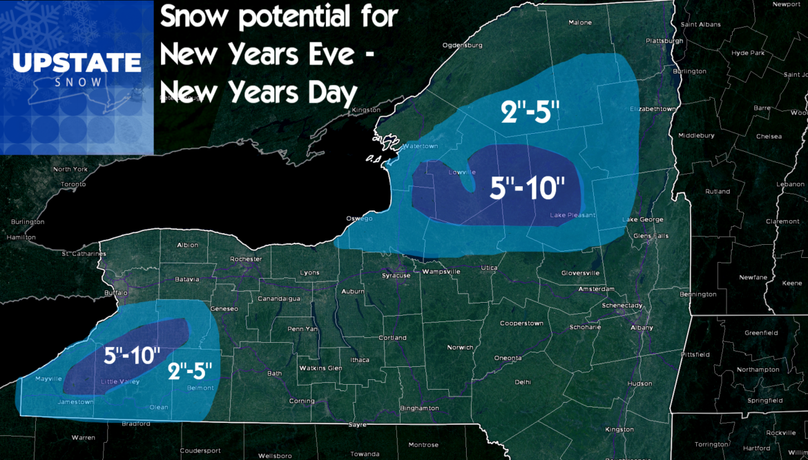
The forecast snowfall later this evening into tomorrow for the snowbelt areas is still on schedule. I’m going to stick and stay with my snowfall forecast from yesterday with these caveats: Yes some parts of the hill will likely break 10″. If they do i’m thinking localized 12-16″ amounts on the hill proper, probably not 20+. The forecast might be a touch aggressive for Western NY, but I like the setup so I’ll let it ride. Closer to the Thruway and into Oswego, Northern Oneida and Central Herkimer Counties, I may be a little low. Close call. Sticking with my gut and we’ll see what happens. For all other areas of Upstate, Dusting to 2″ this evening is in play everywhere, even cities and lower elevations so be prepared for slick conditions going to/from your New Years Eve celebrations. Happy 2020!
We’ll start off the New Year with the lake snows winding down in the snowbelt areas by Wednesday Night as the cold air leaves and the warm air comes in for one final surge. Dry but 30s higher elevations, 40s lower elevations Thursday. Friday is ugly with showers and 40s everywhere. Storm system slowing down which will linger 30s and 40s over Upstate through Saturday until this thing decides to move through, but now looking more like Saturday night before the cold air comes in behind it.

Snow on the back side Saturday Night into Sunday. A few inches possible. Maybe a little lake effect behind it on Sunday but nothing i’m overly excited about at this time.
Then all bets are off.
So wait a second, you’ve been saying pattern shift by first weekend of January at least a week now. What gives?
Yes that is still happening. The pattern will definitely be much more favorable to cold and snow first full week of January and beyond. It won’t be anything like the last 10 days of December, that’s for sure! But this pattern change will not be perfect. And the models are now having a major fight over what will happen during next week as the colder air comes back. A major fight.
Here is what I mean… Look at next Wednesday 1/8. Yesterday on the blog I showed you major cold and the potential for a significant and sustained lake effect event. But it’s also day 8. As many commented and threw their .02 in about what they thought would happen, one made an astute observation: Even someone as detailed as us can’t predict accurately the snowfall beyond a few days. We are lucky to stretch it to day 3 and 4 is really pushing it. We’re talking trends more than anything else at day 8. Yes the trends were pointing to something big, but now major disagreements with the models.
Why?
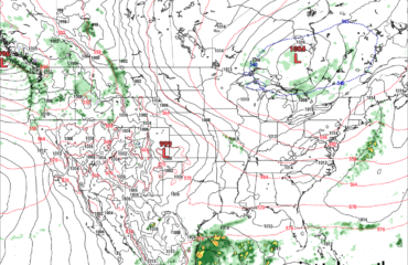
Pattern changes are always difficult to nail in detail. Sometimes it’s messy. And there is a chance it could be in this case. I’ll propose to you the following. The first is the GFS which is a seasonably cold to colder than normal looking map with lake effect snow hitting the snowbelt areas, the second is the Euro (a new Nightmare scenario that gives yet one more shot of rain and warmth at us which if it verifies would jack up everything big time and could knock second weekend of January off the map). Third is the Canadian which would be a dream scenario with a significant storm coming at us from the Ohio Valley, we are on the cold side, and it’s basically like the stuff we got hit with Thanksgiving weekend… Three VERY DIFFERENT SCENARIOS middle of next week. What do I know for sure? TWO WILL BE WRONG. Which one will be right?


The colder pattern with more favorable chances for cold and snow is indicated in the models and long term trends regardless of the scenario. I can say with confidence January will not in whole be like these last 10 days have been.
But the devil is always in the details. And you still can’t call the details, which can make a big impact on riding, with pinpoint accuracy at this range, especially with the now greater uncertainty. Hate to say stay tuned… but stay tuned… Hope and pray this was the models having a bad day at the beauty salon… and that the Euro doesn’t have a clue. Snow dances appreciated…
Quick notes:
I’m going to post a short trail talk podcast later today. It will just be me with a New Years message and thanks for many whom deserve it.
We will move the live weather update to sometime tomorrow with me and Zack. Lets let a few more model runs go and see if we can see things more assuredly into the weekend and next week before we go live again
New “Guide to your ride” podcast will be out by Thursday morning. I can tell you with near certainty Chris Rinck from STH will have an update on the lake snows that will hit the hill through tomorrow. Trust me if there is a chance to ride something Thursday, he’ll let you know and listen to this upcoming podcast. It will be worth your time.
On behalf of Zack, my family and friends, I cannot thank you enough for your support of Upstate Snow. Through the good times and tough times like this when we just want winter to be winter. I cannot thank our sponsors, the clubs and our thousands and thousands of fans across the state and across the country that follow us. We appreciate you all.
Blessings for an awesome 2020 ahead!
Rich


