The freezing rain/icing event has unfolded and thankfully, not as bad as feared. By this we mean by how widespread it has turned out to be and staying away from major population centers. The areas under ice storm warning south of the Thruway, except for the hills near Route 20 and just south of there, did not get as much icing. In the Mohawk Valley itself between Utica and Albany, a little icing, but mostly confined to the hills above the valley. The southern Adirondacks and North Country saw some good icing out of this, highly variable depending on elevation.
With remaining rain coming through today, if areas already have freezing rain, sleet and icing, you’ll likely get a little more. In areas that stayed just rain, it will likely stay the same. As predicted, no icing possible along and west of I-81 as the air there is just too warm.
Speaking of just too warm, I think us snow lovers and winter weather enthusiasts agree with this point. And finally we will take steps in the right direction. Starting New Years Eve, the cold air returns. Cold enough for it to change to all snow across all of Upstate. A cold front brings a quick shot of lake enhanced snow just in time for your New Years Eve celebrations. Heads up if you have parties to ring in 2020, there will be a quick shot of snow for all of Upstate. The areas that will see at least 2″ accumulations will be in the snowbelt areas as the lake effect relearns how to dump snow on Upstate for a new month, year and decade. It won’t be a ton, we have NO BASE LEFT, and there will be water water everywhere. And putting the high end range of 10″ in the heaviest bands over two days could be a little aggressive given the lack of snow… but I have no reason not to let it fly for a first map. This is subject to change in tomorrow morning’s blog…
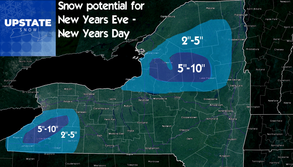
Again, I can’t stress enough. Don’t try to ride anything that falls through New Years Day… unless the clubs explicitly say they have checked the trails and it’s good. My gut says the trails won’t be healed enough yet. We’re talking temps in the teens and 20’s New Years Day and Thursday the 2nd… when we got the nice riding in Old Forge and the Tug Hill 10 days ago, it was a few degrees either side of zero for two days and most of the water and ice froze down. Not cold enough for long enough… you’ll be likely to do damage to your sleds and the trails.
Unfortunately for Friday the 3rd… we have ONE MORE WARMUP to go. ONE MORE before the pattern change hits. There are some similarities to the weather scenario but hopefully not as much moisture. 30s in the Adirondacks and Tug Hill. 40s lower elevations. It’s only one more day. Once Saturday the 4th rolls around… it’s a new ballgame…
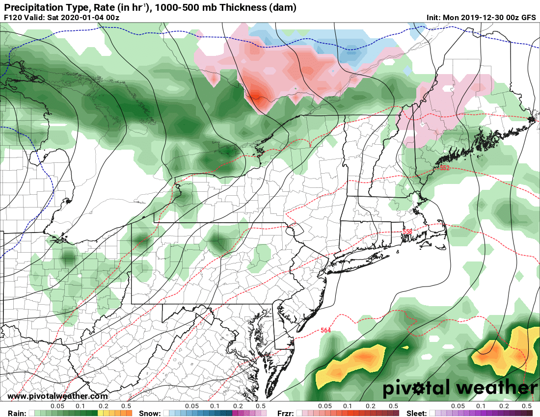
Temperatures gradually cool Saturday the 4th below freezing and lake effect may begin. Better chance as the cold air deepens on Sunday the 5th, and a clipper comes on by. Monday the 6th the trend continues followed by another clipper and an arctic cold front. This will be on the level of what hit us December 18-20, if not better. Take a look at the bitter cold air coming down. Winter will be back soon, and while snowcover will be an issue outside of the areas that get hit with lake effect snow, at least below freezing temperatures and freezing down of all this water will help!
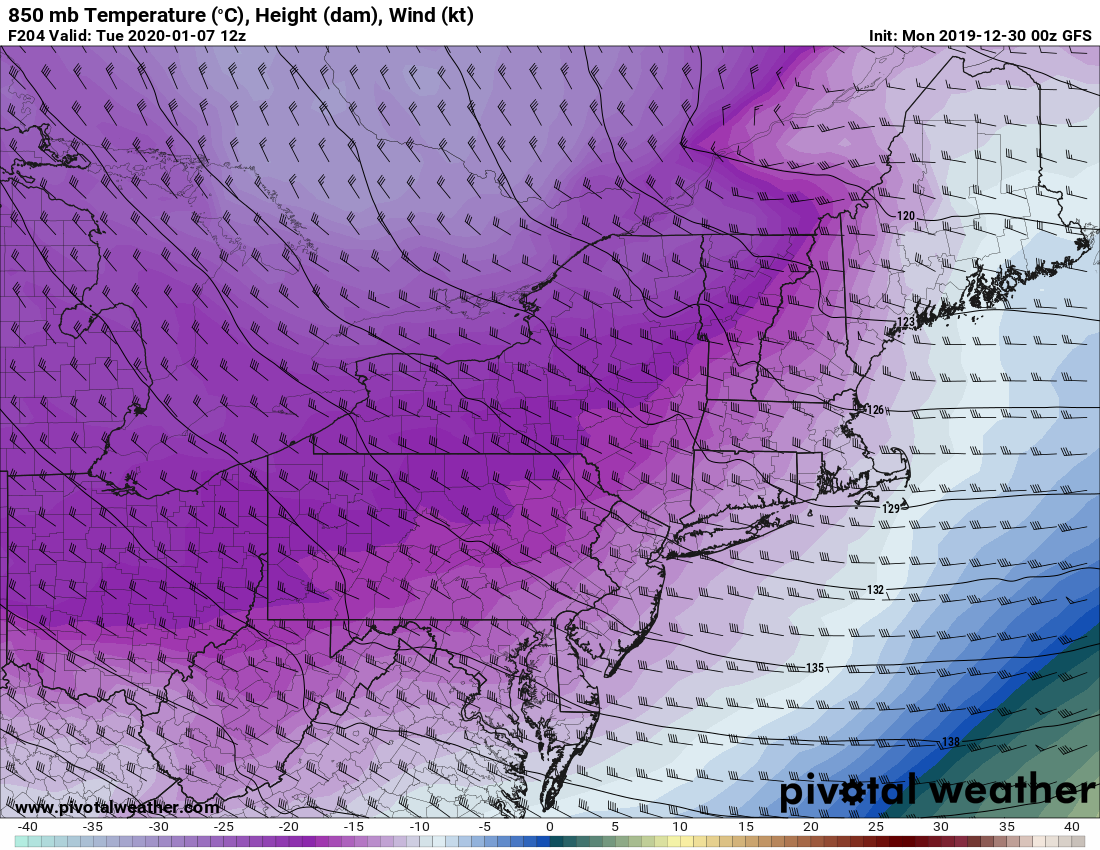

Could it be a big lake effect event? It wouldn’t be out of the question, BUT, we are eight days out from this one. Can I say for sure and start throwing out specifics at this range? NO. Is it the most excited I’ve been about cold and snow since the event on Tug Hill and off Lake Erie almost two weeks ago? YES.
There are indications of a general snow event after this towards the end of the week (January 9-11) but nothing conclusive to hang your hat on just yet. The pattern will be much more favorable by that point in time and after several days of cold everywhere, lake effect where the winds blow, we will finally have a chance to heal and put humpty dumpty back together again.
In conclusion, my original advice in previous blogs and on the videos stands… Second weekend in January is likely to be the first opportunity to get some decent riding back in parts of Upstate. So if you are making plans, i’d say January 11-15 is your earliest window to look at for planning a decent ride. Where is still TBD based on where the snow falls. Better chance the following weekend, MLK weekend. Based on the patterns, climatology and experience, I’m comfortable resting on this advice. Again details and timings subject to change, but this is how I see it as of today.
The plan this week:
Morning blog: Tuesday AM 12/31
Live Video: Evening 12/31
Morning blog: 1/2/2020 Thursday
Morning blog: 1/3/2020 Friday
Best,
Rich & Zack


