The last chance to ride anything anywhere will be today and tomorrow. You have options on the Tug Hill and in Old Forge but extremely limited. With the weather that is coming Sunday into Monday, it will take the entire state offline for at least a few days.
Between the holidays and the fact the weather has downright stunk from a snow lover perspective, I know you could understand the hiatus. Now that we are at the zero hour for the climax of this holiday thaw and the light at end of the tunnel is now becoming clearer, this is a good update for you to read.
What we know:
The Sunday/Monday rain and wind event will be the wipeout event I feared in previous morning blogs. No way around it. Huge snowstorm from the Rockies to the upper Mississippi Valley and western Great Lakes will track a strong Low pressure into south central Ontario. This subjects us to the full force of SW winds and warmth ahead of the storm along with Gulf of Mexico moisture. Rainfall amounts of 1/2 inch to 1 inch Sunday through Monday across Upstate are almost a given. 1 to 2 inches is not out of the question. Regardless, a strong SW flow and temps in the 40s to 50s at all elevations will help to kill off remaining snowpack and base. Even in the heartiest areas of the Tug and Adirondacks. I’m sorry. It is what it is.
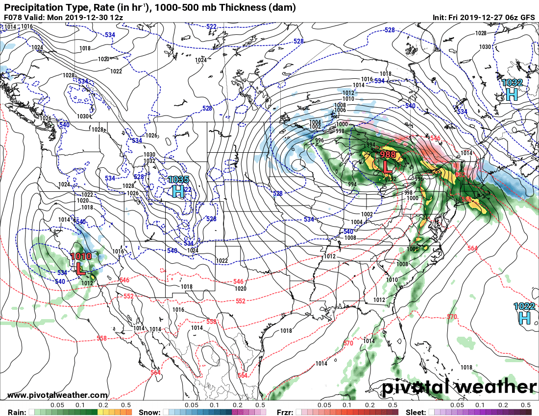
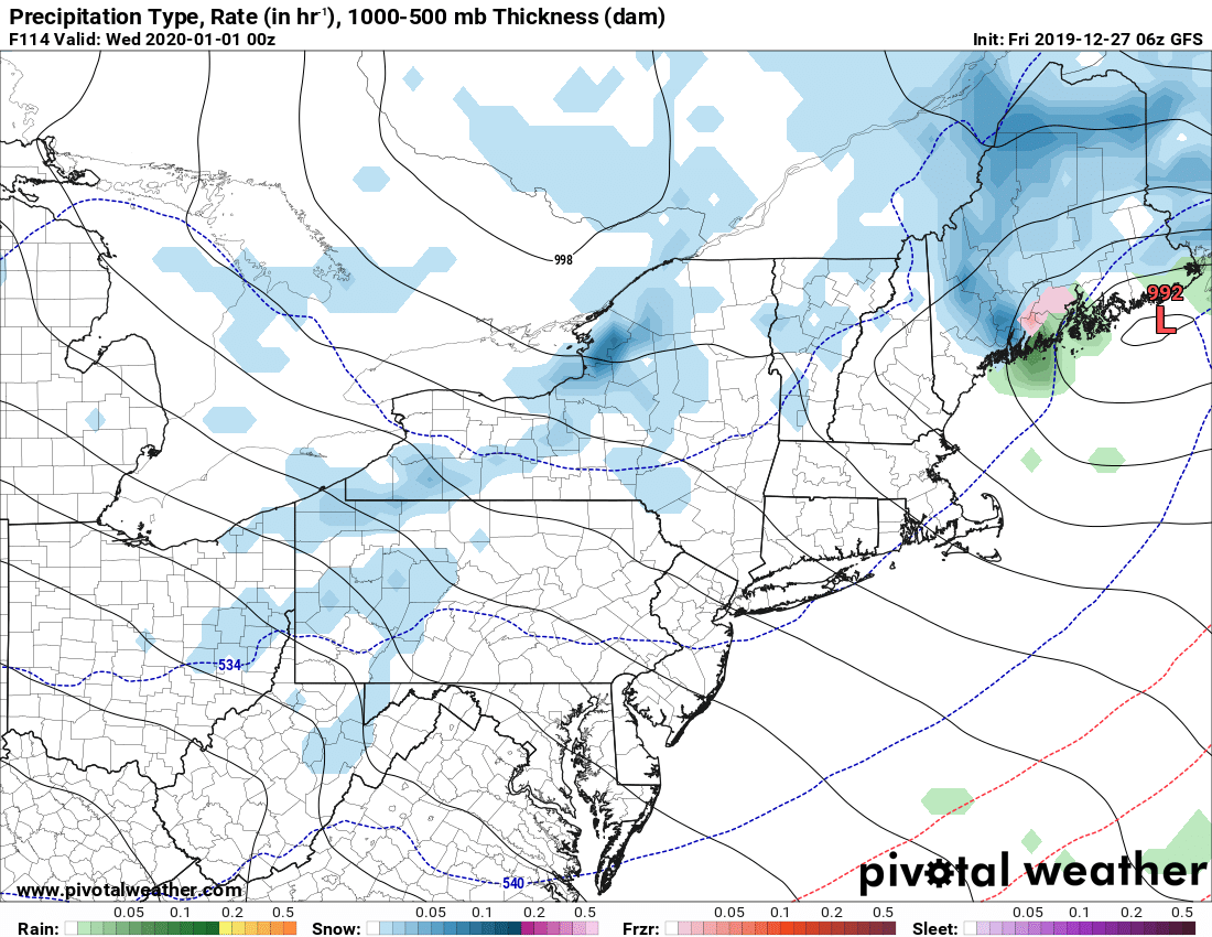
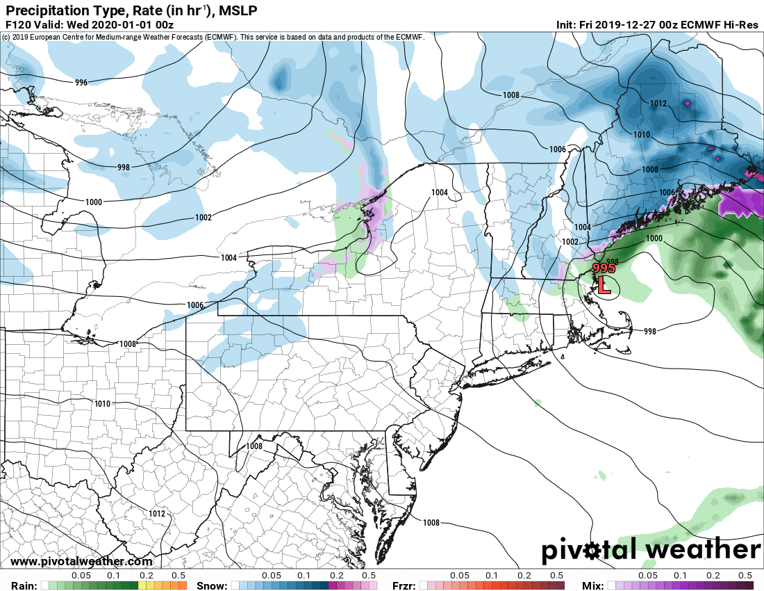
The cold front will swing through by Tuesday, New Years Eve and bring cold and snow back. A secondary front and clipper will blow through Upstate Tuesday evening in time for the ball to drop and usher in 2020. There will be enough low level moisture and just enough cold air to wake Lake Erie and Lake Ontario back up. With this being a day 4 to day 5 forecast, it’s too early for a snow map or any specifics. Just know if you live Upstate and have plans for New Years Eve parties, please file in the back of your mind the fact weather could be a factor. Also, since this will be the first event after the wipeout, this, even if it does turn out to be a decent event Tuesday 12/31 into Wednesday 1/1, will not be enough alone to reverse the damage from the wipeout event and the melting that has taken place. This event, however big or small, we hope will be the start of the new base to last for the rest of the 2020 winter season. We know for sure it will not be super cold, only “seasonably cold” like 20s to low 30s by day and maybe teens at night but no single digit or near/below zero cold to freeze everything back down… yet…
What we don’t know:
What happens after the return to seasonably cold air between January 1-4. This is the critical window which as of today sits in the highly changeable Day 6-10 window. The models continue to be all over the place. GFS, Euro and Canadian all throw out three totally unique and plausible scenarios. It could stay cold then get colder. We may bounce back and get warm one more time. Uncertainty as to how things react in the last days before the pattern finally shifts in our favor for cold and snow. Rather than speculate with the picture out of focus, lets wait until we get things more into focus early next week. Just think good thoughts, do the snow dance, anything you think will help.
What we do know:
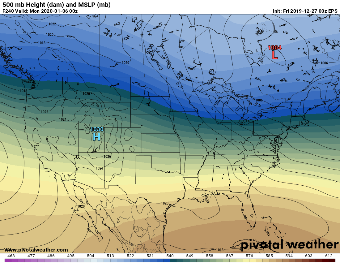
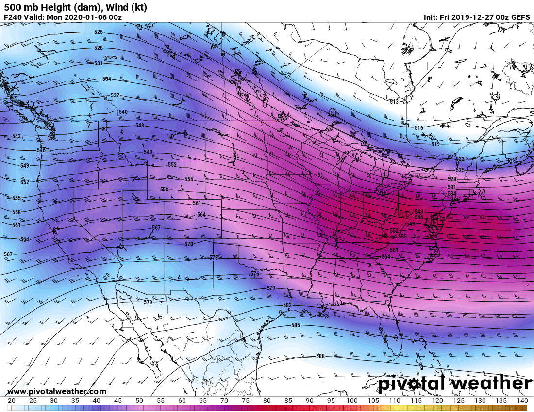
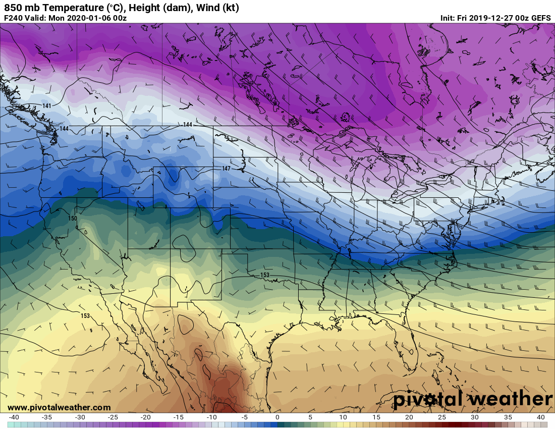
Despite the certainty we will get wiped out, get a little snow and cold back, then enter into a period of uncertainty in days 6-10, ALL MODELS ARE IN UNIVERSAL AGREEMENT WITH THE ENSEMBLES THAT THE LONG AWAITED PATTERN CHANGE BACK TO A COLDER, STORMIER PATTERN FOR UPSTATE WILL HAPPEN GOING INTO THE FIRST WEEK OF JANUARY. THE DAY 10 ENSEMBLES OF BOTH THE EURO AND GFS ARE SHOWING STRONG INDICATIONS OF THE WEST COAST RIDGE FINALLY COMING BACK, EAST COAST TROUGH, THE RETURN TO MUCH COLDER CANADIAN AIR (WHICH SHOULD DRAMATICALLY INCREASE THE LAKE EFFECT POTENTIAL) AND WINTER WEATHER IN GENERAL BEGINS A THE START OF THE FIRST FULL WEEK OF 2020 (JANUARY 5, GIVE OR TAKE A DAY EITHER SIDE). They have indicated this for several days now. Confidence is medium to high in the pattern change taking place in this window.
What does this mean for riding:
It means if you really want to ride anything, get up to the Tug Hill proper or Old Forge today or tomorrow. You won’t find great conditions, it will be poor to fair with changeable conditions and areas of ice and water, but you could bang out a few miles. Only if you are a die hard and/or don’t mind subjecting your sled to early season hazards, rocks, mud and/or water. If you like riding long distances and/or in good conditions or better, you have to wait at least 2 weeks, maybe 3 for the pattern change to kick in and for us to recover from the beating. We will get there. Be patient.
If you have bigger and longer rides planned before January 10, it won’t be likely. Right now the way I see it, the weekend of January 11-12 going into the full week prior to MLK weekend looks like the earliest we could see good snow and riding conditions return to Upstate. This statement should not be taken as gospel and is highly speculative at this point. But if you were to ask me as a Meteorologist and avid rider when do I think things will be good again, this is what I would tell you based on what i’m seeing as of today. This will change as things play out. As always we’ll give you our best opinion.
If you are new to Upstate Snow, we have a podcast series that can help you with more tangible, actionable information each week called the “Guide to your Ride” podcast. I speak with Chris Rinck, President of the Southern Tug Hill Sno-Riders, whom coordinates with clubs on and surrounding the Tug Hill. These come out every Thursday during the season and are sponsored by Mapledale Motors. Check out the first two GTYR podcasts. We also have 10 episodes of our first podcast series, the Trail Talk Podcast available to listen or download on our Trail Talk Podcast page at Upstate Snow. We plan to create a new Trail Talk each Tuesday and a new Guide to Your Ride each Thursday during the season. And on the Trail Talk Podcast we have more special guests in the bullpen we’ll tell you about soon!
Be good! Next morning blog will be Sunday 12/29.
Rich

