And we have snow on the way for tonight and into tomorrow morning, before the snow changes to rain.
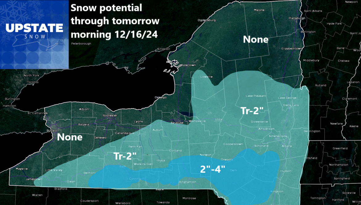
Here you will see hardly anything across areas that have been hit hard early this season. And areas not hit as hard, will actually see some accumulations tonight and into tomorrow morning. Shovel able? Probably. Plow able? Probably not unless you are in the 2-4 inch range and it hits as good if not better than expected. To the south in Pennsylvania, a lot of that state is under Winter Weather Advisories with several inches expected tonight and into tomorrow morning before changeover.
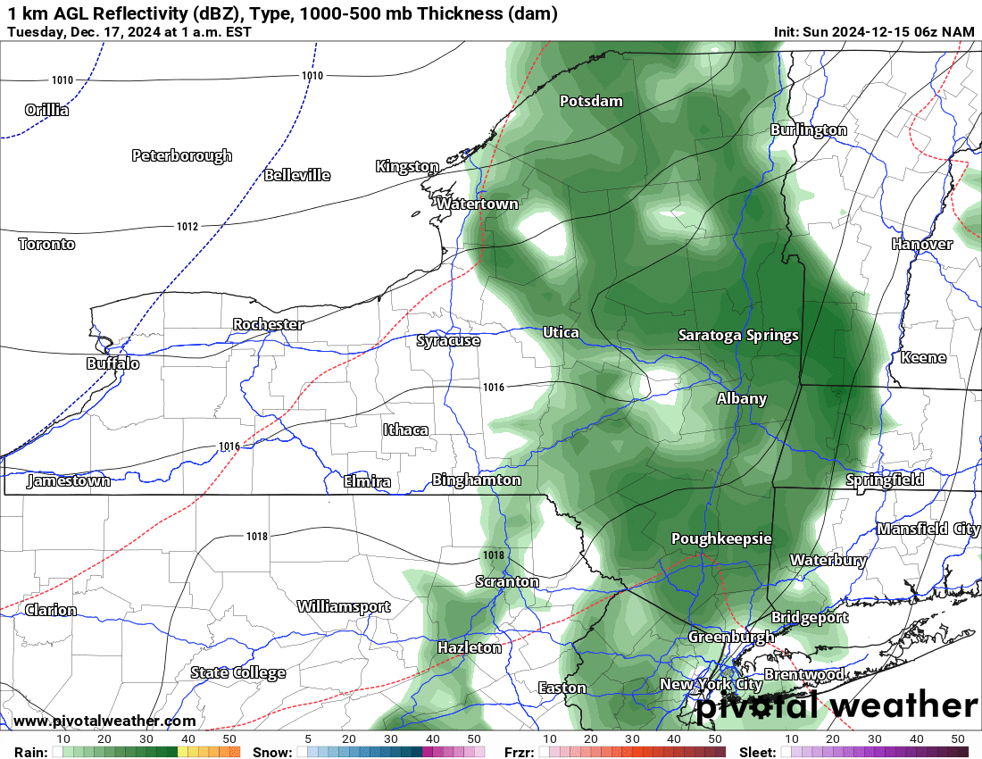
THE RAIN
After that system changes to rain Monday morning, we have about a 60-72 hour window of uh oh. Temperatures climb above freezing the entire time. Most of the time they stay in the 40s. Some low 50s. Some high 30s. But most of the time 40s will be the rule. It will be above normal but nowhere near record territory. This continues through late Wednesday and into early Thursday before we go…
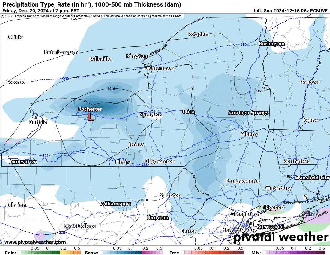
BACK TO SNOW
Thursday, and especially Friday and Saturday, snow returns to the forecast. If anything, the chances for more decent lake effect snow are increasing heading into next weekend. Enough to put numbers on that yet? Nope. Not quite. The models are still not in full agreement on this scenario yet. Some models bring the storm right down on the Northeast and into Upstate NY, which would turn it into a lake effect snow bonanza before Christmas. Others are not as crazy. As we have done before, time is on our side and we have days left to figure out what the scenario will be and how much snow we could see out of it. It could be localized. It could be widespread. Something in between.
Zack and Rich Lupia
Upstate Snow
December 15, 2024
Please thank our advertisers on Upstate Snow for 2024-25
Banner Sponsorship
Enjem’s Flooring America
Ohio Ridge Riders
ilsnow.com
Southern Tug Hill Sno-Riders
Saratoga Snowmobile Association
Business Sponsorship
Paton & Son Excavating and Landscaping


