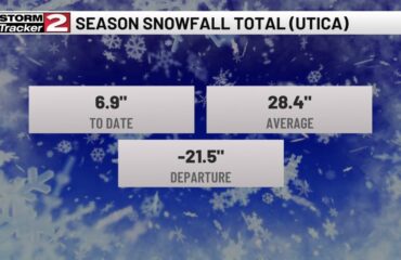
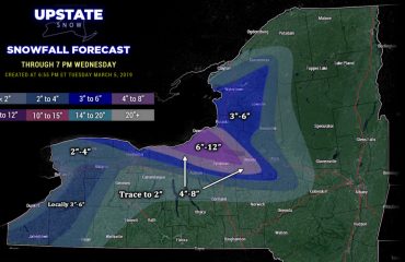
This blog is being posted during the 7 AM hour Sunday 12/15. We are still awaiting final snowfall measurements from WNY and for daylight to reveal whom got what on the NYS Mesonet cams… but in general the Southtowns in S Erie, Chautauqua, Cattaraugus, Wyoming and S Genesee Counties seemed to fare well with several inches of snow. In CNY, the Tug Hill and Adirondacks, not as much snow fell after the changeover last night but the great equalizer, Lake Ontario, has a broad band of lake snow along and N of the Thruway from Oswego and Lewis Counties, eastbound through N Oneida County, the southern Adirondacks and even into the Capital Region and Saratoga County. In snowmobile country, Tug Hill area, mainly the hill and approaches to the south, and the hills and clubs along and north of the Thruway, at least a few additional inches of snow will fall before tapering off later this afternoon.
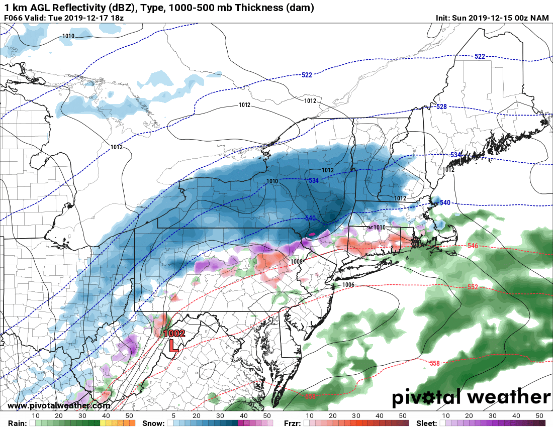
We catch a break tonight through most of Monday before the next storm approaches. This is good news, bad news. First the bad, tracking a little slower and a little farther south so snowfall amounts should not be as heavy. The good, less mixing over less of Upstate. You can see even at 2 1/2 days, a range where models usually are in fairly good agreement, we still don’t have that. But here’s 4 different projections of what the weather maps look like Tuesday afternoon.
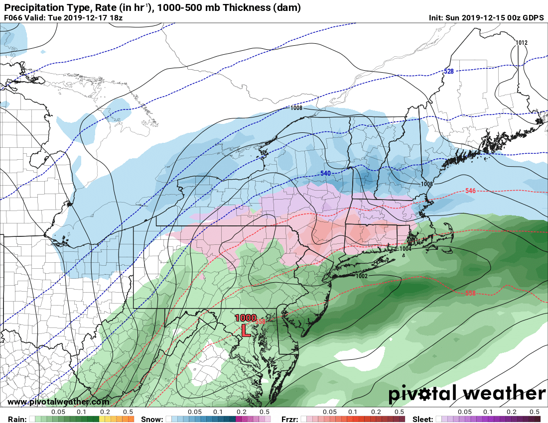
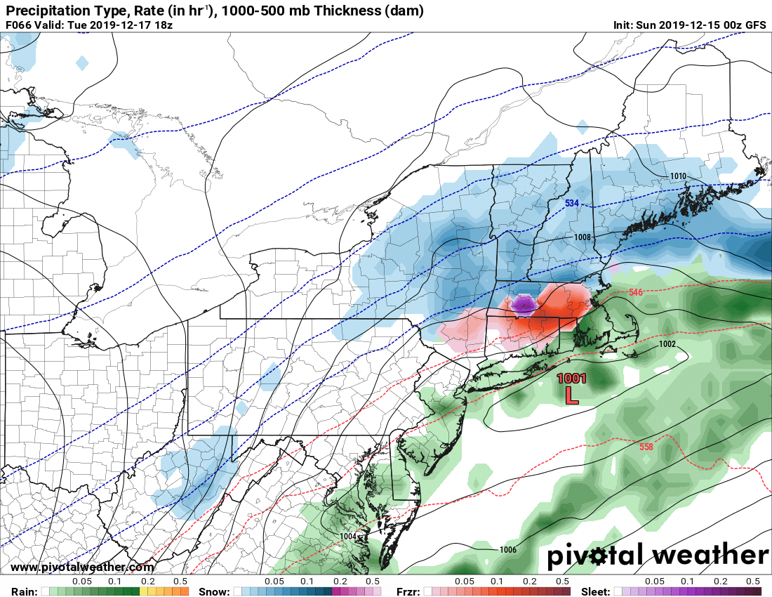
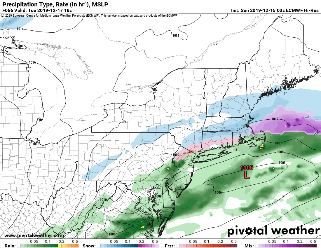
So given these scenarios, and with uncertainty on exact track and intensity, I’m going to go with this as my snowmap for this storm. As always, subject to change…
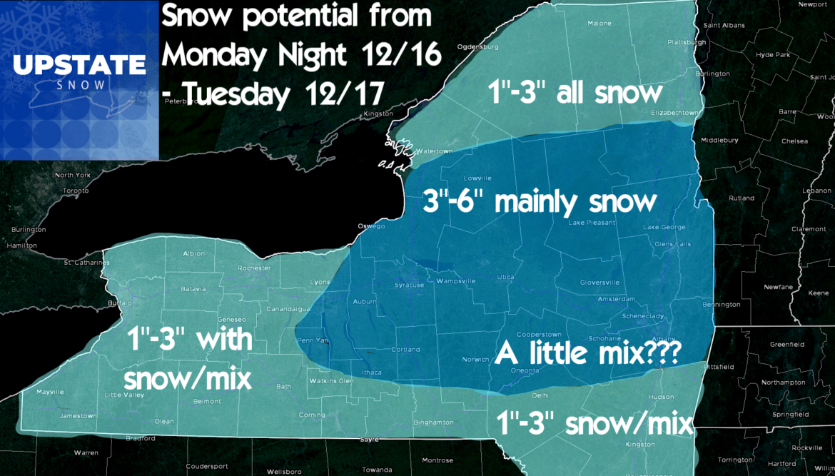
The models behind this storm are in UNIVERSAL AGREEMENT on the following:
1) A strong clipper/Arctic cold front follows this storm on Wednesday. ALL of Upstate will get a quick 1-3 inches of snow, and it may come in the form of a quick snow squall with gusty winds and low visibility. If you are traveling Wednesday, heads up to this travel issue that may be looming.
2) A period of lake effect snow will follow downwind of both lakes Erie and Ontario bringing potentially several additional inches of lake effect fluff in the areas where bands set up
3) The coldest air of the season follows with windchills below zero across ALL of Upstate Wednesday evening/night. In fact by Thursday morning, it’s below zero on actual temps across Upstate. Jack Frost nipping at your nose…
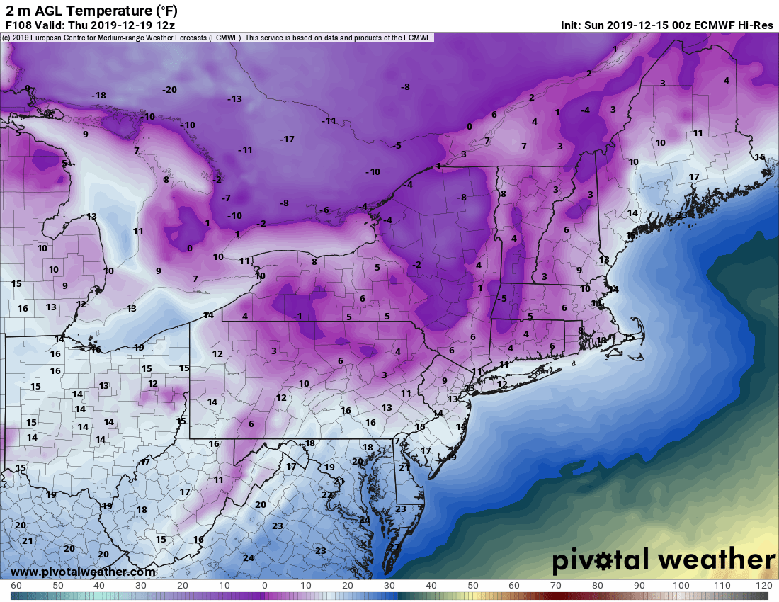
So the bottom line for snowmobiling is this: It’s looking WAY better than it did 5 days ago. I have enough confidence to say THERE WILL BE AT LEAST SOME RIDING AVAILABLE IN UPSTATE NY LATER THIS WEEK POSSIBLY NEXT WEEKEND. Where?
CHECK WITH YOUR CLUBS BEFORE YOU GO
If there is snow on the ground, it DOES NOT MEAN TRAILS ARE OPEN. Whole state opens Tuesday, conditions permitting AND IF CLUBS SAY TRAILS ARE OPEN AND READY TO GO. Many farmers still have crops out to harvest and/or have cattle grazing in the fields. They may not be ready by opening day in some areas. RESPECT THE LANDOWNERS WHOM MAKE OUR GREAT TRAILS POSSIBLE.
Back at you soon with more updates. Enjoy your Sunday. Take care and God bless…
Rich


