Welcome back to December 2015 in December 2021. Clouds give way to sun across most of Upstate NY with 40s and 50s for highs. Sunshine will dominate tomorrow with temps in the 40s and 50s in some spots with overnight lows near or above freezing outside the Adirondacks and Tug Hill. This is typical of early April… or early November. Wednesday as a warm front approaches, sun will fade behind clouds with rain showers developing. Thursday the other side of the storm approaches from the west and and the SW flow really gets going. This will mean more rain and winds increasing (not like what we saw this past weekend). Temperatures on Thursday will be in the 50s with some 60s in the lower elevations, especially in WNY, Southern Tier and Downstate.
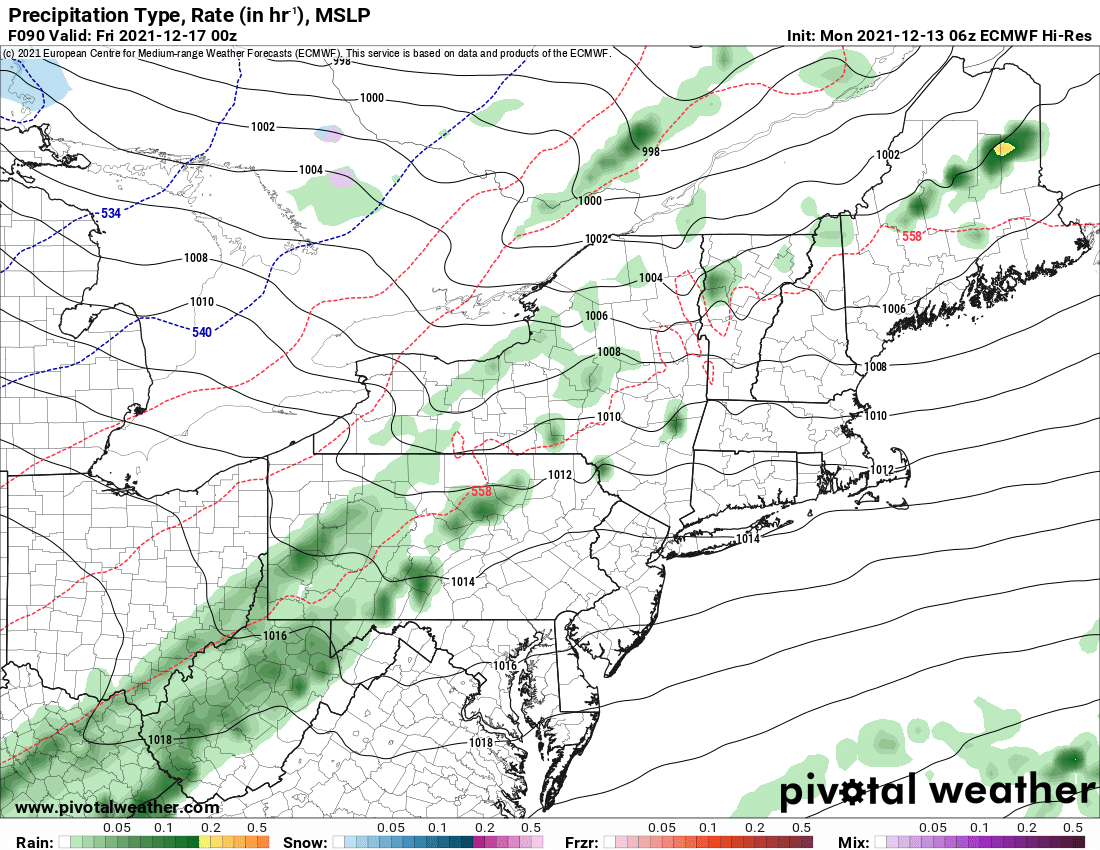
The air behind this storm on Friday is not particularly cold. If anything, still above normal temps with the only below freezing temps at night. Saturday is a different story. A weekend storm has been indicated for several model runs now, but, this last run of the Euro instead of the storm going to the NW of Upstate NY, it ACTUALLY GOES TO THE SOUTH AND EAST OF UPSTATE NY.
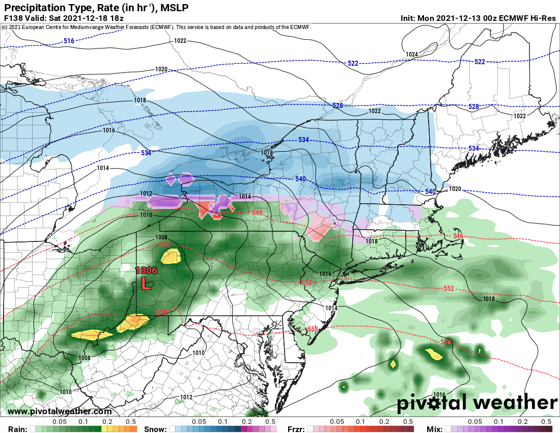
IF that were to happen, key word IF, it would snow. It would snow halfway decent. This is not day 7-10 fantasy. This is day 6 of the Euro. Within 7 days if the Euro says it could happen, then it goes into the “possible” category. If we get within 120 hours (5 days) and it is still showing this storm and trend, then we may actually have something. Get within 72-84 hours, and we start hitting the “likely” scenario and start issuing forecasts including a snowfall map. Within 48 hours, imminent.
This is the general operating scenario with our weather forecasts. We don’t talk about it like this much, but given the situation, I figured I’d explain myself. We will say this weekend, a return to snowfall across parts of Upstate NY, especially north of the Thruway is “possible”. Not likely or imminent, but “possible”. It could go either way. Given trends this fall, I wouldn’t bet money on this yet. We’re not at 50/50 yet.
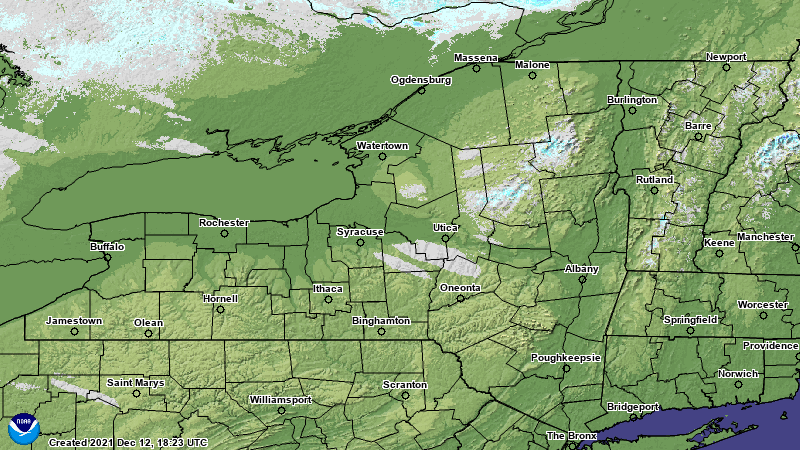
Next week the Euro was going HOGWILD with a very strong cutter turned Nor’easter in the 8-10 day range for the interior NE including Upstate NY. With the shift of the track on the Saturday storm, it also took away this threat for next week (Tuesday 12/21). Is it because the Euro saw something on this last model run that it’s changing and following? We shall see. Remember beyond 72-84 hours, we are almost “wishcasting”, and given how pitiful the snowcover is across Upstate NY and surrounding environs (practically NONE), this is more of a “possible, stay tuned” more than anything else. Y’all wanted hope, this is all I’ve got at the moment. Better than just straight warm through Christmas. Which is still very possible as well.
Until next time, be good, help the clubs, do the snow dance and PRAY.
If you enjoy our weather reports, podcasts, videos, and features, say thank you by becoming a SPONSOR or MEMBER of Upstate Snow! For just $60, sponsors receive a hyperlink to your business or social media page on every morning blog and podcast post on upstatesnow.com for the season (until 8/31/22). For just $10, members get name recognition, or if you wish not to use your name, recognition to your favorite snowmobile club or where you live.
Click below to get started
paypal.me/lupiallc
www.venmo.com/u/Richard-Lupia
THANK YOU to our faithful sponsors and members!
SPONSORS
Southern Tug Hill SnoRiders
Saratoga Snowmobile Association
Ohio Ridge Riders
ILSNOW.com
Enjem’s Flooring America
Water’s Edge Inn – Old Forge
Adirondacks Speculator Chamber of Commerce
White Lake Inn
Toads LLC Fisher and Snow Dog Plows, Cairo, NY
John Schoff Memorial Vintage Ride – January 15, 2022
Lincoln Mountain Gansevoort Snowmobile Club
MEMBERS
Chris Rinck
Charles Klesse
Chaz Albertson
Dave Gleasman
John Bates
Darrin Harr
Mark Enjem
Matthew Pistner
Eric Vilovchik
Brian & Paula Bedell
Robert G. Gartley
Chris Higgins
Nathan DeMarco
Frank Presky
Chris Schoff
Richard Keller
Mark Spano
Paul Marconi
Michael Schrader

