FIRST OFF THANK YOU UPSTATE SNOW NATION! THIS MORNING, OUR FACEBOOK FOLLOWERS SHATTERED THE 20,000 MARK! I AM SO THANKFUL FOR ALL YOU HAVE DONE. THANK YOU!
OH BOY… THEN OH BOY… THEN OH BOY. It’s December. It’s early season riding.
We have everything over the next 72-84 hours. Heavy rains. Then heavy snow behind this storm. Then areas of heavy lake effect snow. Then a chilly weekend for SNOWDEO, followed by a warmup for next week. Ready?
OH MY WORD
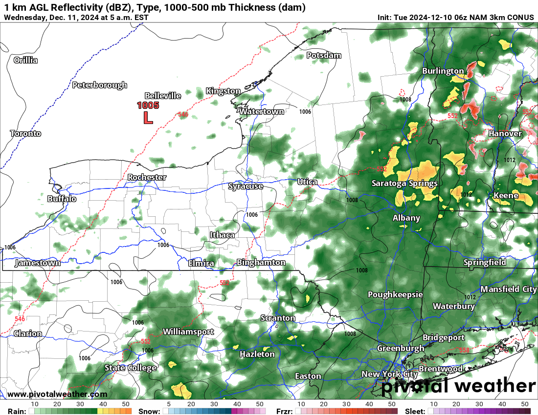
The rains that are coming tonight and tomorrow are nothing to mess with. In fact, these rains will threaten TOP 10 December Records! The last time we saw this was the Christmas Eve/Day Massacre of 2020, when we saw a great snow pack over much of Central and Eastern NY get wiped out in one shot. I am telling you this: There is a chance of this happening yet again. Especially since most of the snowpack on the ground is lake effect. With temperatures in the 40s and heavy rains (to the tune of 1-3 inches) for 24 hours, I am not sure how much of the snowpack makes it. Even the day before the event, I am still not sure. This evening through Wednesday afternoon is the best time.
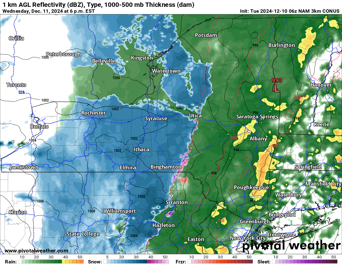
OH BOY!
Then THE SNOW COMES BACK WITH A VENGANCE! It comes from Western NY starting Wednesday afternoon, reaches Central NY Wednesday evening, then Eastern NY Wednesday night into Thursday morning. It all depends on how fast that transition line runs, and how much precipitation is on the back side of that. It is that which will determine exactly how much snow will be lost and how much will be gained afterwards.
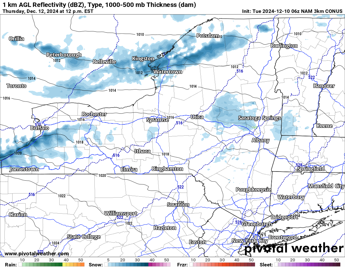
OH BOY AGAIN!
After the steady snows for several hours on the back side of our storm, immediately the lake effect will kick in on Thursday and continue into Friday before tapering off by Friday evening. These bands of lake effect snow will be intense. Expect accumulations in the most intense bands to be at least 1-2 feet with localized areas seeing more. With SNOWDEO starting on Friday in Inlet and Old Forge, and with them being in the crosshairs of the lake effect bands, it could turn out to be a very interesting Friday of racing and testing!
WARMING UP AFTER THAT
The 6-10 Day is above normal. Squarely. This means next week temperatures head back into the 40s with more scattered showers. That will help to decrease the snowpack. Yet again. In the lower elevations, this snow, no snow, snow, no snow thing we will continue to be stuck in for awhile.
The accumulations forecast we will put out later today or at the latest tomorrow morning. Trust me we want to put out something now… but just given how dynamic this storm system is, we wish to be careful. We don’t want to go early then make major changes 12-24 hours later just before it hits. We have done that one too many times.
Zack and Rich Lupia
Upstate Snow
December 10. 2024
Please thank our advertisers on Upstate Snow for 2024-25
Banner Sponsorship
Enjem’s Flooring America
Ohio Ridge Riders
ilsnow.com
Southern Tug Hill Sno-Riders
Saratoga Snowmobile Association
Business Sponsorship
Paton & Son Excavating and Landscaping


