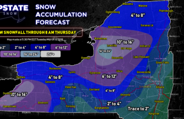
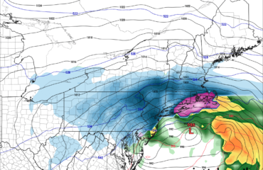
This is not a big snowfall by December standards by any means. But it’s 2020 and it’s a mild winter to start and looking that way in the long term… so minor snow events like this, which would be lost in the noise of a big snow and cold winter, get more attention and tend to be more magnified than usual. Especially since tomorrow’s snow is likely to be our only accumulating snow chances across the Upstate for the next several days… if not more.
Bottom line: Our clipper for tomorrow has a little more zip to it… despite that most of Upstate NY will only see a dusting to an inch or two of snow. In the favored upslope and snow belt areas, I think there is a chance with winds off the abnormally warm lakes, with favorable W to WNW flow off both Ontario and Erie, may lead to additional snowfall in localized areas… I think this clipper will overperform for some in terms of snowfall. Not many but some. I have a hunch given the model trends, especially on the mesoscale models, and the water temps on the lakes still way in the 40s to near 50… the models don’t always catch that because their “climo” of lake temps built into the models are more like 38-43 F at this time of year.
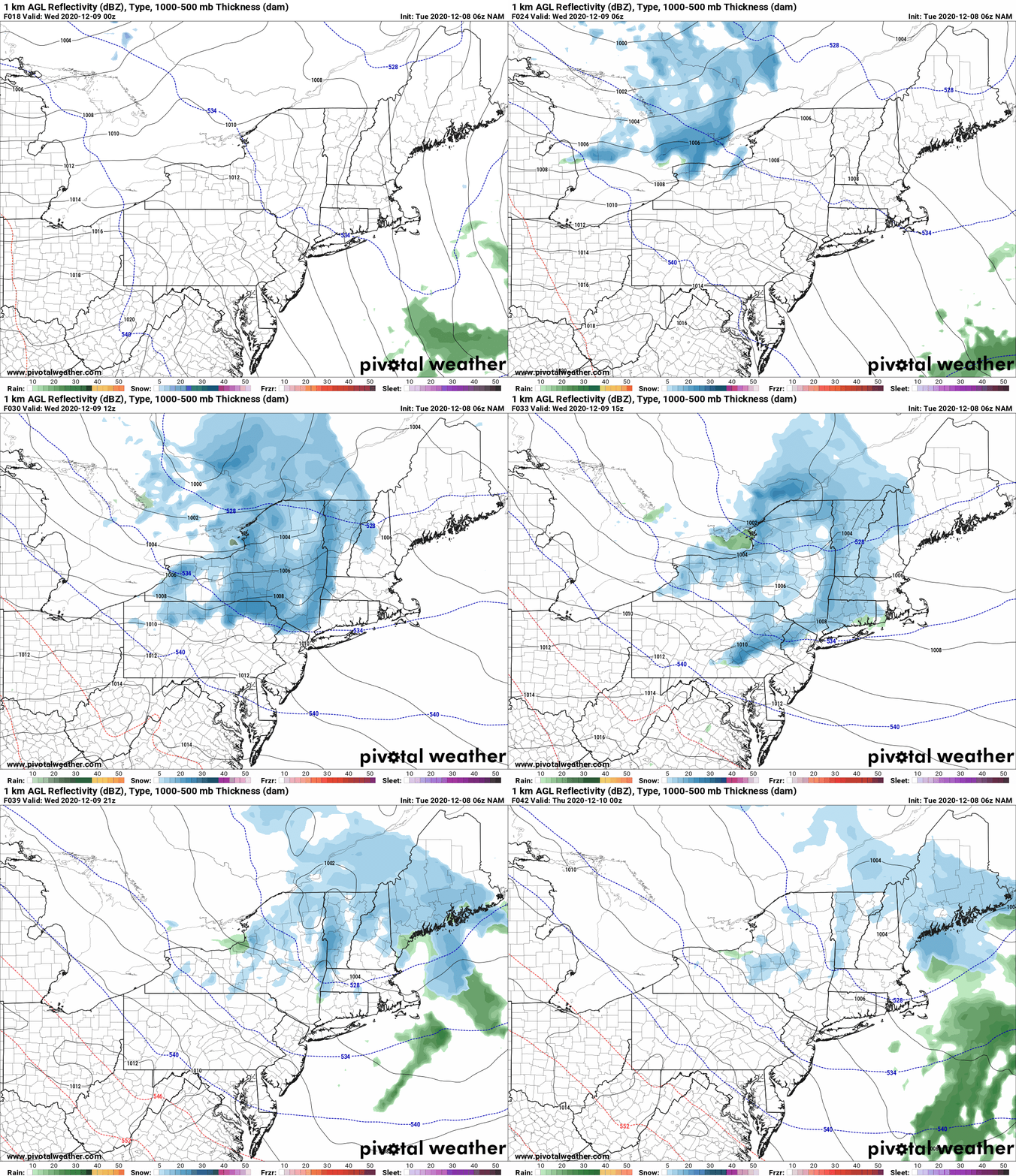
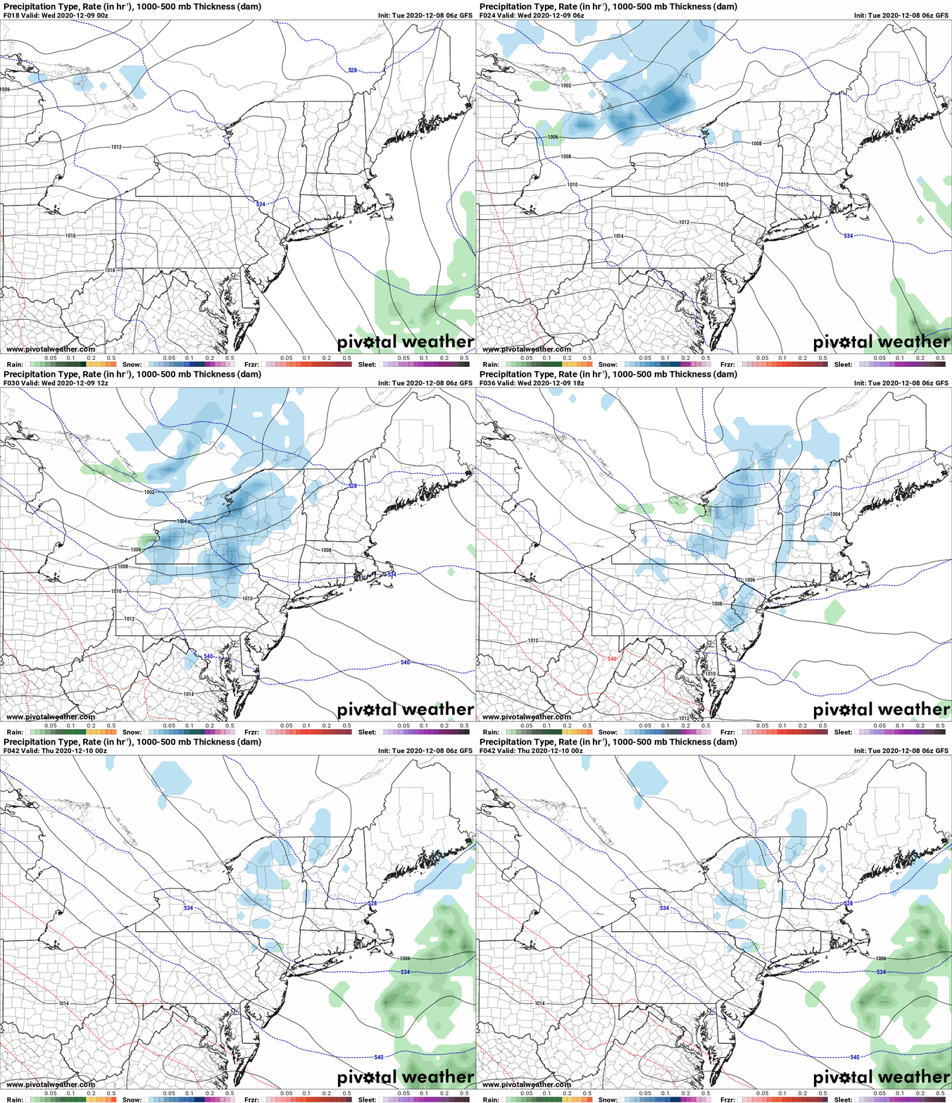
You can see the difference as the NAM lights up more, especially off the lakes, while the GFS is not as excited.
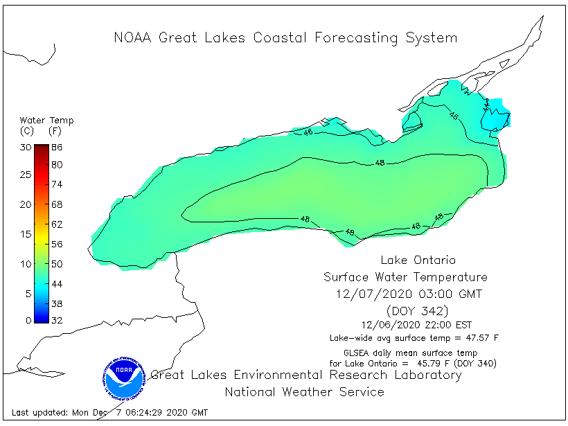
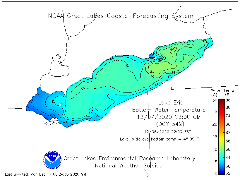
So with the warm lakes, clipper moving through and sufficient cold for several hours, it would not surprise me that localized areas off Lake Erie on the Chautauqua Ridge and Ski Country get just a few inches more. Not major but enough to notice. Off Lake Ontario I think the hills along and just south of Route 20 could squeeze out an extra few inches. Mainly confined to higher elevations over 1500′, would not surprise me to see a 2″, a 3″ or 4″ total. Same applies also in the Old Forge area, Inlet, MRP, Morehouse and Ohio. Black River Valley should stay under 2″, but on the hill above Turin and C’ville, in places like Montague, Osceola, Highmarket and Redfield, I would not be surprise given the setup if 4″ is exceeded tomorrow. 8″ would definitely be high end and highly localized, even on the hill.
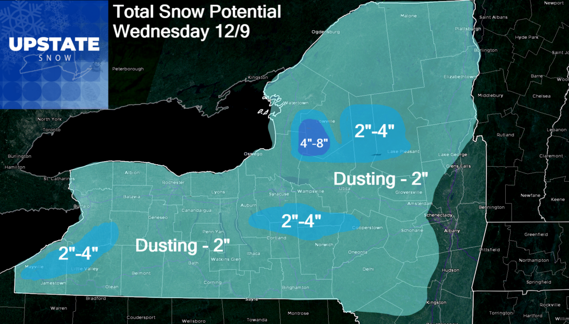
Yes this forecast is different than some I have seen. Many are quick to say “The NWS says” or “My local TV Met says”… while a majority of the time our forecasts are relatively close, we sometimes differ some. This and all our forecasts are of the professional opinion of me, a Meteorologist of 23 years experience. You can play the Billy Joel song in the background, you may be wrong but you may be right 🙂
Moving on, this snow will not stick around very long… because we jump above freezing Thursday and especially Friday. In fact it will just get WARM this weekend. Yes we do cool down back closer to “normal” next week as you see from the temp map through next week… but given the warm fall and lack of snowfall to start the season, this won’t be of much help. Any snow, even on the Tug will be gone quick.
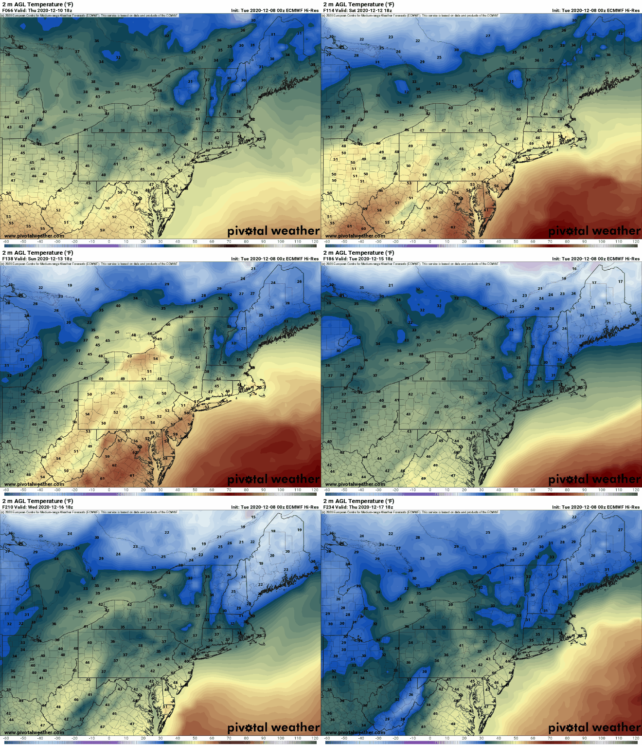
Yep no big cold coming anytime soon. And the longer range, looking 8-14 days out… yep… it’s stomach churning for cold and snow lovers. I hate to suggest this 17 days out from Christmas, but could we be on track for yet another green Christmas???
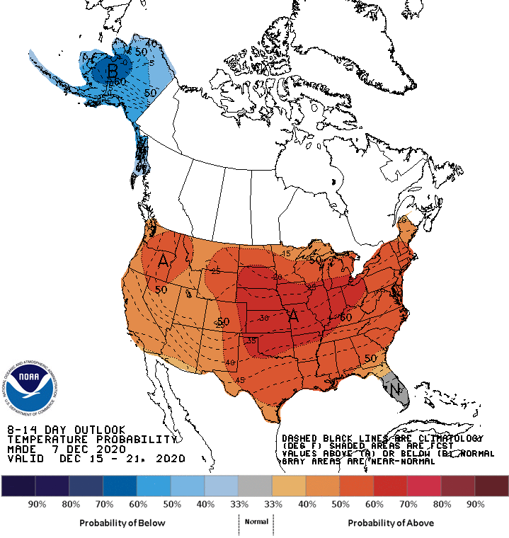
So, we’ll enjoy the snow when we have it tomorrow. For snowmobilers itching for the first ride, don’t even think about going up to the hill to ride unless the clubs up there and where hunting season is over actually say on their web pages and Facebook pages that trails are ready and snow is sufficient. I don’t think it will be enough. I know it’s hard to be patient… but trying to ride on anything that may fall on Tug Hill could do more harm than good. Trust me, the clubs have told me there is a LOT OF MUD up there. We have not had the cold to freeze things down. Fresh snow can hide a multitude of hazards. DO NOT GO unless the clubs say for sure it’s OK. Respect them, their hard work and the landowners.
Later today our Trail Talk Podcast episode with John Bates from the Ohio Ridge Riders will drop. Be on the lookout for that on the Facebook page and on the Trail Talk Podcast page here at Upstate Snow.
Rich


