Good morning Upstate Snow Nation! If you are not prepared to shovel or snow blow over the next few days, PREPARE NOW!
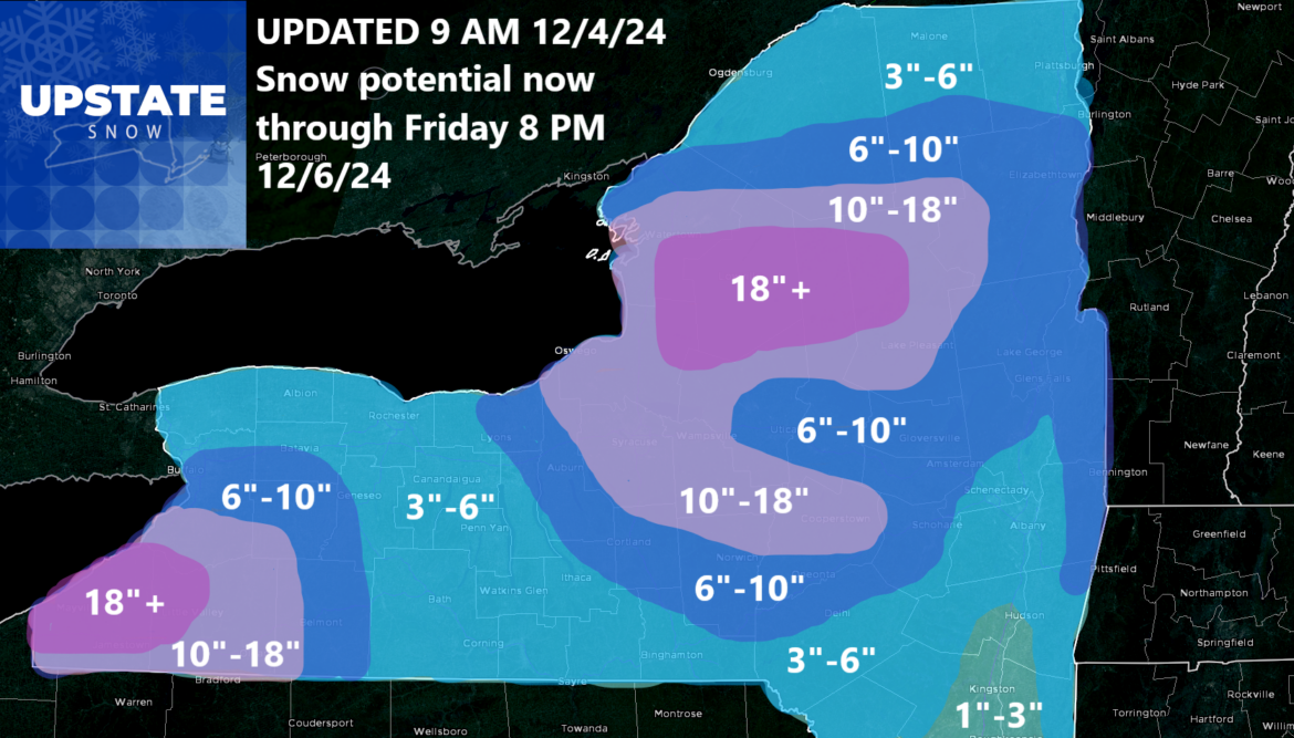
Our first true storm of the season is coming fast. No we are not just talking lake effect this time. Although we have had a lot of lake effect snow already. It’s only December 4th! The trails aren’t even open yet! However, this is the true first good event for everyone for the 2024-25 season. I will break this down much more closely for you that usual:
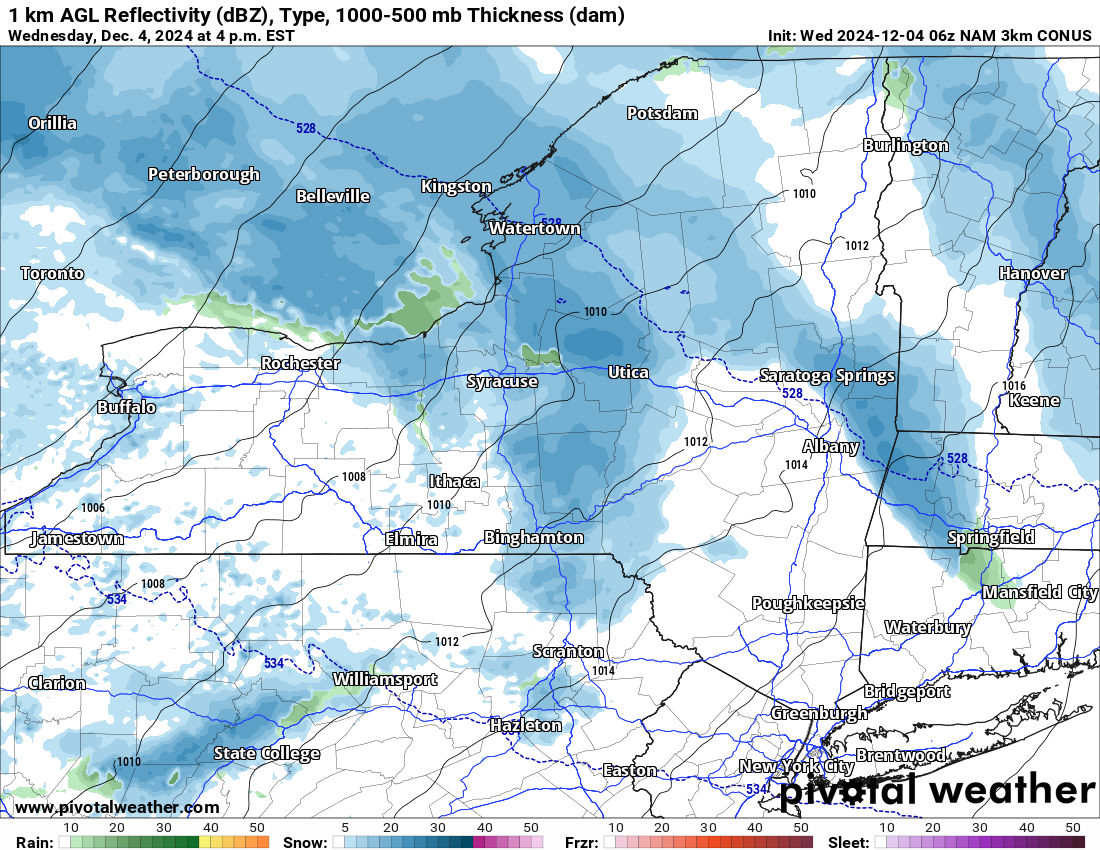
THIS AFTERNOON AND EVENING
The first batch of steady snow moves through Central NY first, then begins to overspread the state quickly from west to east. After sunset, we are looking at the accumulations starting in most areas. For a majority of people, most of your accumulations, especially outside of the lake effect and lake enhanced zones, will happen between starting by 4 PM today and last into tomorrow before coming more localized.
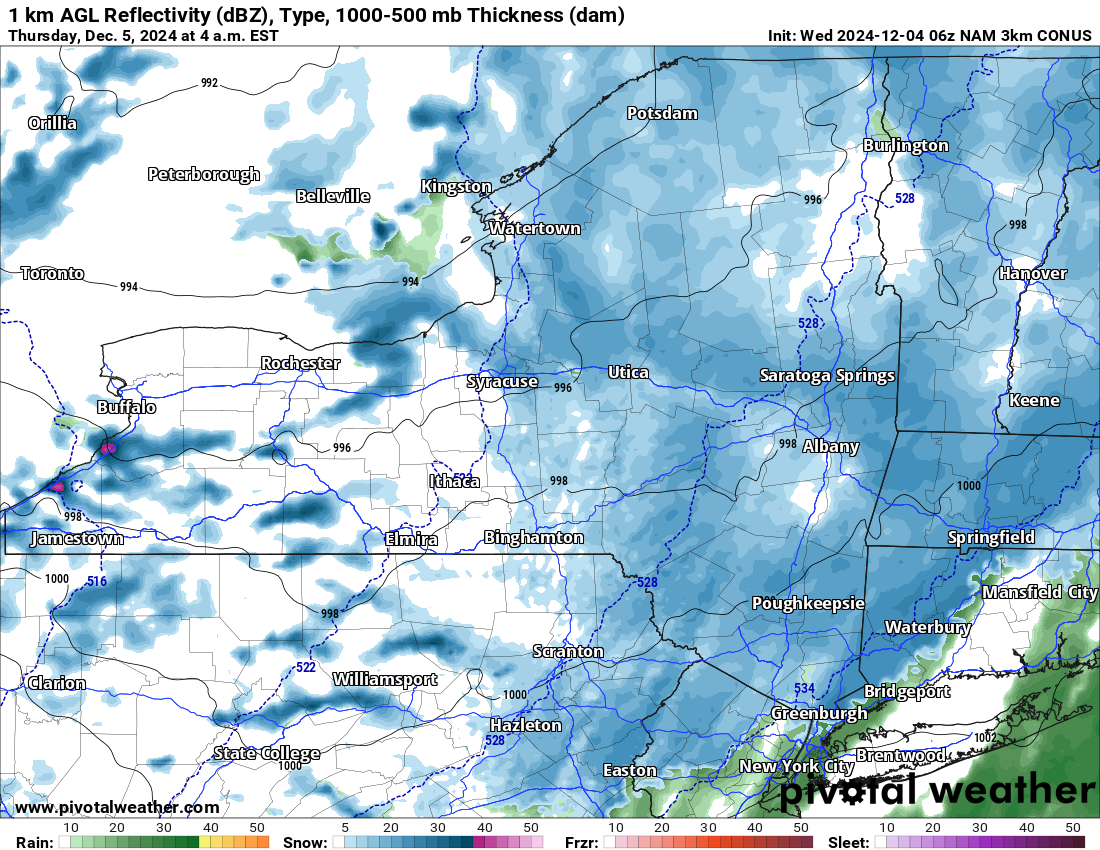
OVERNIGHT AND TOMORROW MORNING
This is when the clipper comes on through Upstate NY. It has been gaining decent strength on its signatures each model run, more than enough to where I have bumped up the forecast over most of the areas away from the lake effect zones. This is when the steadiest snow will be, this is when the trickiest time to travel will be, and this is when the greatest delays will be. Especially commuting tomorrow morning.

THURSDAY PM THROUGH FRIDAY PM
This is when the storm goes by and winds go initially to a NW to WNW direction, then gradually slide back around to more of a due west direction, between 260 and 280. This should keep the heaviest snows over southern Erie, Chautauqua, Cattaraugus, Allegheny, Wyoming and Genesee Counties in Western NY. It starts over Cayuga, Cortland, Chenango, Onondaga, Oswego, Madison, Chenango and Delaware Counties to start coming off of Lake Ontario, then shifts north into Oswego, Jefferson, Lewis, northern Herkimer, Hamilton, southern St. Lawrence, southern Franklin and southern Essex Counties. Even parts of western Warren, western Saratoga, Fulton and even Schoharie Counties could get in on additional accumulations.
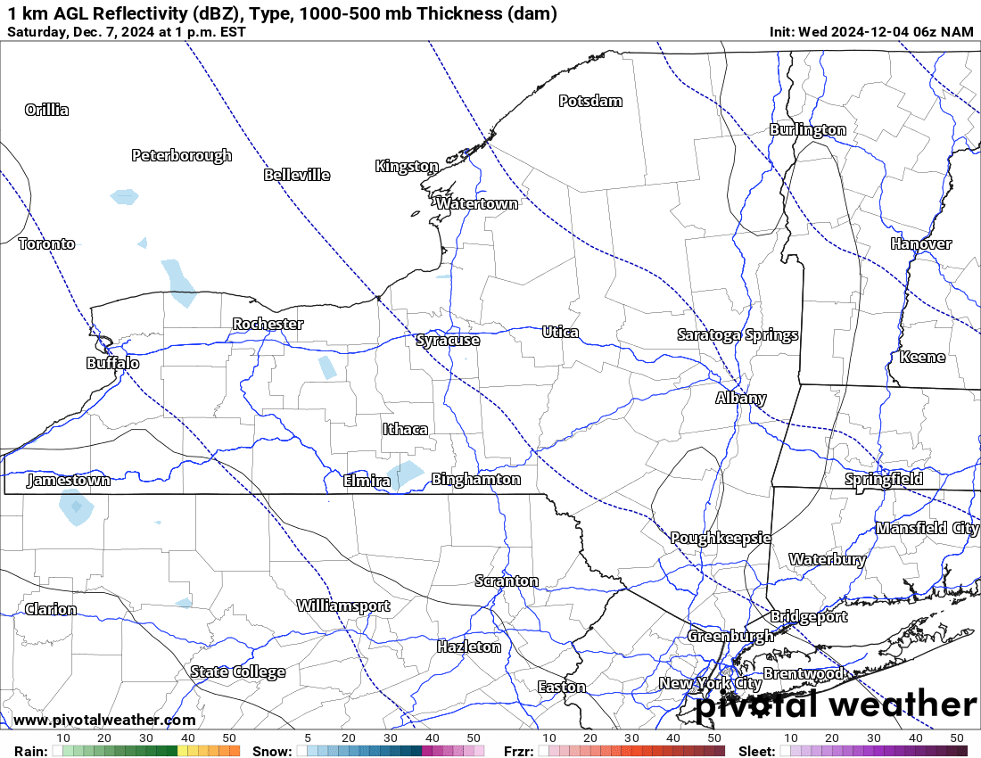
THIS WEEKEND
There will still be some snow showers around along with some lake effect. It will be nowhere near as intense or as widespread as it will be in the next 48-60 hours though. Accumulations of snow will be much less, even in the lake effect areas. Most will see none. A few might see an inch or two but most will be dry.
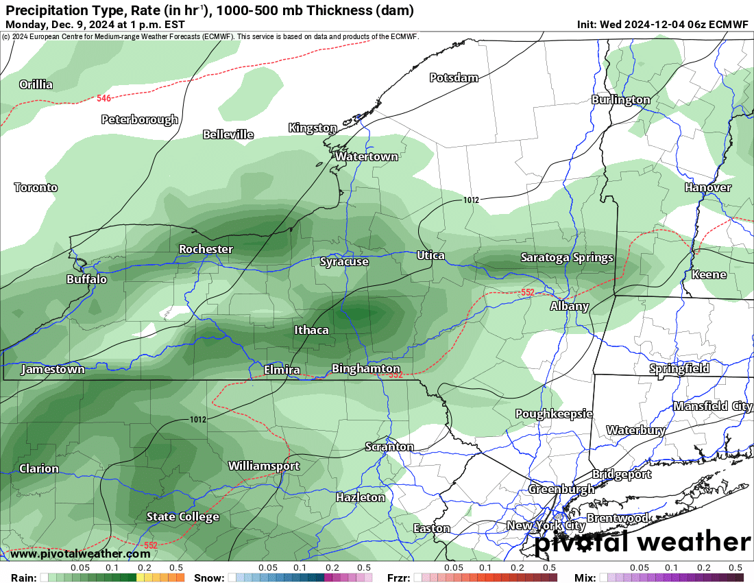
EARLY NEXT WEEK
A brief warmup comes back. For a few days at least we warm back to near to above normal for a few days. Some rain showers will be around. This doesn’t look to be heavy at this time and the temperatures don’t appear to be much above freezing. 30’s to maybe low 40’s at absolute best here. We will definitely see some compaction and settling of the building snowpack that is out there, but we will have more than enough to START THE SEASON ON TIME IN THE NORTH COUNTRY AND ADIRONDACKS THIS YEAR FOR THE FIRST TIME SINCE 2018!
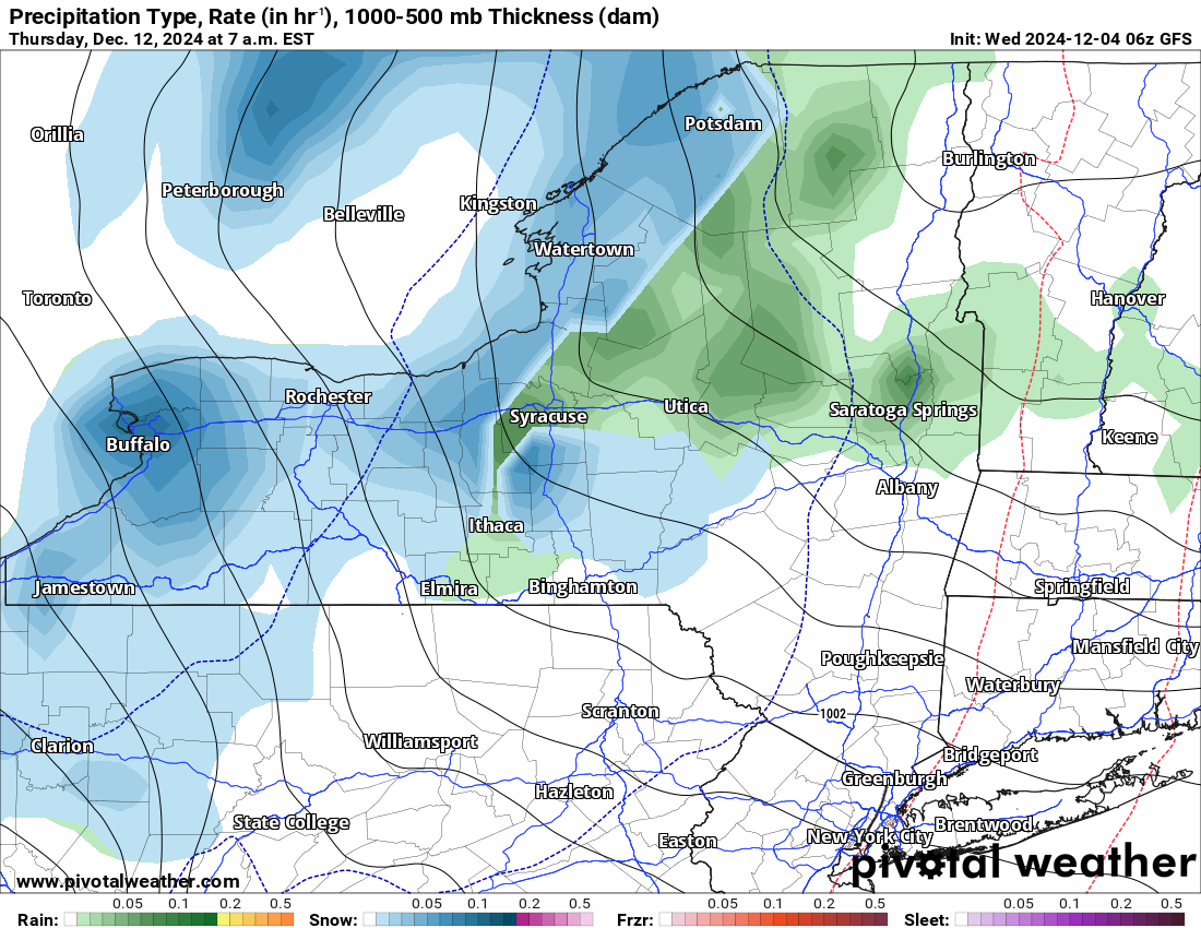
LATE NEXT WEEK
A secondary push of colder air is indicated. This means that the melting and compaction of whatever base we have out there won’t be as bad as we are thinking. Things should be looking good for SNOWDEO in Old Forge, which will actually have SNOW for the first time since 2018!
THANK YOU
For your continued dedication and support of Upstate Snow. We are dangerously close to hitting the 20K mark in followers and 17K in likes. Whenever we hit either one of those marks, we will yell!
Zack and Rich Lupia
Upstate Snow
December 4, 2024
Please thank our advertisers on Upstate Snow for 2024-25
Banner Sponsorship
Enjem’s Flooring America
Ohio Ridge Riders
ilsnow.com
Southern Tug Hill Sno-Riders
Saratoga Snowmobile Association
Business Sponsorship
Paton & Son Excavating and Landscaping


