There is still a high degree of uncertainty with the weekend coastal storm. I know usually you come to expect at least a first call snow map now that we are 60-84 hours of the storm. There will be none today. We will attempt first call numbers in tomorrow morning’s blog.
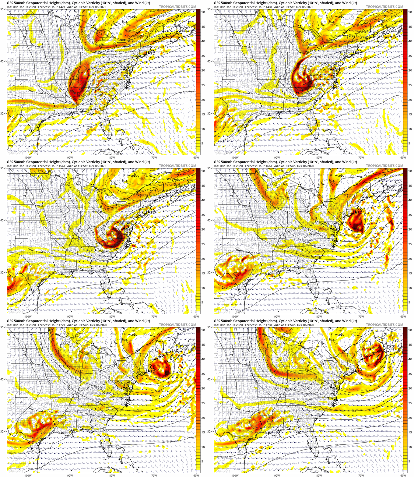
Why is this forecast more difficult than usual? Take a look at the upper air maps across the eastern US. We have a strong southern stream low (what’s coming across the TN Valley and the Carolina’s) that phases somewhat with a trough digging out of the Great Lakes. Precisely where and how much “phasing” occurs will determine the track of both the upper low and the surface low. If you remember correctly, this “phasing” was what we just dealt with in the storm system that just departed Upstate NY yesterday that brought the good snows to WNY and lake effect yesterday to the Tug, CNY and the Adirondacks.
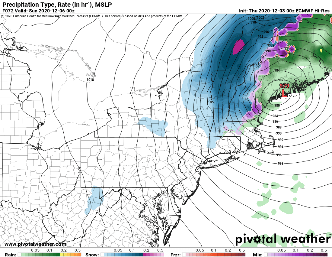
What are we CONFIDENT of RIGHT NOW?: if you are WEST of 81 you will not get this. If you are in the Catskills, Hudson Valley, Capital Region and especially in the hills and mountains along the eastern border of NY… you have the best chances for accumulating snows. The big question area falls north of 88, west of the Northway, east of 81.
Below are the Saturday Night 7 PM ideas from the Euro, GFS (American), NAM (Mesoscale Model) and GDPS (Canadian). Again snapshots…
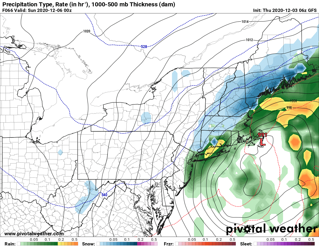
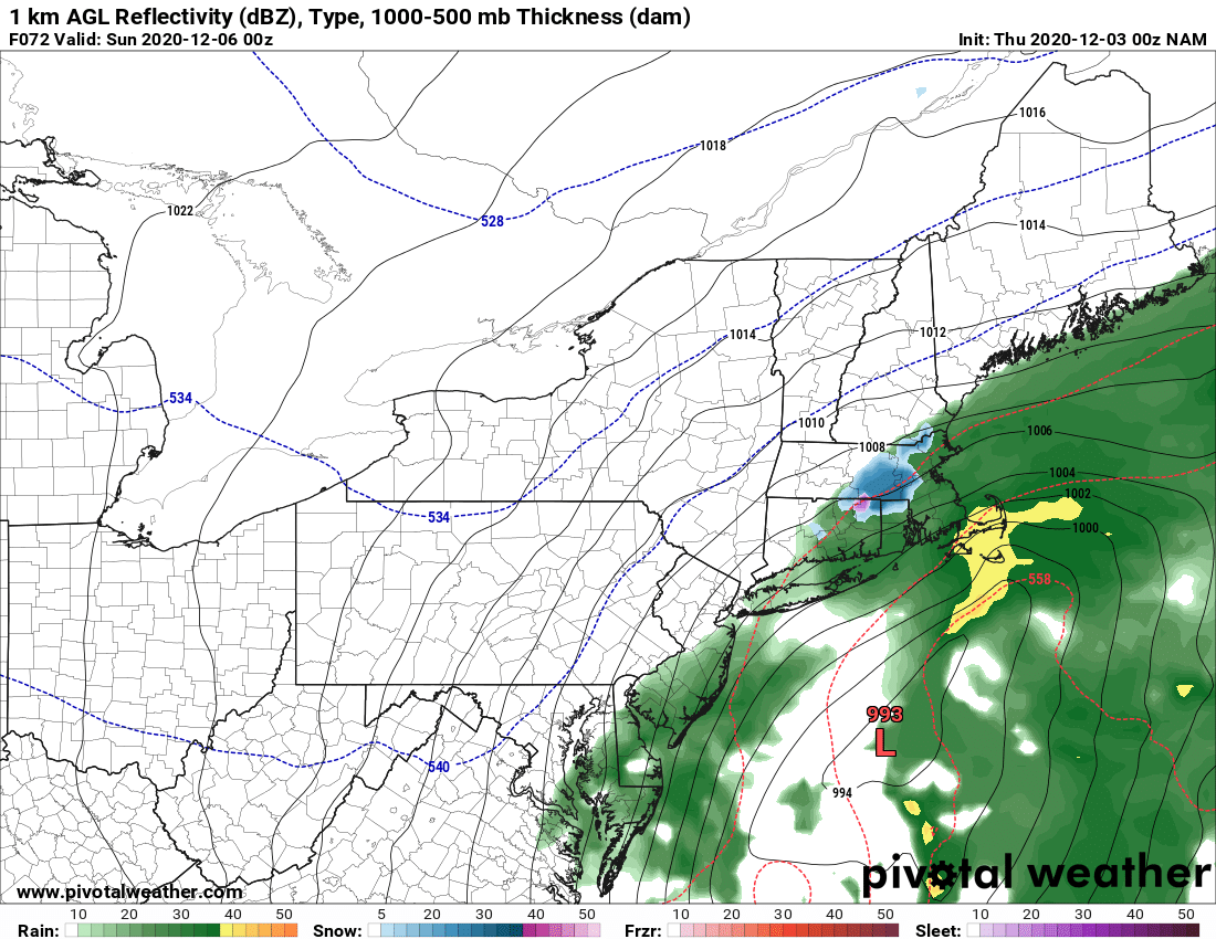
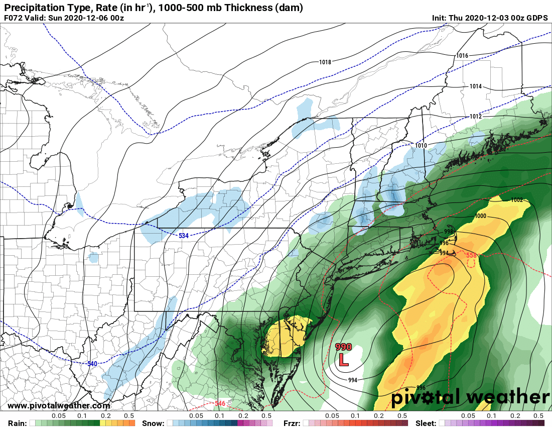
Sunday as the storm departs much colder air comes in to try to freeze things down. With the dry nature of this cold air and wind shear, I’m not high on big lake effect potential at this time though temperature differences would be enough to generate lake clouds and at least some precipitation. You need at least 13 C difference between the lake and the air a mile (850 mb) above the lake to initiate instability and we will have that Sunday and Monday. Again uncertain the degree to which to be excited.
Temperatures will remain at or below normal for next week with indications of a possible clipper and lake effect middle of next week. Confidence still low in where temps and jet stream patterns go afterwards.
Stay tuned. We should have more specifics and a clearer picture in tomorrow’s morning blog.
Rich

