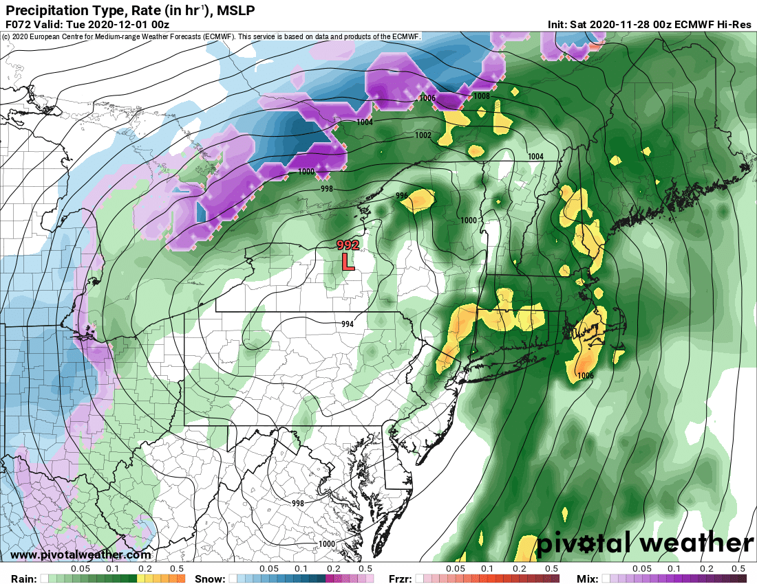
We are right on schedule for storm number 1 to nail Upstate NY with a lot of wind and rain Monday followed by much colder temps and snow chances starting Tuesday 12/1… but even here details are shifting and if you are a snow lover, particularly in Western NY, this could be good news for you.
Jury again is still out on track of storm number 2. Despite the GFS timing of Friday 12/4 for that one, at the moment, GFS is now agreeing with and more in sync with the Euro for a timing of next weekend. While storm number 2 is coming into more of a timing agreement, track is well… a different story. And if you’ve learned anything reading my blogs and old school Meteorology training… I’m like Meghan Trainor… It’s all about that track, bout that track, no models… OK just be thankful I didn’t karaoke that, but you get my point. Modelology is fun but storms follow basic principles of Meteorology… and tracks of storms matter, jet stream positions, air temperatures aloft and wind directions… they all matter and must make sense Meteorologically. See the end of my last blog for an example of this. Now to the new information:
STORM #1 – Storm gets going over the Southeast US tomorrow, then rolls northward spreading rain and wind into Upstate NY starting Monday. All models, even the Euro, are hinting at a subtle shift to the east, just enough to bring some hope of snow into WNY on the back side of this. Maybe more? The initial track of the storm was up the Ohio Valley to around Buffalo. That would keep all of Upstate NY on the warm side of the storm. Now models wanting to take a drive up the spine of the Appalachians on I-81 and move it into Central NY. While such a track is possible and has happened before, big storms don’t like the ridges of mountains. It usually will pick one side or the other. If it stays just west, and aims more at Pittsburgh to Rochester, some snow could get to Chautauqua, Buffalo and Niagara. But if it flips to the east side of the Blue Ridge… and indications are growing it could, then the track could aim more towards a Harrisburg to Hudson Valley track. If that were to happen, whole new ballgame. Here’s the NAM and GFS ideas on this below…
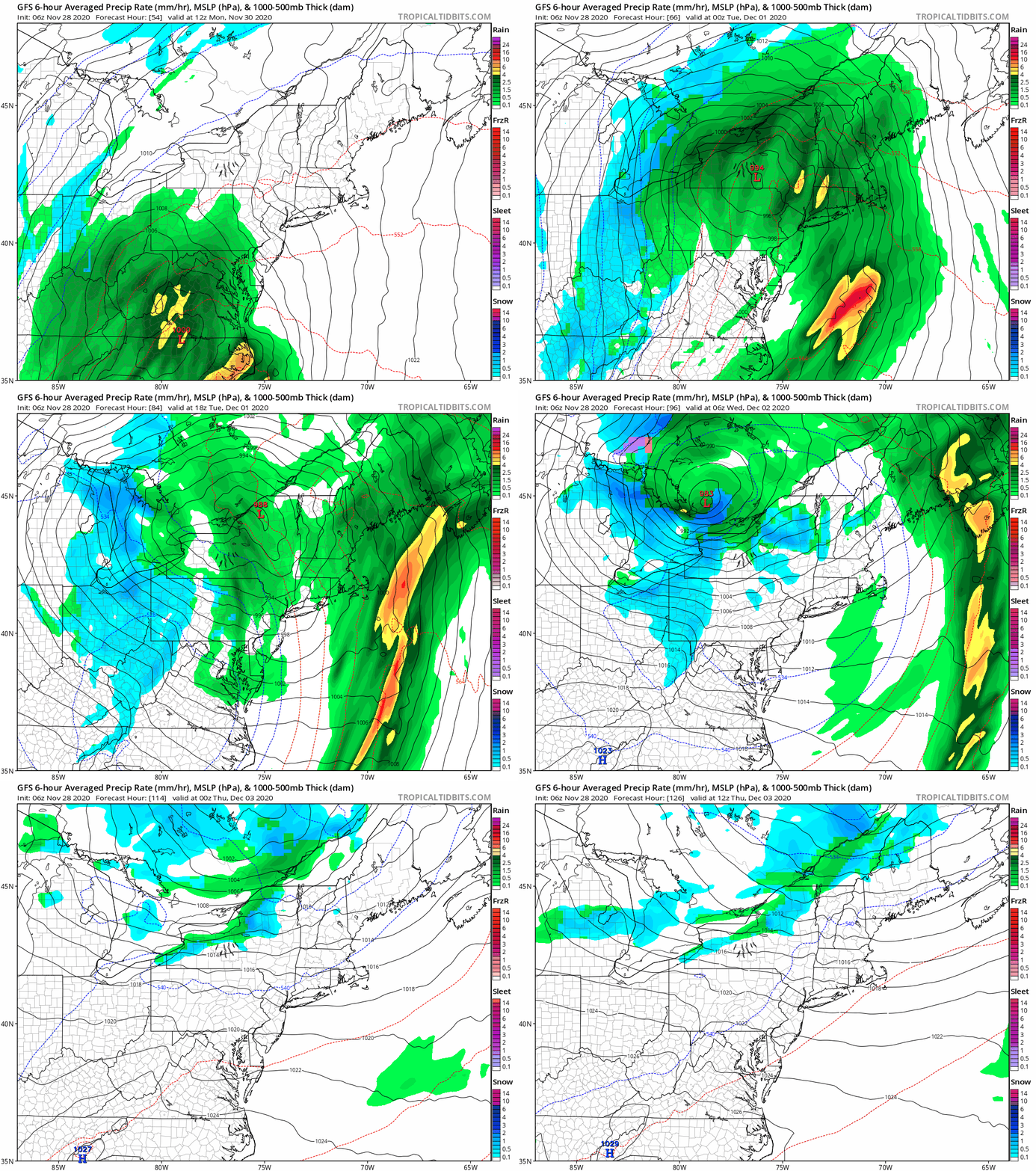
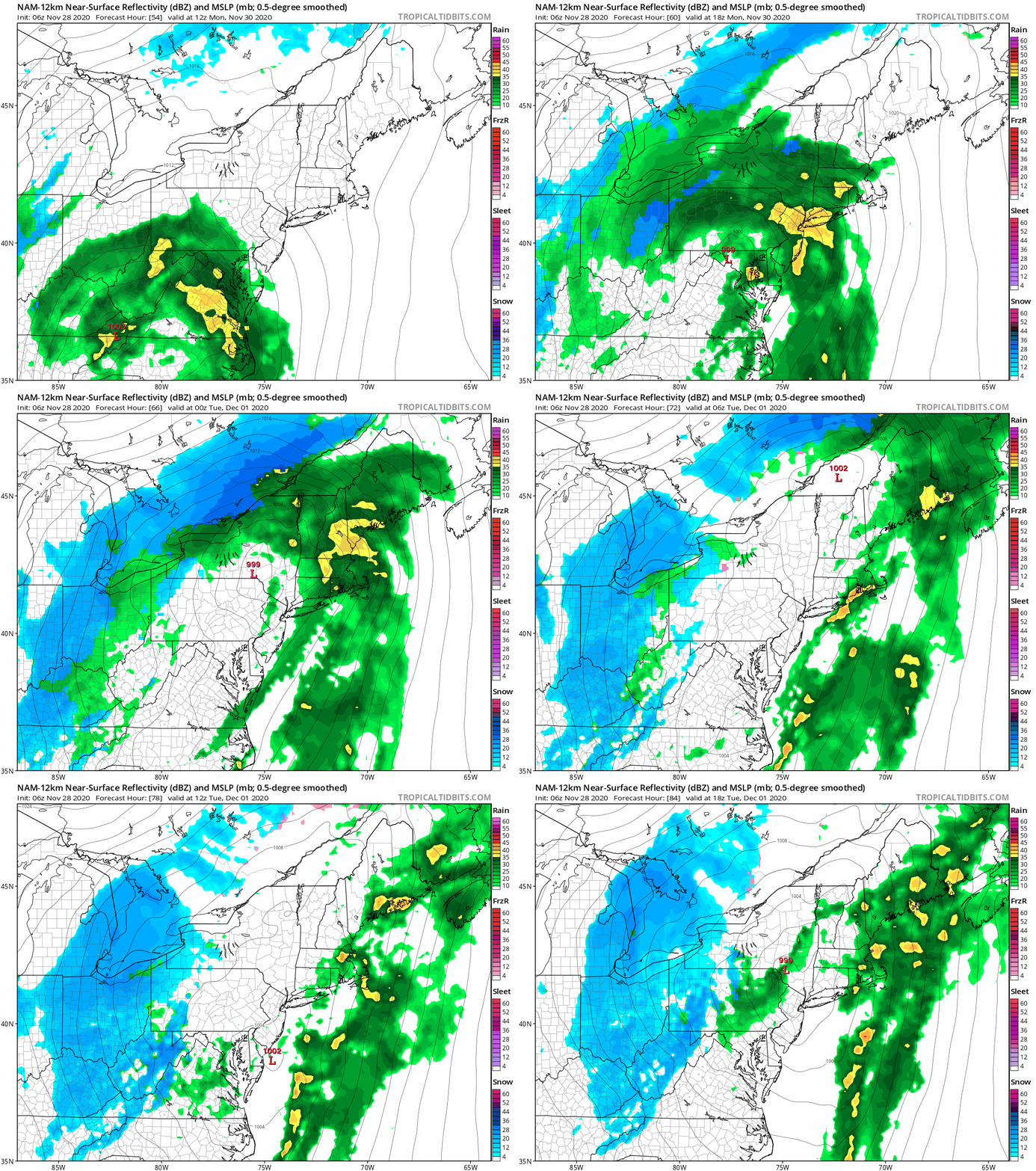
Bottom line: Rain and wind Monday is a lock for Upstate NY, but as the storm center approaches, the track matters. If indeed this eastern nudge continues, it is a much better scenario for snow lovers, especially WNY, but if it got to the Hudson Valley, even the Tug Hill and CNY could get in on it. Still too early to make a call for sure, we are still 3 days out on a large early season complex storm. But if you are in WNY, it’s looking better for snow starting Monday night into Tuesday. CNY and Tug Hill still a question mark. Catskills, most of the Adirondacks (especially east of Route 30) and Eastern NY not likely for snow on this one.
So as the storm winds down Tuesday we will be left with lingering snow showers, chilly temps and the chance for lake effect. How much and where… all depends on the track of this first storm. Potential there… not sure how much of it will materialize yet.
Then there is storm number 2. We wait until a week from today on this one. Check out the latest ideas for next Saturday from the GFS and Euro… Euro is way inland… GFS is still flashing coastal…
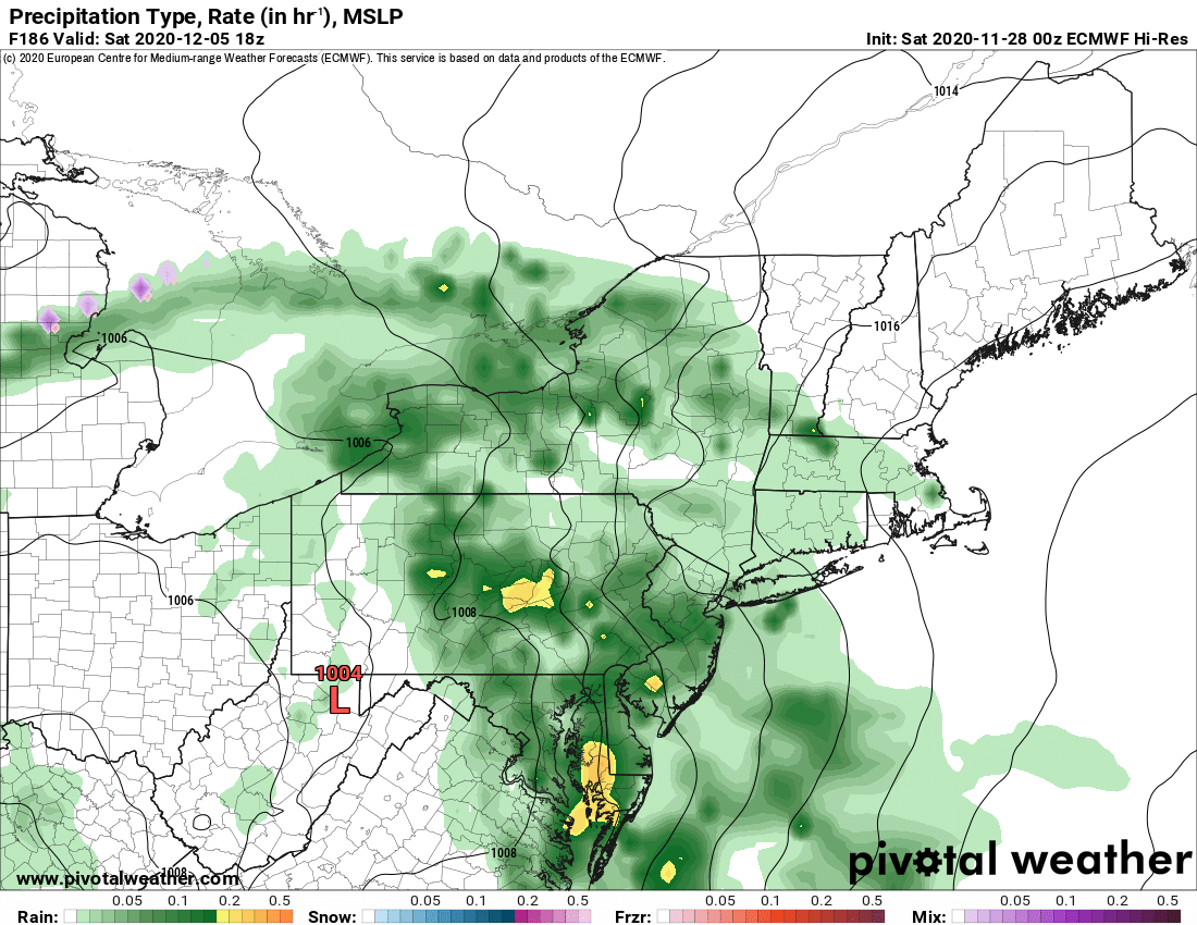
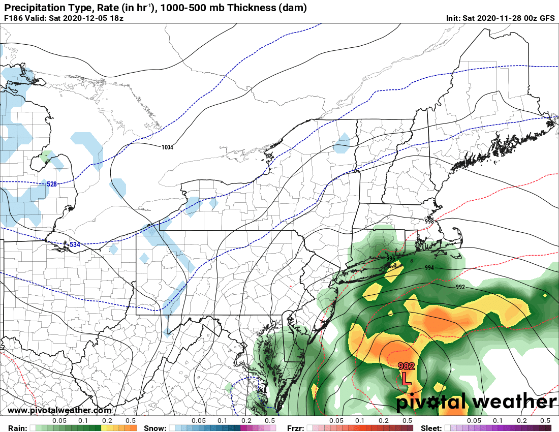
As I said yesterday and will emphasize one more time: Storm number 1, it’s initial track and where it stalls next week is the key to storm number two. Interesting how storm 1 was trending west initially and storm number two was trending east like a classic nor’easter. Now models here slowing down and pushing west. But again 7 days out. Lots of time.
The hope is by tomorrow or Monday we could put actual numbers and locations on snow potential starting Monday night and Tuesday, best chance WNY and areas west of I-81. At least we have something to talk about. Do the snow dance, and keep following us. Looks like we are on daily morning blog duty for the time being… and it’s a pleasure. Enjoy the rest of your holiday weekend and stay healthy and safe.
Rich

