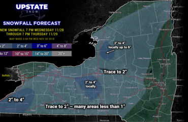
We have been pitching this for over a week now. It’s finally here. Welcome to the first Lake Effect snow event of the year! And this one will have some halfway decent snow with it. It won’t be this morning, midday, or early afternoon. The colder air has to work in, especially aloft, to set this lake snow off. That starts between 2-4 PM this afternoon. Then gets roaring tonight. This is as of 9 AM Monday 11/27/23:
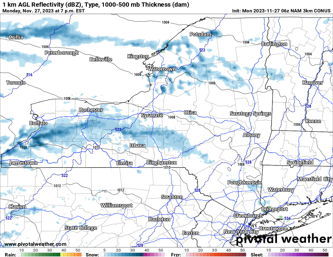
It doesn’t look like a lot at 7 PM tonight. It still may not be at full bore east of Lake Ontario. But east of Lake Erie it will be with heavy lake effect hitting from the Southtowns into the Southern Tier and the Chautauqua Ridge. It may extend to the south of Rochester and potentially the Finger Lakes and even east of I-81! If it’s not going like gangbusters at 7 tonight off of Lake Ontario, no worries. You still have time. You have all night for the snow to increase and get heavy at times, reaching a maximum of 1-3 inches per hour in the heaviest squalls.
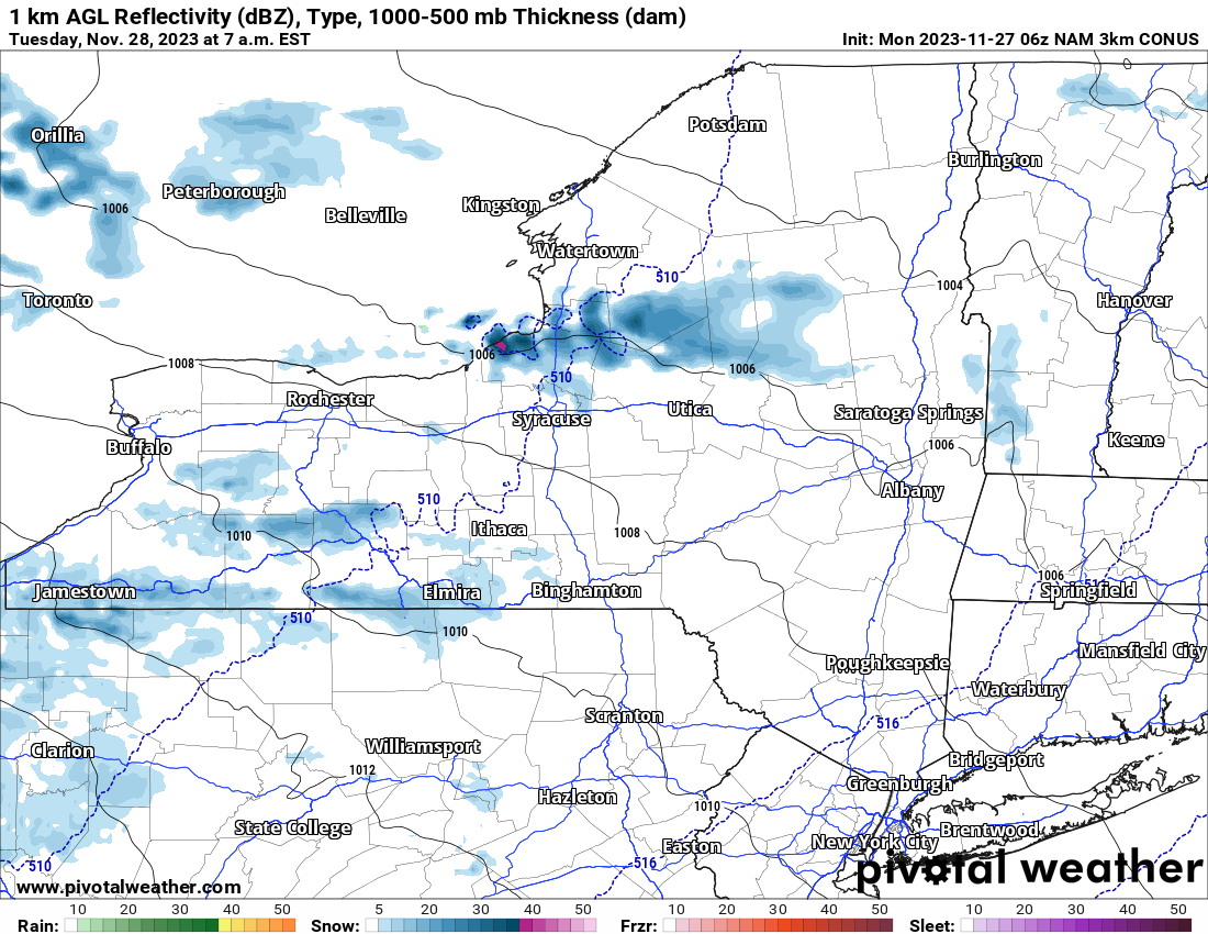
By 7 AM Tomorrow, the heaviest Lake Effect will have left Lake Erie but it will now be over Lake Ontario. Oswego, Lewis, N Oneida, N Herkimer and Hamilton Counties will be getting hammered with lake effect snow showers and squalls. These shall begin during the morning and Tuesday afternoon to move to the south. This is the hardest part of the forecast. If it moves fast, there is hardly any snow. If it moves slower, much more snow will fall. How much happens? This still remains the hardest part of the forecast. If it moves slow, 3-7 inches of snow can hit the Utica/Rome area. If it moves fast, only an inch or two. Since it will be heavier in the Syracuse area and extending south and east from there once it hits a 300 flow, these areas should see more.
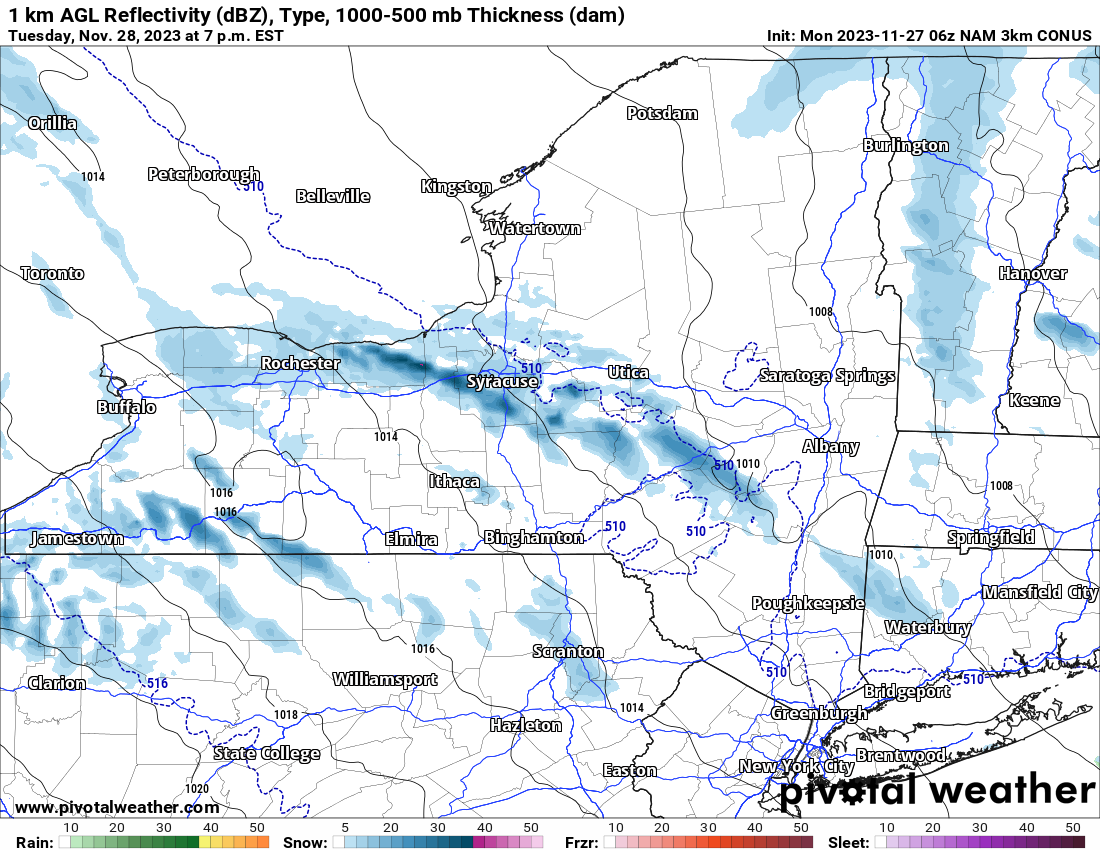
Besides continuing lake effect off of Lake Erie, Lake Ontario will be going from the eastern suburbs of Rochester to the Syracuse area then south of Utica/Rome into the Catskills. This should continue for several hours Tuesday evening before heading back up to the north overnight.
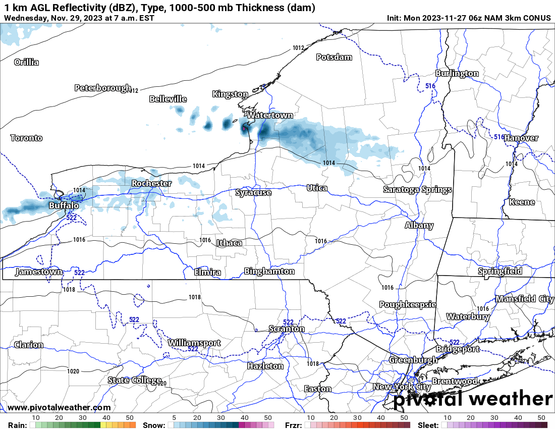
By 7 AM Wednesday the Lake Effect squalls move into the immediate Buffalo area, then move back to the north of Syracuse, Utica/Rome and into the Tug Hill, North Country, and the Adirondacks. This is when the lake snows fade out because later in the day, the next system approaches with snow showers in general for all locations. Whatever we get over the next 48 hours, add a Dusting to 2″ to that from Wednesday afternoon and Wednesday Night’s snow.
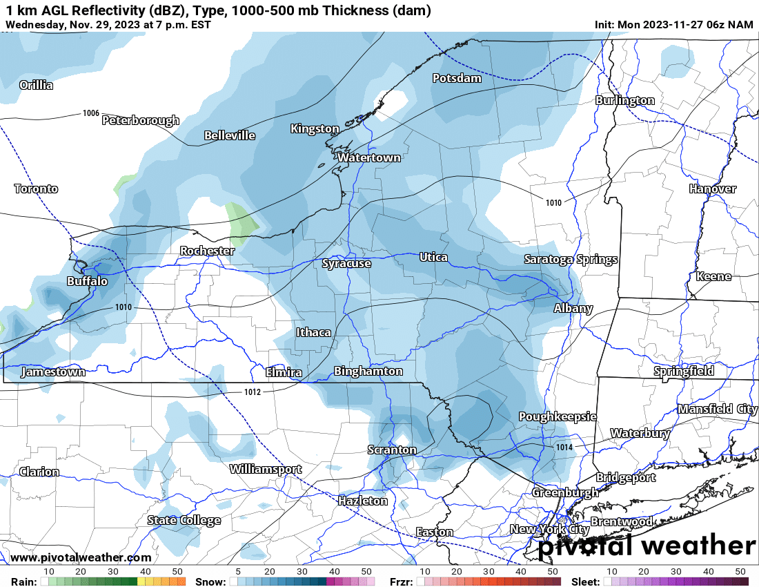
So, with it snowing for three days straight, and with a three day snowfall forecast now promised by yours truly, here is my best shot:
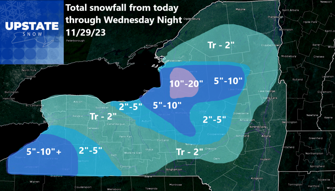
Again. This is a 3 day snowfall total map. This is not broken out by day or by period. This is the whole shebang of snow through Wednesday Night. So when you wake up Thursday morning 11/30, more than likely, this is what you should have at your location. Now, I know this is not 100% and is almost never 100%. And this also DOES NOT COUNT the snow that fell late last night and early this morning particularly across the Adirondacks. Since that snow has already fallen, we will not count that on here. That is why the Western and Central Adirondack numbers are less than what they should be.
Well it’s time to fly. Enjoy the day!
Rich


