Hello Upstate Snow Nation! It’s Thanksgiving Week! This is exactly what I long to see on a week like this. Or is it?
THE SHORT TERM
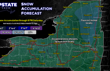
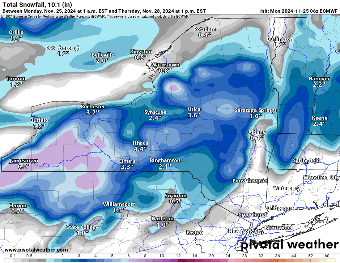
The problem is not tonight through Wednesday AM. All models go for rain, with some freezing rain in the Adirondacks early Tuesday before changing over to all rain. It will definitely be warm enough for all rain and for more snow pack to melt. So if you are in the lower elevations, I am sorry about that. In the higher elevations, hold on tight. Some lake effect over the Tug Hill and Adirondacks tomorrow PM and into Wednesday AM. Here is the graphic on that. That won’t be a lot. TRUST ME.

THANKSGIVING:
This is potentially a BIG STORM. We are talking several inches to over a foot in some areas if it hits at full tilt. Considering how the last one at the end of last week hit at full tilt and gave way more snow that we had predicted, we have got to take this into serious consideration. Overnight Wednesday and into Thanksgiving Morning, snow develops all across Upstate NY. The best places to see it will be from the Adirondacks, Central NY, to especially the Southern Tier and the Catskills. The lower elevations won’t see as much, but unlike last week when they were mostly shut out of snow, this storm would not be like that. The model I am showing is the NAM at 1 PM on Thanksgiving Day. That is a truly good snows for Upstate NY. At least most of it. And this is in the middle of the event at the 84 hour mark.
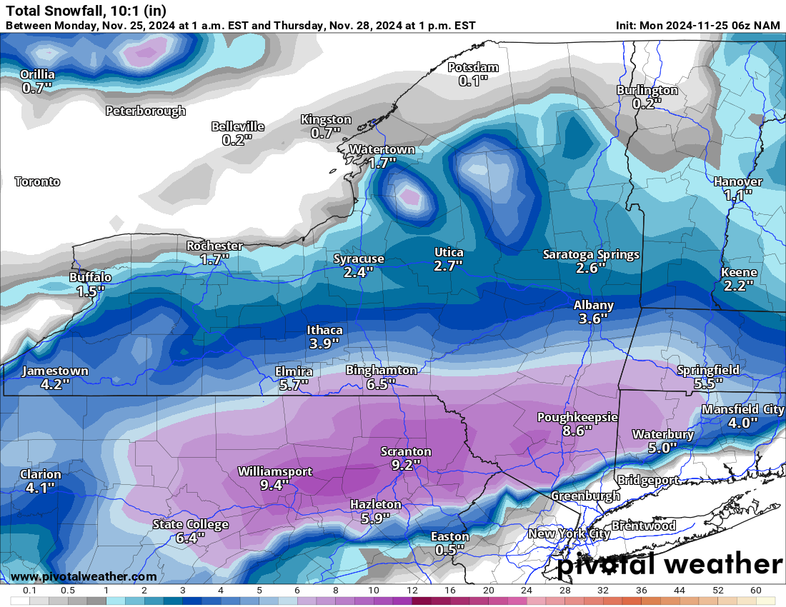
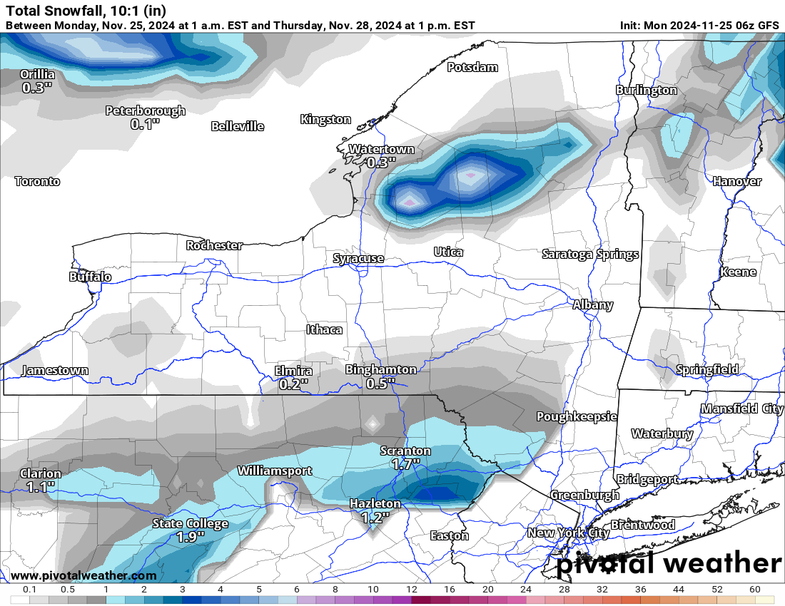
Now I want to show you the 00Z Euro for the same exact time period. See how it has heavy snows for most of the same areas, but more of a mix in the lower elevations. That concerns me some. Then the GFS. This shows much of the activity mainly over the Southern Tier and Catskills without much else for the rest of the state. That is definitely not as good of a scenario for us, especially for Thanksgiving Day. In fact I believe it has been 10 years, not since 2014, that we have seen this much snow on Thanksgiving Day. I pledge to wait out the next several runs of models and give you all my call and “forecast” for the Thanksgiving Day (possible) Storm tomorrow on The Morning Blog.
BEYOND THANKSGIVING
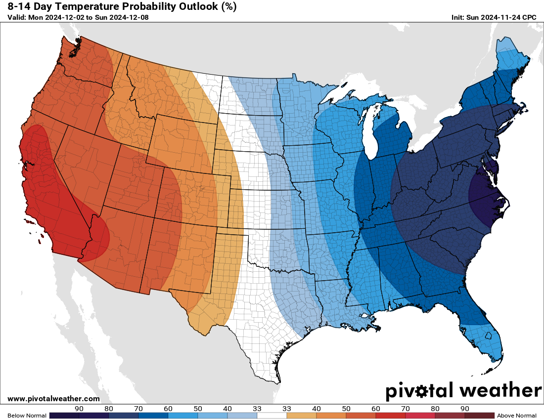
Beyond this, it just turns cold! And it turns snowy! At least with the lake effect downwind of Lake Ontario and Lake Erie. In these areas from Black Friday through the Thanksgiving Weekend, it looks to remain snowy and cold! Temperatures will remain below normal with near freezing during the day and well below freezing at night with teens and 20s most common.
FIRST WEEK OF DECEMBER AND BEYOND
Looking ahead to the first week of December and beyond, it will be continued cold! Lake effect yes, but not really much more than that. It means serious snow totals with multiple days of very cold air over near record warm Great Lakes still running above 50 degrees in most locations. It will take some time for the lakes to cool off so that means the lake effect potential shall be high! But it also means you can go from 30″ in one town to 3″ in the next town, depending on how these bands of snow blow. I will keep you posted on that as these days approach. Also, I will advise you all each day going through December about conditions where it will be open to ride! Trails open December 8 after sunset in the Adirondacks, North Country and parts of the Tug Hill. For some areas, it is another 1-2 weeks later than that. For Southern Zone, we once again are not dealing with Christmas but waiting until January 1st after sunset. PLEASE REMEMBER UNTIL THESE DATES ALL TRAILS REMAIN CLOSED! YOU RIDE THEM, YOU COULD END UP LOSING THEM PERMANENTLY! Again, once again PLEASE DO NOT RISK IT!
Please stay tuned to tomorrow’s update. That one will definitely be an important one. Thank you!
Zack and Rich Lupia
Upstate Snow
November 25, 2024
Please thank our advertisers on Upstate Snow for 2024-25
Banner Sponsorship
Enjem’s Flooring America
Ohio Ridge Riders
ilsnow.com
Southern Tug Hill Sno-Riders
Saratoga Snowmobile Association
Business Sponsorship
Paton & Son Excavating and Landscaping


