After rain developing this afternoon and especially tonight, much colder air and snow returns to Upstate NY Monday and Tuesday.
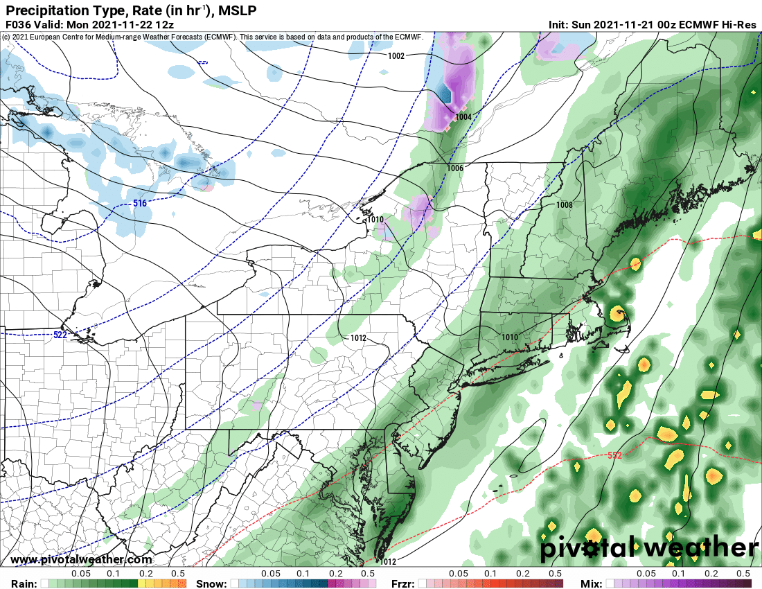
Behind our rain storm will be the coldest air of the season yet. Each cold blast seems to get just a little more BITE on it. As it blows through rain mixes with snow as it ends, and lake effect develops in back of it on Monday. The lake temperature differentials are significant to extreme, with delta T’s well past 20 degrees (13 is needed for lake effect snow) but the biggest thing missing here is low level moisture. With the air coming in being even colder and drier, the storm center being several hundred miles away, and not much cyclonic flow or lift aloft, this is a classic situation of we have the cold air BUT…

If there was a strong storm nearby with all kinds of moisture in the lower levels of the atmosphere swirling around Upstate NY and the Northeast, this could be a much different story. Thank God it is not since this is the biggest traveling week of the year. Instead of widespread intense snows coming off the lakes, it will be more regional to localized, and even where it hits, by Upstate NY standards, it’s nothing to write home about. Especially going into Thanksgiving week. We are at the time of year where the lakes can now unleash full bore FEET of snow on both the Tug Hill/Adirondacks and the Buffalo area (and points south). Think 2014. But with drier air aloft, no soup for us winter weather lovers 🙁 With RH values over the lakes in the 50s and 60s… those very warm lakes have a lot of work to do to squeeze out much of anything on the other side. If RH values were in the blues, 80s and 90s… totally different ballgame.
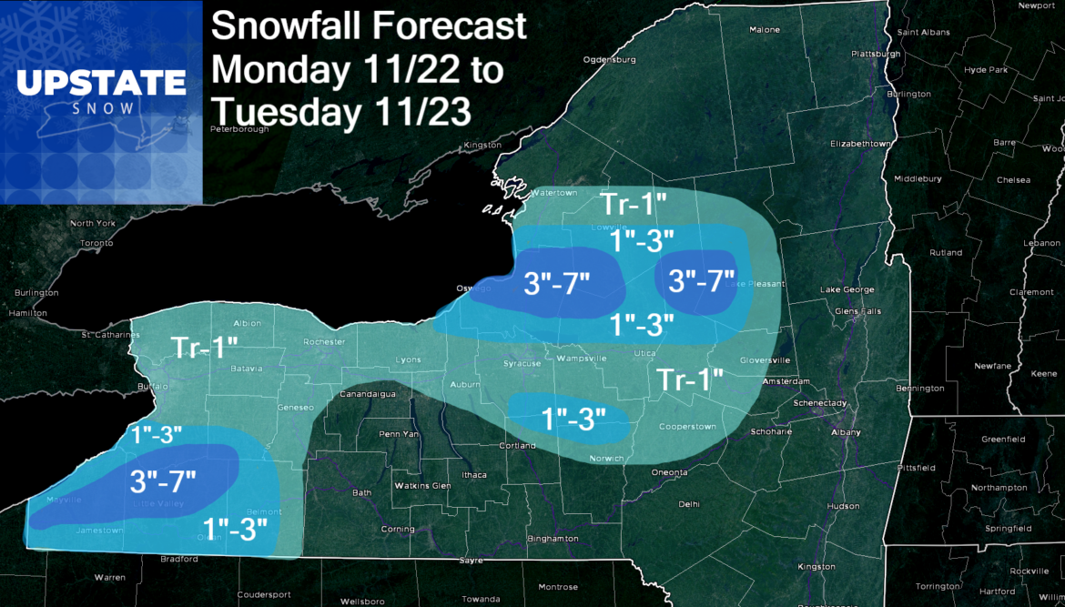
The modest lake effect accumulations, barely worthy of an advisory for the lake belt counties Monday and Tuesday will give way to a perfect Wednesday for traveling and a good start to the Thanksgiving holiday itself. Since it is also deer season, the conditions look great for hunting, cold first thing in the morning, but quiet. It’s after Thanksgiving that the crystal ball is indicating trouble…
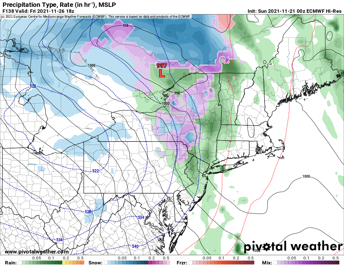
BLACK FRIDAY AND BEYOND is becoming a much bigger concern. You know all I wrote about up above? Well, that scenario gets dropped on Upstate NY starting Black Friday in Saturday. The storm center on the Euro day 6-7 at this time looks much more impressive for snowfall including much heavier lake effect and lake enhanced snowfall. If you keep an eye on any time in the forecast this Thanksgiving week, Friday and Saturday are the days to keep your eyes on right now. The potential for snowfall across much of Upstate NY with several inches possible, especially downwind of the lakes exists. Stay tuned. I’ll have a snowfall map for this one on Wednesday morning’s blog.
Have an awesome day and an awesome week!
If you enjoy our weather reports, podcasts, videos, and features, say thank you by becoming a SPONSOR or MEMBER of Upstate Snow! For just $60, sponsors receive a hyperlink to your business or social media page on every morning blog and podcast post on upstatesnow.com for the season (until 8/31/22). For just $10, members get name recognition, or if you wish not to use your name, recognition to your favorite snowmobile club or where you live.
Click below to get started
paypal.me/lupiallc
www.venmo.com/u/Richard-Lupia
THANK YOU to our faithful sponsors and members!
SPONSORS
Southern Tug Hill SnoRiders
Saratoga Snowmobile Association
Ohio Ridge Riders
ILSNOW.com
Enjem’s Flooring America
Water’s Edge Inn – Old Forge
Adirondacks Speculator Chamber of Commerce
White Lake Inn
Toads LLC Fisher and Snow Dog Plows, Cairo, NY
MEMBERS
Chris Rinck
Charles Kleese
Chaz Albertson
Dave Gleasman
John Bates
Darrin Harr
Mark Enjem
Matthew Pistner
Eric Vilovchik
Brian & Paula Bedell
Robert G. Gartley
Chris Higgins
Nathan DeMarco


