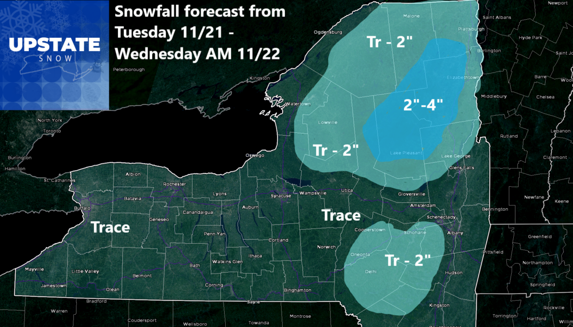
Good morning Upstate Snow Nation! Well I wish I had better news than the forecast snow graphic for later tomorrow into Tuesday Night before it changes over to rain and ends early Wednesday Morning. It is what it is. It’s better than zero. Even though temperatures will pass freezing tomorrow night and race to at or above 40 in pretty much all locations by Wednesday, meaning most of the snowfall will be gone by the time Wednesday arrives. But it is snowing. We are slowly, adding to seasonal totals, and even though we are still below are normal seasonal totals, we are still ahead of each year since 2018. Don’t even get me started on 2018!
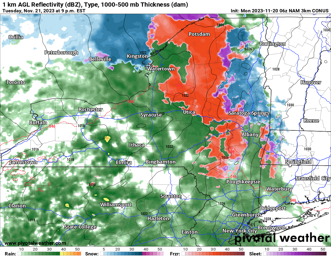
Let’s get started on the forecast by dayparts:; Today is sunny and cold. Locations north of the Thruway don’t make it above freezing today. Tonight it falls into the teens north of the Thruway, 20s elsewhere. Tuesday Morning: Clouds increase quickly. Tuesday Afternoon: Snow develops across Central and Eastern NY, is mixed with and/or changing to rain already to the west of 81, hence why I only have a trace of snow at most for those areas. Tuesday Night: Snow mixes with and changes to rain in all but the highest points in the Adirondacks where easily a few inches of accumulation could fall before changeover. Wednesday Morning: Any leftover snow goes to rain quickly as temps go up to 40 and into the 40s. Rain shall come to an end Wednesday Afternoon. Wednesday Night is OK for travel. Thanksgiving is GOOD.
So what about the Thanksgiving Weekend? Not a whole lot going on. Temperatures will be near to slightly below normal. Not a whole lot of precipitation left on the map through Sunday. But there is still 4 days left in November after Sunday. We will get to those and a look at what may be coming beyond that in tomorrow’s Trail Talk Tuesday!
Rich


