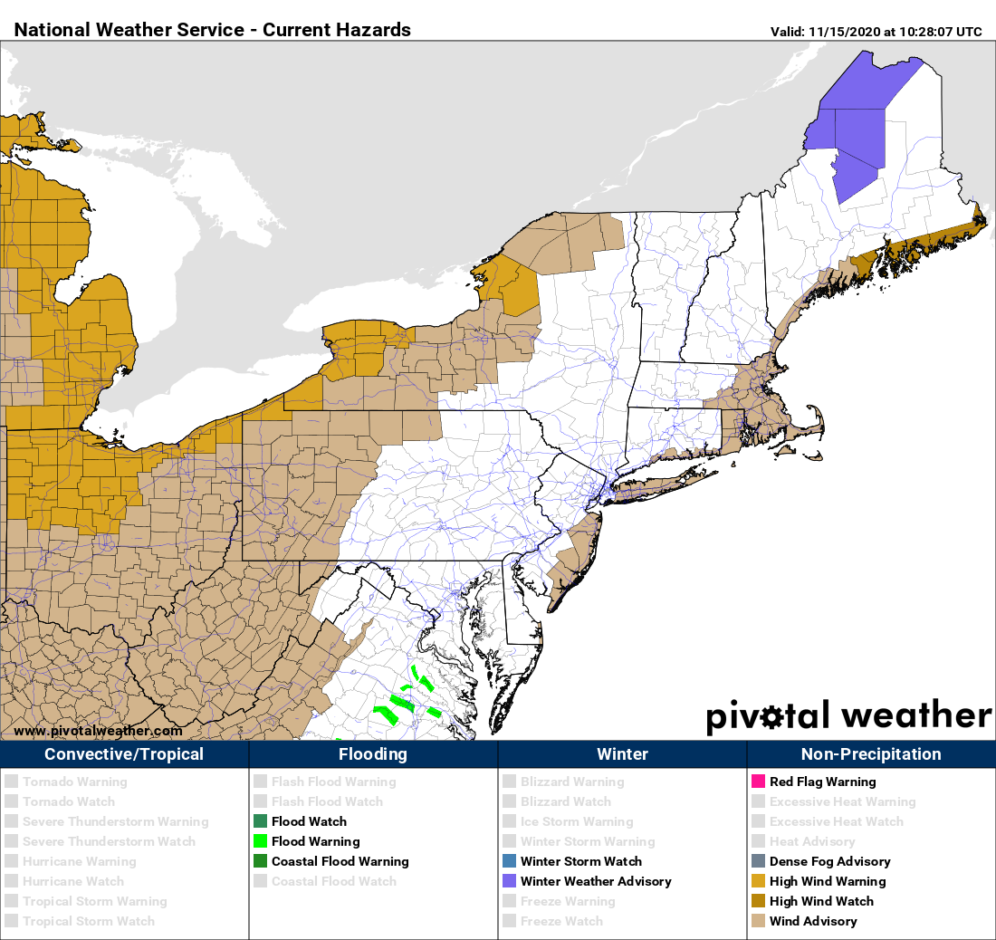
Before the cold and lake effect can return… the winds will blow… in a big way. Wind advisories have been posted for parts of Upstate NY with HIGH WIND WARNINGS along the Lake Erie and Lake Ontario Counties and areas prone to damaging winds on a SW wind flow.
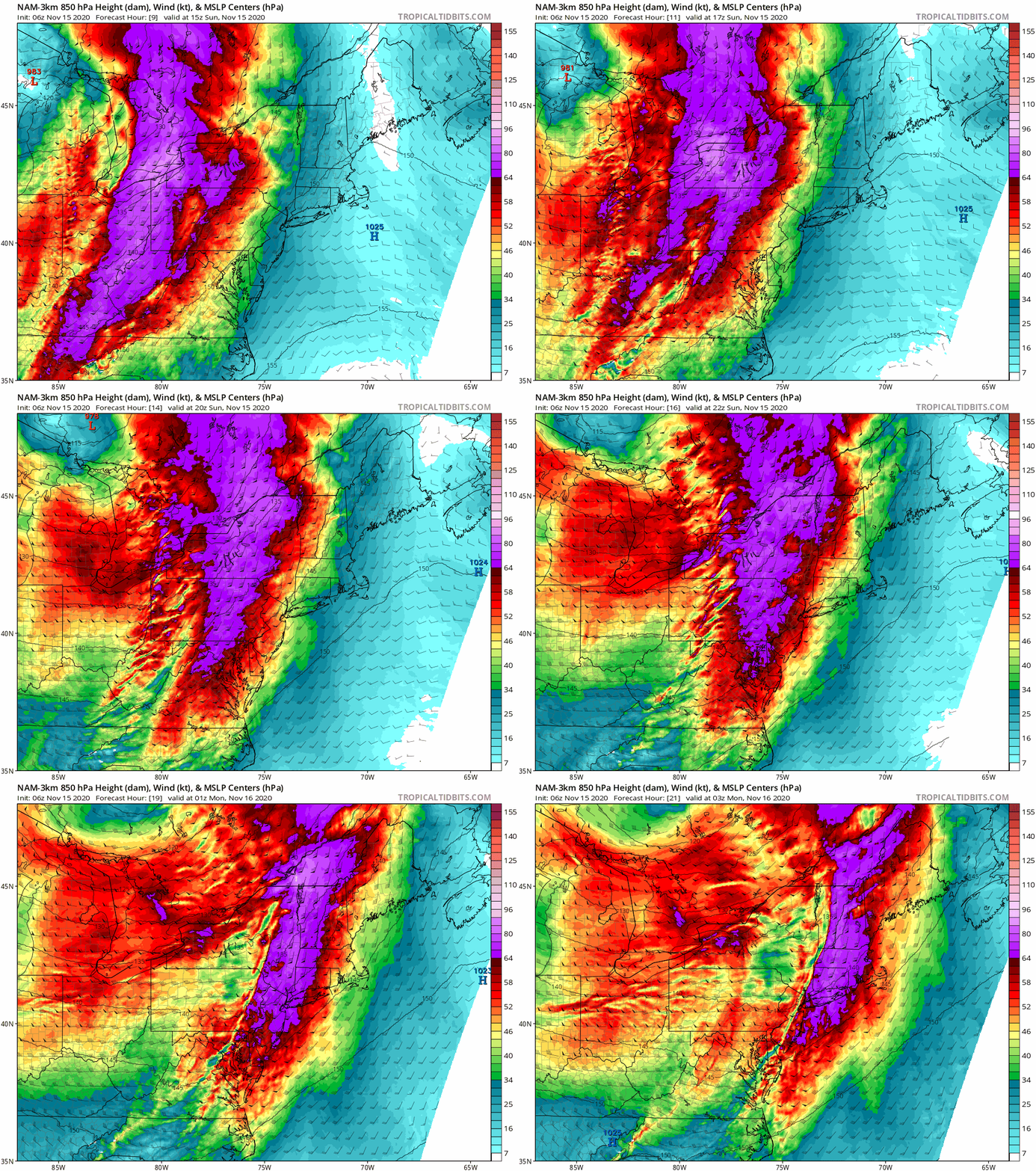
Wind advisories and warnings are nothing new, especially in the counties across Upstate in which they lie. When “the gales of November remember”, big low pressure systems blow up over the Great Lakes in fall, especially November, these same counties encompassing the Buffalo/Niagara area, Greater Rochester, Watertown, the St Lawrence Valley and the Tug Hill usually get legit storm force (54+ MPH) winds. This storm today, if there was a “next level” and a “take this seriously” caveat I’d attach to it, I WILL. Take a look at the winds 4-5K feet above the ground. 75 knots is in the CAT 1 Hurricane range, bordering on CAT 2. Thankfully not all of this wind energy makes it to the ground but when you have this level of winds overhead, you must prepare for things to fly and power to go out.
WHERE? Not everywhere. THIS IS VERY IMPORTANT. The layout of Upstate NY geography means the destructive winds will only hit areas open to SW winds. This is why the afore mentioned warning and advisory areas are of greatest concern. If you are not under wind advisory or warning the reason is because the topography in your county (hills and mountains and layout of valleys) will break up instead of funnel the strongest winds to you. It will be windy everywhere today through tonight, but the damaging winds will again be focused along Lake Erie, Lake Ontario and areas open to the SW. For those that went through the March 2017 wind event, when Rochester, Batavia and areas of WNY saw widespread 65-80 MPH winds and major wind damage, these same areas have the risk of something close to that today and tonight. HOPEFULLY not to that level.
One final note on the Capital Region and Hudson Valley… no advisories and/or warnings at this time but given the strong S component, I would not let your guard down this evening or tonight. This wind event could outperform expectations here (IE instead of 35-45 MPH, I would not be surprised if localized areas here gust into the 50s… keep track of the Albany NWS here for updates).
OK Rich, This IS UPSTATE SNOW RIGHT? Yes it is, but I’m a Meteorologist first and I know many follow this site for severe winter weather and travel guidance and I cannot honestly ignore big hazards like this. But after all the winds are out in front of a cold front, colder air which will set the lakes off starting tonight. Unlike previous model runs, it will take time for the cold air to build in, lake snow accumulations will mainly be above 1000′, especially 1500’+ and amounts will not be as great as first modeled a few days ago…
Round 1 is behind the front tonight through the day Monday. There will be some break Monday Night into Tuesday morning before a second cold front, a reinforcing shot, brings in solid cold air everywhere. It’s over by Wednesday morning with a very cold morning then, with a warming trend on the way for late week. We are still on the temp roller coaster, more high than low this November.

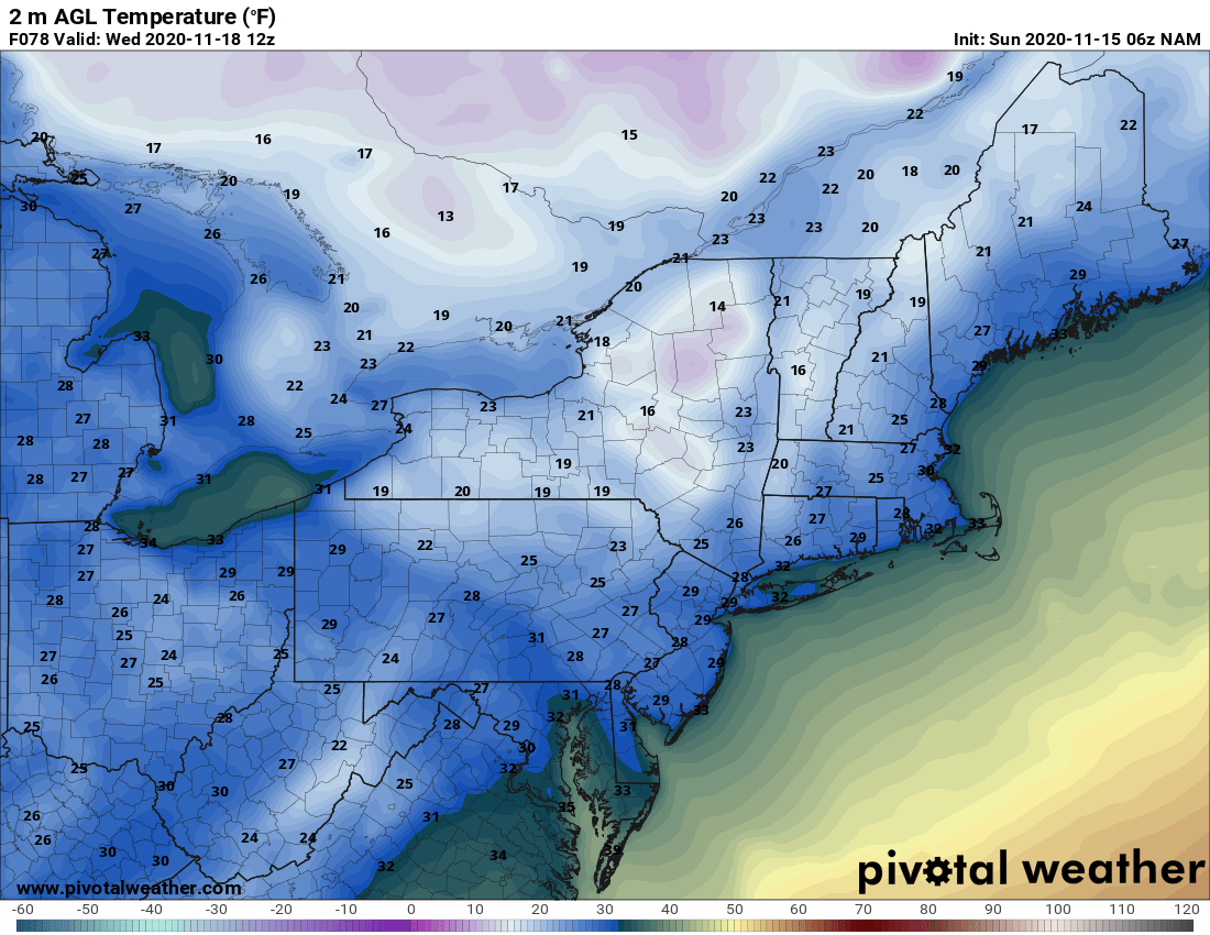
Outside the Tug Hill proper, the Chautauqua Ridge and the higher elevations of the favored snowbelt areas, where several inches of snow are possible, best chance during the day on Tuesday, it’s not looking as big as first rumored. We will continue to monitor and after the winds today, will put up a snowmap tomorrow in the morning blog once we have more conclusive information.
Have a safe Sunday!
Rich

