Things are getting active again when it comes to winter weather. We are focusing on Saturday afternoon through Tuesday as our next windows of time to get accumulating snows across Upstate NY, especially in the lake effect bands and in the higher elevations.
Our strong cold front approaches with strong southerly winds out ahead of this thing. Wind advisories are already up for some locations. The cold front blasts through during the morning hours on Friday with steady rains, possibly a rumble of thunder with it, and a sharp cooldown. Precipitation will taper off in the afternoon and some late day breaks of sun are possible especially across CNY and WNY.
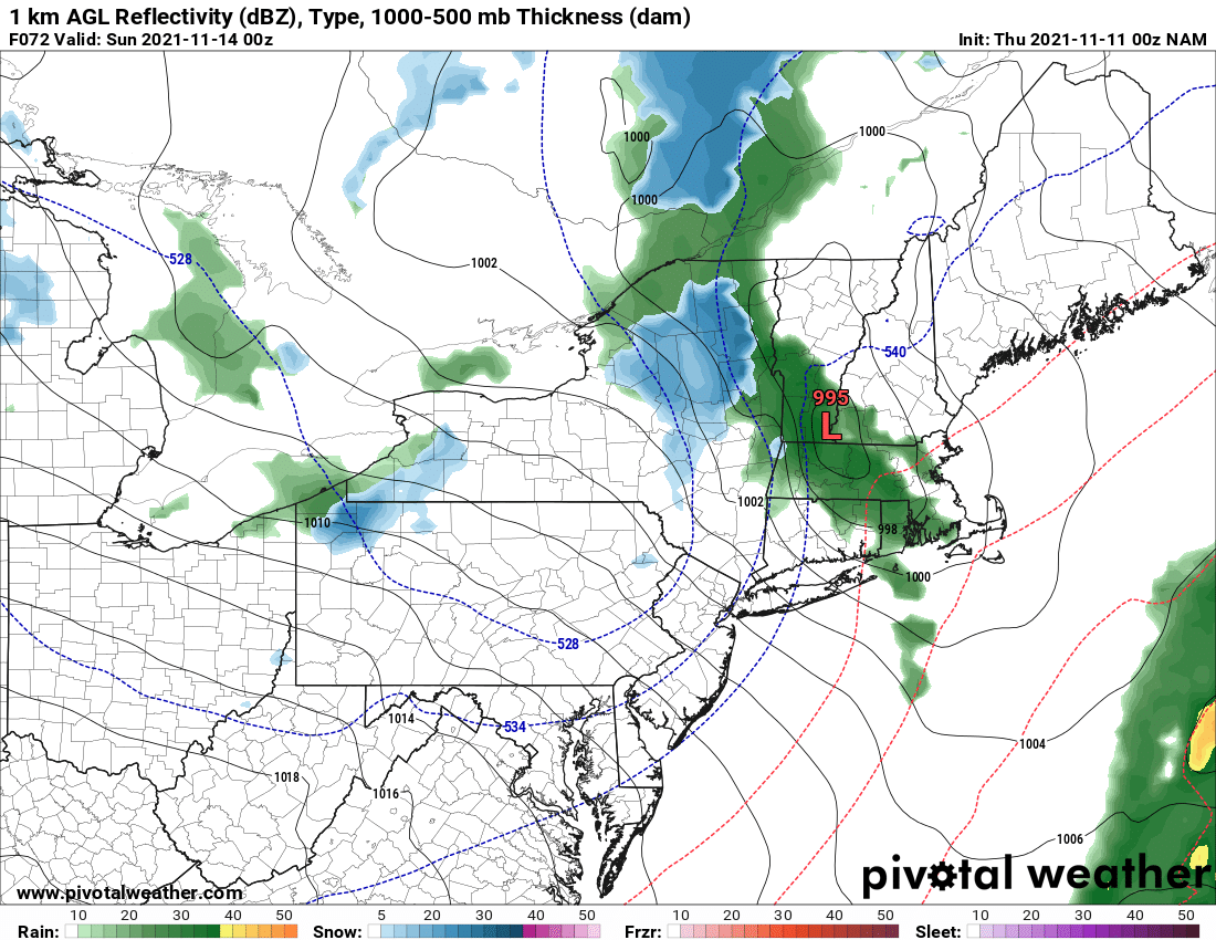
Saturday is the first shot at something happening. The upper level storm pinwheels its way closer to Upstate NY with enough cold air draining into Upstate NY out ahead of it. This sets up a scenario where a disturbance riding along the jet stream interacts with this boundary and a storm begins to develop. It starts over Upstate NY Saturday afternoon going into Saturday Night. It then transitions to mainly lake effect by Sunday morning.
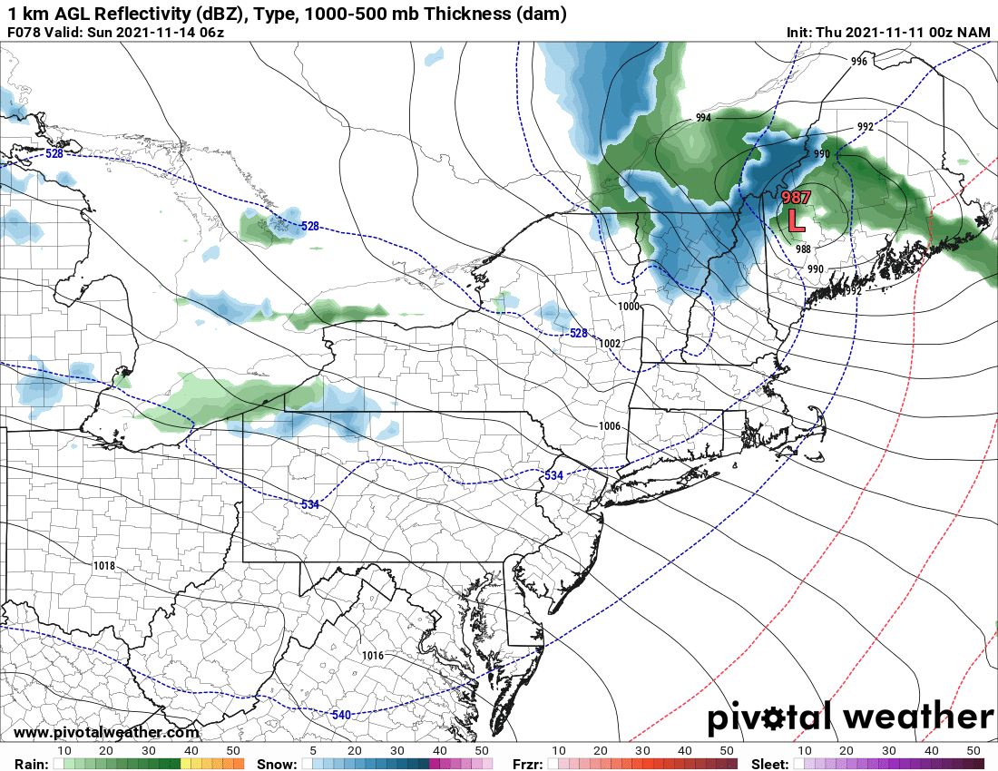
For the lower elevations this is a rain/snow changing to snow scenario Saturday evening. For elevations above 1000′, this is mainly snow. Yes there is the potential for accumulation as this storm rapidly intensifies moving into New England. Will it be several inches? No. A few inches, especially higher elevations is LIKELY, especially downwind of the lakes. My next snow map detailing this scenario will be published TOMORROW MORNING!
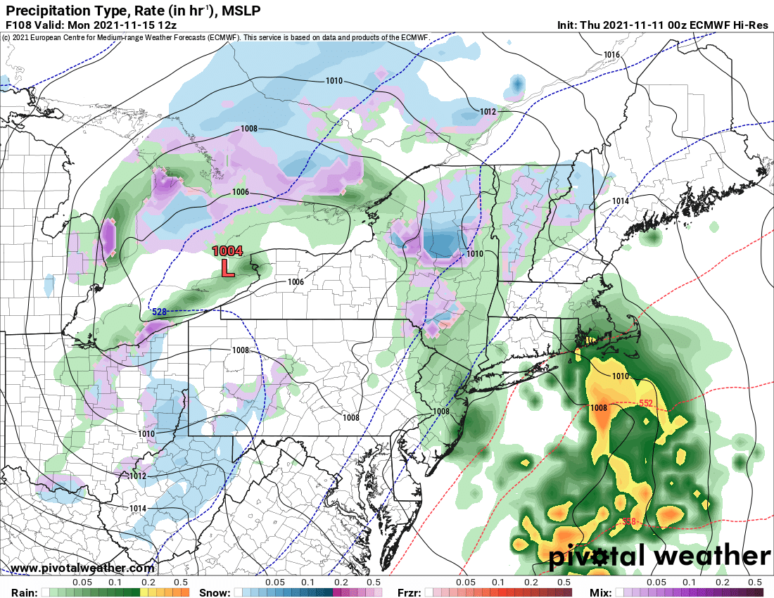
After the lake effect tapers off by Sunday night, yet another wave runs around the upper level area of low pressure into Upstate NY. This one, along with even colder air than Saturday PM/Sunday, will mean mainly snow, even in the lower elevations, even during the daytime. Don’t expect highs to get much above freezing on Monday and potentially getting close to the TEENS by Tuesday morning with yet another round of lake effect snow getting going.
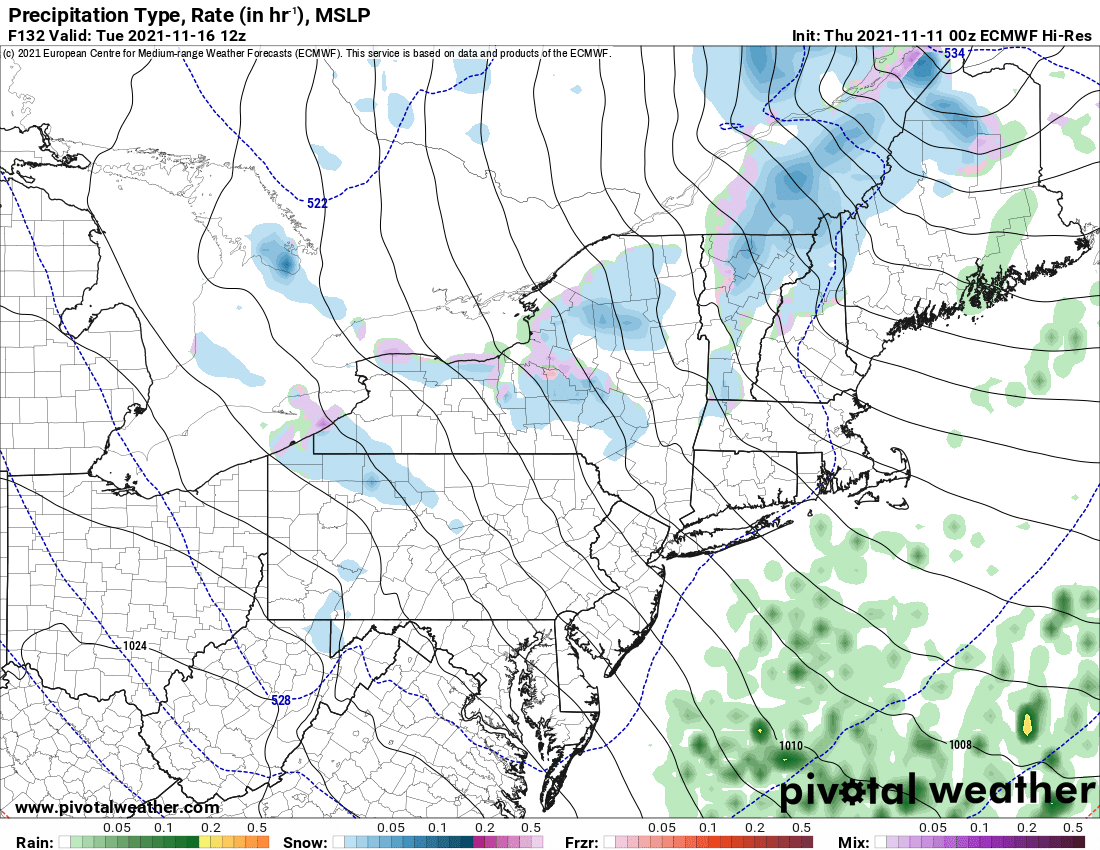
Just at a casual glance the Monday/Tuesday scenario for snow looks BETTER than the Saturday PM/Sunday scenario. But again, one event at a time, one snowfall map at a time. The snowfall map on this one will be release SUNDAY MORNING.
Expect milder conditions and a melting of whatever snow falls middle of next week before the next round of storms moves in.
Expect the up and down weather, temperatures up and down, looks great for snow, oh gosh we’re in the 40s and 50s again scenario to continue for the next 7-14 days. Tis November. This is nothing unusual here. I’ll see you tomorrow morning with the snowfall map for Saturday PM and Sunday. Be good!
Do you like our weather reports, podcasts, videos, and features? Say thank you by becoming a SPONSOR or MEMBER of Upstate Snow! For just $60, sponsors receive a hyperlink to your business or social media page on every morning blog and podcast post on upstatesnow.com for the season (until 8/31/22). For just $10, members get name recognition, or if you wish not to use your name, recognition to your favorite snowmobile club or where you live.
Click below to get started
paypal.me/lupiallc
www.venmo.com/u/Richard-Lupia
THANK YOU to our faithful sponsors and members!
SPONSORS
Southern Tug Hill SnoRiders
Saratoga Snowmobile Association
Ohio Ridge Riders
ILSNOW.com
Enjem’s Flooring America
Water’s Edge Inn – Old Forge
Adirondacks Speculator Chamber of Commerce
White Lake Inn
Toads LLC Fisher and Snow Dog Plows, Cairo, NY
MEMBERS
Chris Rinck
Charles Kleese
Chaz Albertson
Dave Gleasman
John Bates
Darrin Harr
Mark Enjem
Matthew Pistner
Eric Vilovchik
Brian & Paula Bedell
Robert G. Gartley
Chris Higgins
Nathan DeMarco


