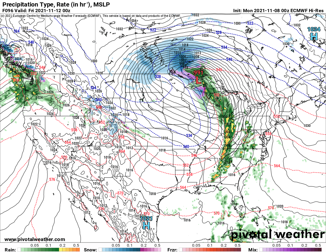
Most of the week will be dry, warm and unusually sunny for November. Starting Veteran’s Day (Thursday) into Friday the 12th, things will flip going into next weekend and beyond.

A very strong storm, a November Gale, will develop across the Great Plains this Wednesday into Veteran’s Day. The difference between the strong highs on the east and west coast, and the deepening low in the central US means it’s going to get windy across a lot of the country. Because the storm center itself passes WELL to the north and west of Upstate NY, it means the winds out ahead of this thing, particularly on Veteran’s Day will be WARM. Expect temps well into the 60s and a few record highs possibly to be threatened.
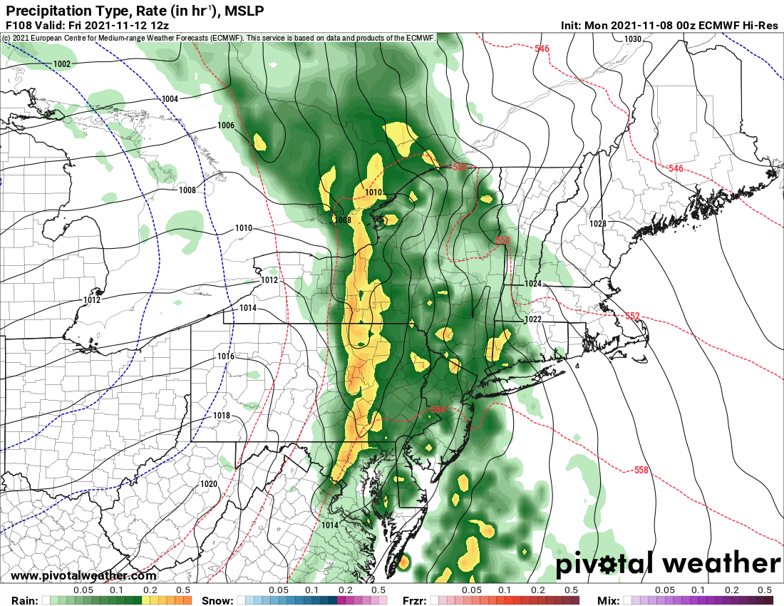
The cold front from this storm will pass through on Friday, bringing heavy rains and possibly even a few thunderstorms. Behind the cold front, since the storm center is so far north and west, the air will take its time getting colder. Instead of a few hours, it will likely take a few days to get back to cold and cloudy conditions.
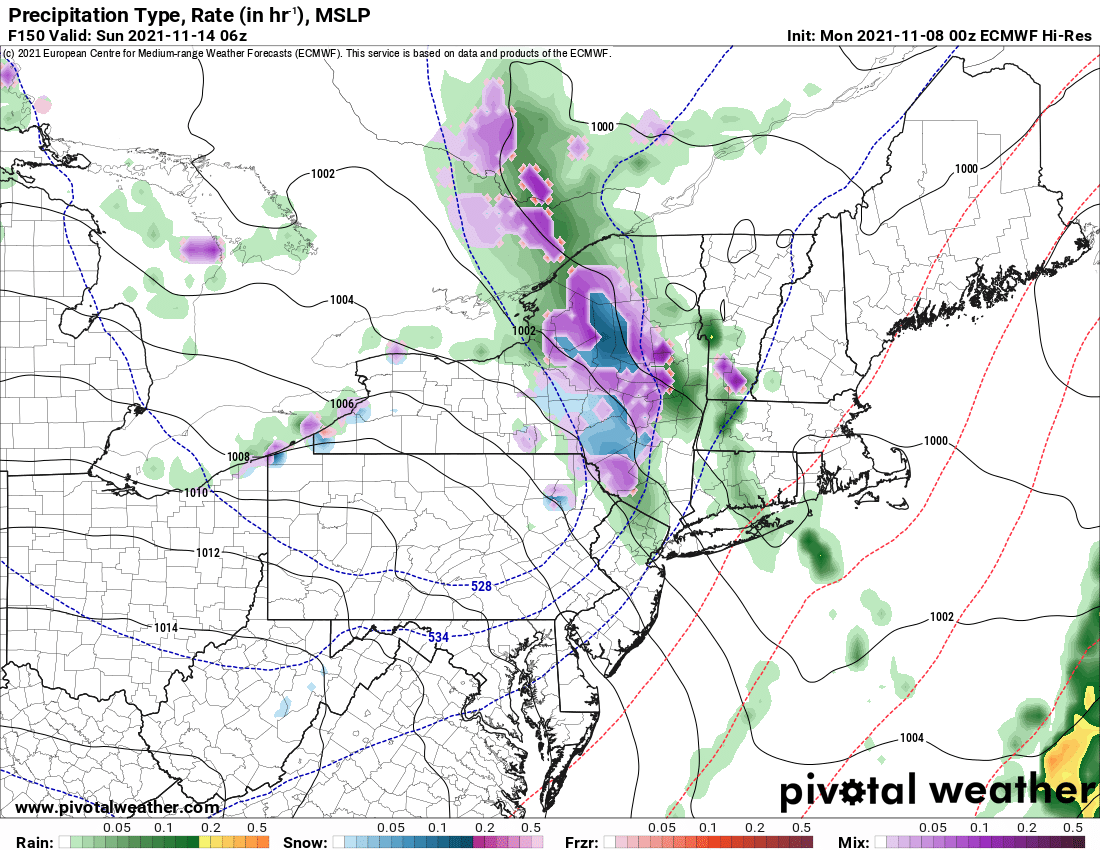
The weekend, especially Saturday PM into Sunday is my time of biggest concern here. The air eventually gets cold enough for snow, and the models are trying to develop something. The upper air disturbance responsible for this is several days away and outside of our upper air network at this time, so expect changes to this forecast at the moment. Does it look substantial? No. But it’s not nothing either. Based on current modeling and guidance I would be prepared for a period of mixed precip and snow Saturday PM into Sunday anywhere across Upstate NY. Yet another system in back of that could be coming through next Monday and/or next Tuesday in the day 8-9 range. Could be a few inches of accumulation. Could be nothing. But the potential is building. We’re in “stay tuned” mode at this time.
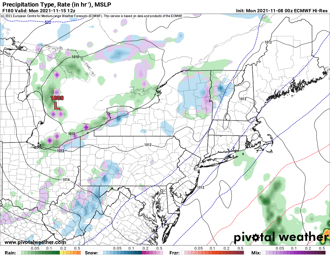
Once this system gets into our upper air network and the mesoscale models have their shot at this, we’ll be able to refine this forecast better for you. So… four warm days ahead (Today – Veteran’s Day), Stormy Friday (Transition Day), Chilly and much more typical November weather with the potential for some snow (Saturday through next Tuesday) before we warm back up ahead of the next November Gale later next week. If this is the pattern we are settling into in November, it is making the first look at my winter weather forecast that much more plausible. Here it is below if you’re interested in reading on further:
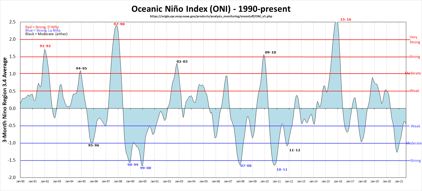
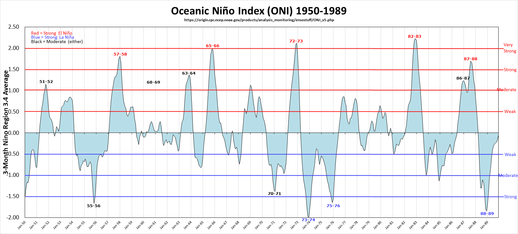
So where are we on the biggest thing we look at, El Nino and La Nina? We are on the La Nina side of things for the second winter in a row. Looking at the indexes now and where they are likely going to be in the next 2-4 months is critical to the forecast. It does look like they will stay in the La Nina range somewhere from light to moderate. This is key. This is crucial.
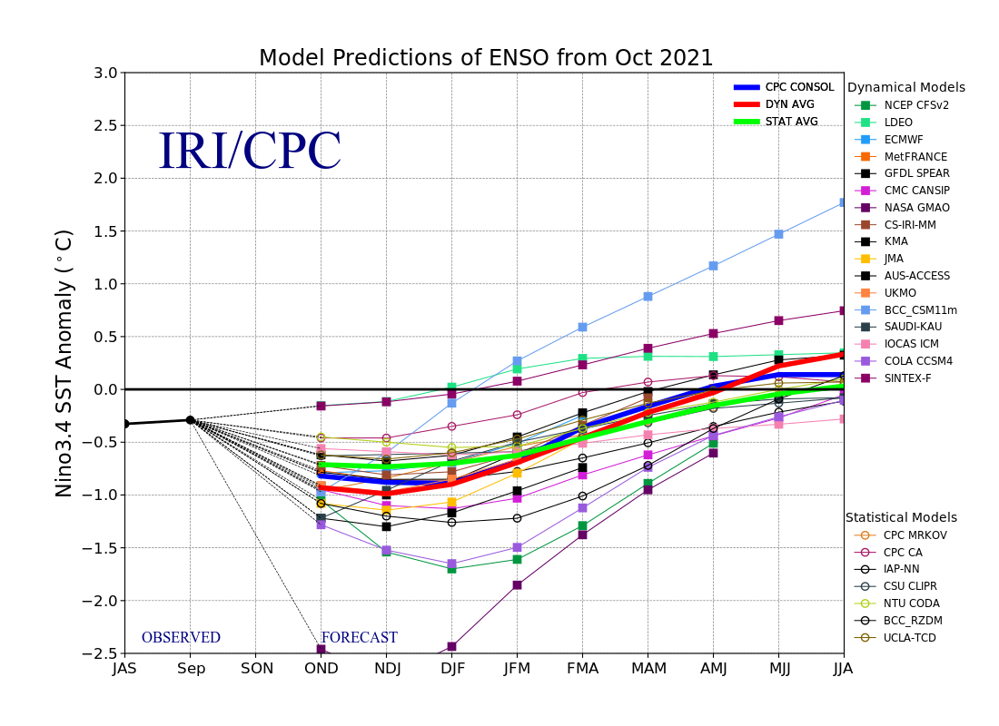
Why is this? Because the other indexes are not slam dunks. If it’s too much El Nino, or too much La Nina, we know we are going to get blown out. If it’s closer, especially on La Nina, we have some good analogues and chances.
What about the PDO? Maybe. What about the NAO, the Greenland Block? Yes, helpful but even being much closer to us, it’s not statistically significant enough to make a sway either way. What is left to look at? ALASKA. They have been NAILED this early season so far. Take a look at weather forecasts right now you’ll see they are already getting hit like it’s the middle of winter. That doesn’t sit well with me.
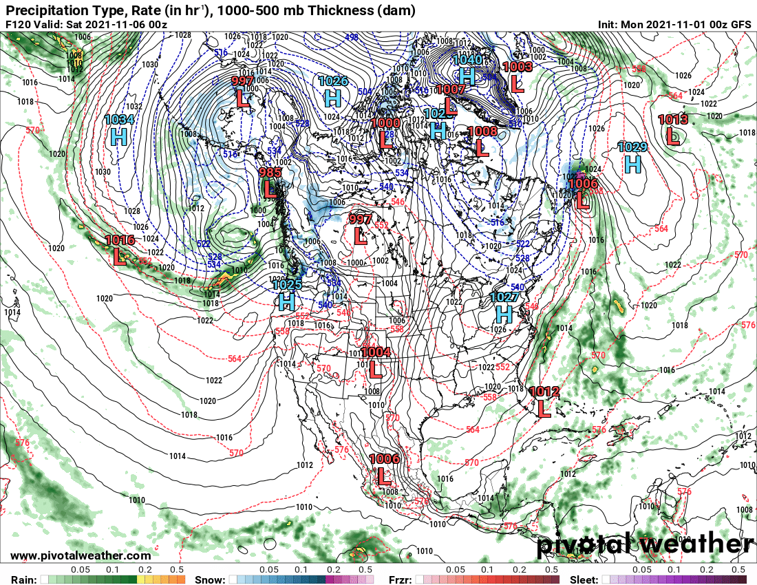
When the pattern flips next week, it will the the ALASKAN ASSASIN as Darrin likes to call the Alaskan low. HUGE one in a week. Nailing Alaska, British Columbia and the Pacific NW. When that pattern is there and the winds are howling off the Pacific, unless it is the middle of winter and something like the NAO is there to bail us out, it usually spells disaster for winter weather lovers and snowmobile lovers.
Bottom Line: While I like the trends with the weak to moderate La Nina, I absolutely do not like the strong Pacific Jet Stream and Alaska getting hammered. That does not bode well for wanting cold and snow in the Northeastern US, especially in Upstate NY. So the “first look” forecast for winter 2021-22 is as follows: At or below normal snowfall. At or above normal temperatures. My gut was initially thinking we are going to get nailed this winter… it has been six winters now since the epic 2014-15, especially January 15-March 15th that year. 2018-19 was a decent one too. The last two have been tough. And I think a third in a row is coming. Less opportunities to ride farther. I fear this may be our winter future at this time. Let us hope to God I am WRONG. Next look ahead in two weeks. Final outlook on December 1.
Do you like our weather reports, podcasts, videos, and features? Say thank you by becoming a SPONSOR or MEMBER of Upstate Snow! For just $60, sponsors receive a hyperlink to your business or social media page on every morning blog and podcast post on upstatesnow.com for the season (until 8/31/22). For just $10, members get name recognition, or if you wish not to use your name, recognition to your favorite snowmobile club or where you live.
Click below to get started
paypal.me/lupiallc
www.venmo.com/u/Richard-Lupia
THANK YOU to our faithful sponsors and members!
SPONSORS
Southern Tug Hill SnoRiders
Saratoga Snowmobile Association
Ohio Ridge Riders
ILSNOW.com
Enjem’s Flooring America
Water’s Edge Inn – Old Forge
Adirondacks Speculator Chamber of Commerce
White Lake Inn
MEMBERS
Chris Rinck
Charles Kleese
Chaz Albertson
Dave Gleasman
John Bates
Darrin Harr
Mark Enjem
Matthew Pistner
Eric Vilovchik
Brian & Paula Bedell
Robert G. Gartley
Chris Higgins
Nathan DeMarco

