Good morning! And it’s the day I get to wish myself a HAPPY BIRTHDAY! Today I turn 48. Only 2 away from 50! Oy vey!
Well for the next several days we don’t have much to talk about because it is just too warm! Scattered rain showers today, tomorrow and Monday. On Monday Night and into Tuesday Morning, a stronger system will come across the Northeast and into Upstate NY bringing more steady precipitation. If you look and notice the rain/snow line gets awfully close to Upstate NY but just misses it. At least this time. After this steady precipitation ends Tuesday Afternoon, some late day clearing from west to east is expected and a cold Tuesday night ahead. On Wednesday, a Partly Sunny day with high temperatures near 40 north of the Thruway and well into the 40s along and south of the Thruway.
Then things get “interesting”… Here is what I mean…
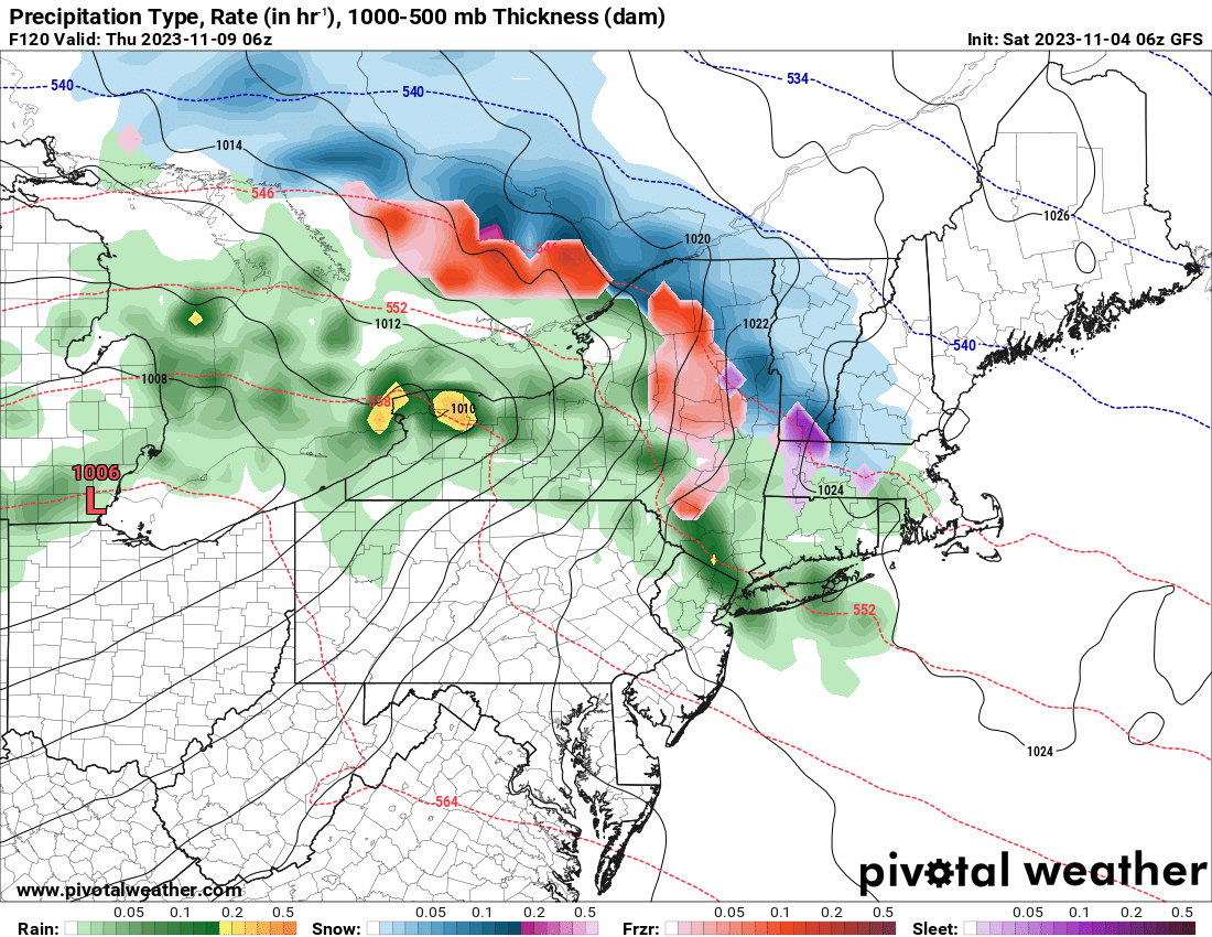
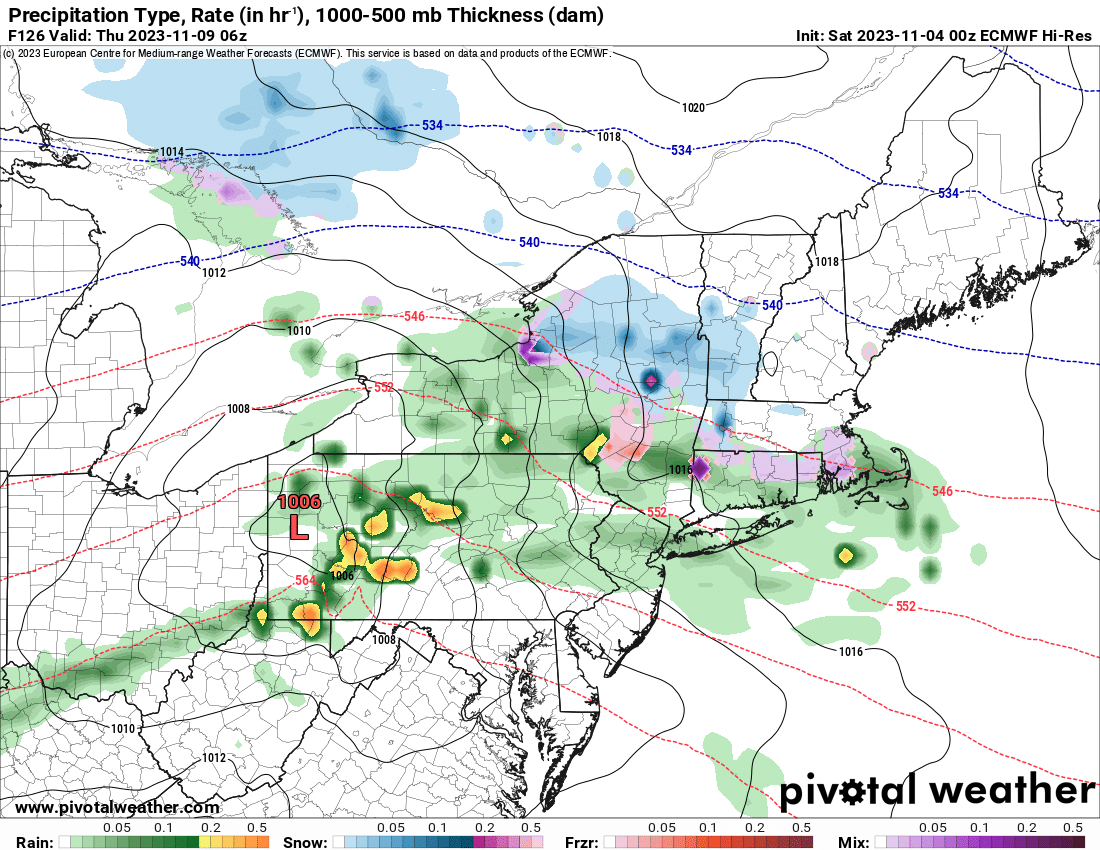
Both the GFS and the EURO go for our next storm to come through starting overnight Wednesday and into Thursday AM. With the temperatures being just a few degrees colder ahead of THIS system, it brings into the equation the potential for SNOW! In fact, both models are fairly close given this is 5 1/2 days away from happening. That alone got my attention. Any snowfall and any accumulations with this storm (which shall be north of the Thruway and at higher elevations at or above 1000′), will fade away quickly. By Friday any snow that may have fallen across Upstate NY shall be history. Again.
Looking to Veteran’s Day Weekend and beyond, it continues to look near normal on temperatures. Which in mid November with highs in the 40s, leave it too warm for snow.
So the bottom line is this: Definitely something to look at middle of next week, otherwise it’s just a quiet November around here. For now.
Thanks!
Rich


