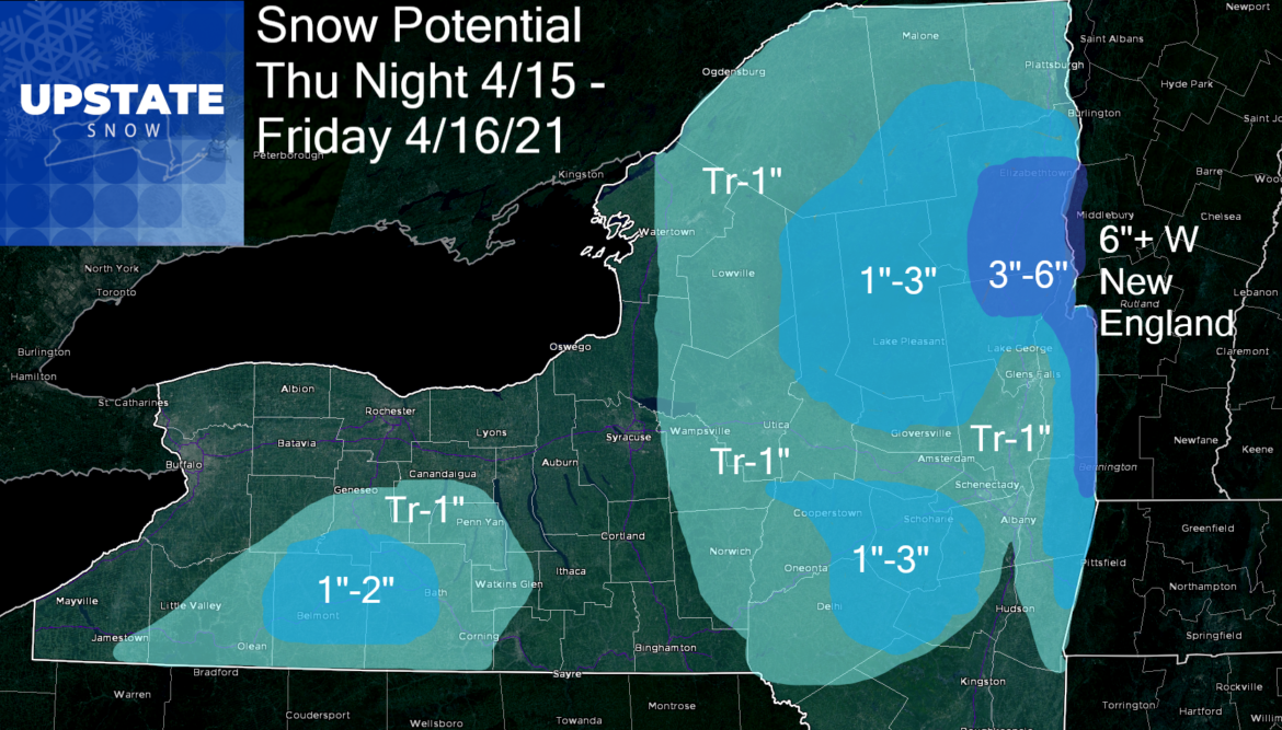
I didn’t think I’d put up a snow map one more time… especially the way this (actual) spring weather has been going across Upstate NY. But here we go…
First off, it’s not a HUGE storm. It’s Mid-April and this is not unprecedented historically. Second, it will be enough to keep it cloudy, rainy, raw and chilly for most, but with enough cold air tonight and Friday, we will have flakes flying, especially in the higher elevations. It will mainly be on grassy surfaces, even at higher elevations, but can’t rule out any slick spots. Best shot at this south of Rochester and Buffalo in the hills… and east of I-81, especially east of NY-12. Capital Region, Hudson and Champlain Valleys closest to this storm center. So high peaks and eastern Adirondacks, Taconics, hills east of I-87 will get the most here. Western New England will get legit shovelable and plowable snow. Here is what I am thinking tonight through tomorrow. And it will be a much better weekend!
So I’m also going to leave you with a treat. Some of you may have seen me share my new weather project, WxLive at 645. I started it Monday. I cut a custom video for Upstate Snow Nation just to preview this. And if you are interested tomorrow (Friday) morning at 645, I’ll be firing up the NY Meso cams, radar and tracking in real time what we do end up getting. I hope you enjoy it during the off season. You can like and follow richlupia.com on Facebook to get the feeds each Monday through Saturday at 645 AM. Let me know what you think in the comments or shoot me an email at rich@richlupia.com. You can also support this and other projects I am working on if you are so led.
LINK TO WXLIVE AT 645 APRIL 15, 2021
https://fb.watch/4TWyNTTvkP/

Have a great day!
Rich


