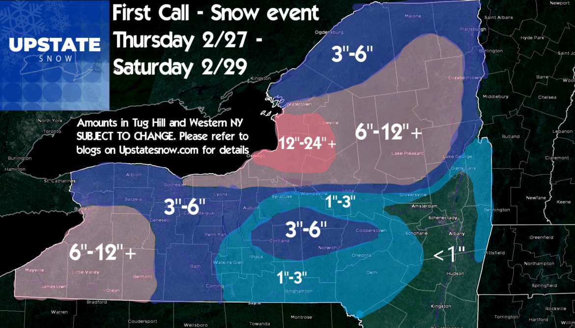
NWS is putting up the Winter Storm Watch flags already for storm + lake effect totals through Saturday 2/29. So we will follow suit in this report with our best idea as of this writing Tuesday 2/25/2020 at 630 AM. If you are reading this anytime after Wednesday morning 2/26/2020 PLEASE double check upstatesnow.com on the web or click directly to the Upstate Snow Facebook page. I know A LOT of people will see this and you need to remember people will share this stuff whenever not paying attention to when this was made, the fact there may be updates, etc. This forecast for those whom may not be familiar with Upstate Snow is coming from a Meteorologist with over 20 years experience, including 9 on TV and several additional years in radio. This forecast scenario WILL CHANGE between now and the event and even during the event. Now with the LONG disclaimers out of the way…
What we know: Main storm hits Wednesday night into Thursday morning. For most areas west of I-81, or where the low pressure ultimately tracks, this will be mainly a snow event. It will be a decent snow event for areas like Rochester and Buffalo for Thursday morning but not beyond the ordinary. For Syracuse, Utica, Binghamton and Watertown areas Wednesday Night into Thursday morning, rain mixing with and changing to snow. Some slick spots but again just a delayed commute Thursday AM, not a disaster. For the Capital Region through the Hudson Valley: What’s all this talk about snow?
For the snowbelt areas of the Adirondacks, Tug Hill and Southtowns S of Buffalo, this will be the start of an extended period of snow as lake effect takes over Thursday PM after the initial storm lifts N into Canada and almost STALLS. This sets up the extended 36-48, maybe 60 hour window of lake effect snow, something we have not seen this year.
WHAT WE DO NOT KNOW YET: Because the storm track is critical to where the lake snows set up after Thursday PM into Friday and Saturday, it’s TOO FAR OUT to give precise detail on where the heaviest snows set up. We know SOMEONE on the Tug Hill will get a jackpot over 2 feet. In this scenario a storm total in the 30s or even in a localized area above 40 inches is not out of the question. It’s way too soon to try and pinpoint on a map as 3-4 days out it’s most likely to be WRONG. That’s why a broad 12-24+ area. As we get closer, I’ll refine. Hence the importance of checking back in for updates…
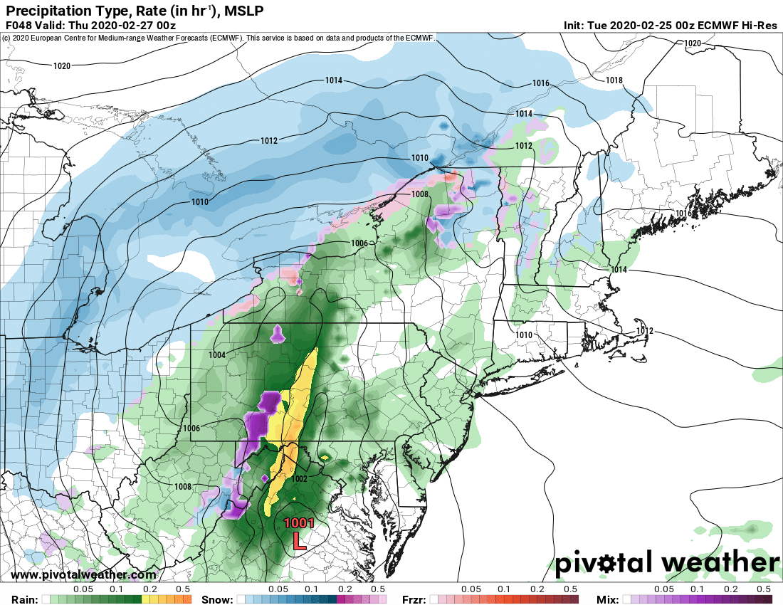
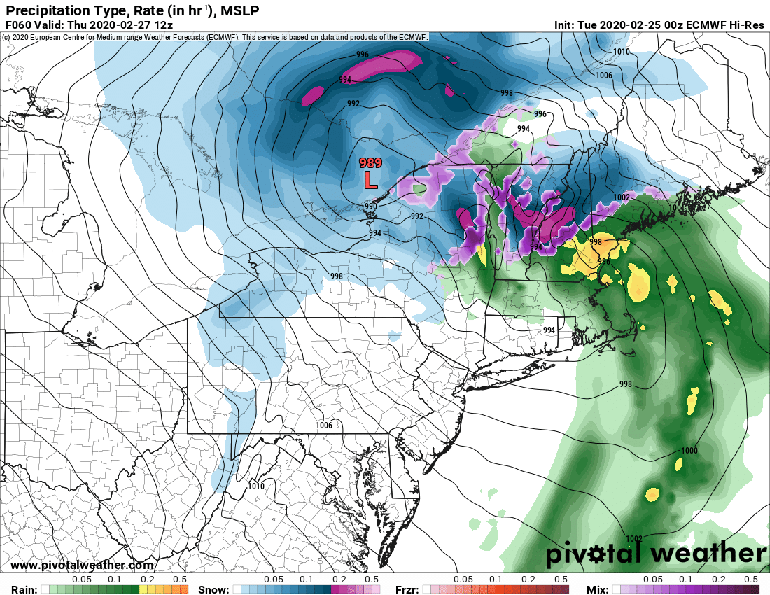
Heading into Thursday Night, assuming the models are on the right track with placement, this favors a 270 to 280 windflow. For Tug Hill and Adirondacks it means basically everything from Winona and Valley Snow Travelers south to Osceola, TC Riders, STH, Lee Center and into Boonville/Foresport areas at the farthest for the heavy bands. Brantingham, Old Forge/Inlet into Moose River Plains and Perkins Clearing should do nicely and over a foot over 3 days in these areas east of Route 12 is very doable. All depends on the main storm and where lake bands park. As you see, even on the Euro by Friday night, a very intense band of snow is indicated. Models favoring the southern half of Tug Hill into the southern Adirondacks. Way too early to say for certainty but you get the idea. For Western NY, models may be under doing snow off Lake Erie. Why? LAKE ERIE IS WIDE OPEN. MOST YEARS IT IS FROZEN SOLID ON THE EAST END. The models have this bias built into them to limit lake effect snow totals in Western NY as the lake usually is not open for business. This year it is. If you are in southern Erie, Chautauqua, Cattaraugus, Wyoming or Allegheny County, heads up. You may have a storm that over performs on lake effect Friday and Saturday.
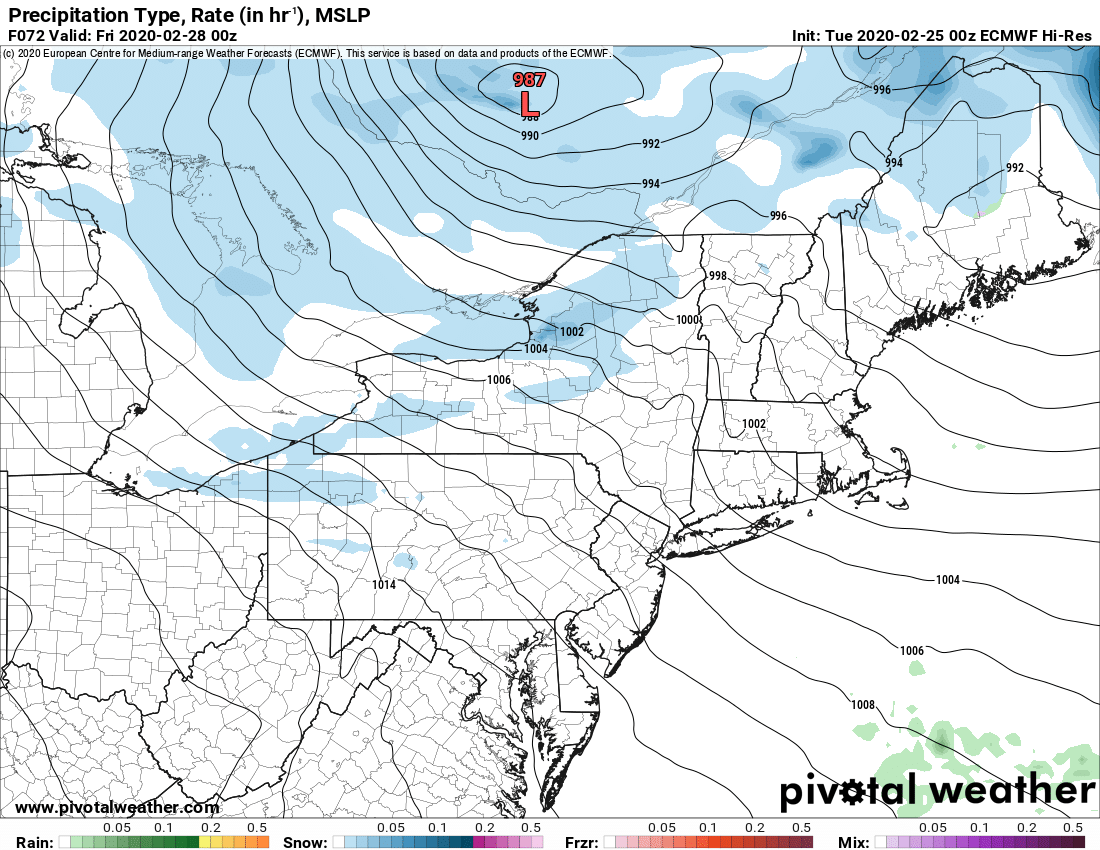
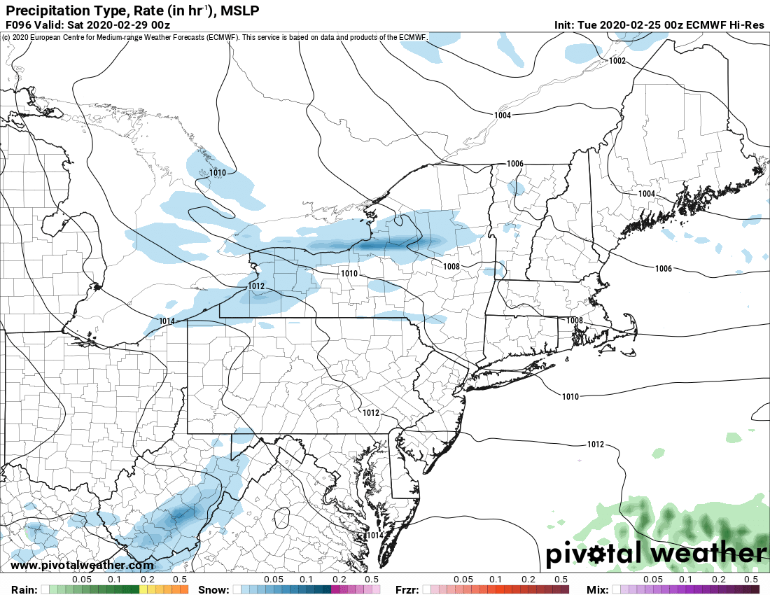
It looks like the heaviest lake effect snow will be Thursday PM through Saturday AM. Winds will slacken Saturday but the bands may hold on. Again we are way far out to call for sure.
This means despite the hurt we’ve gotten from the thaw and rain Wednesday night into Thursday AM on the front end before the change to snow Thursday AM… many areas N of the Thruway should fare well with fresh snow and another great weekend of riding is very possible after all this snow. For areas S of the Thruway, the snowpack is thinner and getting eaten away. Hopefully we’ll get just enough to keep clubs in the hills of Onondaga, Madison, Cortland and Chenango Counties, maybe even Otsego Counties in business. For clubs in Saratoga and Washington Counties, thanks for playing we have some nice parting gifts for you 🙁
And once again snow lovers in the Albany area and south get about zilch. Time to trailer N and W again.
Update Schedule:
Wednesday 2/26 AM – Morning Blog, updated snow map
Wednesday 2/26 PM – Guide to your Ride podcast
Thursday 2/27 AM – Morning Blog
Friday 2/28 AM – Morning Blog
Saturday 2/29 AM – Morning Blog
Best,
Rich Lupia
Upstate Snow

