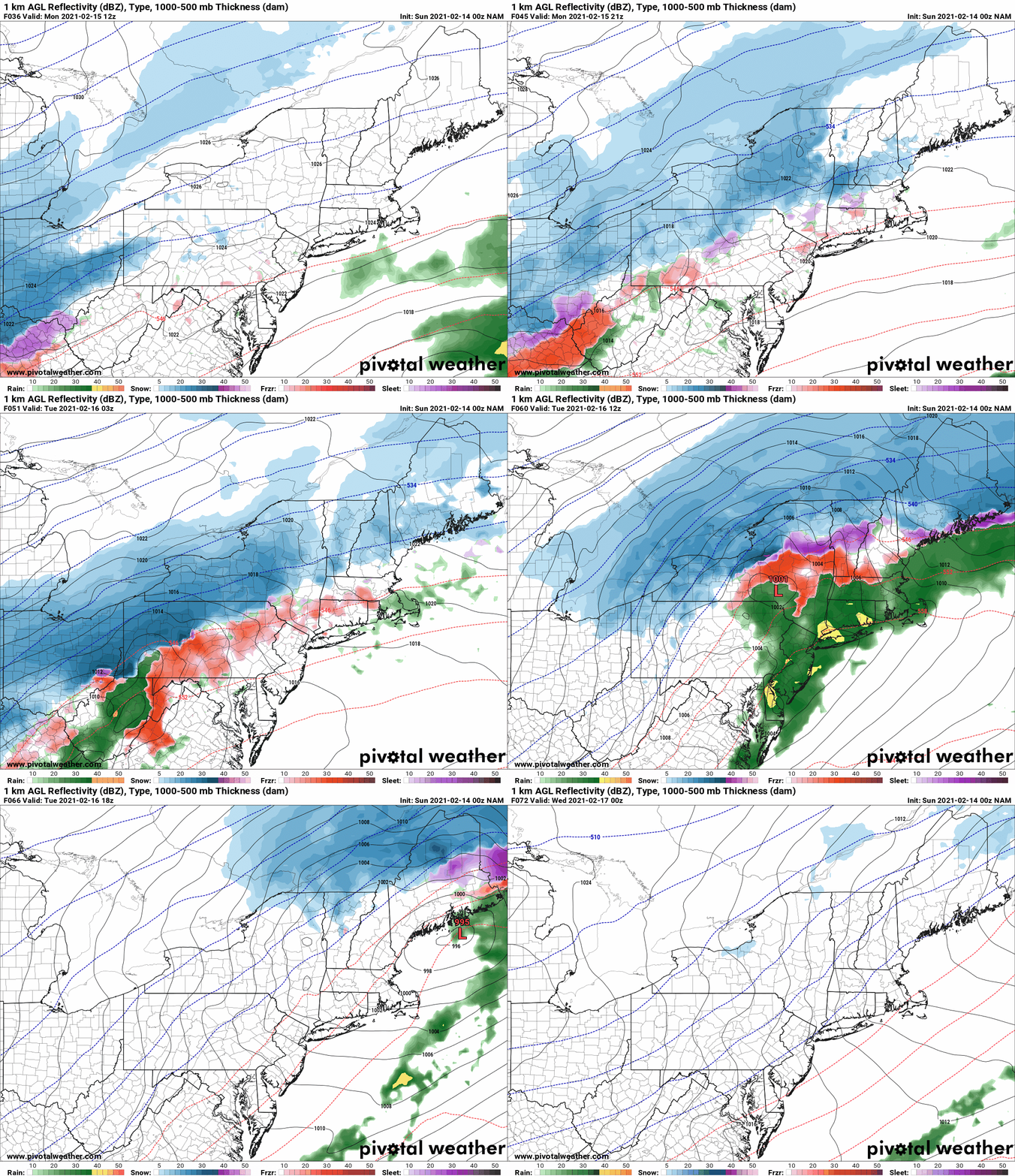
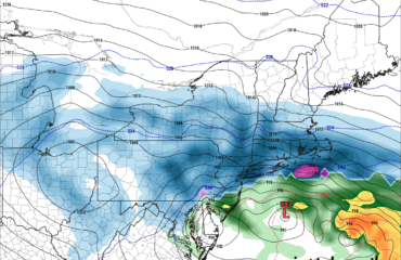
The snowstorm (and sleet for some) is taking shape and will head into Upstate NY tomorrow through Tuesday. Regardless of where you are and what your precipitation type is, the timing is high confidence now. The first wave hits tomorrow and tapers off during the late afternoon and early evening. First wave will be light to moderate snow (or sleet). There will be a break of several hours, mainly Monday night, before the heart of the storm arrives. Expect this to happen after midnight with moderate snow (and sleet for some) when you wake up Tuesday morning. The morning Tuesday will be the period of heaviest precip and when colder air aloft starts to get pulled back east. By Tuesday afternoon precip goes to mainly snow for all except from the southern Catskills (Sullivan County) and Mid-Hudson Valley, southward. It’s mainly over by sunset Tuesday evening. I’ve put up the NAM, which is the closest model I could find to my forecast map. NAM is the most aggressive bringing warm air aloft northbound. All models show a sharp cutoff from rain to wintry mix to heavy snow. Past experience with the fact that warm surges with mixed precip almost always go farther north than predicted, the fact model trends have been nudging north a little with each run, the fact the surface low gets into western PA before making the jump to the coast, and a wide open Gulf of Mexico with DEEP southerly flow… all point to me to be cautious about too much snow, too far south and east.

I understand your weather app, or the official NWS forecast for your county or zone, or your favorite local TV meteorologist may weight these factors differently and their snow maps for your point may reflect differently than mine. That’s OK. There is nothing wrong with me or them. We all have professional training and make decisions based on the model GUIDANCE, our past experiences, and will sometimes differ. This is my personal forecast based on my training of over 25 years going back to my college days. I’m not going to get every place and every detail right, but I will give you my best shot always, and my thoughts on WHY I make the forecast what it is. That’s what makes Upstate Snow different from many other places. We root for snow but we are conservative as well.
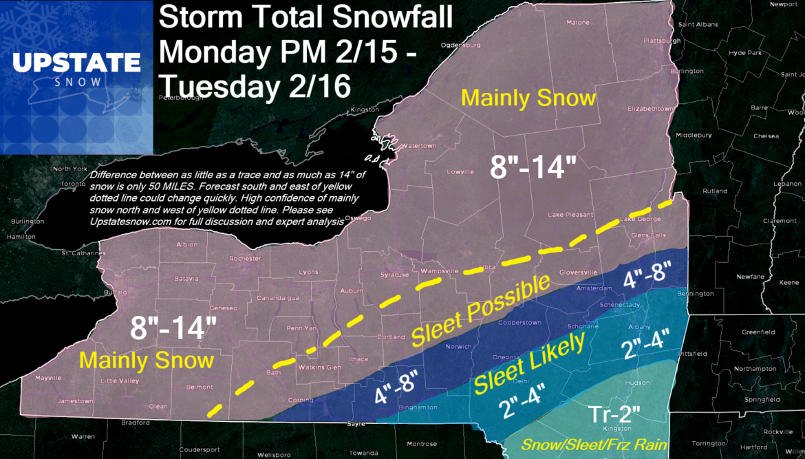
 The biggest bust potential is by far the Capital Region. I do think the immediate Albany, Schenectady and Troy areas will get a period of sleet which will knock snow totals down a lot. Especially SOUTH. But the closer you get to Saratoga and Lake George, huge change to heavy snow and a high chance of healthy snow totals. This zone is super sharp on all the models, and only 50 miles approximately on my map. The storm is 1500 miles away as of this writing and I’m trying to call it to within 50 miles. That’s barely 3% room for error. Any jog can mean a BIG forecast change in a hurry for a certain point. The same goes for the Greater Binghamton area and most of the Catskills. I truly believe warm air aloft will cut down totals in these areas. Mid Hudson Valley gets a lot of mix mess.
While I believe the Elmira, Ithaca, Cortland, Syracuse and Utica/Rome areas should be mainly snow, I cannot rule out sleet overnight Monday and into Tuesday morning. If you are inside the Adirondack Park line, ALL of the North Country to the St Lawrence and the Canadian Border, ALL of the Rochester area, ALL of Western NY from Lake Effect snow country through all of Niagara, Erie, Genesee, Orleans, Livingston, Monroe, Wayne, Ontario, Seneca and Cayuga Counties, it’s mainly snow.
BOTTOM LINE: The 4-8 inch zone and the 2-4 inch zone I could change quickly north of 8″… or knock down. I know I am farther north and west than others, but my analysis tells me it’s the most likely scenario. We’ll see if it happens.
For MOST of the snowmobile clubs, even if sleet gets mixed in, it will help the base and add moisture/water content to the snow pack. Most clubs should be fine. My greatest concerns are Broome, Tioga, Chenango, Delaware, Otsego, Schoharie, Albany, Schenectady, southern Saratoga and at least the southern half of Washington County. Clubs here have a little less snowpack especially in the Capital Region.
Beyond this storm next Friday is another good storm, still looking like mainly snow. Another clipper and lake effect behind that next weekend. We’ll see what the pattern does next week. For now enjoy the ride, be safe, ride ride, SLOW DOWN and remember… someone’s sweetheart is on the trail. On this Valentine’s Day or any other day. Look out for one another. Think of others first.
Rich


