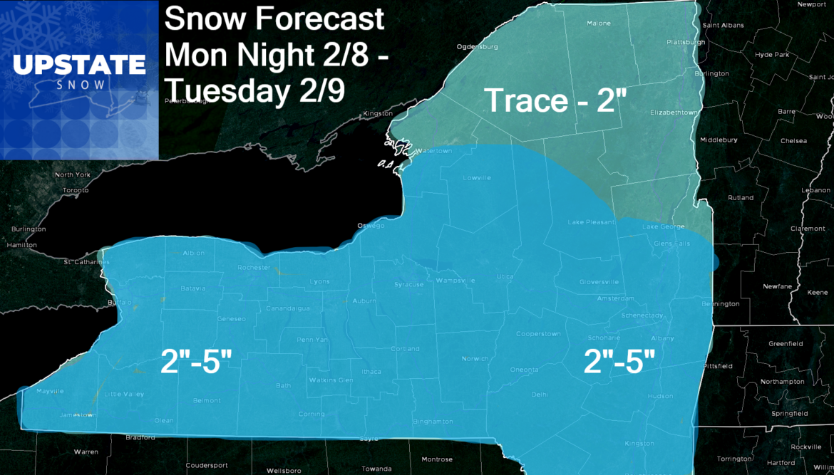
Snow will be moving in this evening and last through the day tomorrow. Since the heart of the energy is heading more into PA, I don’t see a ton of potential for lake enhancement… And I think Northern NY gets little out of this. For most of the state, not a disruptive travel situation, but snow and slow and go… go shovel and snow blow and plow… for snow lovers, most fresh white gold on the trails… with cold lasting through the week

Not much lake effect behind this. Wednesday and Thursday should remain fair and cold. There is now some divergence into model solutions as GFS wants to unload polar vortex onto Minnesota and the western Great Lakes. This would keep Upstate NY cold but not well below zero like points west. That has implications for the storm track as well.
As I highlighted before in the previous morning blog, the jet stream is very fast and active. Expect many forecast changes in the coming days and weeks… more than usual. And because the jet stream is very fast and flowing more west to east than I like (Not as big of a ridge out west as I’d like to see), it’s truly the polar vortex and Greenland block that is the main driver of our weather through President’s Day Weekend. If those features weaken and shift next week, could be a whole new ballgame. Maybe it’s just me waiting for the other shoe to drop. Carpe Diem. Next 7-10 days are the best of the season and the best in years across Upstate NY.
Rich
Rich


