Slight adjustments to storm #1 forecast for tomorrow. Storm #2 a bigger one on Friday with more snow. And the cold coming behind it for the weekend, particularly Saturday, means we will have the best weekend of the season so far not just for the Tug Hill and Adirondacks but for a lot of Upstate NY in terms of rideable areas.
Very critical you check in with clubs in areas with no/thin snow cover now… make sure they are officially opened and safe if you have several inches of snow to ride on closer to your home this weekend.
So the adjustments are simple… Storm #1 Thursday and Storm #2 Friday (with anywhere from a 6-12 hour break between the two), are tracking just a little farther south. Winter Weather Advisories for Thursday across most of Upstate NY, especially given the hit time for Thursday morning commute and the fact sleet/frz rain will be an issue on Storm #1. In areas that stay snow on storm #1, north of the Thruway mainly, this is a HIGH WATER CONTENT snow. Good news.
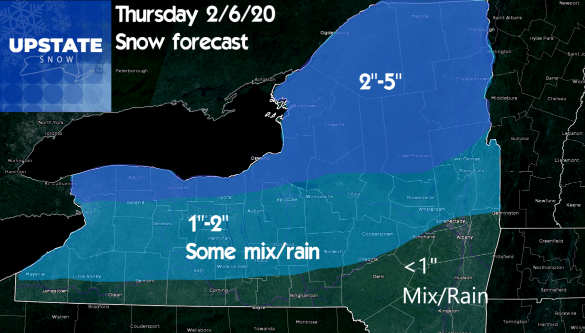
So storm #2 gets going into morning drive on Friday and lasts through the day. The strengthening low pressure center will track instead of a Pittsburgh to Binghamton to Albany track… now looking more like Harrisburg to Newburgh to southern New England. That 50-75 mile shift means all snow for areas West of I-81 Friday, and likely all snow for Central New York (with only a little mix there), The Tug Hill, Adirondacks and even closer to the Capital Region and Southern Tier… the farther north in both areas the better. The closer you are to the Catskills and Hudson Valley, the better chance for mix/rain you have on Friday’s storm #2. REMEMBER THIS IS A DENSE, HEAVY WET SNOW! This forecast is subject to change on track. Any shifts in track will change snow total placements.
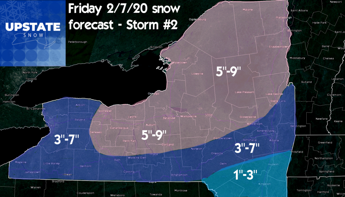
So the bottom line is this: Between the storm Thursday and the storm Friday, buy this weekend we SHOULD have almost everything north of the Thruway in business for riding! This means Tug Hill, Adirondacks, riding between the two places hopefully, the approaches to them from both north and south, and hopefully into the lower elevations too. We also could open up and expand some areas in the hills of Central NY south of the Thruway along the Route 20 corridor like Madison, S Oneida, Otsego, Chenango, S Onondaga, Cortland and Cayuga Counties! Even some places in Western NY, Rochester area, and southtowns, may get just enough to play on this weekend. Again, check with clubs and fingers crossed!
Another great benefit behind these storms: A cold Saturday and a quick very cold shot going into Sunday morning to freeze this down and give the clubs a chance to groom and set up trails!
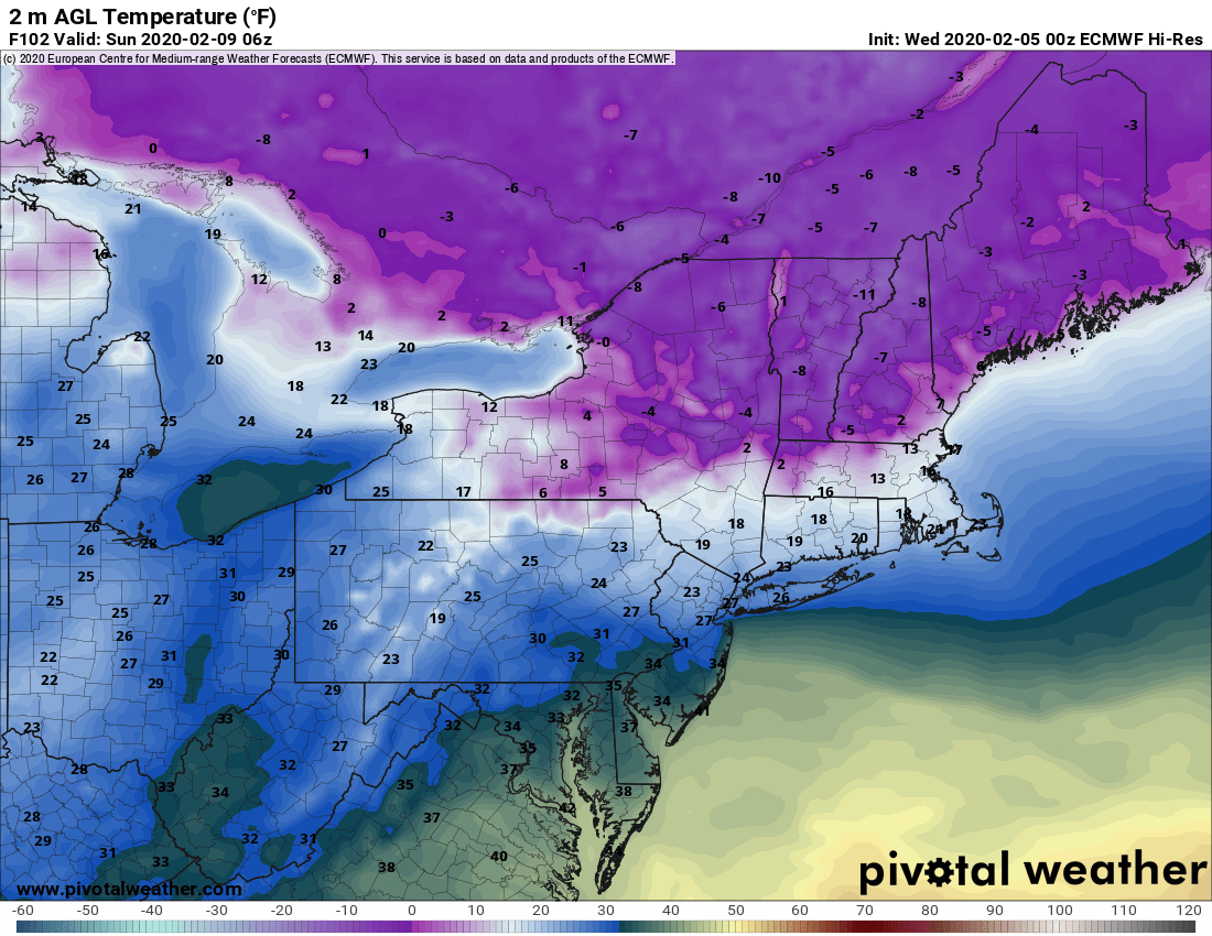
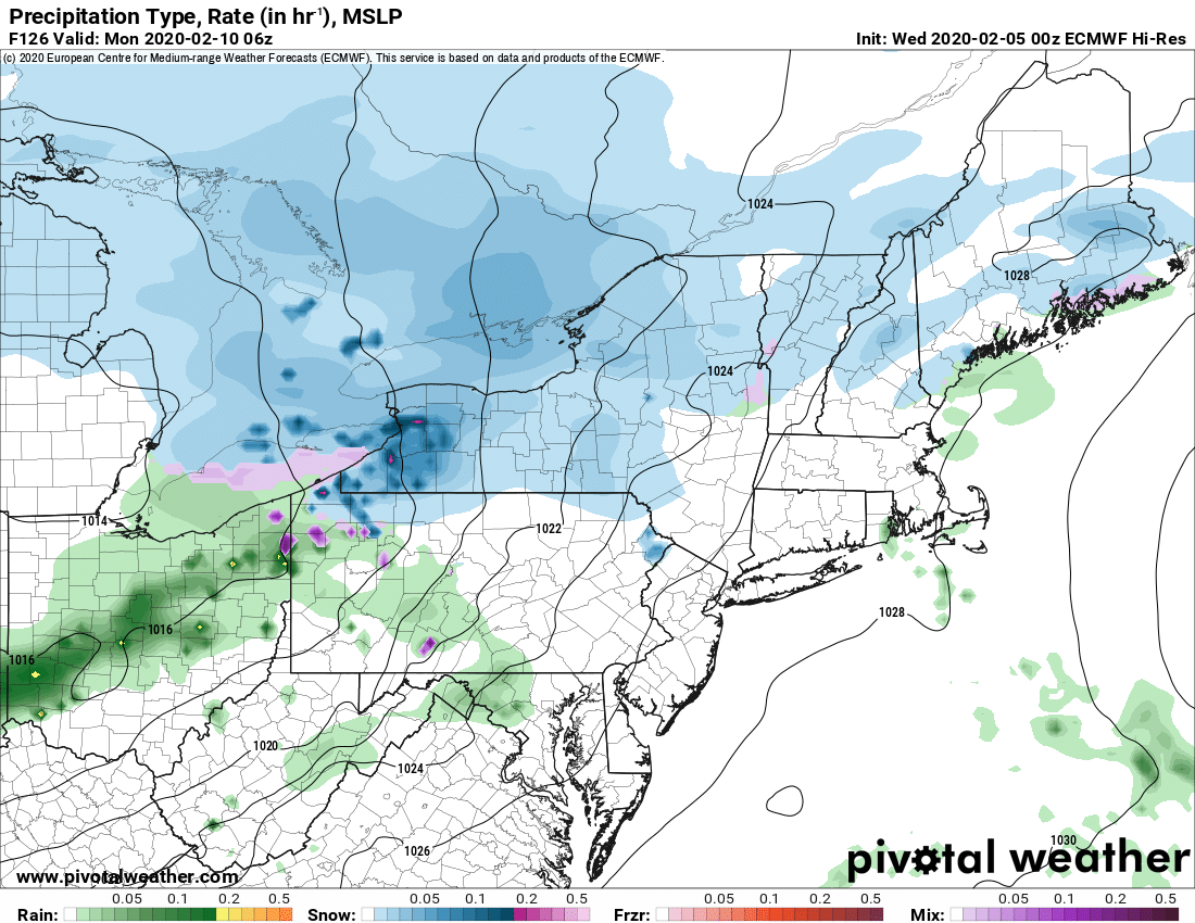
Heading into the end of the weekend and towards Monday morning, a lesser event, but for consistency we’ll call Storm #3… comes in from the west with a bonus shot of snow…
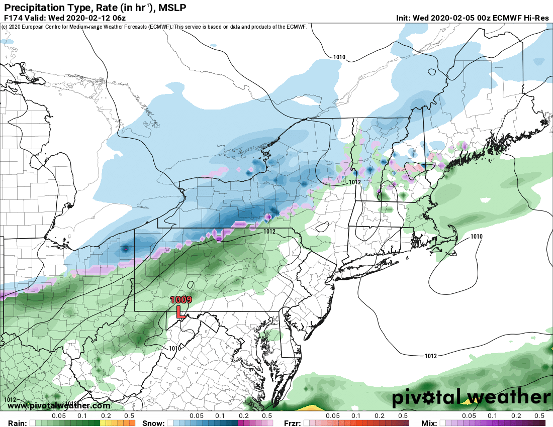
Then yet another one, #4, comes into view sometime late Tuesday or early Wednesday next week. So basically, four chances for snow in the next week. A much more active pattern and mostly snow! Great news!!!
BOTTOM LINE: BEST OF THIS THIN SEASON LOOKS TO BE AHEAD OF US IN THE NEXT WEEK! HOPEFULLY LONGER. IT WOULD BE NICE IF THIS HOLDS INTO PRESIDENT’S WEEK WHEN A LOT OF FOLKS ARE OFF! BUT IF YOU HAVE BEEN PICKY THIS SEASON, DON’T BE. I THINK THIS IS AS GOOD AS WE ARE GOING TO GET THIS SEASON. HOPE I’M WRONG, BUT REMEMBER MARCH IS LESS THAN 4 WEEKS AWAY…
Rich


