The Weather Center is getting fired up and ready for battle. As has been the case this winter, borderline temperatures and tougher than normal calls on the snowfall amounts will be the rule. In the meantime it won’t be as warm today but still above freezing. Expect quiet but colder conditions for Wednesday as limited cold air bleeds into Upstate from the north. Overnight Wednesday heading into morning drive Thursday, the precipitation spreads quickly across the state, lasting anywhere from 7-14 hours in this first wave.
What we know on the first storm (Thursday)
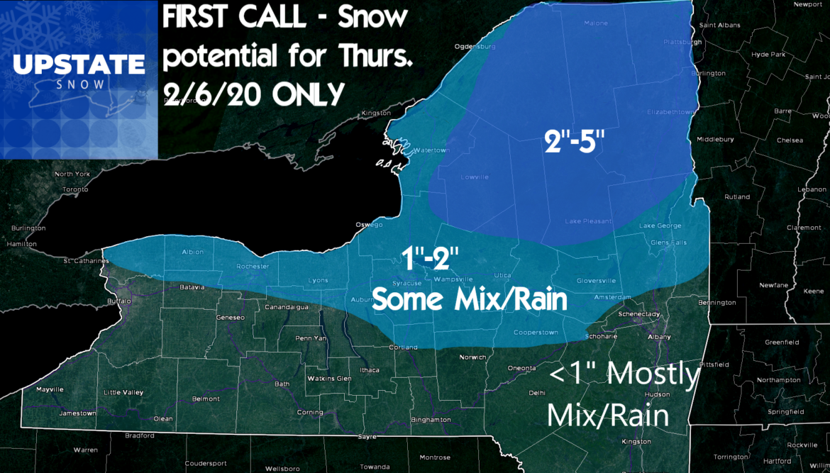
Best chance for wet snow accumulations will be in the Adirondacks and Tug Hill. Locations near the Thruway in Central NY will see some snow but warmer temps will result in some sleet/frz rain mix or outright change for a time to rain, especially lower elevations, hence the lower call on snow amounts.
The farther south of the Thruway, regardless of elevation, the less snow on this round.
The Capital Region and Hudson Valley along with the Southern Tier (I-86/NY 17 Corridor) and Catskills are most likely to get skunked on this snow event.
Precipitation should end in the afternoon and evening, allowing for a short break before storm #2 comes at us quickly…
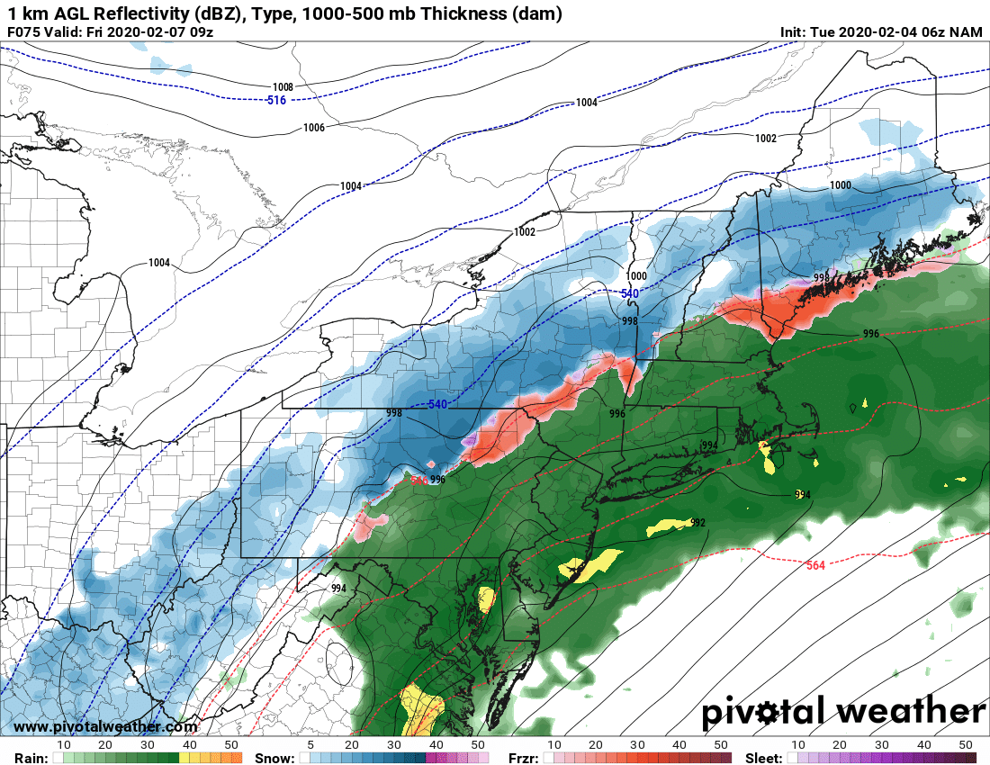
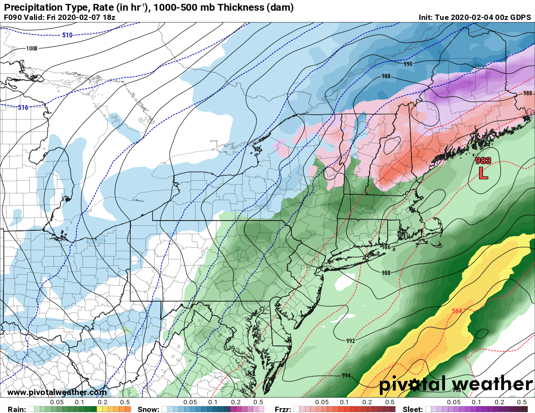
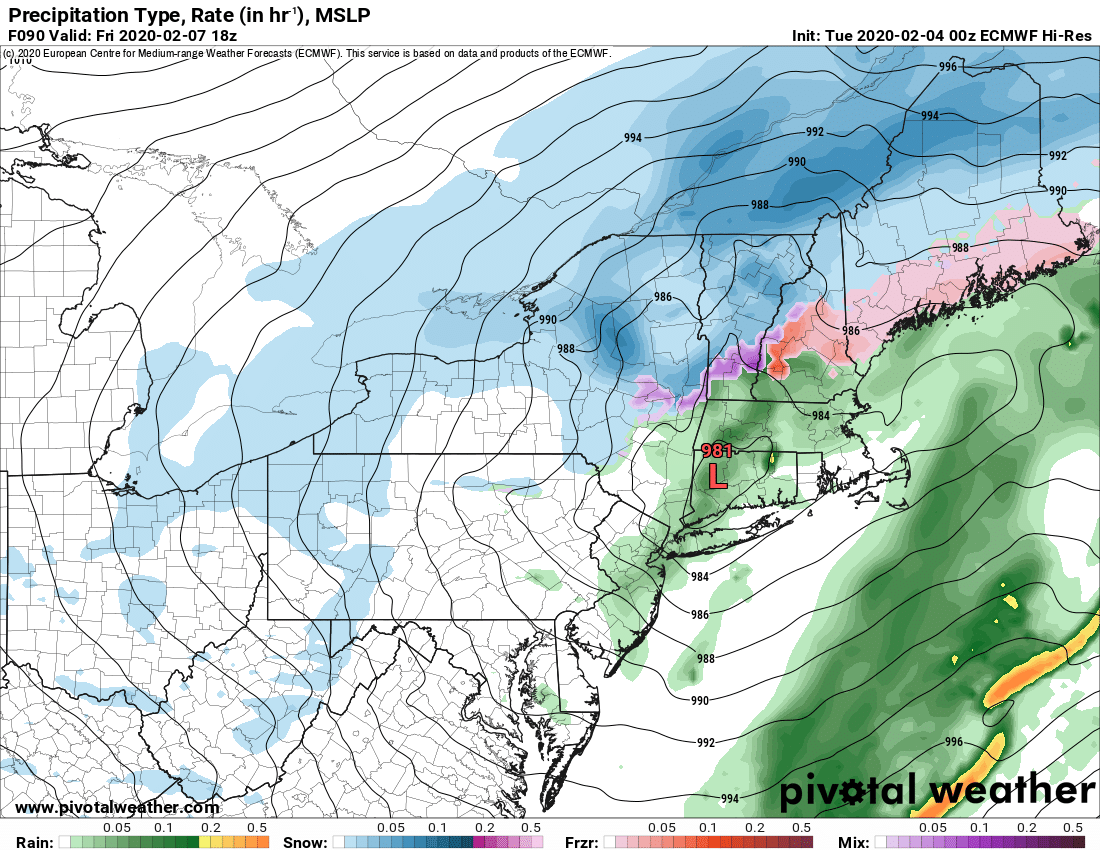
The second storm will take a different track, starting farther south and taking more of a northeasterly direction. Still a lot of uncertainty on track for this one, but it looks to fall somewhere between the I-88 and I-84 corridors. The closer to downstate the low tracks, the more snow hits Upstate in round 2. The closer to I-88 and the Capital Region it tracks, it may take snow away from Central NY and the southern reaches of the Adirondacks due to mix/changeover. For this second storm on Friday, the Adirondacks and Tug Hill should get another several inches of snow, while areas from the Finger Lakes, westbound into the southtowns S of Buffalo should get at least a few inches of accumulation, if not more.
There looks to be a round 3, 4 and 5. Timing gets more unclear as model solutions diverge with time, but our best idea at this time is:
Saturday: Quiet
Sunday: Round 3 possible, may scoot south of Upstate
Monday 2/10: Break with Round 4 approaching
Tuesday 2/11: Round 4. Some models go wipeout rain with a St Lawrence Valley track. Others a mixed bag.
Sometime Wednesday 2/12- Thursday 2/13: Round 5 and a big question mark. Unknown with any certainty if we break out of this quick hitting storm pattern after that.
Patterns as mentioned before can last as short as 7-10 or perhaps 14 days, or as long as a few months. Our hope is for snow on all these upcoming events obviously, but especially so because the lack of bitter cold (Single digits, near/below zero at night) to freeze down the trails) looks to be an issue. And so us snow lovers struggle into the second half of this winter, just thankful we have had something to ride and that it’s not as bad as 2011-12 or 2015-16… every winter is different and this story isn’t done yet.
Until next time,
Rich


