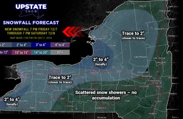
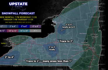
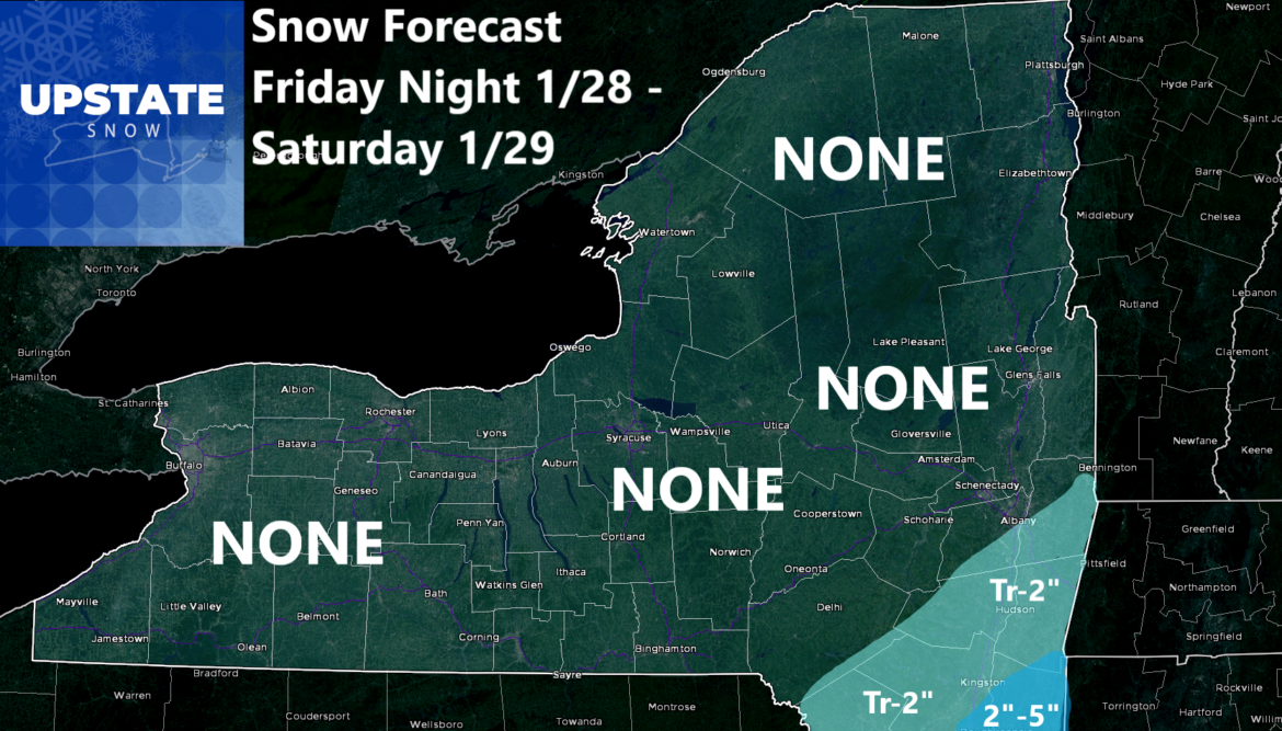
It’s not what you want to hear, but I have to play it straight. I have no model support for the forecast I had wanted to make yesterday. ALL MODELS are trending eastbound and down. Even the NAM and Euro, which remain the farthest west. They have shifted 75-100 miles farther east over the last 24 hours. The GFS is keeping this thing so far east NYC would get ZERO. Meanwhile on NAM and Euro still shows significant accumulations for Central Park. I feel bad for y’all in the NYC area and please give respect to the Meteorologists there. This storm, for ALL riding areas will be a MISS. One thing that will not be a miss this weekend will be the COLD and the WIND. Everyone shares in that and wins with that during a brutally cold day today, somewhat milder (but still cold) tomorrow with a dusting to an inch or two (not Nor’easter related, but with the reinforcing cold front) and bitter cold this weekend.
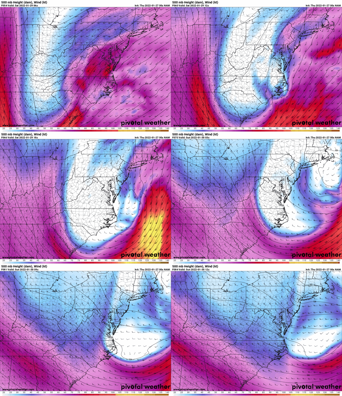
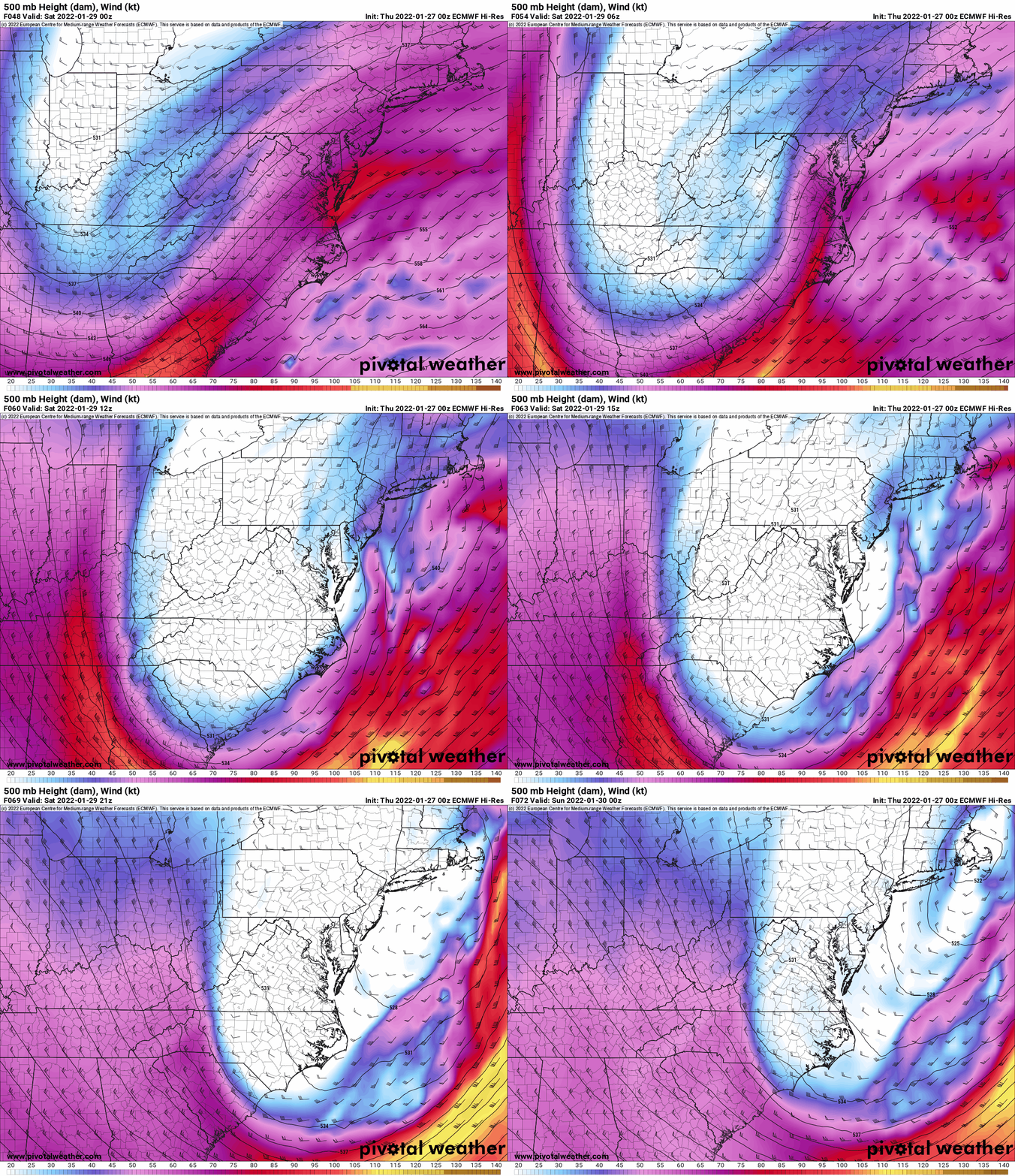
BUT RICH, WHAT ABOUT THE 500 MB TROUGH YOU WERE SCREAMING ABOUT?
Indeed I was. As the models in the last several runs shifted east, I dug into all of the 500mb maps on the models to ask WHY? I found my answer and it is a two fold answer. 1) The trough itself has dug more to the south than predicted, hence why we now have the threat for accumulating snows here tomorrow afternoon and tomorrow night in the Carolinas. With the low and trough digging more to the south, this also helps to develop 2) The 500mb low forms earlier and closes off earlier with the actual storm. In previous model runs it didn’t happen until it got close to New England. Now it does it off Cape Hatteras. This is KEY. What this does, because even though the trough is still over Western NY Saturday morning, with a separate low and deepening low with the surface cyclone bombing out, the 500mb flow is SSW to SW over Upstate NY. It would need to be more due south to SSE to bring the moisture in off the Atlantic for lighter fill in snows of a few inches, which was my original gut. My gut was never a big hit north and west of Albany. Never discussed that. But because of this subtle change, I have to roll with the NAM/EURO forecast which my snowfall map is based off, 75-100 miles farther east. Hudson Valley/Downstate get a little something. But with no trails down that way, sorry 🙁
WHAT ABOUT AFTER THE STORM
All models show Sunday and Monday as cold but sunny days. That part has not changed.
WHAT ABOUT THE HUGE WARMUP NEXT WEEK
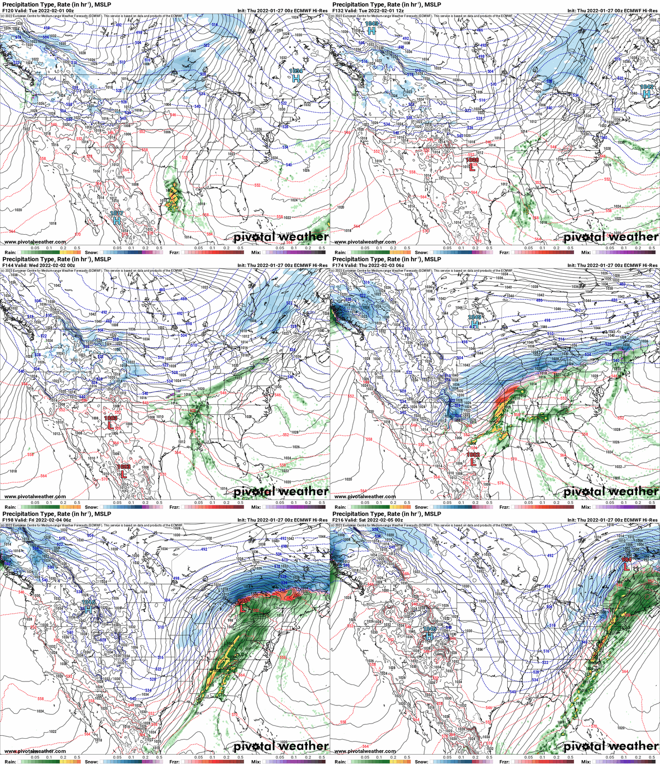
Unfortunately the models are all in agreement on this one and the details with each model run continue to get WORSE. It was originally looking like Wednesday was the start of the warmup. Now it is TUESDAY. After a very cold start Tuesday morning, expect temperatures to SOAR above freezing, especially in the lower elevations. Wednesday and Thursday? BRUTAL. 40s to even lower 50s, especially in WNY with some wind. That’s going to take the good situation on the trails in WNY and WIPE THEM OUT. For the Tug Hill, Adirondacks and North Country, it means melting of what is there, lower elevations get burned out, Tug Hill gets isolated again, the Adirondacks and North Country which have thin conditions now, may likely need to start closing trails. We are not in a position to sustain much of a warmup but Tuesday, and especially Wednesday and Thursday look brutal. Thursday PM into Friday AM, RAIN. And a lot of it potentially. Of course because the models are showing this 6-7 days in advance, it will stay and you can take it to the frickin bank. A snowstorm at day 6-7, a lot of changes then ultimately get screwed. Isn’t it funny how this all works out? Day 5-7 you can bank it if it’s warm, pray and maybe 50-50 if it’s a snow event. That’s the way it goes in low snow winters, the winter of fighting for scraps, fighting for every freaking inch you can get. Mercy.
BETTER AFTER THE WARMUP/WIPEOUT
YES! Friday once the cold air comes rushing back in, it is here to stay the following weekend into next week. If you believe the Euro, just cold. If you believe the GFS, we could get a lot of snow the following week, but with that at 10 days and beyond, we must unfortunately but that possibility into “fantasy land” for now. In the winter of “I’ll believe it when I see it”, this is where our hearts and minds need to be.
RIDE NOW! JUST RIDE NOW!
You are officially on notice you have only 5 days left to ride the nicest conditions across Upstate NY, potentially all this winter. There is no guarantee February, or March comes to our rescue. It could. It took us so long to get here, we’re still behind normal, and have next week to survive. While I’m relatively sure we will get more cold and snow opportunities in February and March, next weeks warmup will undo the good the COLD the last few weeks straight have done. There look to be a lot more water issues and mud holes post thaw, something which you are flying over frozen ground on right now. No guarantees beyond Tuesday next week so pack on the miles now while you can.
THANK YOU!
I’ve received a ton of positive feedback this week along with a few additional donations to say “thank you” for these Morning Blogs and all I do to keep you, the snowmobilers and winter weather enthusiasts who live in (or play in) Upstate NY, happy. I’m blessed to be able to do this. Thank you for letting me keep the dream alive! Have a great day!
To become a MEMBER, drop me $10, and you’ll get name recognition, or if you wish not to use your name, recognition to your favorite snowmobile club or where you live. To become a SPONSOR, drop me $60 and I’ll put up a link to your business, Facebook page or snowmobile club!
Click below to get started
paypal.me/lupiallc
www.venmo.com/u/Richard-Lupia
THANK YOU to our faithful sponsors and members!
SPONSORS
Southern Tug Hill SnoRiders
Saratoga Snowmobile Association
Ohio Ridge Riders
ILSNOW.com
Enjem’s Flooring America
Water’s Edge Inn – Old Forge
Adirondacks Speculator Chamber of Commerce
White Lake Inn
Toads LLC Fisher and Snow Dog Plows, Cairo, NY
John Schoff Memorial Vintage Ride – January 15, 2022
Lincoln Mountain Gansevoort Snowmobile Club
ATV Tractor
Foley’s Lawn Care and Gardening
Better Homes and Gardens Pristine Real Estate – Cape Coral, FL
North Country Market – Thendara, NY
PR Plus Small Engine Repair – Sherrill, NY
EnergyMark LLC
Mountain Culinary Company – Mountain Top, PA
MEMBERS
Chris Rinck
Charles Klesse
Chaz Albertson
Dave Gleasman
John Bates
Darrin Harr
Mark Enjem
Matthew Pistner
Eric Vilovchik
Brian & Paula Bedell
Robert G. Gartley
Chris Higgins
Nathan DeMarco
Frank Presky
Chris Schoff
Richard Keller
Mark Spano
Paul Marconi
Michael Schrader
Chris Skipper
Frank Sansone
Mercy Board LLC
John Scalora
Tom & Alis Vincent
Angelina Gogola
Cricket Corelli
Russ Lamoy
Jeff Greene
Chaz Albertson Jr.
John Bossolt
John Foley
Andy Artessa
Jenny & Ron Tyre
Mark Finkbiner
Christopher Cawley
Darren Bryant
M&M, SnoCh!c and SnoL!fe
Doug Wasiura
Devon Senecal
Billy & Millie McLaughlin
Rachelle Gross
Marc Mellaly
DV
Vicki Muehleck
Gertude Corelli
Brian Shoemaker
Brian Salamone
Tom Sylvia
Tom Robinson
Eric Olofson
Gill Benedek
Jason Sosiewicz
Ron Linich
Debra Hubbard
Dennis Sullivan
JAYSOS!
JDR
Stephen Prinzi
Chautauqua Boat Works
Brian Bedell
Barbara and Joe Monahan
Des Ballard


