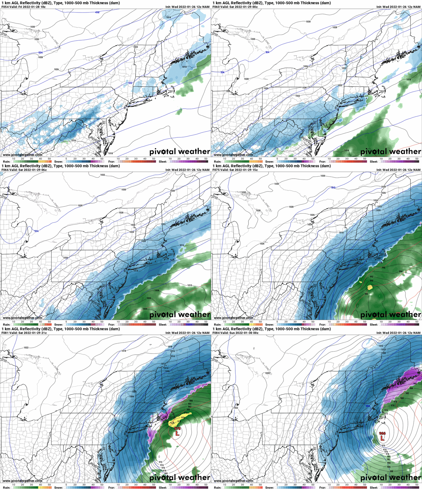
Waited for the 12Z NAM and Mesoscale runs to come down before firing this out. Sorry for the delay of a few hours. But I know you will appreciate the analysis…
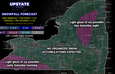
The cold front comes through Thursday night into Friday morning and will leave most locations in Upstate NY with at least a dusting of snow, with most receiving anywhere from 1/2″ to an inch or two. Friday will feature a mix of clouds and sun but otherwise quiet. Friday night clouds increase. Saturday is snow day if you are in eastern NY, especially towards downstate NY…
WHAT IS YOUR GUT FOR THIS NOR’EASTER?
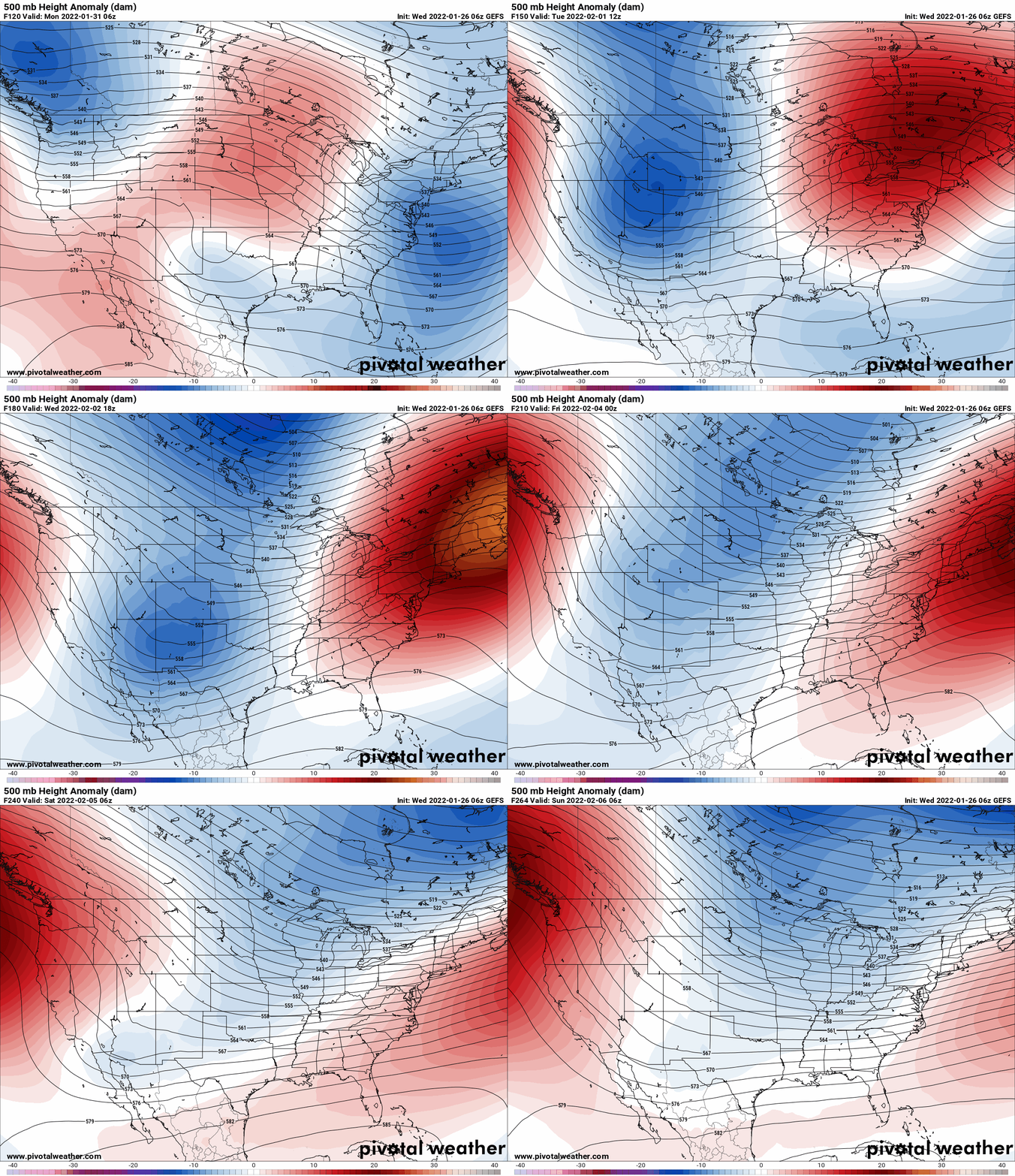
It’s amazing how this Nor’easter has been on all the models consistently for a week, yet, so much back and forth on the storm track, how far west the snowfall gets, and what about that 500mb trough lying so far to the west… but the models are saying “pay no attention to that man behind the curtain”. OK, before I go any further, I’m talking about a few inches of snow as opposed to ZERO. I’m not talking about a foot or more here, especially anywhere north and west of Albany. One thing that is becoming clearer… from Albany south and east will take a serious hit. Period. How far north and west of Albany does this go???
OK, bottom line, with the 500mb track still west, I will be in agreement with storms pulling closer to the coast. This storm is not going to go into the 960s off Nantucket with the 500mb low over Syracuse. That’s just not going to happen. That being said, the snow I believe will get somewhat into Upstate NY. Capital Region will receive the biggest benefit, and points south and east of there. The 12Z NAM I really like for storm track and dynamics. I don’t think this thing will be 100-200 miles off Nantucket. I think it will be really close. This is the scenario:

The 12Z NAM hugs a little closer to the coast than models just shooting off the coast with the low. It brings the strong Nor’easter to near Nantucket by Saturday Night bombing all the way to 966mb off Nantucket, which means a huge hit for NYC and the Tri State area, Southern New England. THIS WILL BE A BLIZZARD FOR SOUTHERN NEW ENGLAND, PARTICULARLY EASTERN LI (HAMPTONS), RHODE ISLAND, EASTERN CT AND EASTERN MA. With this track, even with the 500mb trough lingering over CNY and central PA, It’s not going to magically vacuum the heavy snow all the way west to the 500mb trough. Every storm is different. The jet stream dynamics just favor SE NY, Long Island and New England taking a direct hit from the strongest Nor’easter this year, possibly in years.

SO WHAT ABOUT OTHER MODELS?
The Canadian 12Z RGEM just came out and is 75-100 miles to the east of Nantucket. That moves this whole map above, should it verify, that much farther east. The 12Z GFS is even farther to the east and barely gives snow to NYC. Say what? The Euro and the NAM are giving FEET of snow to NYC, GFS you’re gonna blank??? I have no idea what the GFS is looking at on this morning’s deterministic BUT… I think it’s out to lunch. Seriously. But again, this is why I don’t put numbers out this far in advance, especially with this much uncertainty.
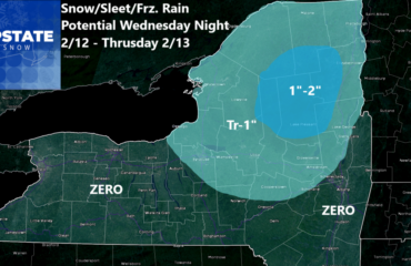
No numbers on this thing until tomorrow morning. I’m sorry, I know you want them, but I’m not gonna do it. Instead, Look at the NAM above and the snowfall “idea” map I put out. For snowmobilers, the Capital Region and Saratoga Region trails should get some decent snow. Less to the west of Route 30. Get west of Route 12, it won’t be much of anything. For most of the Adirondacks, consider this like a strong clipper coming through with a few inches of snow. Tug Hill, sorry, you’re too far west. CNY, unless you are more like Mohawk Valley, sorry. Southern Tier and especially WNY… You got the last big one. Your turn to sit out and watch everyone else this time.
TROUBLE NEXT WEEK

It has been warned about for a few days now but next week with be a brief commercial interruption in the heart of winter. Expect temperatures next week to be nowhere near as cold as it has been. By middle of next week all of Upstate NY will be into the 30s with 40s in WNY. With the thin snowpack we have compared to other years, this will be a big concern. I anticipate WNY is in the biggest trouble middle to end of next week, especially lower elevations with the south winds blowing. Less of a concern, but still some across the rest of the state. As usual, Adirondacks, Tug Hill and North Country should survive the warmup the best. You also see this warmup is TEMPORARY. Strong signals after several days of milder temps next week, the pattern begins to flip back. Cross your fingers that happens. If it stays warm, unless it’s 2018 and we go full bore into winter mode with an almost record cold and snowy March… Yep… RIDE WHILE YOU CAN ON WHAT YOU CAN, WHERE YOU CAN.
To become a MEMBER, drop me $10, and you’ll get name recognition, or if you wish not to use your name, recognition to your favorite snowmobile club or where you live. To become a SPONSOR, drop me $60 and I’ll put up a link to your business, Facebook page or snowmobile club!
Click below to get started
paypal.me/lupiallc
www.venmo.com/u/Richard-Lupia
THANK YOU to our faithful sponsors and members!
SPONSORS
Southern Tug Hill SnoRiders
Saratoga Snowmobile Association
Ohio Ridge Riders
ILSNOW.com
Enjem’s Flooring America
Water’s Edge Inn – Old Forge
Adirondacks Speculator Chamber of Commerce
White Lake Inn
Toads LLC Fisher and Snow Dog Plows, Cairo, NY
John Schoff Memorial Vintage Ride – January 15, 2022
Lincoln Mountain Gansevoort Snowmobile Club
ATV Tractor
Foley’s Lawn Care and Gardening
Better Homes and Gardens Pristine Real Estate – Cape Coral, FL
North Country Market – Thendara, NY
PR Plus Small Engine Repair – Sherrill, NY
EnergyMark LLC
Mountain Culinary Company – Mountain Top, PA
MEMBERS
Chris Rinck
Charles Klesse
Chaz Albertson
Dave Gleasman
John Bates
Darrin Harr
Mark Enjem
Matthew Pistner
Eric Vilovchik
Brian & Paula Bedell
Robert G. Gartley
Chris Higgins
Nathan DeMarco
Frank Presky
Chris Schoff
Richard Keller
Mark Spano
Paul Marconi
Michael Schrader
Chris Skipper
Frank Sansone
Mercy Board LLC
John Scalora
Tom & Alis Vincent
Angelina Gogola
Cricket Corelli
Russ Lamoy
Jeff Greene
Chaz Albertson Jr.
John Bossolt
John Foley
Andy Artessa
Jenny & Ron Tyre
Mark Finkbiner
Christopher Cawley
Darren Bryant
M&M, SnoCh!c and SnoL!fe
Doug Wasiura
Devon Senecal
Billy & Millie McLaughlin
Rachelle Gross
Marc Mellaly
DV
Vicki Muehleck
Gertude Corelli
Brian Shoemaker
Brian Salamone
Tom Sylvia
Tom Robinson
Eric Olofson
Gill Benedek
Jason Sosiewicz
Ron Linich
Debra Hubbard
Dennis Sullivan
JAYSOS!
JDR
Stephen Prinzi
Chautauqua Boat Works
Brian Bedell
Barbara and Joe Monahan
Des Ballard


