Another weekend… another storm… another hitting of the RESET button for a lot of Upstate New York with snow cover and riding possibilities 🙁
Of course the precip on radar is stronger than first thought. Of course it’s warmer. Of course it’s rain for most. Anyone detect the sarcasm yet 🙁
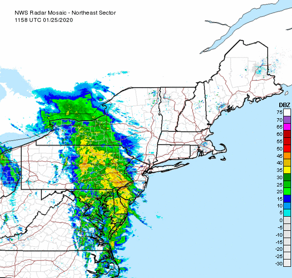
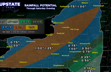
Here is the radar as of 7 AM Saturday. Yep… mostly rain. For this Saturday it looks like a washout for much of the state, with the exception of areas east of I-81 where some semblance of cold air may hold on to create a freezing rain/sleet/icing situation for a time today. Doesn’t look to be major as the push of warm air this afternoon on deep southerly flow will kill it everywhere, even on the Tug Hill and Adirondacks it’s gonna rain and rainfall amounts based on the radar could easily exceed the model guidance of 1/2″ to 1″ of liquid falling from the sky.
IF ONLY THIS WERE SNOW… WE WOULD BE BACK IN BUSINESS… BUT THIS IS THE STORY OF WINTER 2019-20 DESPITE OUR BULLISH OUTLOOK AND GREAT NOVEMBER START IS OBVIOUSLY NOT WORKING OUT IN THE END… ONLY THING THAT HAS MADE THIS NOT AS BAD AS 2011-12 and 2015-16 IS THE FACT WE’VE HAD SOME COLD AND SOME SNOW IN SOME AREAS. KEY WORD, SOME. THOSE WINTERS HAD NONE.
So is there any good news? Some… LOL… Whatever is on the back side of this storm tonight, through Sunday and lingering into as late as Monday morning… is our consolation prize for the hurt about to be leveled on us today. It won’t make up for the hurt today… but at least it’s something…
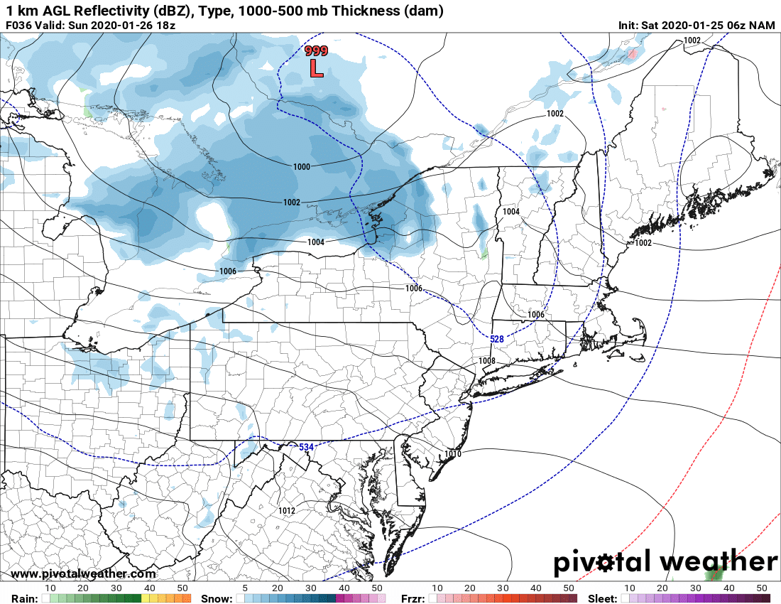
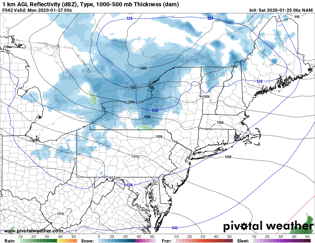
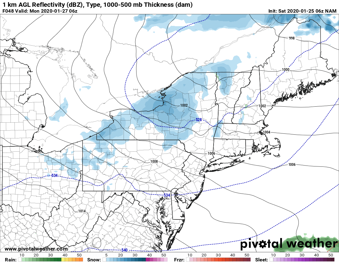
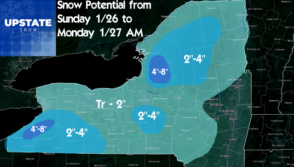
As the main low passes by this Saturday evening and puts and end to that steadier rainfall, the upper low (primary low) at the surface and aloft will go drifting by along the US/Canadian Border to our north. This wind shift will bring seasonably cold air at best back into Upstate overnight and through the day on Sunday. This will set off lake effect and lake enhanced snows that will eventually kick in but probably not until during the day on Sunday, best chance in the afternoon. A trough indicated to linger on the NAM will help be a focus for this. This activity could linger through Sunday night and into Monday morning before shutting off. And with that, a revised snowfall forecast map I’ve made. Much of this falls during the day Sunday, tapering off by Monday morning the 27th.
So what about the extended period? Models are in great divergence and disagreement heading into the second half of next week, but all show some level of colder air coming back into Upstate. Models also in major disagreement on a storm developing somewhere during next weekend February 1-2. Models agree something will happen somewhere, but with the trends this winter, especially lately, I’m not even going to speculate or hint. Because I honestly just don’t know yet. I’m hoping by Monday or Tuesday to have a clearer picture.
What about riding?
Basically, outside of the Tug Hill, Adirondacks (no connection between the two) and select spots in Western NY that don’t get wiped out… there’s not going to be much to ride next week. Many parts surrounding the Tug Hill and Adirondacks, and even the southern Adirondacks, that were able to snowmobile this past week on minimal snow cover, will be knocked out of the game once again for at least another week most likely.
As we’ve been in most of this winter… back into rebuilding mode, waiting and hoping for winter to show up… in earnest… if only for a few weeks… before we run out of calendar. We’re down to 45-60 days left.
Stay dry and warm… catch you again Monday morning with another Morning Blog…
Rich


