Another two days of snow to go across a lot of Upstate NY. Some will get a little. Some will get a lot. We have two separate weather systems, the clipper coming through today with lake effect behind it this evening through tomorrow, then very little break before our big cold front comes through with general snows and sweeps the lake effect from the snowbelt areas off Lake Ontario especially, and shifts the bands to the south. As winds become more sheared and northerly, along with much drier air aloft by Saturday morning expect much of the lake effect snow and clouds to dissipate with the exception of right near the lake and in localized bands.
Here is the timing and breakdown of the snow by region over the next two days. See below the map:
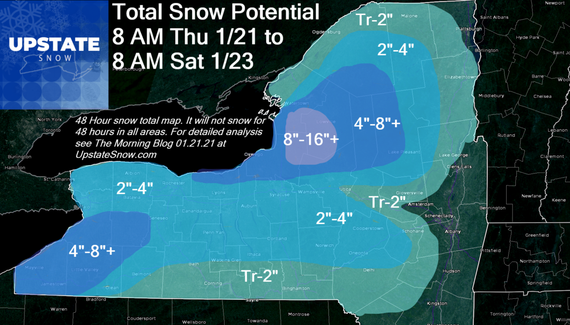
Buffalo and Rochester areas: 2″-4″. Snow on and off. Burst of heavy snow during the day Friday as the cold front comes through. This is where a good portion of your accums will come from.
WNY (Southtowns and Southern Tier): Occasional lake effect snow through Friday. Burst of heavy snow Friday afternoon, snow becomes scattered Friday night.
Rest of Southern Tier, Finger Lakes, Catskills: A little snow today, rest of your snow in the quick burst Friday PM into Friday night from the lake effect bands shifting into your area. Lingering into Saturday morning. Heaviest accums along Route 20 and high elevations of Cortland, Chenango, Madison and Otsego Counties which could see several inches Friday PM to Saturday AM.
CNY: Along Thruway (Utica/Syracuse Areas), A little snow today, but most of your accums hit Friday with the burst of snow then Friday PM as lake bands sweep through after the cold front and burst of snow.
Mohawk Valley east of Herkimer: Friday with the cold front, quick burst of snow.
Oswego County and Tug Hill Region (N Oneida, Lewis, S Jefferson) and Western Adirondacks (Old Forge area, MRP, Morehouse, Piseco, Speculator, Perkins Clearing): Heavy snow squalls develop today, last through tonight, ends in burst of heavy snow everywhere Friday AM and midday as cold front comes through. Most snow done by sunset Friday.
Rest of Adirondacks, St Lawrence County/Tri Lakes Region: Most of your snow is between now and Friday PM ending as burst of snow with cold front. All snow done by sunset Friday.
Hudson and Champlain Valleys: Snow showers will little to no accumulation. Quick hour long burst of snow Friday with front, just enough to make things white briefly.
After the cold gets here Saturday morning, IT STAYS!!! The cold will moderate some early next week followed by another reinforcing shot of snow (a few inches plus lake effect sometime middle next week) followed by more cold to round out the last weekend of January. This means the snow will stay around on the ground! Great news for all snowmobilers and winter weather enthusiasts.
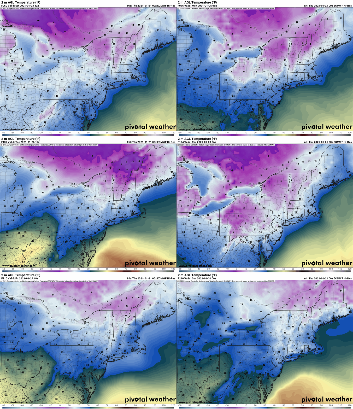
Bottom line: This is the season. This is the AFC Championship game (Go BILLS!). If you don’t seize the opportunity to ride in the next 10 days and get to the areas with great riding, winter will pass you by. It’s possible to put up good mileage now in both the Tug Hill and Adirondacks. Areas of WNY that have the snow to ride on you can put decent miles on too. It’s not the whole state, it’s not perfect, check with clubs, but get out and make the most of the winter that finally decided to show up and stay for longer than a cup of coffee. The local businesses desperately need your support and you desperately need to get fresh air, enjoy the amazing scenery of Upstate NY in winter, and reset after a hellish 2020 and rocky start to 2021. GET OUT AND ENJOY IT!
Rich


