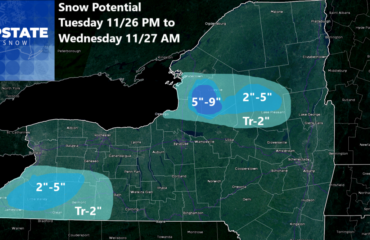
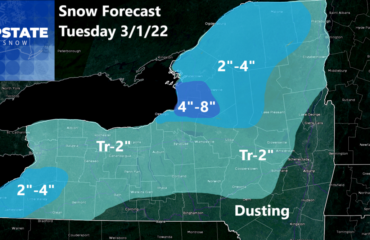
Against my better judgement to wait another run or two, and with everyone putting out their forecasts from the NWS to TV stations to super hyper posts to drive clicks to radio station groups, I’m pushing my 84-hour limit rule to the limit. As of press time, the snow ends right at or just after 84 hours. Close enough. Y’all are begging for it, so here you go! Feast! Tear it apart! Challenge! Give me your own forecast from your trusted “experts” because apparently doing this 10 years and being a Meteorologist 25 years is just not good enough, expert enough, or qualified enough for some of you snow lovers.
I could do this another 10-25 years and it will never change. I’ll still be the outsider. It will never impress a keyboard cowboy.
I’ve fought my way through. I cheated death nearly a year ago. I’ve got a great following with a lot of people’s respect, and I am proud of it! I am right, most of the time. Thousands on here agree. I do miss every season and I’ve missed a few this season, but not many. I promise to give it to you straight and give it my best shot. It’s here! First, the BITTER COLD! Or about to be, depending on when you read this:
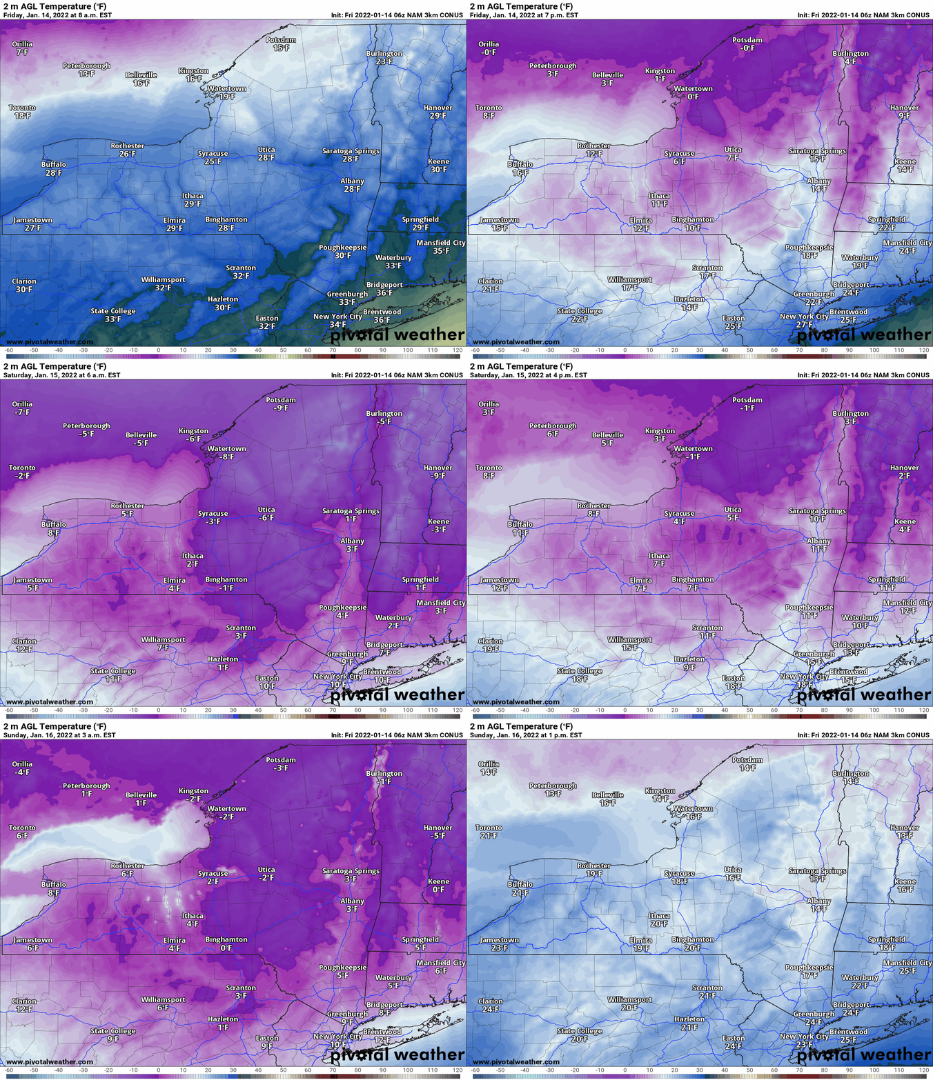
During the day today temps will fall faster than gravity. Winds will blow to. It gets dangerous tonight. By Saturday morning actual air temps are cold enough to freeze your nose hairs. Without the -40 windchill over the Adirondacks and Tug Hill. Saturday is going to be a sunny but brutally cold day. Saturday night very cold but not as cold nor as windy. Sunday the sun will fade behind increasing clouds. Temps will moderate some, but not up to freezing. Or even close.
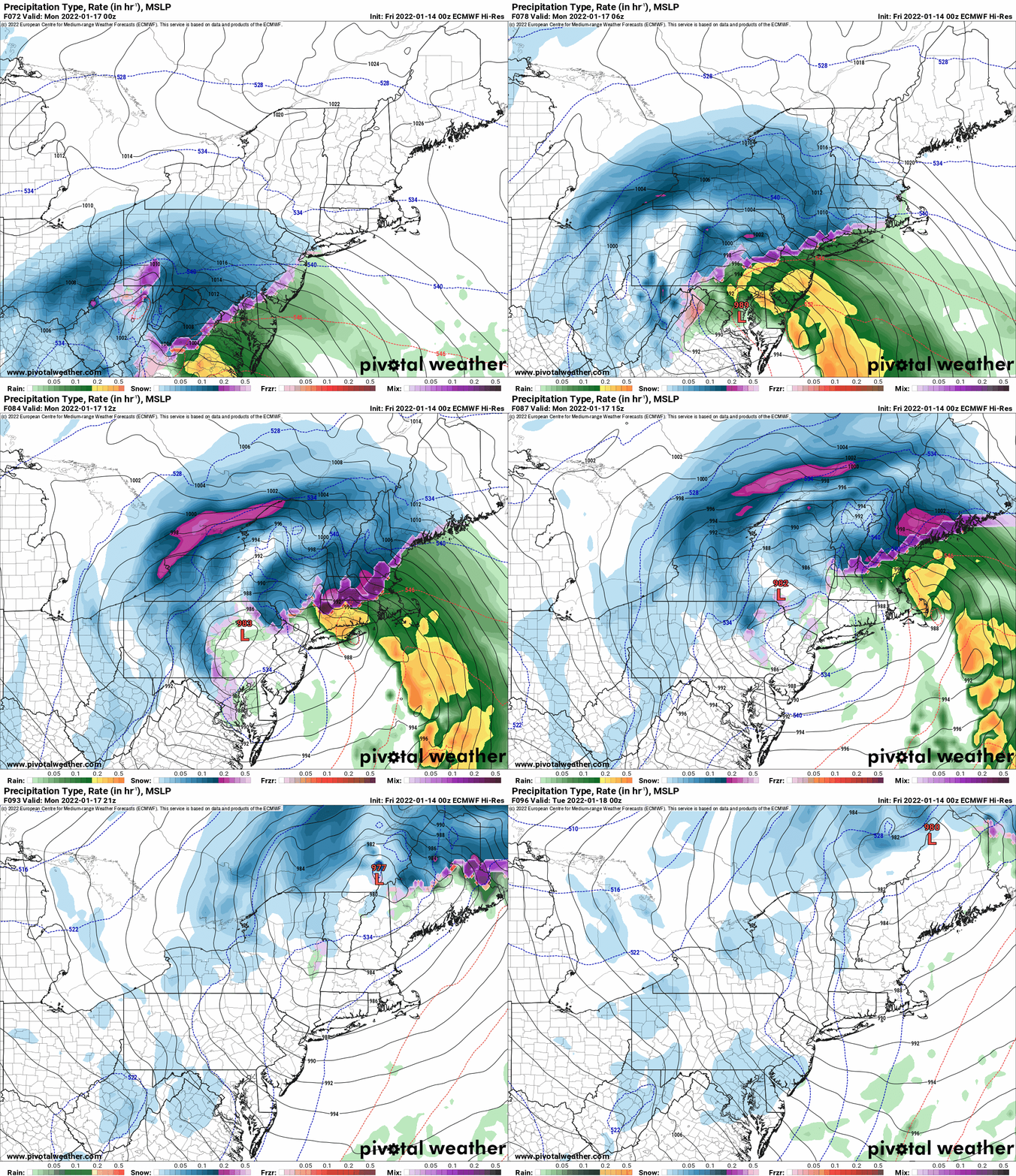
Then, THE STORM. It’s coming in hot. Just like a fajita. Sunday night we go from nothing to a steady moderate to occasionally heavy snow. For areas west of Interstate 81, this will be particularly true. For areas to the east of Interstate 81, the mix mess will enter into the equation. This happens during the morning hours so after a quick burst of snow and some accumulations, the mix mess will weight it down and turn it into a miserable thing to shovel and snow blow. Several hours of sleet Monday morning, with some freezing rain possible, but should mainly be sleet. It will be enough I believe to keep a good portion of CNY, the eastern Southern Tier, Tug Hill, Adirondacks, North Country, and Hudson Valley out of the double digits for snow totals. I’ve seen it too many times and I lean on this experience. The storm track is starting to settle in. While ensembles try to pull the low off the coast, and try to pull the higher numbers eastbound, the track is still inland from Washington DC to Philly to the Hudson Valley, then jumping to the Connecticut Valley between Albany and Burlington. While Connecticut Valley is a CNY/ADK/Tug Hill BULLSEYE track, it’s usually just offshore NJ/NYC then comes up through Long Island. This storm will be inland 50-60 miles, hence I’m calling the mix/mess along and east of 81 for a few hours plus a dry slot to knock down totals. IF this does not happen, IF, I will miss low. Given this winter and how folks I know will react in this situation, I’d much rather have an 11 or 12 fall in a 5-9 than go 8-16 and have y’all only get 4, 5 or 6 there. Huge difference in reaction and expectations.
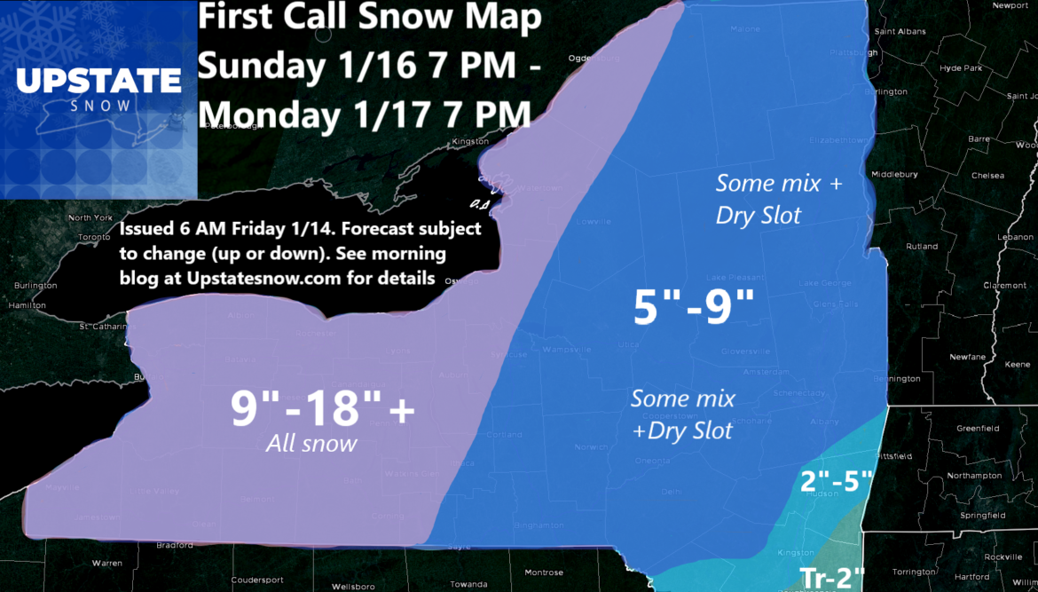
I believe 9-18 inches is solid west of Interstate 81. In particular, the Rochester and Buffalo metros will get crushed on this. Too bad that Saturday Night game wasn’t Monday Night against the Patriots at Orchard Park! I think 10 above is not as epic as 10+ inches of snow! Oh well. 1 to 2 inches per hour will add up FAST. I do think there is the potential for over 18 inches locally across WNY, especially west of Interstate 390. This will threaten to break the top 20, if not top 10 for Nor’easters in portions of Western NY. For those folks, it will be a doozy!
From Interstate 81 eastbound I’m painting a general 5-9 inches of snow. Mixed with sleet and possible freezing rain. This is based upon the low track being inland, heavy snows in Ohio and western PA (when they hit there, they rarely make it to CNY), and the infamous and rarely talked about DRY SLOT that will cut off precipitation and limit totals. While this will still be a respectable winter storm east of Interstate 81, it’s not as good as it could be. For the Capital Region, especially south, the totals fall off FAST to under 5, inches, to just a dusting to 2” in Poughkeepsie, where radio folks and social media folks shared like wildfire 16” Hudson Valley totals. I’ll just leave that there for a moment. To roost…
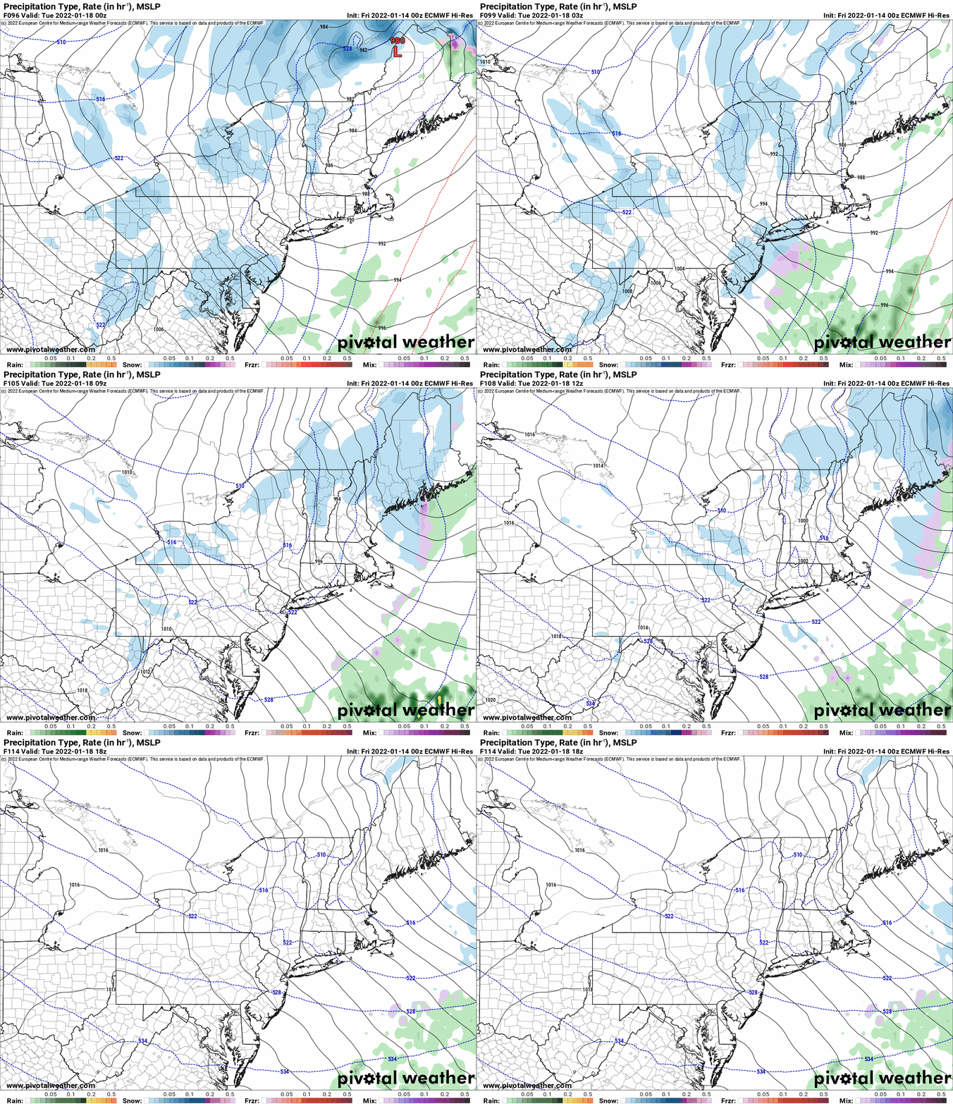
Monday evening and Tuesday morning, with wrap around moisture, winds coming off of the Great Lakes, particularly Ontario, and some alignment of the winds aloft (some directional and speed shear), it should be enough to wake up the lakes and provide additional accumulations, which are NOT part of this map and forecast. Anything after the storm ends Monday evening will be IN ADDITION to the storm totals shown. Monday night into Tuesday there will be additional accumulating snows of at least a few inches. In the heaviest bands, several additional inches. I’ll focus more on that tomorrow or Sunday. This will add to snow totals mostly where the 5-9 for the storm is.
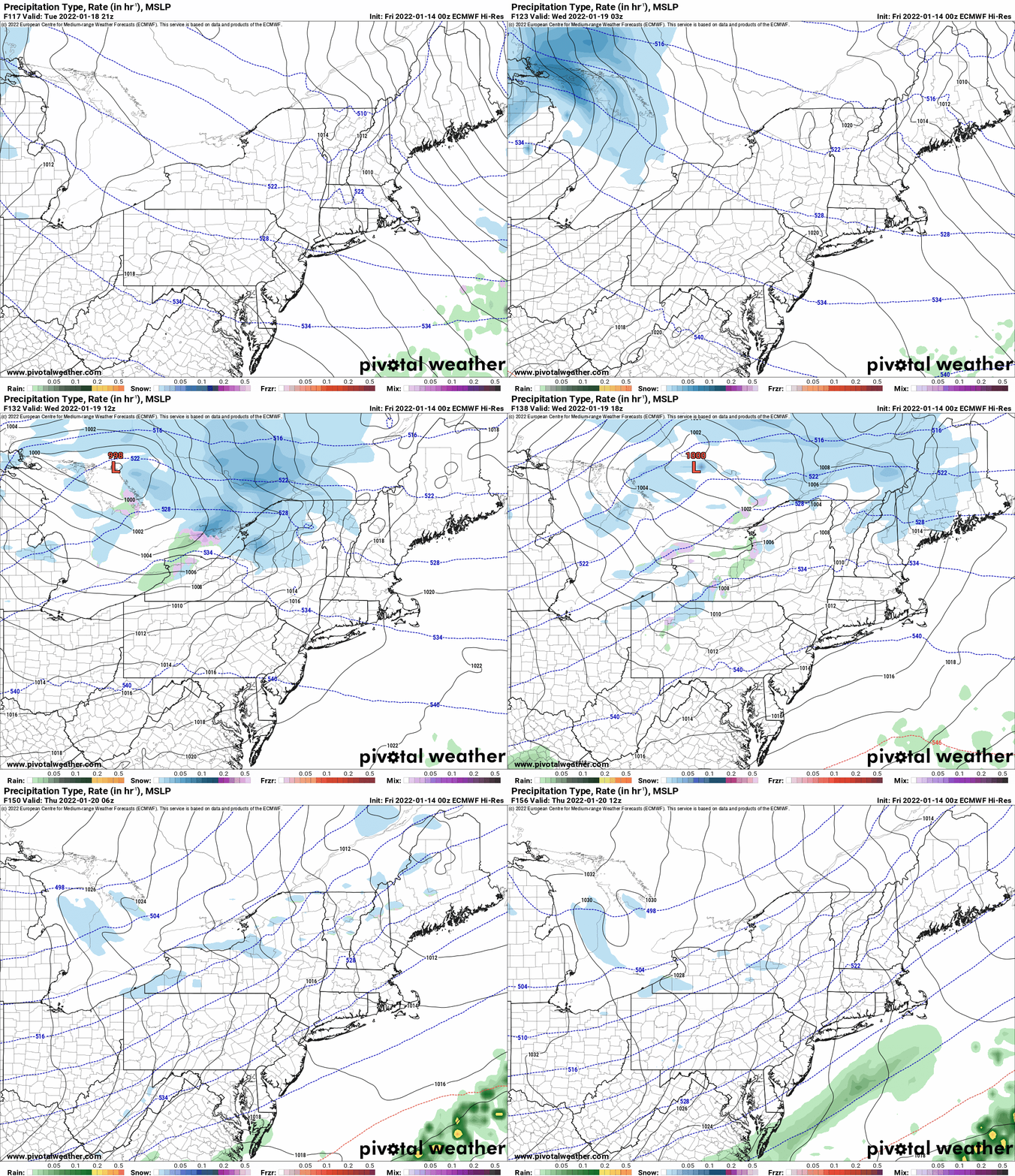
After a break Tuesday afternoon, the next clipper comes screaming in. Tuesday Night into Wednesday will provide another general few inches of snow with additional lake effect after that Wednesday PM into Thursday AM along with another big chill down. Still plenty of time to watch this as well.
Bottom line: Winter is here! It keeps coming with more bouts of cold then snow then cold then snow. Eventually, we will get to the conditions we want, in more places, on the snowmobiles in Upstate NY. Just give it time folks. It’s coming. I’m thankful it’s turning out this way, very similar to last season. Just hoping it stays through February at least!
Until next time, keep it shiny side up, and help people every day in every way regardless of what it is.
To become a MEMBER, drop me $10, and you’ll get name recognition, or if you wish not to use your name, recognition to your favorite snowmobile club or where you live. To become a SPONSOR, drop me $60 and I’ll put up a link to your business, Facebook page or snowmobile club!
Click below to get started
paypal.me/lupiallc
www.venmo.com/u/Richard-Lupia
THANK YOU to our faithful sponsors and members!
SPONSORS
Southern Tug Hill SnoRiders
Saratoga Snowmobile Association
Ohio Ridge Riders
ILSNOW.com
Enjem’s Flooring America
Water’s Edge Inn – Old Forge
Adirondacks Speculator Chamber of Commerce
White Lake Inn
Toads LLC Fisher and Snow Dog Plows, Cairo, NY
John Schoff Memorial Vintage Ride – January 15, 2022
Lincoln Mountain Gansevoort Snowmobile Club
ATV Tractor
Foley’s Lawn Care and Gardening
Better Homes and Gardens Pristine Real Estate – Cape Coral, FL
North Country Market – Thendara, NY
PR Plus Small Engine Repair – Sherrill, NY
EnergyMark LLC
MEMBERS
Chris Rinck
Charles Klesse
Chaz Albertson
Dave Gleasman
John Bates
Darrin Harr
Mark Enjem
Matthew Pistner
Eric Vilovchik
Brian & Paula Bedell
Robert G. Gartley
Chris Higgins
Nathan DeMarco
Frank Presky
Chris Schoff
Richard Keller
Mark Spano
Paul Marconi
Michael Schrader
Chris Skipper
Frank Sansone
Mercy Board LLC
John Scalora
Tom & Alis Vincent
Angelina Gogola
Cricket Corelli
Russ Lamoy
Jeff Greene
Chaz Albertson Jr.
John Bossolt
John Foley
Andy Artessa
Jenny & Ron Tyre
Mark Finkbiner
Christopher Cawley
Darren Bryant
M&M, SnoChic and SnoL!fe
Doug Wasiura
Devon Senecal
Billy & Millie McLaughlin
Rachelle Gross
Marc Mellaly
DV
Vicki Muehleck
Gertude Corelli
Brian Shoemaker
Brian Salamone
Tom Sylvia
Tom Robinson
Eric Olofson
Gill Benedek
Jason Sosiewicz
Ron Linich
Debra Hubbard
Dennis Sullivan
JAYSOS!


