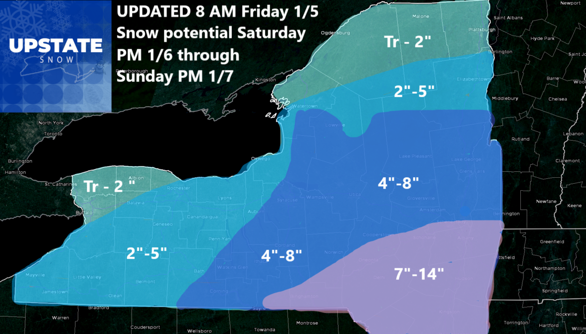
OK so I am ready to roll this Friday Morning with updated accumulation maps. Basically I went farther north and west with my 2-5 and 4-8 ranges as I see these numbers getting more clearance than double digits. Those numbers remain most possible from the Binghamton area, through Oneonta, the Catskills, Schoharie, The Capital Region particularly Albany and points south. I did add a little more snow for the Adirondacks and Tug Hill, particularly southern and central regions of these areas, but kept amounts lower across the northern Tug Hill and across northern NY.
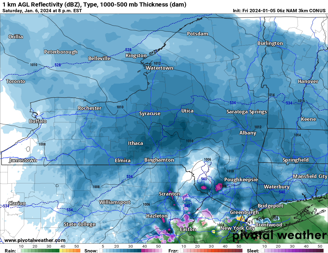
We shall see what happens, but unless there is a major last minute change, which has been happening lately on my stuff, we will probably stick with this forecast and “let it ride” until the end and see how this one plays out.
Once again Saturday Night through Sunday is the time target for this storm with 6 PM Saturday to 6 PM Sunday the most likely time to get hit with snow from this. After that expect mostly cloudy skies Sunday Night, through Monday and into Tuesday. Then late Tuesday, especially Tuesday Night through Wednesday, wind and rain, then changing back to snow. But not before a lot of rain and temperatures heading up into the high 30s through the 40s specifically on Wednesday before the colder air comes rushing back in.
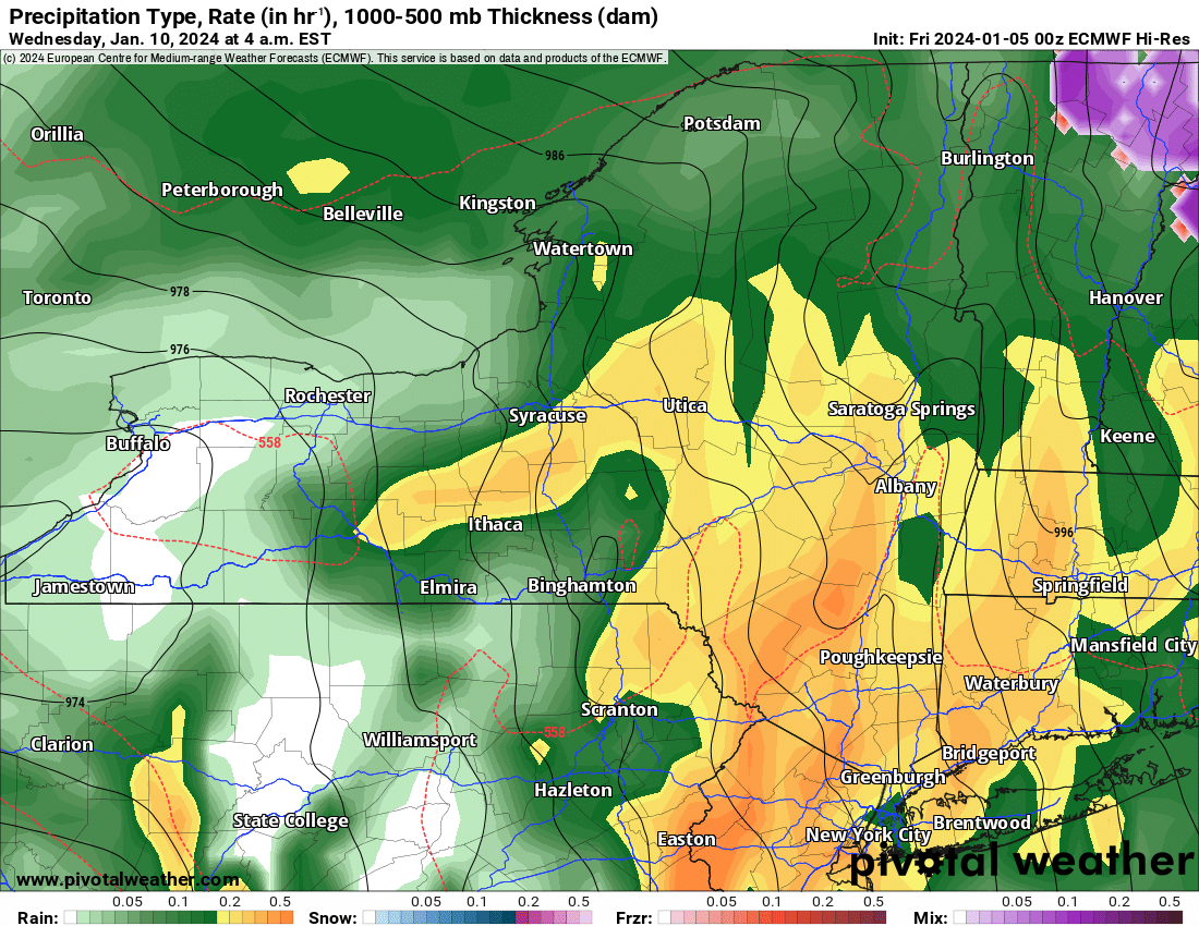
And it’s not super cold air. Yet. The bitter polar arctic air of the Polar Vortex and the Siberian Express has yet to arrive to Canada, much less the USA. It’s going to take a little bit longer for it to get here.
Bottom line – We are SO MUCH BETTER than we were one week ago. There are storms and winter precipitation in the forecast. It’s not all bright and a 10/10 for that but it’s a lot better than it was a week ago.
Have a great weekend! I will be on the road later today through Monday. I will report in from my remote location as soon as I can,
Rich Lupia
Upstate Snow


