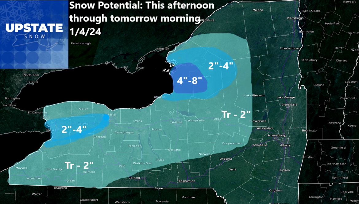
Good morning! For the first time in 16 days, I have actually created a snowfall map! YAY! It turns out a lot of the lake effect that’s hitting the City of Buffalo and points east, and also the Tug Hill, is not being picked up even on the more recent model runs. That’s not good. Because it means out of this stuff I have up there… there is a chance we could end up with a little more than expected. Not a ton. But after the last three weeks, you all should be elated about today!
Weak storm system moves through late this afternoon into tonight with general snow showers. I put most of it close to the lakes with only a dusting for a majority of us… an inch or two for those less (or more) fortunate depending on your worldview!
And then, there is the weekend! This weekend! Take a look:
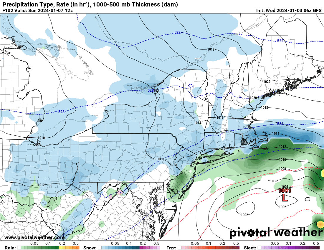
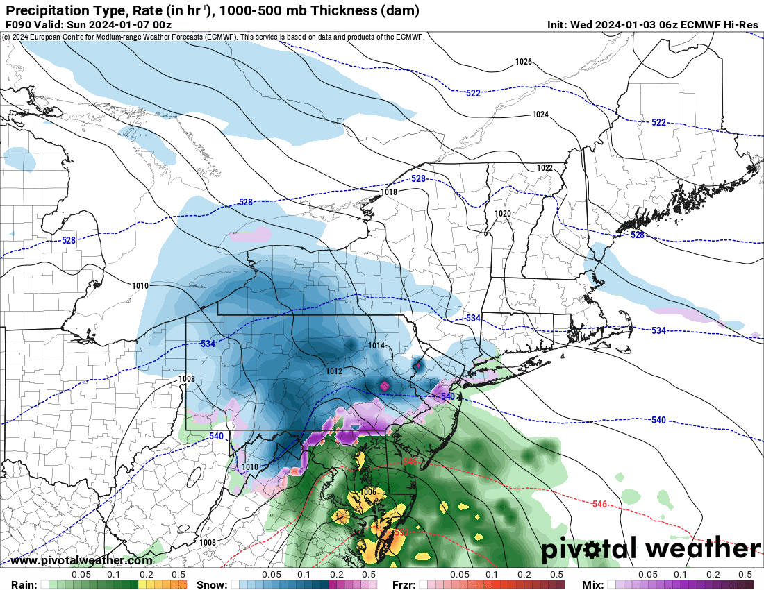
So the European is going a lot more aggressive with snow with several inches likely should that scenario verify. If the GFS turns out to be the prevailing solution, then only a few inches of snow should fall. Honestly, not that much more that what we have for tonight and into tomorrow with the snow falling in different parts of the state. That storm starts Saturday evening then clears out by Sunday evening. Monday looks like a nice day! And then…
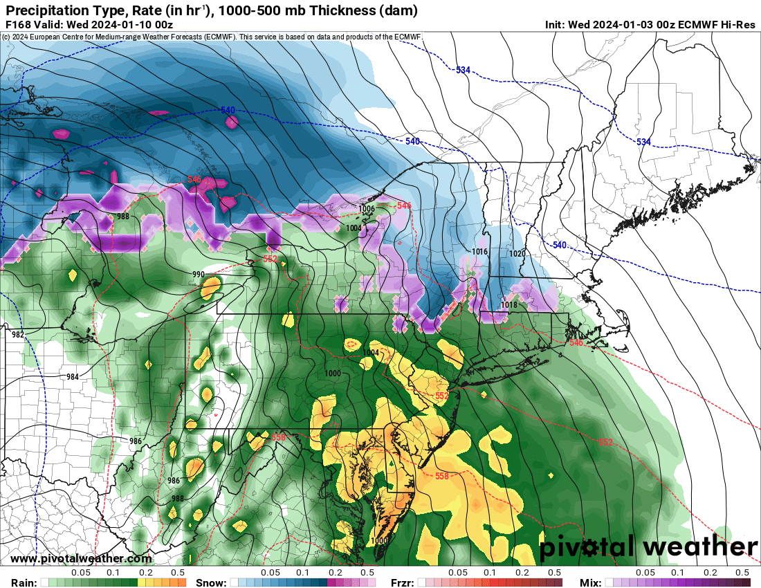
Tuesday! Snow to sleet to freezing rain to rain. The winds shall get roaring as well with a very tight pressure gradient developing over the Northeast and pressures dropping LOW. Down into the 28s! That’s a big time low. But since we are behind, how about a November type low in January! Why not, right? 🙂
There continues to be a lot of activity beyond this one week look. I will take a closer look to that tomorrow with the Trail Talk Thursday!
Rich Lupia
Upstate Snow


