This is the post you don’t want to know about. At the same time, this is absolutely positively the post that you do want to know about! In the short term – BAD. In the medium and long term – GREAT!
That is basically how this is going to play out in the remaining few days of 2024 and as we go through most of January 2025. The heart of winter. It has been since the winter of 2017-18, seven seasons ago. Since then we have not seen anything like what we are about to see. It has become abundantly clear over the last 5-10 days. Now that it is in our medium range and approaching our high resolution model range (84 hours or less) I have the confidence and strength to now make this proclamation to the Upstate Snow Nation:
JANUARY 2025 WILL BE COLD
JANAURY 2025 WILL BE SNOWY
WE WILL BE RIDING ALL OVER THE STATE IN JANUARY 2025
Will this happen as the ball drops on January 1st? NOPE. We have to go through one more BLOW TORCH warmth before we get there. Then after January 1st we can look forward to the cold!
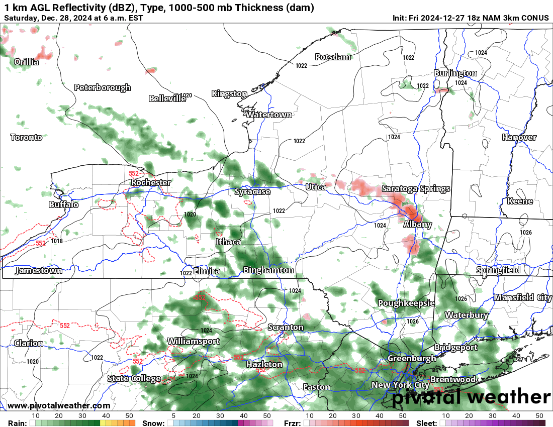
FREEZING RAIN TO RAIN SATURDAY 12/28
This system moves in overnight and through the morning and midday hours on Saturday. This is particularly over Central and Eastern NY. There will be some freezing rain and some light icing possible. With it being a holiday weekend and with any icing becoming a major hazard out there, you know why the NWS put up the advisories.
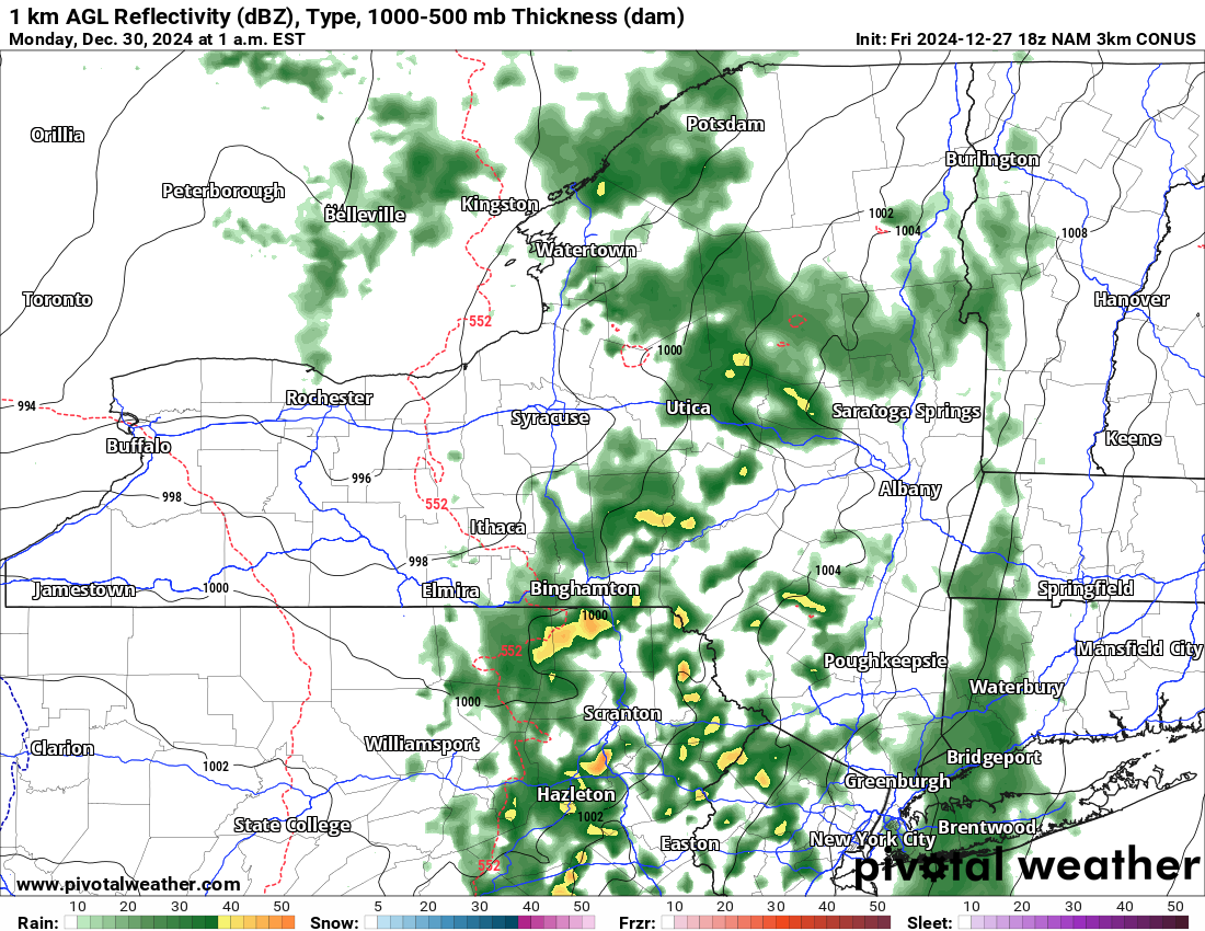
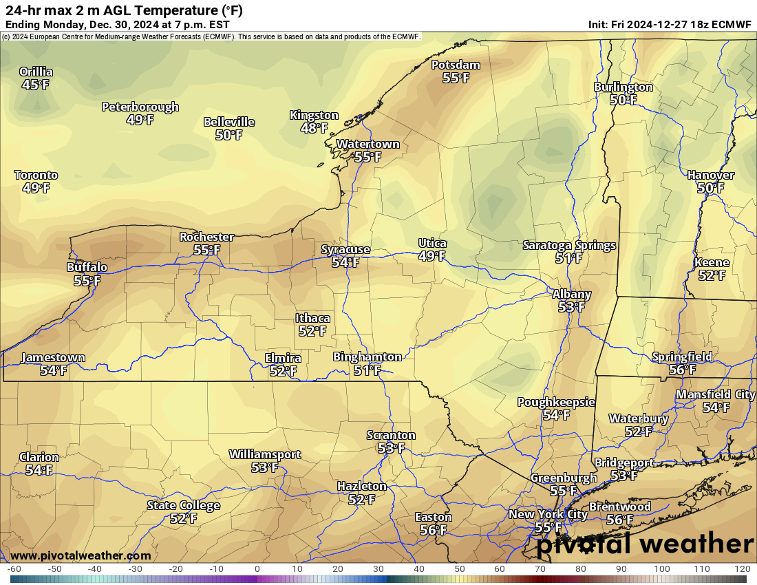
RAIN AND WARMTH SUNDAY 12/29 THROUGH NEW YEAR’S EVE
The warmth really hits on Sunday. This is when the 50s come blasting in. This is when it goes blow torch and whatever snow that is left across Upstate NY, especially the lower elevations, goes BYE BYE. Even in the higher elevations of the Tug Hill, Adirondacks and North Country, will see a significant melting of most of the snow. If not all of it. By the time the ball drops and we ring in the New Year, it shall be green across Upstate NY. If not all of it, most of it.
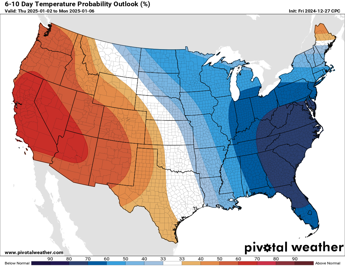
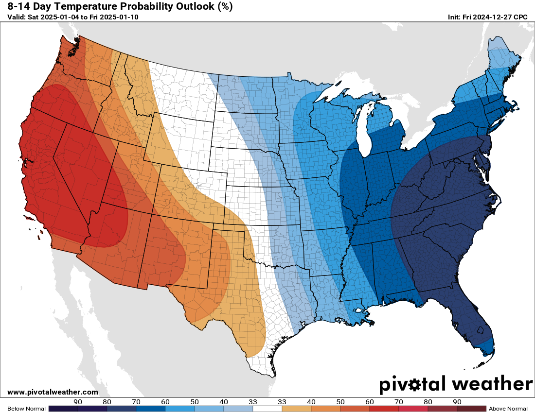
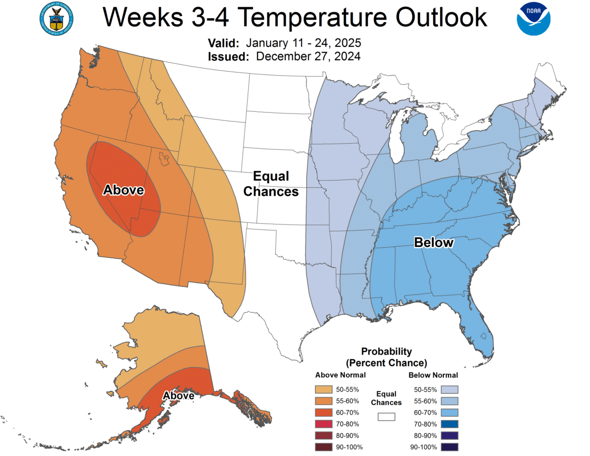
THE COLD RETURNS AFTER THE NEW YEAR
Starting the day after New Year’s, rain changes back to snow. And it stays there. It will stay there for a while. Quite a while. It will stay that way probably for most of the month of January. At least that is everything on what our medium and long range models are saying. By a mile. It’s not even close. If there was any chance of this being a short lived cold blast before Christmas, let me tell you, this will not be. January 2025 will be BELOW NORMAL. Snowfall will be at least 50/50 above normal, or if not, 50/50 near normal. I expect almost zero chance of below normal snowfall. In fact, I am so sure of this pattern right now, that I am putting out there the possibility that January 2025 COULD BE A TOP 10 COLDEST MONTH AND/OR A TOP 10 COLDEST ALL TIME MONTH. I am definitely not saying definite on that. Not yet. Just based on how things are running after January 1st with the bottom falling out after that and 30s and 40s ruling for highs most of the month, with some days not even seeing 30, and teens to low 20s at night (normal is 30), you can understand why here in South Carolina why I am worried about this. You can also see why I am worried about SEEING SNOW here in South Carolina for the first time in three years. And on more than one occasion! As for Upstate NY, expect most days to range from the teens to 20s for highs with some days struggling just to get above zero. As for overnight lows, I would expect at least several days below zero with some days between -15 and -30 across Upstate NY. That could threaten records on some days. All I know is this: We have not been through this in a long while. Now it is time.
Buckle your seat belts! After the ball drops into 2025, the ball will drop on us in terms of the weather.
Zack and Rich Lupia
Upstate Snow
December 27, 2024
Please thank our advertisers on Upstate Snow for 2024-25
Banner Sponsorship
Enjem’s Flooring America
Ohio Ridge Riders
ilsnow.com
Southern Tug Hill Sno-Riders
Saratoga Snowmobile Association
Business Sponsorship
Paton & Son Excavating and Landscaping


