Hey! Did you think since the lake effect snow tapered off in a lot of areas and the bands moved that the event was over?
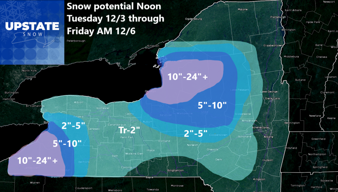
Nope. Not yet! Take a look at this map which I have out through Friday morning 12/6. Since it is a 72 hour map, there could be adjustments to this. However, most of the snow with this map falls between Wednesday PM and Thursday PM.

What happens after that? Lake effect snows will continue. Friday and through the upcoming weekend the lake effect will continue. Nowhere near as much as over the next few days.

FINALLY BY EARLY NEXT WEEK, WE CATCH A BREAK!
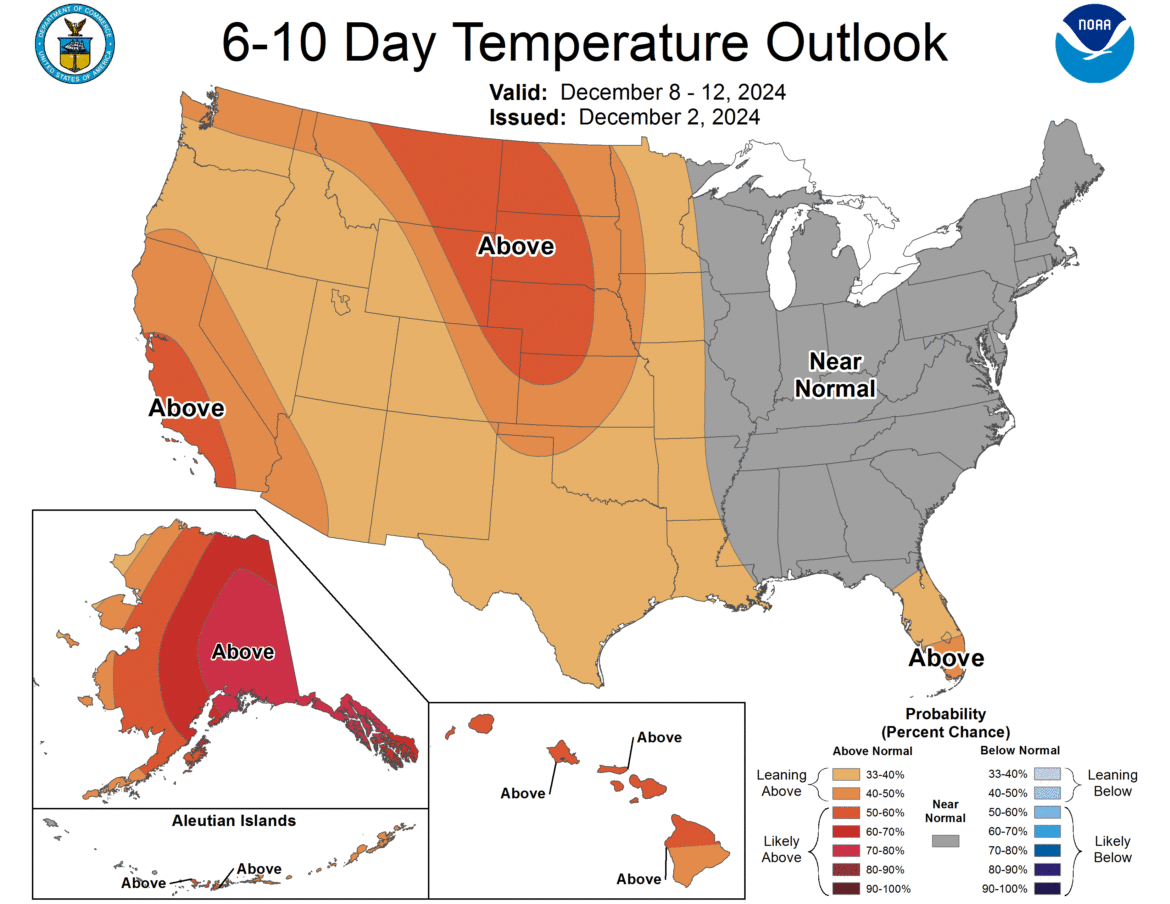
Temperatures warm above freezing early next week and instead of lake effect snow, which seems now to be a daily occurrence, rain starts to enter the picture, especially in the lower elevations early next week. The 6-10 day goes back to near normal. The 8-14 day goes slightly above normal. With our normal temperatures in the 30s now, it means potentially some melting and compacting of the snow in the medium term. Whether it stays mild and the snow gets wiped out before the holidays is a whole other concern.
That’s our report for today. Please continue to follow us on social media!
Zack and Rich Lupia
Upstate Snow
December 3, 2024
Please thank our advertisers on Upstate Snow for 2024-25
Banner Sponsorship
Enjem’s Flooring America
Ohio Ridge Riders
ilsnow.com
Southern Tug Hill Sno-Riders
Saratoga Snowmobile Association
Business Sponsorship
Paton & Son Excavating and Landscaping


