One more storm system to go Sunday, which will hit downstate and New England harder than Upstate NY, before an unusually quiet week ahead with above normal temperatures, especially so on overnight lows.
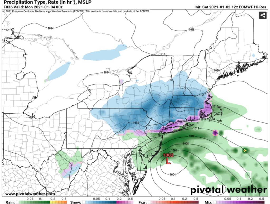
We get a close call with a storm system moving up out of the Carolinas and offshore towards NJ and New England on Sunday into Monday AM. I expect a dusting to and inch or two of snow across much of Upstate NY Sunday and Sunday Night. It will taper off Monday morning. Areas of the Catskills, Taconics, Hudson Valley, and New England could see more than 2” of snow.
The rest of the week will be QUIET. Nothing to talk about really. NO big storms or cold snaps to talk about. Highs around to above freezing by day. upper teens to 20s at night. To put in perspective of “normal” early January weather, for the Tug Hill and Adirondacks “normal” is highs in the 20s lows in the single digits. Lower elevations and south of the Thruway “normal” is Upper 20s to Lower 30s for highs, lows in the teens.
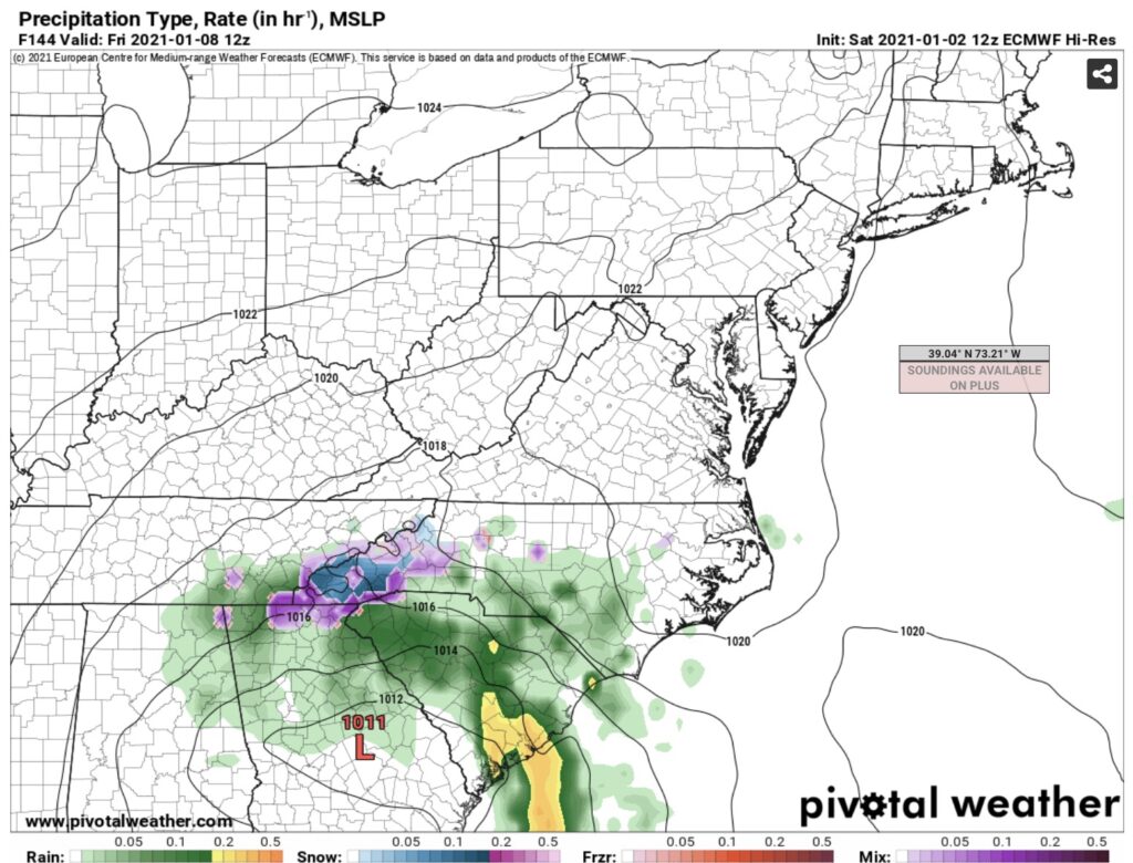
Next item of interest is something BOTH GFS and Euro have been picking up on, a southern stream low and developing area of low pressure rolling across the Deep South, Georgia and the Carolinas by Friday 1/8. Keep an eye on this one. Yes, it’s possible that higher elevations in the Southern Appalachians of Tennessee, Georgia, South Carolina, North Carolina and Virginia could see more snow in the next 7 days combined than most of Upstate NY.
Beyond this heading into the following week is a HUGE Greenland block. HUGE. One problem though, every other factor is going AGAINST big cold and big snow. Polar Vortex is not over Central to Eastern Canada… It’s over the Bering Sea and Alaska. Anytime big cold and big lows are there, with no west coast ridge, it means the Pacific air floods this US and Southern Canada. Without access to air over Northern Canada, The Arctic and/or Siberia, you will not get sustained cold and snow. If this pattern holds into the second week of January, it will take until at least the second half of January if not closer to the last week of January to see anything that would get us excited. It’s still possible. Does it flip like 2006-07 did? Or does it fizzle like 2011-12 and 2015-16 did? We’ll know for sure in the coming weeks.
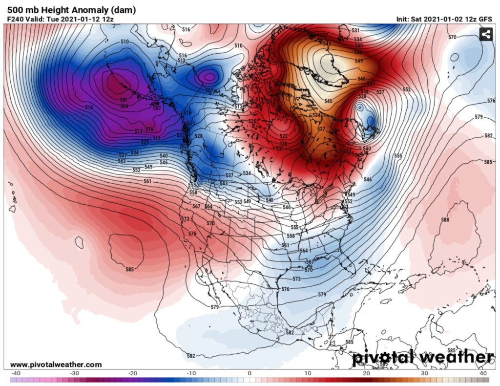
Remember, cold temperatures are truly the key to good trail setup and trails holding up. Too much time near and above freezing open up the swampy areas, water hazards, and will continue to limit ice making on lakes north of the Thruway. The lack of cold air with the aforementioned upper air pattern is a big liability with what snow we do have.
Double check with clubs before you trailer up to ride Tug Hill, Old Forge or any other areas that are able to open up. A great way to do this is to drop the $5 through the App Store or Google Play for the NYSSA Interactive trail map. This highlights from the clubs the trails that are open and trails that are closed.
Updated planned schedule for next week:
Sunday 1/3 – No Blog
Monday 1/4 – Morning Blog
Tuesday 1/5 – Trail Talk Podcast
Wednesday 1/6 – Guide to Your Ride Podcast
Thursday 1/7 – Morning Blog
Friday 1/8 – Morning Blog
Saturday 1/9 – No Blog (Unless conditions warrant)
Thanks!
Rich


